Displaying items by tag: foreshore
Foreshore Planning: Irish Sailing Urge Sailors to Have a Say at Marine Planning Framework Consultations
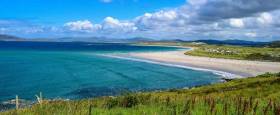
As Afloat reported yesterday, the Government launched its Consultation Draft of the National Marine Planning Framework (NMPF). Lead by the Department of Housing, Planning and Local Government (DHPLG), the draft document aims to create a “co-ordinated and coherent approach to decision-making and governance” in respect to marine planning. It includes planning for development proposals by sports, recreation and tourism bodies, which in turn covers the all-important Foreshore Licence.
Applying for a Foreshore Licence
Currently, any change or introduction of infrastructure below the high-water mark, e.g. marinas, pontoons, slipways, moorings, must apply for a Foreshore Licence. The application is divided up between two Departments (Department of Agriculture, Food & the Marine, and the Department of Communications, Climate Action & Environment) and can be a very time consuming, expensive and cumbersome process in some cases taking a number of years to complete which is a deterrent for any provider looking to develop facilities along the foreshore. There is also no link currently to local authority planning. As a result, we have very poor marine infrastructure around our coasts. The aim of the NMPF is to create a more streamlined approach for developing marine infrastructure and link applications and planning to local authorities and county development plans.
Irish Sailing & the Advisory Group
Harry Hermon, CEO of Irish Sailing sits on the Advisory Group working with the DHPLG on the proposed framework. The Advisory Group is made up of representatives from sport, tourism, fisheries, environmental agencies, local government, harbours, energy, and many others with an interest in the marine.
As Hermon describes it “we’ve been advocating continuously on this for many years so that members of the sailing community can work closely with local authorities to develop infrastructure on a county basis. If this goes through, clubs and centres will be able to apply directly to their local authority instead of the cumbersome and convoluted process that exists currently. I urge everyone to attend the Consultation Meetings set up by the Department and have their voices heard”.
Planning Policies
In the 196-page document, there are two key areas that are perhaps most relevant for sailing organisations: the sections on “Sport and Recreation” p.158, and “Tourism” p.168. The sections lay out a series of planning policies which include objectives to increase participation in water-based sports, improve access to marine and coastal resources, and the sustainable development of outdoor recreation facilities.
You can read the full document here
Get Your Voice Heard
The Department has set up regional public events outlined here, and you can read the full list here
|
Date |
Time |
Venue |
|
21/11/2019 |
14:00 – 16:00 |
Greenhills Hotel, Limerick |
|
21/11/2019 |
18:00 – 20:00 |
Greenhills Hotel, Limerick |
|
26/11/2019 |
14:00 – 16:00 |
Town Hall, Westport |
|
26/11/2019 |
18:00 – 20:00 |
Town Hall, Westport |
|
02/12/2019 |
14:00 – 16:00 |
Connaught Hotel, Galway |
|
02/12/2019 |
18:00 – 20:00 |
Connaught Hotel, Galway |
|
10/12/2019 |
14:00 – 16:00 |
Meadowlands Hotel, Tralee |
|
10/12/2019 |
18:00 – 20:00 |
Meadowlands Hotel, Tralee |
Irish Marine Federation Welcomes Changes to Foreshore Act
#foreshore – The Irish Marine Federation (IMF) has given a cautious welcome to much heralded changes to the foreshore bill that is designed to streamline the development consent process.
The government has published its Legislation Programme for Spring/Summer 2015 and the Maritime Area and Foreshore (Amendment) Bill is among a list of key Bills of interest which currently before the Houses of the Oireachtas.
The Bill will streamline the development consent process for the foreshore, including the integration of certain parts of the foreshore consent process (under the Foreshore Act 1933) with the existing on-land planning system.
The IMF, the national federation of the marine leisure industry in Ireland, has long held out that the failure to manage Ireland's natural resources "in a consistent or coherent manner" has led to serious setbacks in the support of marine tourism on the island.
The IMF has long argued the State must develop a clear and simplified pathway for the licensing of offshore and foreshore activity - in marina development, aquaculture, and energy exploitation. Currently, there is no timeframe for the granting of permissions leaving many developers facing a lifetime of unneccesary bureaucractic hurdles that stymies development, according to one marina developer.
In 2002, there was an attempt to address this when the Marine Institute published 'A Development Strategy for Marine Leisure Infrastructure'. Shortly afterwards, however, the responsibility for marine tourism research was transferred from the institute to the then Department of Arts, Sport and Tourism. It would appear that during this move, a disagreement over how this new responsibility for marine infrastructure was to be resourced led to its not being resourced at all.
In 2007, the Marine Institute followed up with another report - the Marine Tourism and Leisure Development Strategy 2007-2013 - which valued the water-based tourism and leisure sector at €630m and anticipated it would grow to €1bn by 2013.
That report identified a failure to manage Ireland's natural resources "in a consistent or coherent manner" in support of marine tourism. That report, and and its recommendations, was left to gather dust alongside its 2002 predecessor.
So it is something that the Government's new marine plan, 'Harvesting our Ocean Wealth' aims to develop a national maritime spatial plan, and recognises the need to engage with experts and stakeholders. But it is imperative that government does not overlook the various barriers and pressures that exist in our various sea areas.
Above all, the key to unlocking Ireland's marine potential, according to the Irish Marine Federation is to complete the necklace of marinas around our coast - marinas which can provide a lifeline for struggling coastal communities with the sort of jobs that cannot be shipped abroad.
Ireland has a chronically underdeveloped marina system. The single marina in La Rochelle, France, for example, has the same capacity as our entire island. There are more berths in North Wales alone than there are in all of Ireland.
Marinas create small hubs of marine enterprise, supplying services to cater for the boat owners gathered there or just visiting, and bringing massive spin-off benefits for the neighbouring coastal communities. Studies show that for every €10 spent by a yachtsman in a marina, €100 is spent in the local town in shops, pubs and restaurants.
A visiting overseas boat leaves €132 per night. A visiting Irish boat leaves considerably more at over €300 per night. The average spend of a boat owner in a marina berth is in excess of €8,000 per annum. Most of this stays in the local community. One full time job is supported by every 3.7 marina berths according to Federation reports.
#LIFEBOATS - The latest marine notice from the Department of Transport, Tourism and Sport (DTTAS) advises of construction work being carried out on Baltimore Lifeboat Station from today 5 March.
As previously reported on Afloat.ie, the works are part of a €2.6 million State-funded project to conduct essential remedial works at harbours across West Cork this year.
The works - which will be ongoing till mid-October pending weather conditions - will involve piling immediately adjacent to the foreshore on the north-east side of the building, and the deposition of rock to form an armoured breakwater jutting some 80m into Church Strand Bay.
No forseeable impact to mariners in the area is expected, but vessels are in any case requested to proceed slowly and with caution in the approach channel to Church Strand Bay and to give the works a wide berth to avoid wave-wash.
Further details for mariners are included in Marine Notice No 9 of 2012, a PDF of which is available to read and download HERE.


