


Displaying items by tag: survey
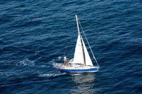
Survey Receives Positive Response Says Isle of Man Steam Packet
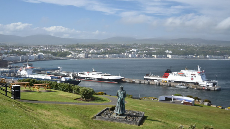
There has been a 'positive' response to a company survey according to the Isle of Man Steam Packet.
As Manx Radio reports, more than 7,000 people took part after it was launched at the end of last month.
The Company is trying to gain a better understanding of passenger views on travel services and on-board facilities.
Results from the survey will be taken into account during the design of a new vessel, which is due to replace the Ben-my-Chree over the next 2-3 years.
Inland Fisheries Ireland Seeks Views In Survey On Angling Participation
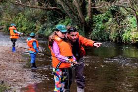
Keen to encourage more people of all ages to discover and enjoy angling as a sport and pastime, Inland Fisheries Ireland (IFI) is looking to gather the views of the public around fishing via an online survey.
IFI says its findings will help inform a Novice Angler Strategy which will aim to increase participation across all types of angling.
The survey looks to discover the barriers novice anglers could experience when it comes to fishing, and to find out their perceptions and experiences of fishing to date.
It also will survey existing anglers around the type of fishing they practice and examine how angling clubs recruit and interact with novice anglers.
“We know that there are fewer people fishing than there were in previous decades and we want to find out why and how we can interest them in this lifelong hobby,” says Suszanne Campion, IFI’s head of business development.
“Fishing is a sport which is suitable for all ages and abilities. In today’s society, outdoor recreational activities are more important than ever from a health and well-being perspective, and in Ireland we are uniquely placed with the breadth and quality of our fisheries resource which is available to all to enjoy.
“The information and views of the public are very important to us and will help to make angling better for everyone.”
The online questionnaire takes only around 15 minutes to complete, and all who take part will be in with a chance of winning one of three €50 vouchers for fishing equipment.
Herring Spawning Stock Survey Off West & North West Coasts This December
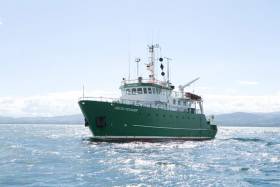
The Marine Institute’s Fisheries Ecosystems Advisory Services (FEAS) department will undertake a survey of herring off the West and North West Coasts from 1-10 December.
This survey is the fourth in a time series that is hoped will be developed into a long-term index of spawning/pre-spawning herring in ICES area 6a S/7b, for use in stock assessments in the future.
The overall 6a survey (6a N and 6a S/7b) is part of a collaborative partnership between Ireland, the Netherlands and UK (Scotland) that aims to improve understanding of the individual stock components of herring in 6a and 7b.
Next month’s survey will be conducted by the RV Celtic Voyager (callsign EIQN) using a towed body with two split-beam transducers (38 kHz and 120 kHz). The vessel will be trackable online during the survey.
In total around 1,100 nautical miles of cruise track will be undertaken with a mixture of parallel (spaced at 7.5 and 3.5 nm) and zig-zag transects. The vessel will display appropriate lights and signals.
Night operations will involve the towing of the two split-beam transducer. Fishing will take place opportunistically during daylight hours.
Contact details and co-ordinates of the relevant survey areas are included in Marine Notice No 50 of 2019, a PDF of which is available to read or download HERE.
Have Your Say In Irish Sailing's Strategic Review
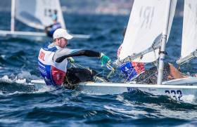
Sailors and boaters and other stakeholders in Ireland still have two weeks in which to contribute to Irish Sailing's strategic review for its next five-year plan.
In conjunction with regional consultation meetings, Irish Sailing says it wants to garner input from all stakeholders via a short online survey.
This survey should take no more than five minutes to complete and will be available until Thursday 31 October.
Irish Sailing chief Harry Hermon has discussed the governing body's challenges future vision in a recent podcast with Tom MacSweeney, while this past weekend our own W M Nixon expressed positivity for the vast potential of sailing in Ireland.
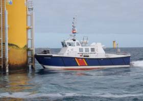
A series of ecological surveys will take place in the Irish Sea off the Dublin and Wicklow coast between now and May next year to provide data on seabirds and marine mammal species to inform the development of the Dublin Array Wind Farm.
The survey dates are weather dependent but will comprise a survey in each calendar month until May 2020, commencing tomorrow (Monday 24 June), with additional monthly surveys this August and September.
The location of the surveys will be off the Dublin and Wicklow coast in the vicinity of the Kish and Bray Banks. Surveys will be undertaken in daylight hours and each will usually be completed over a period of two days.
For the initial survey, the work vessel will not be towing survey equipment. During subsequent surveys the vessels may be towing a hydrophone up to 100m astern and will be restricted in their ability to manoeuvre. Vessels are requested to leave a wide berth.
Details of co-ordinates of the survey areas, and relevant work vessels, are included in Marine Notice No 18 of 2019, a PDF of which is available to read or download HERE.
Council Launches Online Visitor Survey For Dalkey Island
Dun Laoghaire-Rathdown County Council is currently carrying out a visitor survey for Dalkey Island to assist in the long-term management and protection of a key historical and ecological site in Dublin Bay.
Dalkey Island, which is owned by the council, is a part of the Dublin Bay Biosphere, and is home to a significant colony roseate terns, not to mention seals, rabbits and wild goats.
The island has also been an important site of pilgrimage for many centuries, and was previously knows as St Begnet’s Isle.
The online survey aims to quantify the number of visitors and the quality of their experience. It will only take a few minutes to complete, and is available HERE.

New seagrass beds are among the heartening finds announced at the launch of results from the most recent Coastwatch Survey, as Coast Monkey reports.
But the launch event in Dublin last Friday (5 April) also heard that hard erosion controls, unlicensed aquaculture and marine litter were having a deleterious effect on Ireland’s ocean wealth.
As the 2018 Coastwatch Survey drew to a close in October, it was reported that non-flushable wet wipes were “in abundance” around the Irish coastline.
Speaking on Friday, Coastwatch co-ordinator Karin Dubsky also observed that “no big flat fish nurseries have been reported for years now”.
On a positive note, however, it was recognised that participation on the annual Coastwatch survey is growing among volunteers from the general public as well as fishermen and anglers.
Last year marked the 31st Coastwatch citizen science survey of Ireland’s shores. Coast Monkey has more on the story HERE.
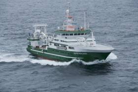
The annual Anglerfish and Megrim Survey has begun off the West South West and South Coasts of Ireland in fulfilment of Ireland’s Common Fisheries Policy obligations.
The purpose of this project is to carry out annual survey for relative annual abundance and distribution of anglerfish and megrim. However, other species of national
importance will also be sampled, along with physical and chemical oceanographic parameters.
IAMS 2019 runs till Monday 25 March. The demersal trawl survey consists of around 110 otter trawls (of 60 minutes each) in ICES areas 7b, 7c, 7g, 7h, 7j and 7k as indicated the map below.
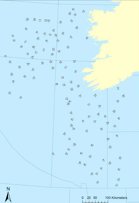
Fishing in 2019 will take place within a three-nautical-mile radius of all positions indicated.
The survey will be conducted by the RV Celtic Explorer (Callsign: EIGB). The vessel will display all appropriate lights and signals during the survey and will also be listening on VHF Channel 16. The vessel will be towing a Jackson demersal trawl during fishing operations.
Commercial fishing and other marine operators are requested to keep a 3nm area around the tow points clear of any gear or apparatus during the survey period. For more details see Marine Notice No 6 of 2019, a PDF of which is available to read or download HERE.
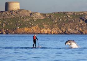
Arctic Beluga Among Whale Species Recorded In Irish Waters In New Research
The Beluga whale — a species mainly found in the Arctic Circle — has been recorded in Irish territorial waters as part of a groundbreaking three-year research project into our offshore habitats for marine wildlife.
On Friday (23 November) the ObSERVE Programme team announced the findings of its aerial and acoustic projects, led respectively by UCC and GMIT and which survived larked areas of the Irish and Celtic seas as well as the Atlantic Margin.
Besides the begula, the researchers detected endangered blue whales underwater up to 200km from their survey position, noting strong seasonal patterns in their sounds.
The most abundant baleen whale species is the minke whale, whose numbers in Irish waters reach some 12,000 in summer months and 5,000 in winter, including significant sightings of calves.
Fin whales were also recorded throughout the year, suggesting the continental slope and adjacent deep waters are an important area for this species.
Numbers of deep-water beaked whales — recently the subject of concern over mass strandings in Ireland and Scotland — were also estimated to reach some 4,000 in winter months.
In addition the ObSERVE Programme studied distribution and behaviour of dolphin species, as well as the half a million seabirds of the Atlantic Margin — which included sightings of white-tailed tropicbirds normally found much further south.
The news comes just days after a rare spotting of killer whales in pair off the coast of Co Dublin — and as hundreds of translucent parasitoid phronima have washed up on a beach near Dingle, as TheJournal.ie reports.
Survey Says Just 8% Of Irish Waterside Spots Are Litter-Free
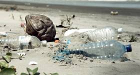
#Litter - Only 8% of beaches, harbours and rivers in Ireland can be considered clean, according to the first national survey on littering at waterside spots.
An Taisce investigated 50 sites nationwide on behalf of the Irish Business Against Litter (IBAL) group and found that just four – Salthill in Galway, Kinsale Harbour in Co Cork, Lanesborough and Carrick-on-Shannon – were clean when measured against EU standards.
Outsider.ie has the full survey results, which point at Cork Harbour and the Wild Atlantic Way as among the biggest offenders for litter blight around the coast.
“We know the success of the Wild Atlantic Way is placing strains on infrastructure of various kinds,” said IBAL spokesperson Conor Horgan. “Litter is a likely consequence of this and one local authorities need to manage to ensure the appeal of the way is sustained.”
Among inland waterways, the Boyne in Drogheda, the Shannon at Portumna, the Suir in Waterford city and the Tolka at Annesley Bridge were considered “heavily littered” — mostly by plastic bottles and drinks cans, cigarette butts and plastic sweet wrappers.
In an editorial earlier this week, The Irish Times warned over “the permanent damage being caused to the marine environment in the form of plastic pollution”.
The issue is one that many campaigners around the country are attempting to tackle – including young Flossie Donnelly and her clean-up efforts in Dun Laoghaire Harbour.
It’s also considered a threat to Ireland’s angling resource. “Our waterways and the fish which they sustain are one of our great natural assets,” said Suzanne Campion, head of business development at Inland Fisheries Ireland (IFI).
“Ireland has a reputation as an outstanding angling destination however this is reliant on our ‘green’ image. We are disappointed to learn that angling destinations such as the Boyne, Shannon, Suir and Tolka feature on the ‘heavily littered’ list.”
IFI promotes a ‘leave no trace’ ethos with anglers and all water users, and Campion appealed to the public “to refrain from littering in or around our waterways”.
Campion added: “If we are to ensure the sustainability of the resource in the long term and to safeguard Ireland’s enduring appeal within the world of angling then we each need to quickly remedy this litter issue.”
As previously noted on Afloat.ie, Doolin ferry operator Eugene Garrihy hit out at the IBAL’s claims that the Clare town is a “litter blackspot”.


 sub-contract.")
 at 10am, meanwhile can anyone tell us more about the white cruising yacht in the background here?")


 for the new skiff and builder Patsy Whelan Jnr.")


