Menu

Ireland's sailing, boating & maritime magazine

Inland afloat headers


Displaying items by tag: Cape Clear

Today, 26 European islands have officially launched their clean energy transition with the support of the European Commission’s Clean Energy for EU Islands Secretariat.

In a first phase, 6 islands, the Aran Islands (Ireland) Cres-Lošinj (Croatia), Sifnos (Greece), Culatra (Portugal), Salina (Italy) and La Palma (Spain) will develop and publish their clean energy transition agendas by summer 2019.

"This is an important breakthrough for the Island which also sees electricity vehicles being used for public transport from Summer 2019", Cape Clear's Seamus Ó Drisceoil told Afloat.ie


The other 20 islands will do so by summer 2020. These islands are:

• Hvar, Croatia • New Caledonia, France • Pantelleria, Italy • A Illa de Arousa, Spain
• Brač, Croatia • Crete, Greece • Azores, Portugal • Gotland, Sweden
• Korčula, Croatia • Samos, Greece • Ibiza, Spain • Öland, Sweden
• Kökar, Finland • Cape Clear, Ireland • Mallorca, Spain • Orkney, UK
• Marie-Galante, France • Favignana, Italy • Menorca, Spain • Scottish Islands, UK

"European Commission initiative kick-starts energy transition process with islands to support them in becoming more self-sufficient, prosperous and sustainable"

Dominique Ristori, Director-General for Energy at the European Commission, said:
“The 26 islands selected display a remarkable potential and enthusiasm for developing strong and lasting multi-stakeholder collaborations around the clean energy transition. By embarking on this path, not only will they become more energy self-reliant and prosperous, but also provide inspiring examples for other islands and Europe as a whole. This in turn will help the EU achieve its ambitious climate and energy targets.”

There are more than 2200 inhabited islands in the EU. Despite having an abundance of renewable sources of energy, such as wind, solar and wave energy, many of them currently depend on expensive fossil fuel imports for their energy supply. The clean energy transition can help islands not only become more self-sufficient and prosperous, but also unlock new employment opportunities in their communities.

The objective of the Clean Energy for EU Islands Secretariat is to help as many European islands as possible embark on and advance their clean energy transition in a way that includes the whole island and its stakeholders. Based on experience with successful transition processes, the key to success is to involve all levels of governance of the islands - citizens, municipalities, local businesses, universities and schools – as well as relevant stakeholders from the mainland and bring them on board to actively support and shape their own transition.

Croatian MEP Tonino Picula said: "Islands are becoming more and more visible on the European agenda. The support for 26 islands throughout the Union is an important step in making island communities torchbearers in clean energy transition. This is a first, but an important, step in securing permanent EU assistance to islands. Congratulations to everyone!"

The 26 islands were selected based on their potential for establishing a high-quality transition process with the support of the Secretariat. In order to serve as inspiring examples for as many European islands as possible over the coming years, special attention was paid to including islands covering a broad variety of geographic and contextual conditions.
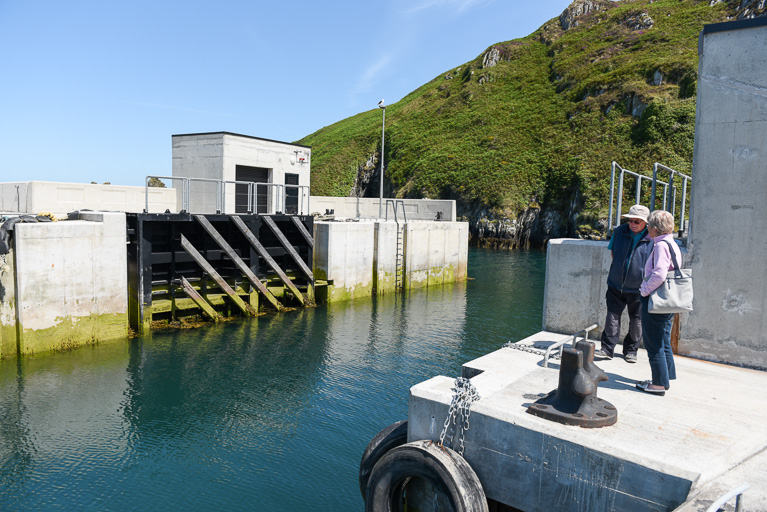
Published in Island News
Tagged under

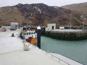
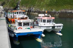
The storm gates on Cape Clear Island in West Cork have malfunctioned and the island ferry has been stranded inside the harbour.

"We are undergoing a bit of a crisis at the moment as a result," according to the islanders who are dependent as a result on small boats to provide transport or supplies until the situation is resolved.

"We have received every possible help and support from our local fellow operators and service providers which is greatly appreciated but it is nevertheless a very difficult situation," they say.

The Cape Clear Ferry Company has issued this statement about the Storm Gates malfunction:

On Wednesday morning, 18 April the Cape Clear Ferry, Dún Aengus was berthed at her overnight station inside the recently installed Storm Gates, designed to protect the inner harbour. Unfortunately, during the opening of the gate, operated hydraulically one of the stainless steel pipes burst leading to a loss of oil pressure and the gates remained closed, thus trapping the ferry inside. Given the nature of this marine standard equipment, sourcing spare parts and replacement oil will take some days at the earliest.

At this time of the year the Island’s main Ferry, Dún an Óir 11 is undergoing her annual survey and is not available for service.

We are very grateful to our good friend Nic Slocum of West Cork Whalewatch who agreed to provide an unofficial relief service on Wednesday at extremely short notice and arrangements have been made to provide an emergency service from today, Thursday 19th using our own 12 passenger vessel, Deep Star. Since this vessel has very limited passenger capacity, multiple trips will be required at peak times, possibly leading to delay’s and lack of cargo capacity is obvious. We are very grateful also to the Ro Ro service operated by Vince Ó Driscoll which will make a run to Cape Clear at 2pm today bringing both heavy and light cargo and with a license also for 12 passengers.

Intending passengers are asked to contact us by text or email, especially at peak times where lists of bookings will be taken for multiple trips. By doing this, we hope to avoid or reduce long delays. We ask all service users to check our Facebook page and website regularly for sailing updates and where possible, trips that can easily be postponed would be a great help to us.

We also thank the wonderful staff at Fields Supermarket for their legendary cooperation and forbearance and indeed to all the wonderful local people on the Island and elsewhere who have offed every possible help and assistance to us and to one another.

Published in Island News
Tagged under

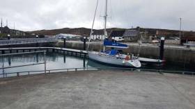
South Harbour in Cape Clear is a favourite anchorage of mine. There are other beautiful West Cork locations - Schull, Baltimore, Crookhaven, Glandore and Kinsale to be enjoyed, but I have really loved a calm, moonlit night lying at anchor in South Harbour as a very special experience.

North Harbour on the other shore of Cape is more popular because of the onshore facilities there, but also more crowded and often difficult to find space there.

“The island is hopeful of a good response from the sailing community”

However, all that is changing, with a new marina provided, I am told, by the Department of the Marine, where work is ongoing this week installing power points, with plans for water availability onto the marina. The Island Co-op premises is being upgraded to provide clothes washing and drying and the FLAGS development programme where financial support is given through Fishing Local Area Groups, administered by Bord Iascaigh Mhara, is going to fund shower facilities for marina users.

“The island is hopeful of a good response from the sailing community,” I was told this week “’’’ and diesel is available, petrol also and the pubs and restaurants are well set-up.”

NIC SLOCUMS WHALE WATCHING BOAT AT CAPE CLEAR MARINANic Slocum's Whale Watching boat at the new Cape Clear pontoon

Two early visitors to the marina were Neil Prendeville from Kinsale Yacht Club who brought his Mary P there this week… “three metres depth at low water” he told me.. …. An observant and dedicated sailor he suggested the installation of “better cleats for yachts…” and said it was great to see the facilities that will encourage more yachts to visit this Summer.

Also berthed there in the past week was Nic Slocum’s West Cork Whale Watching vessel.

That’s another marina on the West Cork coastline to add to Bantry from last year and, with the granting of €112,000 from the Department for the installation of a pontoon at Schull, perhaps - at last – official appreciation is growing of the jewel which West Cork provides for marine tourism.

Listen in to the podcast here: 
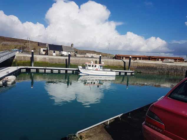
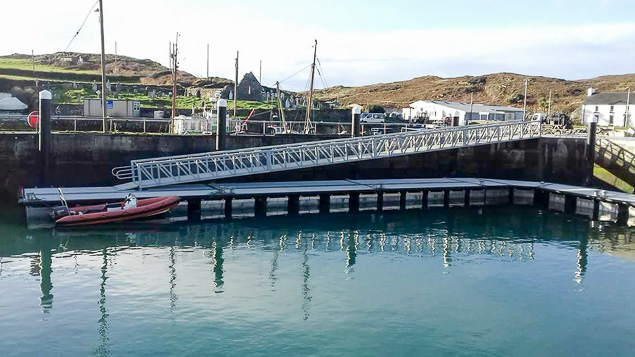
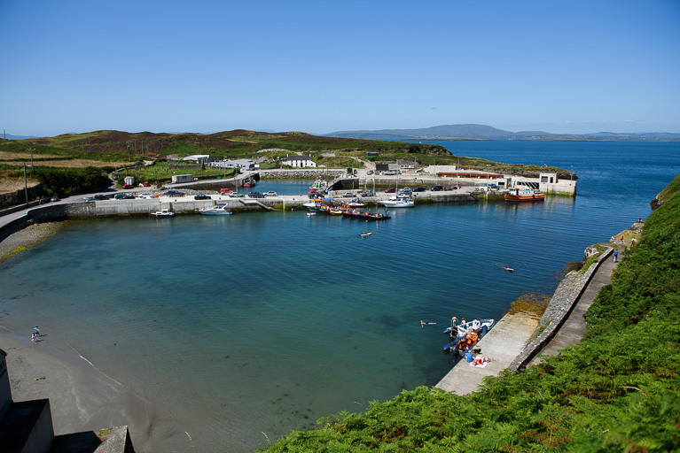
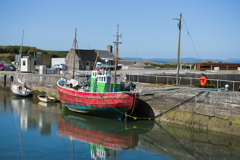
Published in West Cork
Tagged under

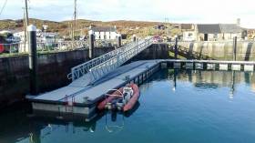
Marina pontoon installation work has been installed at Cape Clear Island's North Harbour where pontoons to the value of €200,000 are now in place at the West Cork island harbour.

As our pictures below show the new facility is a welcome addition in the popular harbour for both commercial and leisure craft. It's another valuable asset for boaters exploring the sailing wonders of West Cork.

The facility was installed by leading Irish pontoon supplier, Inland and Coastal Marina Systems Ltd.

 cape clear pontoon1cape clear pontoon1

Under the 2017 fishery harbour and coastal infrastructure capital programme, Junior Minister Andrew Doyle told the Dail Harbour's debate in June he had allocated €720,000 for maintenance and development works at the Island's North Harbour.

'The 2017 programme provides €200,000 for pontoons at Cape Clear and €250,000 for the design, preparation of contract documents and planning for additional repair work to Duffy's Pier' he said.

Read more on the works in our July report here.
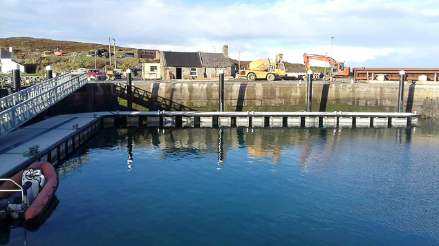
Published in West Cork
Tagged under

Marina pontoon installation work is well underway at Cape Clear Island's North Harbour where pontoons to the value of €200,000 have been procured for the West Cork island harbour.

Under the 2017 fishery harbour and coastal infrastructure capital programme, Junior Minister Andrew Doyle told the Dail Harbour's debate in June he had allocated €720,000 for maintenance and development works at the Island's North Harbour.

'The 2017 programme provides €200,000 for pontoons at Cape Clear and €250,000 for the design, preparation of contract documents and planning for additional repair work to Duffy's Pier' he said.

Read more on the works in our June report here.
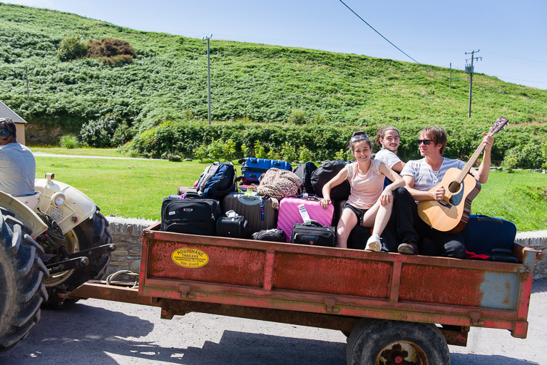
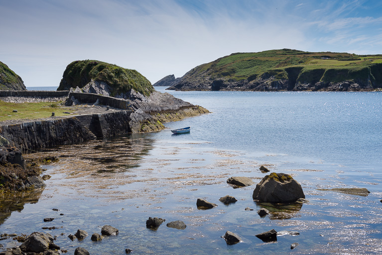
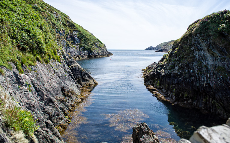
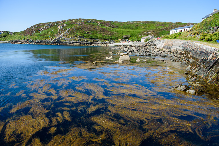
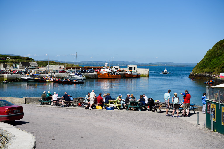
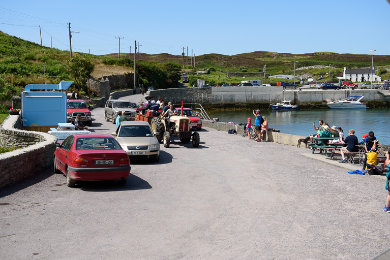
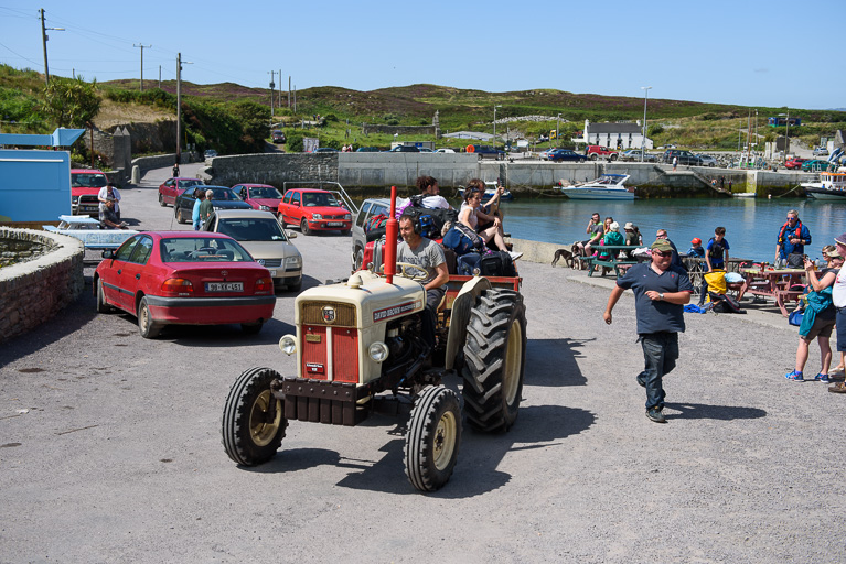
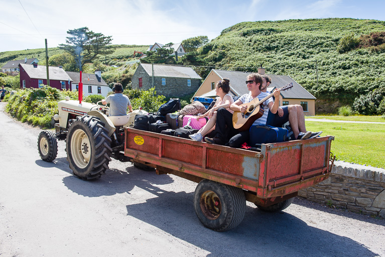
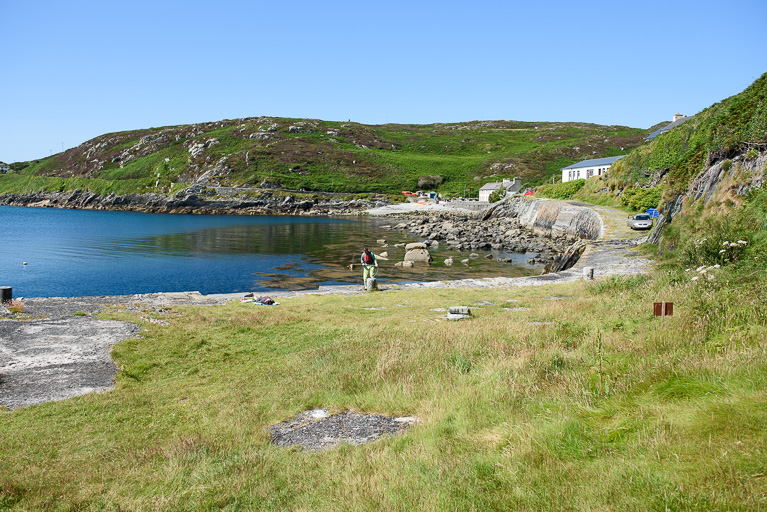
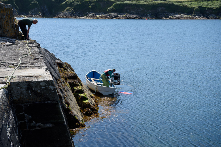
Published in Irish Marinas
Tagged under

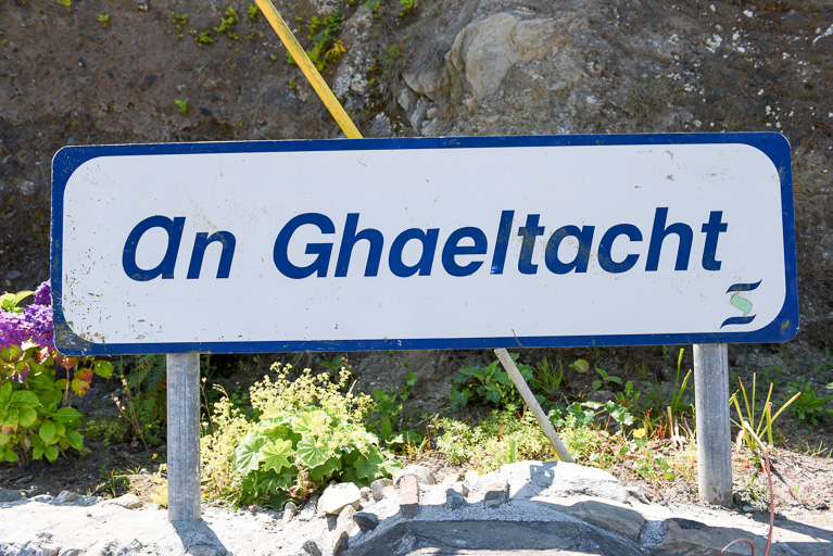
It may be just three miles long by one mile wide but there's heaps of maritime activity on Ireland’s southern most inhabited Gaeltacht island, Cape Clear. 

Removed from the hustle and bustle of mainland life, Cape Clear offers relaxation, nature and peace. Photographer Bob Bateman captured exactly that (see images below) on a recent visit to the rugged and remote island, eight miles off the coast of West Cork.

Cape Clear’s remote island location, coupled with its proximity to the continental shelf, makes it a foremost centre for bird watching in Ireland. It is also a marine widlife haven with Whales, leatherback turtles, sun fish, dolphins and sharks are spotted regularly every year. 

Cape Clear 4313Cape Clear 4313Cape Clear 4313Cape Clear 4313Cape Clear 4313Cape Clear 4313Cape Clear 4313Cape Clear 4358Cape Clear 4358Cape Clear 4358Cape Clear 4358Cape Clear 4358Cape Clear 4358Cape Clear 4358Cape Clear 4358Cape Clear 4358Cape Clear 4358

Published in Island News
Tagged under

The good news for West Cork boaters is that the €200,000 pontoons procured for Cape Clear island's North Harbour will be installed this Summer. And as our photo taken this week shows there's little doubt that they will be put to immediate use.

Under the 2017 fishery harbour and coastal infrastructure capital programme, Junior Minister Andrew Doyle told the Dail Harbour's debate in June he had allocated €720,000 for maintenance and development works at the Island's North Harbour. 'The 2017 programme provides €200,000 for pontoons at Cape Clear and €250,000 for the design, preparation of contract documents and planning for additional repair work to Duffy's Pier' he said.

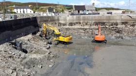
After storm damage wrecked the coastal infrastructure there, construction work has been underway at Cape Clear island since 2014. As Afloat previously reported in March that year, the works have involved the construction of a slipway; replacement of the Bull's Nose structure incorporating a storm gate and an extension to the end of Duffy's Pier; excavation, dredging and reclamation works including the construction of an armoured embankment at the seaward side of the new Bull's Nose structure.

It is expected the Duffy’s Pier preparatory work will also be completed in 2017. However, further work will be subject to permission and funding in future years.

Published in Coastal Notes

Pontoons in Cape Clear, West Cork a small craft harbour in Killybegs, County Donegal and dredging works in Howth, County Dublin are part of an €18m Capital Investment Package in 2016 for the development of Ireland’s fishery harbour network announced today by Minister for Agriculture, Food and the Marine, Simon Coveney T.D. See the full table below.

Announcing the investment package, the Minister said “In total I am allocating €18m for this year's Fishery Harbour and Coastal Infrastructure Capital Programme. I have set aside €16m towards safety, maintenance and new development works at the six Fishery Harbour Centres at Howth, Dunmore East, Castletownbere, Dingle, Rossaveel and Killybegs. I am also making €2m available for a Local Authority Harbour Programme, and I am assessing specifically what is required to address storm damage at Local Authority owned fishery harbours.”

Flagship projects in the 2016 Capital Programme (see table1) include the provision of dedicated Ferry pontoons on the West Pier in Howth, infrastructure upgrades in Dunmore East, commencement of the Dinish Wharf expansion Project in Castletownbere, expansion of the small craft harbour in Ros an Mhíl and the Smooth Point pier extension in Killybegs. The Minister continued, “While there are a number of flagship projects for completion this year, of equal importance is the preparatory work for significant potential projects in Howth, Dunmore East, An Daingean and Ros an Mhíl”

The 2016 Fishery Harbour and Coastal Infrastructure Capital Programme outlined by the Minister also contains funding of €2m to assist coastal Local Authorities repair, maintain and develop piers, harbours and slipways under their ownership. The Minister stated “I am delighted to continue to support Local Authorities in their efforts to maintain and develop the fishery harbour network which provides much needed facilities for our rural fishing and marine focussed communities. A number of smaller fishing piers around the coast experienced some damage during the recent storms and we are currently assessing how best to assist Local Authorities in carrying out repairs”

Concluding on the 2016 Fishery Harbour and Coastal Infrastructure Capital Programme, the Minister said “This year’s programme is significant on a number of fronts, firstly it provides for the continuation of this Governments strategy to develop and improve the facilities at our fishery harbours in 2016. Secondly it prepares the groundwork for potential projects in the coming years all of which will benefit the fishing industry, seafood processing sector, other ancillary marine industries.”


Table 1- Fishery Harbour & Coastal Infrastructure Development Programme 2016 

Location Project Cost €m

Howth:

Traffic Management Works

East Pier Repairs

Pontoons to west pier for ferry landings

Engineers office

Preparation of Dumping at Sea licence

Provision of Berthing Face to Middle Pier

Electric Works West Pier

Gas Main

Other Services (Sewers,ducting,watermains)

Total

0.150

0.050

0.400

0.050

0.100

0.100

0.300

0.150

0.150

1.450

Dunmore East:

Harbour Office Upgrade

West Wharf upgrade

Breakwater (Design Report)

- Harbour Road re-surface

Total

0.700

0.200

0.160

0.100

1.160

Castletownbere:

Harbour User toilet and Shower facilities

Dinish Wharf Expansion

Harbour Slipway

Quayside Electrical Upgrade

Harbour Offices Upgrade

Replacement of water network Dinish

Dinish Bridge Survey

CCTV

Total

0.090

1.000

0.040

0.150

0.250

0. 450

0.080

0.070

2.130

An Daingean:


Workshop Design ,Planning and commence works

Capital Dredging Navigation Channel –  Dumping at sea

  Licence, tender preparation and preparation works

Net mending area

Total

0.400 

0.500

0.100

1.000

Ros an Mhíl:


- Quay Development – Design, Evaluations, Consulting, EIS, Permitting and preparation works

- Small craft Harbour – Dredging

Total

0.800

1.800

2.600

Killybegs:


Repairs to Blackrock/Auction Hall Piers

Small Craft Harbour

Smooth Point Pier Development

- Landing Pier Fendering

- Landing Pier Electrical Design/Works

- Boatyard investment

Total

0.175

0.900

2.500

0.300

0.190

0.0 70

4.135

Cape Clear


-Pontoons

Total

400

0.400

Total Departmental Owned Marine Infrastructure projects €12.875
Safety and Maintenance and Non-Discretionary and Contractual Capital Commitments 2016 (incl Disability Access) €3.120
Total Local Authority Harbour Development and Marine Leisure €2.000
Total Fishery Harbour and Coastal Infrastructure Capital Programme

€17.995


Published in Irish Harbours

Baltimore RNLI received an an alert from Valentia Coastguard at 09:29 this morning when a young boy in urgent need of medical attention required immediate evacuation from Cape Clear Island.

Coxswain Aidan Bushe along with 5 volunteer crewmen were launched within minutes of the alert. They proceeded in poor weather conditions to the North Harbour of Cape Clear Island against a swell of 3 metres and force 6-7 northwest winds.

When the lifeboat crew arrived at the pier the little boy was unresponsive. He was immediately stretchered aboard the the lifeboat where he was constantly monitored on the journey back to Baltimore. The lifeboat arrived at Baltimore pier at 10:30, from where the boy was transferred to Skibbereen for medical attention.

The evacuation was successfully completed in one hour, a remarkable achievement given that current weather conditions have meant frequent cancellation of local ferries.

On board were ; Coxswain Aidan Bushe, Mechanic Cathal Cottrell, crew Sean McCarthy, Jerry Smith, Ronnie Carty and Don O'Donovan

Published in RNLI Lifeboats

#MarineWildlife - Do you remember the basking shark that surprised a group of bathers off Cape Clear last summer?

According to TheJournal.ie, it's now featured in a documentary shot on the fly by a team of quick-thinking filmmakers.

Aonrú, a film funded by Cork County Council and Bord Iascaigh Mhara, tackles the delicate subject of the West Cork island's future after the decline of the regional fishing industry.

But in the process of filming, they happened to be close by when the basking shark - the second-largest fish in the oceans – made its appearance, the solitary beast almost a metaphor for the island's dwindling community.

TheJournal.ie has more on the story HERE.

Published in Marine Wildlife
Page 2 of 4

General Information on using Waterways Ireland inland navigations

Safety on the Water

All users of the navigations are strongly recommended to make themselves aware of safety on the water for whatever activity they are involved in and to read the advice offered by the various governing bodies and by:

The Dept. of Transport, Ireland: www.gov.ie/transport and The Maritime and Coastguard Agency, UK, The RNLI – Water Safety Ireland for information in terms of drowning prevention and water safety.

Registration of Vessels

All vessels using the Shannon Navigation, which includes the Shannon-Erne Waterways and the Erne System must be registered with Waterways Ireland. Only open undecked boats with an engine of 15 horsepower or less on the Shannon Navigation, and vessels of 10 horsepower or less on the Erne System, are exempt. Registration is free of charge.

Craft registration should be completed online at: https://www.waterwaysireland.org/online-services/craft-registration

Permits for use of the Grand and Royal Canals and the Barrow Navigation

All vessels using the Grand and Royal Canals and the Barrow Navigation must display appropriate valid Permit(s) i.e A Combined Mooring and Passage Permit (€126) and if not intending to move every five days, an Extended Mooring Permit (€152).

Permit applications should be completed online at: https://www.waterwaysireland.org/online-services/canal-permits

Passage on the Royal and Grand Canals – Dublin Area

For boat passage through the locks east of Lock 12 into / out of Dublin on either the Royal or Grand Canals, Masters are requested to contact the Waterways Ireland Eastern Regional Office (M-F 9.30am-4.30pm) on tel: +353(0)1 868 0148 or email [email protected] prior to making passage in order to plan the necessary lock-keeping assistance arrangements.

On the Grand Canal a minimum of two days notice prior to the planned passage should be given, masters should note that with the exception of pre-arranged events, a maximum of 2 boats per day will be taken through the locks, travelling either east or west.

Movements in or out of the city will be organised by prior arrangement to take place as a single movement in one day. Boaters will be facilitated to travel the system if their passage is considered to be safe by Waterways Ireland and they have the valid permit(s) for mooring and passage.

Newcomen Lifting Bridge

On the Royal Canal two weeks’ notice of bridge passage (Newcomen Lifting Bridge) is required for the pre-set lift date, and lock assistance will then also be arranged. A minimum of 2 boats is required for a bridge lift to go ahead.

Waterways Ireland Eastern Regional Office (Tel: +353(0)1 868 0148 or [email protected] ) is the point of contact for the bridge lift.

A maximum number of boats passing will be implemented to keep to the times given above for the planned lifts (16 for the Sat / Sun lifts & 8 for the weekday lifts). Priority will be given on a first come first served basis.

On day of lift, boaters and passengers must follow guidance from Waterways Ireland staff about sequence of passage under bridge & through Lock 1, and must remain within signed and designated areas.

Events Held on the Waterways

All organised events taking place on the waterways must have the prior approval of Waterways Ireland. This is a twelve week process and application forms must be accompanied with the appropriate insurance, signed indemnity and risk assessment. The application should be completed on the Waterways Ireland events page at :

https://www.waterwaysireland.org/online-services/event-approval

Time Limits on Mooring in Public Harbours

On the Shannon Navigation and the Shannon-Erne Waterway craft may berth in public harbours for five consecutive days or a total of seven days in any one month.

On the Erne System, revised Bye Laws state that: No master or owner shall permit a vessel, boat or any floating or sunken object to remain moored at or in the vicinity of any public mooring, including mooring at any other public mooring within 3 kilometres of that location, for more than 3 consecutive days and shall not moor at that same mooring or any other public mooring within 3 kilometres of that location within the following 3 consecutive days without prior permission by an authorised official.

Winter Mooring on the Shannon Navigation and Shannon Erne Waterway

Winter mooring may be availed of by owners during the period 1 Nov to 31 Mar by prior arrangement and payment of a charge of €63.50 per craft. Craft not availing of Winter Mooring must continue to comply with the “5 Day Rule”. Winter Mooring applications should be completed online at : https://www.waterwaysireland.org/online-services/winter-moorings-booking

Owners should be aware that electricity supply and water supply to public moorings is disconnected for the winter months. This is to protect against frost damage, to reduce running costs and to minimise maintenance requirements during the winter months.

Vessel owners are advised that advance purchasing of electricity on the power bollards leading up to the disconnection date should be minimal. Electricity credit existing on the bollards will not be recoverable after the winter decommissioning date. Both services will be reinstated prior to the commencement of the next boating season.

Smart Cards

Waterways Ireland smart cards are used to operate locks on the Shannon Erne Waterway, to access the service blocks, to use the pump-outs along the navigations, to avail of electrical power at Waterways Ireland jetties.

Berthing in Public Harbours

Masters are reminded of the following:

  • Equip their vessel with mooring lines of appropriate length and strength and only secure their craft to mooring bollards and cleats provided for this purpose.
  • Ensure the available berth is suitable to the length of your vessel, do not overhang the mooring especially on finger moorings on floating pontoon moorings.
  • Ensure mooring lines, electric cables and fresh water hoses do not create a trip hazard on public jetties for others users.
  • Carry sufficient fenders to prevent damage to your own vessel, other vessels and WI property.
  • Allow sufficient space between your vessel and the vessel ahead /astern (c.1m) for fire safety purposes and /or to recover somebody from the water.
  • Do not berth more than two vessels side by side and ensure there is safe access/egress at all times between vessels and onto the harbour itself.
  • Do not berth in such a way to prevent use of harbour safety ladders, slipways or pump-outs.
  • Do not allow the bow of your vessel to overhang the walkway of a floating mooring thus creating a hazard for others with an overhanging anchor or bow fendering.
  • Animals are not allowed to be loose or stray at any time.
  • Harbour and jetty infrastructure such as railings, power pedestals, fresh water taps, electric light poles, safety bollards, ladders etc are not designed for the purpose of mooring craft , they will not bear the strain of a vessel and will be damaged.
  • At Carrybridge on the Erne System, Masters of vessels are not permitted to use stern on mooring. Masters of vessels must use the mooring fingers for mooring of vessels and for embarkation / disembarkation from vessels.

Passenger Vessel Berths

Masters of vessels should not berth on passenger vessel berths where it is indicated that an arrival is imminent. Passenger vessels plying the navigations generally only occupy the berths to embark and disembark passengers and rarely remain on the berths for extended periods or overnight.

Lock Lead-in Jetties

Lead-in jetties adjacent to the upstream and downstream gates at lock chambers are solely for the purpose of craft waiting to use the lock and should not be used for long term berthing.

Vessel Wake

Vessel wake, that is, the wave generated by the passage of the boat through the water, can sometimes be large, powerful and destructive depending on the hull shape and engine power of the vessel. This wake can be detrimental to other users of the navigation when it strikes their craft or inundates the shoreline or riverbank. Masters are requested to frequently look behind and check the effect of their wake / wash particularly when passing moored vessels, on entering harbours and approaching jetties and to be aware of people pursuing other activities such as fishing on the riverbank.

Speed Restriction

A vessel or boat shall not be navigated on the Shannon Navigation at a speed in excess of 5 kph when within 200 metres of a bridge, quay, jetty or wharf, when in a harbour or canal or when passing within 100 metres of a moored vessel or boat.

Vessels navigating the Shannon-Erne Waterway should observe the general 5 kph speed limit which applies along the waterway. This is necessary in order to prevent damage to the banks caused by excessive wash from vessels.

Vessels navigating the Erne System should observe the statutory 5kt / 6mph / 10kph speed limit areas.

A craft on the Royal and Grand canals shall not be navigated at a speed in excess of 6km per hour.

A craft on the Barrow Navigation shall not be navigated at a speed in excess of 11km per hour except as necessary for safe navigation in conditions of fast flow.

Bank Erosion

Narrow sections of all the navigations are particularly prone to bank erosion due to the large wash generated by some craft. Masters are requested to be vigilant and to slow down to a speed sufficient to maintain steerage when they observe the wash of their craft inundating the river banks.

Unusual Waterborne Activity

Unusual waterborne vessels may be encountered from time to time, such as, hovercraft or amphibious aircraft / seaplanes. Masters of such craft are reminded to apply the normal “Rule of the Road” when they meet conventional craft on the water and to allow extra room to manoeuvre in the interest of safety.

Sailing Activity

Mariners will encounter large numbers of sailing dinghies from late June to August in the vicinity of Lough Derg, Lough Ree and Lower Lough Erne. Sailing courses are marked by yellow buoys to suit weather conditions on the day. Vessels should proceed at slow speed and with due caution and observe the rules of navigation when passing these fleets, as many of the participants are junior sailors under training.

Rowing

Mariners should expect to meet canoes and vessels under oars on any part of the navigations, but more so in the vicinity of Athlone, Carrick-on-Shannon, Coleraine, Enniskillen and Limerick. Masters are reminded to proceed at slow speed and especially to reduce their wash to a minimum when passing these craft as they can be easily upset and swamped due to their very low freeboard and always be prepared to give way in any given traffic situation.

Canoeing

Canoeing is an adventure sport and participants are strongly recommended to seek the advice of the sport’s governing bodies i.e Canoeing Ireland and the Canoe Association of Northern Ireland, before venturing onto the navigations.

Persons in charge of canoes are reminded of the inherent danger to these craft associated with operating close to weirs, sluice gates, locks and other infrastructure particularly when rivers are in flood and large volumes of water are moving through the navigations due to general flood conditions or very heavy localised precipitation e.g. turbulent and broken water, stopper waves. Shooting weirs is prohibited without prior permission of Waterways Ireland.

Canoeists should check with lockkeepers prior entering a lock to ensure passage is done in a safe manner. Portage is required at all unmanned locks.

Canoe Trail Network – "Blueways"

Masters of powered craft are reminded that a canoe trail network is being developed across all navigations and to expect more organised canoeing along these trails necessitating slow speed and minimum wash when encountering canoeists, rowing boats etc

Rockingham and Drummans Island Canals – Lough Key

It is expected that work on Rockingham and Drummans Island Canals on Lough Key will be completed in 2021. Access to these canals will be for non-powered craft only, eg canoes, kayaks, rowing boats.

Fast Powerboats and Personal Watercraft (Jet Skis)

Masters of Fast Powerboats (speed greater than 17kts) and Personal Watercraft (i.e.Jet Skis) are reminded of the inherent dangers associated with high speed on the water and especially in the confines of small bays and narrow sections of the navigations. Keeping a proper look-out, making early alterations to course and /or reducing speed will avoid conflict with slower vessels using the navigation. Personal Watercraft are not permitted to be used on the canals.

Towing Waterskiers, Wakeboarders, Doughnuts etc

Masters of vessels engaged in any of these activities are reminded of the manoeuvring constraints imposed upon their vessel by the tow and of the added responsibilities that they have to the person(s) being towed. These activities should be conducted in areas which are clear of conflicting traffic. It is highly recommended that a person additional to the master be carried to act as a “look-out” to keep the tow under observation at all times.

Prohibition on Swimming

Swimming in the navigable channel, particularly at bridges, is dangerous and is prohibited due to the risk of being run over by a vessel underway in the navigation.

Age Restrictions on operating of powered craft

In the Republic of Ireland, Statutory Instrument 921 of 2005 provides the legal requirements regarding the minimum age for operating of powered craft. The Statutory Instrument contains the following requirements:

- The master or owner of a personal watercraft or a fast power craft shall take all reasonable steps to ensure that a person who has not attained the age of 16 years does not operate or control the craft

- The master or owner of a pleasure craft powered by an engine with a rating of more than 5 horse power or 3.7 kilowatts shall take all reasonable steps to ensure that a person who has not attained the age of 12 years does not operate or control the craft.

Lifejackets and Personal Flotation Devices (PFDs)

Lifejackets and PFD’s are the single most important items of personal protective equipment to be used on a vessel and should be worn especially when the vessel is being manoeuvred such as entering / departing a lock, anchoring, coming alongside or departing a jetty or quayside.

In the Republic of Ireland, Statutory Instrument 921 of 2005 provides the legal requirements regarding the wearing of Personal Flotation Devices. The Statutory Instrument contains the following requirements:

- The master or owner of a pleasure craft (other than a personal watercraft) shall ensure, that there are, at all times on board the craft, sufficient suitable personal flotation devices for each person on board.

- A person on a pleasure craft (other than a personal watercraft) of less than 7 metres length overall shall wear a suitable personal flotation device while on board an open craft or while on the deck of decked craft, other than when the craft is made fast to the shore or at anchor.

- The master or owner of a pleasure craft (other than a personal watercraft) shall take all reasonable steps to ensure that a person who has not attained the age of 16 years complies with paragraph above.

- The master or owner of a pleasure craft (other than a personal watercraft), shall take all reasonable steps to ensure that a person who has not attained the age of 16 years wears a suitable personal flotation device while on board an open craft or while on the deck of a decked craft other than when it is made fast to the shore or at anchor.

- The master or owner of a pleasure craft (other than a personal watercraft) shall take all reasonable steps to ensure that a person wears a suitable personal flotation device, at all times while – (a) being towed by the craft, (b) on board a vessel or object of any kind which is being towed by the craft.

Further information is available at: http://www.irishstatutebook.ie/eli/2005/si/921/made/en/print

Firing Range Danger Area – Lough Ree

The attention of mariners is drawn to the Irish Defence Forces Firing Range situated in the vicinity of buoys No’s 2 and 3, on Lough Ree on the Shannon Navigation. This range is used regularly for live firing exercises, throughout the year, all boats and vessels should stay clear of the area marked with yellow buoys showing a yellow "X" topmark and displaying the word "Danger".

Shannon Navigation, Portumna Swing Bridge Tolls

No attempt should be made by Masters’ of vessels to pay the bridge toll while making way through the bridge opening. Payment will only be taken by the Collector from Masters when they are secured alongside the jetties north and south of the bridge.

Navigating from Killaloe to Limerick on the Shannon Navigation

The navigation from Killaloe to Limerick involves passage through Ardnacrusha locks, the associated headrace and tailrace and the Abbey River into Limerick City. Careful passage planning is required to undertake this voyage. Considerations include: lock passage at Ardnacrusha, water flow in the navigation, airdraft under bridges on Abbey River in Limerick, state of tide in Limerick

Users are advised to contact the ESB Ardnacrusha hydroelectric power station (00353 (0)87 9970131) 48 hours in advance of commencing their journey to book passage through the locks at Ardnacrusha. It is NOT advised to undertake a voyage if more than one turbine is operating (20MW), due to the increased velocity of flow in the navigation channel, which can be dangerous. To ascertain automatically in real time how many turbines are running, users can phone +353 (0)87 6477229.

For safety reasons the ESB has advised that only powered craft with a capacity in excess of 5 knots are allowed to enter Ardnacrusha Headrace and Tailrace Canals.

Passage through Sarsfield Lock should be booked on +353-87-7972998, on the day prior to travel and it should be noted also that transit is not possible two hours either side of low water.

A Hydrographic survey in 2020 of the navigation channel revealed that the approach from Shannon Bridge to Sarsfield Lock and the Dock area has silted up. Masters of vessels and water users are advised to navigate to the Lock from Shannon bridge on a rising tide one or two hours before High Tide.

Lower Bann Navigation

The attention of all users is drawn to the “Users Code for the Lower Bann”, in particular to that section covering “Flow in the River” outlining the dangers for users both on the banks and in the navigation, associated with high flow rates when the river is in spate. Canoeists should consult and carry a copy of the “Lower Bann Canoe Trail” guide issued by the Canoe Association of Northern Ireland. Users should also contact the DfI Rivers Coleraine, who is responsible for regulating the flow rates on the river, for advisory information on the flow rates to be expected on any given day.

DfI Rivers Coleraine. Tel: 0044 28 7034 2357 Email: [email protected]

Lower Bann Navigation – Newferry – No wake zone

A No Wake Zone exists on the Lower Bann Navigation at Newferry. Masters of vessels are requested to proceed at a slow speed and create no wake while passing the jetties and slipways at Newferry.

Overhead Power Lines (OHPL) and Air draft

All Masters must be aware of the dangers associated with overhead power lines, in particular sailing vessels and workboats with cranes or large air drafts. Voyage planning is a necessity in order to identify the location of overhead lines crossing the navigation.

Overhead power line heights on the River Shannon are maintained at 12.6metres (40 feet) from Normal Summer level for that section of navigation, masters of vessels with a large air draft should proceed with caution and make additional allowances when water levels are high.

If a vessel or its equipment comes into contact with an OHPL the operator should NOT attempt to move the vessel or equipment. The conductor may still be alive or re-energise automatically. Maintain a safe distance and prevent third parties from approaching due to risk of arcing. Contact the emergency services for assistance.

Anglers are also reminded that a minimum ground distance of 30 metres should be maintained from overhead power lines when using a rod and line.

Submarine Cables and Pipes

Masters of vessels are reminded not to anchor their vessels in the vicinity of submarine cables or pipes in case they foul their anchor or damage the cables or pipes. Look to the river banks for signage indicating their presence.

Water Levels - Precautions

Low Water Levels:

When water levels fall below normal summer levels masters should be aware of:

Navigation

To reduce the risk of grounding masters should navigate on or near the centreline of the channel, avoid short cutting in dog-legged channels and navigating too close to navigation markers.

Proceeding at a slow speed will also reduce “squat” effect i.e. where the vessel tends to sit lower in the water as a consequence of higher speed.

Slipways

Reduced slipway length available under the water surface and the possibility of launching trailers dropping off the end of the concrete apron.

More slipway surface susceptible to weed growth requiring care while engaged in launching boats, from slipping and sliding on the slope. Note also that launching vehicles may not be able to get sufficient traction on the slipway once the craft is launched to get up the incline.

Bank Erosion

Very dry riverbanks are more susceptible to erosion from vessel wash.

Lock Share

Maximising on the number of vessels in a lock will ensure that the total volume of water moving downstream is decreased. Lock cycles should be used for vessels travelling each way.

High Water Levels:

When water levels rise above normal summer level masters should be aware of:

Navigation

Navigation marks will have reduced height above the water level or may disappear underwater altogether making the navigable channel difficult to discern.

In narrow sections of the navigations water levels will tend to rise more quickly than in main streams and air draft at bridges will likewise be reduced.

There will also be increased flow rates particularly in the vicinity of navigation infrastructure such as bridges, weirs, locks etc where extra care in manoeuvring vessels will be required.

Harbours and Jetties

Due care is required in harbours and at slipways when levels are at or near the same level as the harbour walkways' as the edge will be difficult to discern especially in reduced light conditions. It is advised that Personal Flotation Devices be worn if tending to craft in a harbour in these conditions.

Slipways

Slipways should only be used for the purpose of launching and recovering of water craft or other objects from the water. Before using a slipway it should be examined to ensure that the surface has sufficient traction/grip for the intended purpose such as launching a craft from a trailer using a vehicle, that there is sufficient depth of water on the slipway to float the craft off the trailer before the concrete apron ends and that the wheels of the trailer do not drop off the edge of the slipway. That life-saving appliances are available in the vicinity, that the vehicle is roadworthy and capable of coping with the weight of the trailer and boat on the incline. It is recommended that slipway operations are conducted by two persons.

Caution to be Used in Reliance upon Aids to Navigation

The aids to navigation depicted on the navigation guides comprise a system of fixed and floating aids to navigation. Prudent mariners will not rely solely on any single aid to navigation, particularly a floating aid to navigation. With respect to buoys, the buoy symbol is used to indicate the approximate position of the buoy body and the ground tackle which secures it to the lake or river bed. The approximate position is used because of the practical limitations in positioning and maintaining buoys in precise geographical locations. These limitations include, but are not limited to, prevailing atmospheric and lake/river conditions, the slope of and the material making up the lake/river bed, the fact that the buoys are moored to varying lengths of chain, and the fact that the buoy body and/or ground tackle positions are not under continuous surveillance. Due to the forces of nature, the position of the buoy body can be expected to shift inside and outside the charted symbol.

Buoys and perches are also moved out of position or pulled over by those mariners who use them to moor up to instead of anchoring. To this end, mariners should always monitor their passage by relating buoy/perch positions with the published navigation guide. Furthermore, a vessel attempting to pass close by always risks collision with a yawing buoy or with the obstruction that the buoy or beacon/perch marks.

Masters of Vessels are requested to use the most up to date Navigation guides when navigating on the Inland Waterways.

Information taken from Special Marine Notice No 1 of 2023