Menu

Ireland's sailing, boating & maritime magazine

Inland afloat headers


Displaying items by tag: Marine Insitute

The Marine Institute’s Explorers Education programme has launched the Explorers We Are Ocean Champions School Project module and Awards this week, recognising the UN’s international education day - Changing Course, Transforming Education.

The Explorers new school project module adopts an all-school approach where the Explorers outreach teams around Ireland will work with teachers and children, developing their own healthy ocean project to inspire and engage their school and community to become ocean champions.

“The Explorers Ocean Champions project and awards highlights the Marine Institute’s aim to help encourage marine education and engagement at a community level,” said Ms Patricia Orme, Director, Marine Institute. “Schools working in collaboration with the Explorers outreach teams and their local communities, will gain a better understanding of our ocean and is a fantastic opportunity to inspire our younger generation, creating ocean champions and leaders of the future.”

The project and awards focus on the concept of healthy oceans and marine environmental care, with the aim that children will identify issues or challenges that affect the ocean and then develop a project to explore solutions. Throughout the project the children will work together with the Explorers outreach teams, their school, friends, family, and local community, helping to raise awareness and engagement about the ocean. This may include organising community beach cleans, development of science projects and artwork, to organising school drama, songs or public speaking competitions about the ocean.

Primary schools may apply to work on a school project with their regional Explorers Outreach centres.

“Adopting an all-school approach to complete this project is an excellent opportunity for children to develop their own skills and their relationships with their community and the environment. A significant part of the project is taking what they have learned and using it to creative positive actions to improve the ocean’s health,” explained Cushla Dromgool-Regan, Strategic Education and Communications Manager, Explorers Education Programme, Camden Education Trust.

“We hope that the scope of this project will appeal to primary schools, where the cross-curricular nature of the activities and support from the outreach teams will allow the children, their teachers, and their community to engage with the ocean in a creative manner and focus on an issue that interests them,” Ms Dromgool-Regan added.

There are three categories, where the school project must adopt a Healthy Ocean theme include: Marine Cross Curricular and STEAM school project; Ocean Literacy and Sustainable Development Goals creative school project; and Marine Outdoor school project. More information about the school project and awards can be found on the Explorers website.

Each school and outreach centre will submit their projects, showing the impact and engagement of the children’s work. Project submissions will be judged by a team of marine and education experts, where the winners will receive a Marine Institute Ocean Champion award for their school. Winners of the awards will be announced around World Ocean Day on the 8th June.

For more information about the Explorers Education Programme see www.explorers.ie. The Explorers Education Programme is funded by the Marine Institute, Ireland's state agency for marine research and development.

Published in Marine Science
Tagged under

Ireland’s first floating solar energy plant is another step closer to fruition thanks to funding from the Marine Institute.

Co Mayo-based SolarMarine Energy Ltd shared in the €2.4 million Industry-Led Awards scheme for research projects in 2018, putting its grant into the design of a floating solar energy structure to generate ‘green hydrogen’.

As previously reported on Afloat.ie, the company secured permission from the Port of Cork some 18 months ago to install a 1.5MW plant in Cork Harbour at Ringaskiddy.

However, there is currently no official recognition of the company’s innovative concept within marine planning legislation.

This remains “an obstacle to obtaining a foreshore license for the development of floating solar projects”, as the final report into the project states.

Eamon Howlin, CEO of SolarMarine Energy, says: “The floating solar industry is only emerging in Europe having been established in Japan in 2014, and has a projected market value of over $1 billion by 2023.

“Thanks to our collaborative study in partnership with the Marine Institute and University College Cork, SolarMarine Energy Ltd are playing an important part in this developing industry.”

Dr Paul Leahy of the Science Foundation Ireland MAREI Centre at University College Cork (UCC) added that permission for a prototype at Ringaskiddy “would allow SolarMarine and UCC to capitalise on the design work undertaken under the Marine Institute-funded project, and bring the SolarMarine floating solar concept closer to market”.

Published in Power From the Sea

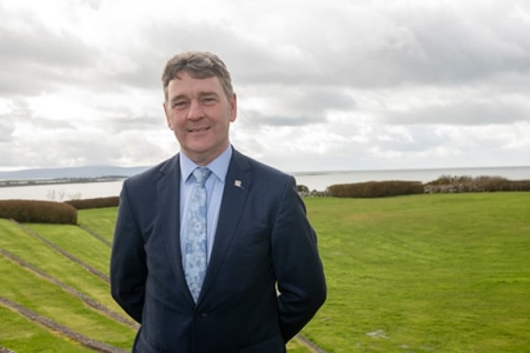
The former chief executive of the Marine Institute has been appointed as the new chair of the council of the Dublin Institute for Advanced Studies (DIAS).

Dr Peter Heffernan served as the Marine Institute’s CEO for 27 years, retiring from the post in October 2019, and his new role is with the world’s second — and Ireland’s only — institute for advanced studies.

DIAS leads Ireland’s participation in a number of international research endeavours that focus on the big, unanswered questions for mankind.

Dr Heffernan previously played a fundamental part in developing Ireland’s ocean research capacity, which included overseeing the arrival of Ireland’s two purpose-built marine research vessels: the RV Celtic Voyager in 1997 and the RV Celtic Explorer in 2003.

He also instigated the development of the Inter-Department Marine Coordination Group in 2009, which led to Ireland’s first integrated marine plan, Harnessing Our Ocean Wealth.

Dr Heffernan acted as an inspiration and Irish EU Presidency Ambassador for the creation of the Atlantic Ocean Research Alliance (AORA) with the signing of the Galway Statement on Atlantic Ocean Co-operation between Canada, the European Union and the United States of America.

And he is Ireland’s only representative on the European Union’s Mission Board for Healthy Oceans, Seas, Coastal and Inland Waters.

Published in Marine Science

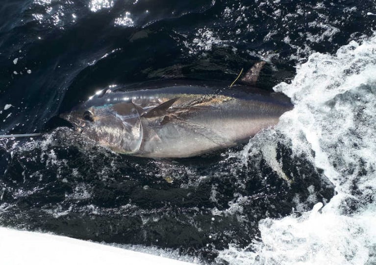
Building on the success of last year’s Tuna CHART (CatcH And Release Tagging) pilot programme, a bluefin tuna research catch-and-release fishery for Ireland will operate in 2020.

A maximum of 25 authorisations may be granted to qualifying angling charter vessel skippers around the Irish coast for this fishery which will open on Wednesday 1 July and close on Thursday 12 November, without exception.

And depending on the successful operation and review of this year’s fishery, it is intended that a scientific catch and release fishery may also operate in 2021 and 2022.

Atlantic bluefin tuna, the largest tuna in the world, frequent Irish coastal waters to feed during its annual migration through North Atlantic waters. The bluefin tuna is prized by sea anglers for its power and fighting ability and is a very valuable commercial species.

The Tuna CHART programme is a collaborative scientific programme between Inland Fisheries Ireland (IFI) and the Marine Institute in partnership with the Sea Fisheries Protection Authority, the Department of Agriculture, Food and the Marine (DAFM) and the Department of Communications, Climate Action and Environment (DCCAE).

In 2019, the Tuna CHART pilot programme authorised 15 charter skippers to operate a scientific fishery, in which anglers participated fully, to catch, tag and release bluefin tuna.

These professional skippers were trained to tag, measure and record bluefin data and over the course of the 2019 three month season, 219 bluefin tuna were caught, tagged and released. As many as eight bluefin were tagged on one fishing trip.

All tuna were carefully handled subject to strict guidelines set by the Tuna CHART programme and all were released alive. Data from the tagging programme are being collated by the partnership for reporting to the International Commission for the Conservation of Atlantic Tuna (ICCAT).

As with the pilot programme, this year’s authorised skippers will be required to have high specification rods, reels and line in advance of the open season in order to bring the fish alongside in a timely manner. Skippers will be required to collect data on every bluefin trip undertaken and each bluefin tuna they catch, tag and release.

A call for applications for the 2020 fishing season will be announced next Tuesday 18 February and the last date for the receipt of a completed application will be 1pm on Friday 6 March.

Published in Angling

Tánaiste Simon Coveney has paid tribute to outgoing Marine Institute chief executive Dr Peter Heffernan for the “phenomenal impact” he has had on Irish and international scientific research writes Lorna Siggins.

Dr Heffernan has been a “trailblazer, demanding political attention”, ensuring Ireland’s reputation as a global leader in the “international marine space”, Mr Coveney said.

Dr Heffernan, who is retiring after almost 27 years in the post, says that Ireland can play a key role in international monitoring of ocean health and impacts of climate change.

Speaking by video at an event in the Marine Institute’s headquarters in Galway on Wednesday, Mr Coveney said that he shared Dr Heffernan’s “passion for the sea and all things marine”.

“As minister for marine, planning and now foreign affairs, I can say that without Peter we wouldn’t have a Marine Institute,” Mr Coveney said.

He recalled how his father, the late Hugh Coveney, had spoken about Peter Heffernan during his own time as marine minister, and how he had also then experienced the scientist’s “extraordinary energy, drive and ambition”.

"Without Peter, we wouldn’t have a Marine Institute”

US National Oceanic and Atmospheric Administration’s acting chief scientist Craig McLean and Minister for Marine Michael Creed also paid tribute to Dr Heffernan, while European Commission senior official John Bell highlighted his role in creating the Atlantic Ocean Research Alliance.

Initiated in 2013, the alliance commits North America, Canada and the EU to a shared vision of the Atlantic as “healthy, resilient, safe, productive, understood and treasured”.

Under Dr Heffernan’s tenure, the Marine Institute established a headquarters in Galway and developed a marine research fleet – with plans to purchase a new 50m ship to replace the 31m Celtic Voyager.

Dr Heffernan said the changing climate’s impact on the oceans is now the “greatest global challenge”, which Ireland is well placed to monitor – with significant investment in monitoring technology, including the weather buoy network and gliders,

Dr Paul Connolly, who succeeds Dr Peter Heffernan, is a former president of the International Council for the Exploration of the Seas (ICES).

Up until recently, he was the director of the Marine Institute’s Fisheries and Ecosystems Advisory Services (FEAS) team, providing scientific advice on the sustainable exploitation of Ireland’s fisheries resource and marine ecosystems.

Marine Institute chairman Dr John Killeen said that Dr Connolly “brings a wealth of experience and knowledge to the role, and will be dedicated to positioning the institute as a global leader in ocean knowledge, and empowering Ireland to harness our marine resource”.

Dr Killeen said that Dr Heffernan had “played a fundamental role in developing Ireland’s ocean research capacity”, and “driving collaboration in marine research and innovation in Europe and internationally”.

Dr Heffernan has been selected as a member of the European Commission’s mission board for Healthy Oceans, Seas, Coastal and Inland Waters.

The board is one of five major research missions of Horizon Europe, the EU Research and Innovation programme (2021 – 2027), and Dr Heffernan is one of two Irish appointees.

Published in Marine Science

Dr Paul Connolly has been announced as the Chief Executive Officer of the Marine Institute, Ireland’s state agency for marine research, technology development and innovation. The appointment follows the upcoming retirement of Dr Peter Heffernan after 27 years as CEO of the institute.

Dr Connolly is the current Director of Fisheries and Ecosystems Advisory Services (FEAS) at the Marine Institute, leading a team of more than 80 scientists and staff to provide scientific advice on the sustainable exploitation of Ireland’s fisheries resource and marine ecosystems.

On the announcement Minister Creed said, “Our marine resource offers significant opportunities for Ireland in areas of research and innovation, the sustainable development of our blue economy, and ocean observation to prepare for the impacts of climate change. With Dr Connolly’s extensive experience in sustainable fisheries management, leading innovative and integrated research programmes and driving strategic collaborations nationally and internationally, the Marine Institute will continue to deliver excellent science, advice and technical support to government and industry.”

Dr Connolly said, “Over the next five years, I will be deeply committed to supporting a culture of high performance driven by our people, whose skills, experiences and passion for the marine are central to the work of the Marine Institute. These are very exciting times for ocean science, with the UN Decade of the Ocean beginning in 2021, the anticipated delivery of a new research vessel in 2022 and the need to address the challenges posed by a changing climate.”

Dr Connolly is a former president of the International Council for the Exploration of the Seas (ICES); a network of 20 countries, which aims to advance scientific understanding of marine ecosystems and provides impartial scientific advice for meeting conservation, management, and sustainability goals.

He has chaired the quarterly meetings of the Irish Fisheries Science Research Partnership (IFSRP) since it was established by the Minister in 2008. Dr Connolly led the development of the ICES Strategic Plan (2014-2018) which was adopted by 20 member countries, and worked closely with government, agencies and the Marine Institute team to develop Ireland’s integrated marine plan, Harnessing Our Ocean Wealth. He also led the executive in developing the Marine Institute’s Strategic Plan, Building Ocean Knowledge Delivering Ocean Services (2018 - 2022).

Dr Connolly has a PhD from UCD (1986), an MBA from NUI Galway (2006) and completed the Timoney Advanced Leadership programme in 2016.

Published in Marine Science
Tagged under

Seven successful applicants will be awarded funding under the Marine Institute’s SmartBay National Infrastructure Access Programme (NIAP) following the 2018/2019 funding call.

The awardees will receive support of around €25,000 per project to trial and validate their technology and/or gain access to data feeds to carry out scientific research at the SmartBay Marine and Renewable Energy Test Site in Galway Bay.

The call was open to both academia and industry, and other relevant organisations, on the island of Ireland to access the SmartBay test site and subsea observatory.

The chosen organisations may deploy equipment on the test site, connect to and access the underwater observatory, and analyse the many data feeds which are collected on site every day.

Over the past seven years, more than 50 projects have been awarded funding, facilitating a wide range of multi-disciplinary marine research, development and innovation at this national facility, the Marine Institute says.

Welcoming the announcement, the institute’s outgoing chief executive Dr Peter Heffernan said the funding awards “are aligned with the goals of the national Marine Research and Innovation Strategy 2017–2021”.

This year the following projects were awarded funding:

  • Dublin City University — Demystifying the ocean through underwater video analysis: marine life activity detection, classification and indexing for the SmartBay ocean observation platform
  • Sligo Institute of Technology — A small waterplane area twin hulled (SWATH) tide buoy with real-time kinematic (RTK) positioning for accurate (centimetre level) tide gauge calibration
  • Queen’s University Belfast — Can introduced marine infrastructure enhance the conservation of vulnerable species?
  • Dundalk Institute of Technology — Wave parameter estimation from oscillating water column pressure signal - Phase 2 electronic optimisation of the WASP
  • Galway Mayo Institute of Technology — Environmental DNA/RNA metabarcoding for monitoring marine biodiversity in Galway Bay, with particular attention to marine invasive alien species
  • Danalto Ltd — LoRaC2.4: a geolocation technology for the marine environment
  • NUI Galway — Wave resource characterisation at the Galway Bay Marine and Renewable Energy Test Site

The first projects are preparing for deployment and testing over the coming month.

SmartBay is Ireland’s national marine test and demonstration facility for the development of innovative products and services for the global maritime sector. The National Infrastructure Access Programme is funded by the Marine Institute under the Marine Research Programme with the support of the Irish Government.

Published in Marine Science
Tagged under

Overseas visitors holidaying in Ireland’s coastal areas spent €1.94 billion in 2018, while marine tourism generated €650 million in the same period.

That’s according to new research from NUI Galway’s Socio-Economic Marine Research Unit (SEMRU), which also identified activities such as coastal sightseeing, beach and island visits and walking, running and cycling along the coast as most popular among overseas visitors.

SEMRU’s Survey of Marine and Coastal Overseas Tourism Activity in Ireland was funded by the Marine Institute through the National Marine Research Programme as part of a larger project aimed at valuing and understanding the dynamics of Ireland’s ocean economy.

The survey found that while tourism and leisure comprise a key contribution to Ireland’s ocean and coastal economies, there is a gap nationally and internationally in trying to assess its value specific to marine and coastal areas.

SEMRU’s survey suggests that more than three-quarters (76%) of Ireland’s 7.9 million overseas visitors in 2018 are estimated to have visited a coastal area, while 61% are thought to have participated in a marine-related leisure activity.

The average total expenditure per travelling party in the survey sample was €1,630, with the average trip lasting seven days. Of this, an estimated €699 was spent in coastal areas.

The results also indicated that overseas visitors participate in coastal and marine tourism activities largely on the West Coast of Ireland, with Co Kerry leading over Co Galway and Co Clare.

Dr Niall McDonough of the Marine Institute said: “This report by SEMRU provides useful information to stakeholders and policy makers on the value and growth potential of this activity, which is so reliant on our rich coastal and marine resource.

“An analysis of research maturity, completed as part of developing the National Marine Research and Innovation Strategy, showed a gap in research capability in the area of tourism and leisure.

“These findings by SEMRU increase our knowledge in this area. As research in higher education institutions in Ireland is limited, however, the Marine Institute has also included a potential fellowship in its recent Post-Doctoral Fellowship Call.”

Applications under this call are being accepted until next Wednesday 18 September for proposals of three to five years in duration.

Published in Aquatic Tourism
Tagged under
EU Commissioner for Maritime Affairs and Fisheries, Maria Damanaki will visit Ireland this week to discuss reform of the Common Fisheries Policy.
Commissioner Damanaki will speak tomorrow at the Institute of International and European Affairs where she will address Irish stakeholders on the new policy, which aims at preserving fish stocks at sustainable levels by managing fisheries in a responsible, science-based way.
She will also meet with Minister for Agriculture, Fisheries and Food Simon Coveney.
On Friday she will travel to Galway with EU Commissioner for Research, Innovation and Science, Máire Geoghegan-Quinn, to visit the Marine Institute and participate in a roundtable on maritime policy with representatives of the Irish administration and the Irish maritime sector.
Commissioner Damanaki will also gauge the views of Irish stakeholders on the upcoming Atlantic Strategy under the Integrated Maritime Policy, which the European Commission is currently drawing up.

EU Commissioner for Maritime Affairs and Fisheries, Maria Damanaki will visit Ireland this week to discuss reform of the Common Fisheries Policy.

Commissioner Damanaki will speak tomorrow at the Institute of International and European Affairs where she will address Irish stakeholders on the new policy, which aims at preserving fish stocks at sustainable levels by managing fisheries in a responsible, science-based way.

She will also later meet with Minister for Agriculture, Fisheries and Food Simon Coveney.

On Friday she will travel to Galway with EU Commissioner for Research, Innovation and Science, Máire Geoghegan-Quinn, to visit the Marine Institute and participate in a roundtable on maritime policy with representatives of the Irish administration and the Irish maritime sector.

Commissioner Damanaki will also gauge the views of Irish stakeholders on the upcoming Atlantic Strategy under the Integrated Maritime Policy, which the European Commission is currently drawing up.

Published in Fishing

General Information on using Waterways Ireland inland navigations

Safety on the Water

All users of the navigations are strongly recommended to make themselves aware of safety on the water for whatever activity they are involved in and to read the advice offered by the various governing bodies and by:

The Dept. of Transport, Ireland: www.gov.ie/transport and The Maritime and Coastguard Agency, UK, The RNLI – Water Safety Ireland for information in terms of drowning prevention and water safety.

Registration of Vessels

All vessels using the Shannon Navigation, which includes the Shannon-Erne Waterways and the Erne System must be registered with Waterways Ireland. Only open undecked boats with an engine of 15 horsepower or less on the Shannon Navigation, and vessels of 10 horsepower or less on the Erne System, are exempt. Registration is free of charge.

Craft registration should be completed online at: https://www.waterwaysireland.org/online-services/craft-registration

Permits for use of the Grand and Royal Canals and the Barrow Navigation

All vessels using the Grand and Royal Canals and the Barrow Navigation must display appropriate valid Permit(s) i.e A Combined Mooring and Passage Permit (€126) and if not intending to move every five days, an Extended Mooring Permit (€152).

Permit applications should be completed online at: https://www.waterwaysireland.org/online-services/canal-permits

Passage on the Royal and Grand Canals – Dublin Area

For boat passage through the locks east of Lock 12 into / out of Dublin on either the Royal or Grand Canals, Masters are requested to contact the Waterways Ireland Eastern Regional Office (M-F 9.30am-4.30pm) on tel: +353(0)1 868 0148 or email [email protected] prior to making passage in order to plan the necessary lock-keeping assistance arrangements.

On the Grand Canal a minimum of two days notice prior to the planned passage should be given, masters should note that with the exception of pre-arranged events, a maximum of 2 boats per day will be taken through the locks, travelling either east or west.

Movements in or out of the city will be organised by prior arrangement to take place as a single movement in one day. Boaters will be facilitated to travel the system if their passage is considered to be safe by Waterways Ireland and they have the valid permit(s) for mooring and passage.

Newcomen Lifting Bridge

On the Royal Canal two weeks’ notice of bridge passage (Newcomen Lifting Bridge) is required for the pre-set lift date, and lock assistance will then also be arranged. A minimum of 2 boats is required for a bridge lift to go ahead.

Waterways Ireland Eastern Regional Office (Tel: +353(0)1 868 0148 or [email protected] ) is the point of contact for the bridge lift.

A maximum number of boats passing will be implemented to keep to the times given above for the planned lifts (16 for the Sat / Sun lifts & 8 for the weekday lifts). Priority will be given on a first come first served basis.

On day of lift, boaters and passengers must follow guidance from Waterways Ireland staff about sequence of passage under bridge & through Lock 1, and must remain within signed and designated areas.

Events Held on the Waterways

All organised events taking place on the waterways must have the prior approval of Waterways Ireland. This is a twelve week process and application forms must be accompanied with the appropriate insurance, signed indemnity and risk assessment. The application should be completed on the Waterways Ireland events page at :

https://www.waterwaysireland.org/online-services/event-approval

Time Limits on Mooring in Public Harbours

On the Shannon Navigation and the Shannon-Erne Waterway craft may berth in public harbours for five consecutive days or a total of seven days in any one month.

On the Erne System, revised Bye Laws state that: No master or owner shall permit a vessel, boat or any floating or sunken object to remain moored at or in the vicinity of any public mooring, including mooring at any other public mooring within 3 kilometres of that location, for more than 3 consecutive days and shall not moor at that same mooring or any other public mooring within 3 kilometres of that location within the following 3 consecutive days without prior permission by an authorised official.

Winter Mooring on the Shannon Navigation and Shannon Erne Waterway

Winter mooring may be availed of by owners during the period 1 Nov to 31 Mar by prior arrangement and payment of a charge of €63.50 per craft. Craft not availing of Winter Mooring must continue to comply with the “5 Day Rule”. Winter Mooring applications should be completed online at : https://www.waterwaysireland.org/online-services/winter-moorings-booking

Owners should be aware that electricity supply and water supply to public moorings is disconnected for the winter months. This is to protect against frost damage, to reduce running costs and to minimise maintenance requirements during the winter months.

Vessel owners are advised that advance purchasing of electricity on the power bollards leading up to the disconnection date should be minimal. Electricity credit existing on the bollards will not be recoverable after the winter decommissioning date. Both services will be reinstated prior to the commencement of the next boating season.

Smart Cards

Waterways Ireland smart cards are used to operate locks on the Shannon Erne Waterway, to access the service blocks, to use the pump-outs along the navigations, to avail of electrical power at Waterways Ireland jetties.

Berthing in Public Harbours

Masters are reminded of the following:

  • Equip their vessel with mooring lines of appropriate length and strength and only secure their craft to mooring bollards and cleats provided for this purpose.
  • Ensure the available berth is suitable to the length of your vessel, do not overhang the mooring especially on finger moorings on floating pontoon moorings.
  • Ensure mooring lines, electric cables and fresh water hoses do not create a trip hazard on public jetties for others users.
  • Carry sufficient fenders to prevent damage to your own vessel, other vessels and WI property.
  • Allow sufficient space between your vessel and the vessel ahead /astern (c.1m) for fire safety purposes and /or to recover somebody from the water.
  • Do not berth more than two vessels side by side and ensure there is safe access/egress at all times between vessels and onto the harbour itself.
  • Do not berth in such a way to prevent use of harbour safety ladders, slipways or pump-outs.
  • Do not allow the bow of your vessel to overhang the walkway of a floating mooring thus creating a hazard for others with an overhanging anchor or bow fendering.
  • Animals are not allowed to be loose or stray at any time.
  • Harbour and jetty infrastructure such as railings, power pedestals, fresh water taps, electric light poles, safety bollards, ladders etc are not designed for the purpose of mooring craft , they will not bear the strain of a vessel and will be damaged.
  • At Carrybridge on the Erne System, Masters of vessels are not permitted to use stern on mooring. Masters of vessels must use the mooring fingers for mooring of vessels and for embarkation / disembarkation from vessels.

Passenger Vessel Berths

Masters of vessels should not berth on passenger vessel berths where it is indicated that an arrival is imminent. Passenger vessels plying the navigations generally only occupy the berths to embark and disembark passengers and rarely remain on the berths for extended periods or overnight.

Lock Lead-in Jetties

Lead-in jetties adjacent to the upstream and downstream gates at lock chambers are solely for the purpose of craft waiting to use the lock and should not be used for long term berthing.

Vessel Wake

Vessel wake, that is, the wave generated by the passage of the boat through the water, can sometimes be large, powerful and destructive depending on the hull shape and engine power of the vessel. This wake can be detrimental to other users of the navigation when it strikes their craft or inundates the shoreline or riverbank. Masters are requested to frequently look behind and check the effect of their wake / wash particularly when passing moored vessels, on entering harbours and approaching jetties and to be aware of people pursuing other activities such as fishing on the riverbank.

Speed Restriction

A vessel or boat shall not be navigated on the Shannon Navigation at a speed in excess of 5 kph when within 200 metres of a bridge, quay, jetty or wharf, when in a harbour or canal or when passing within 100 metres of a moored vessel or boat.

Vessels navigating the Shannon-Erne Waterway should observe the general 5 kph speed limit which applies along the waterway. This is necessary in order to prevent damage to the banks caused by excessive wash from vessels.

Vessels navigating the Erne System should observe the statutory 5kt / 6mph / 10kph speed limit areas.

A craft on the Royal and Grand canals shall not be navigated at a speed in excess of 6km per hour.

A craft on the Barrow Navigation shall not be navigated at a speed in excess of 11km per hour except as necessary for safe navigation in conditions of fast flow.

Bank Erosion

Narrow sections of all the navigations are particularly prone to bank erosion due to the large wash generated by some craft. Masters are requested to be vigilant and to slow down to a speed sufficient to maintain steerage when they observe the wash of their craft inundating the river banks.

Unusual Waterborne Activity

Unusual waterborne vessels may be encountered from time to time, such as, hovercraft or amphibious aircraft / seaplanes. Masters of such craft are reminded to apply the normal “Rule of the Road” when they meet conventional craft on the water and to allow extra room to manoeuvre in the interest of safety.

Sailing Activity

Mariners will encounter large numbers of sailing dinghies from late June to August in the vicinity of Lough Derg, Lough Ree and Lower Lough Erne. Sailing courses are marked by yellow buoys to suit weather conditions on the day. Vessels should proceed at slow speed and with due caution and observe the rules of navigation when passing these fleets, as many of the participants are junior sailors under training.

Rowing

Mariners should expect to meet canoes and vessels under oars on any part of the navigations, but more so in the vicinity of Athlone, Carrick-on-Shannon, Coleraine, Enniskillen and Limerick. Masters are reminded to proceed at slow speed and especially to reduce their wash to a minimum when passing these craft as they can be easily upset and swamped due to their very low freeboard and always be prepared to give way in any given traffic situation.

Canoeing

Canoeing is an adventure sport and participants are strongly recommended to seek the advice of the sport’s governing bodies i.e Canoeing Ireland and the Canoe Association of Northern Ireland, before venturing onto the navigations.

Persons in charge of canoes are reminded of the inherent danger to these craft associated with operating close to weirs, sluice gates, locks and other infrastructure particularly when rivers are in flood and large volumes of water are moving through the navigations due to general flood conditions or very heavy localised precipitation e.g. turbulent and broken water, stopper waves. Shooting weirs is prohibited without prior permission of Waterways Ireland.

Canoeists should check with lockkeepers prior entering a lock to ensure passage is done in a safe manner. Portage is required at all unmanned locks.

Canoe Trail Network – "Blueways"

Masters of powered craft are reminded that a canoe trail network is being developed across all navigations and to expect more organised canoeing along these trails necessitating slow speed and minimum wash when encountering canoeists, rowing boats etc

Rockingham and Drummans Island Canals – Lough Key

It is expected that work on Rockingham and Drummans Island Canals on Lough Key will be completed in 2021. Access to these canals will be for non-powered craft only, eg canoes, kayaks, rowing boats.

Fast Powerboats and Personal Watercraft (Jet Skis)

Masters of Fast Powerboats (speed greater than 17kts) and Personal Watercraft (i.e.Jet Skis) are reminded of the inherent dangers associated with high speed on the water and especially in the confines of small bays and narrow sections of the navigations. Keeping a proper look-out, making early alterations to course and /or reducing speed will avoid conflict with slower vessels using the navigation. Personal Watercraft are not permitted to be used on the canals.

Towing Waterskiers, Wakeboarders, Doughnuts etc

Masters of vessels engaged in any of these activities are reminded of the manoeuvring constraints imposed upon their vessel by the tow and of the added responsibilities that they have to the person(s) being towed. These activities should be conducted in areas which are clear of conflicting traffic. It is highly recommended that a person additional to the master be carried to act as a “look-out” to keep the tow under observation at all times.

Prohibition on Swimming

Swimming in the navigable channel, particularly at bridges, is dangerous and is prohibited due to the risk of being run over by a vessel underway in the navigation.

Age Restrictions on operating of powered craft

In the Republic of Ireland, Statutory Instrument 921 of 2005 provides the legal requirements regarding the minimum age for operating of powered craft. The Statutory Instrument contains the following requirements:

- The master or owner of a personal watercraft or a fast power craft shall take all reasonable steps to ensure that a person who has not attained the age of 16 years does not operate or control the craft

- The master or owner of a pleasure craft powered by an engine with a rating of more than 5 horse power or 3.7 kilowatts shall take all reasonable steps to ensure that a person who has not attained the age of 12 years does not operate or control the craft.

Lifejackets and Personal Flotation Devices (PFDs)

Lifejackets and PFD’s are the single most important items of personal protective equipment to be used on a vessel and should be worn especially when the vessel is being manoeuvred such as entering / departing a lock, anchoring, coming alongside or departing a jetty or quayside.

In the Republic of Ireland, Statutory Instrument 921 of 2005 provides the legal requirements regarding the wearing of Personal Flotation Devices. The Statutory Instrument contains the following requirements:

- The master or owner of a pleasure craft (other than a personal watercraft) shall ensure, that there are, at all times on board the craft, sufficient suitable personal flotation devices for each person on board.

- A person on a pleasure craft (other than a personal watercraft) of less than 7 metres length overall shall wear a suitable personal flotation device while on board an open craft or while on the deck of decked craft, other than when the craft is made fast to the shore or at anchor.

- The master or owner of a pleasure craft (other than a personal watercraft) shall take all reasonable steps to ensure that a person who has not attained the age of 16 years complies with paragraph above.

- The master or owner of a pleasure craft (other than a personal watercraft), shall take all reasonable steps to ensure that a person who has not attained the age of 16 years wears a suitable personal flotation device while on board an open craft or while on the deck of a decked craft other than when it is made fast to the shore or at anchor.

- The master or owner of a pleasure craft (other than a personal watercraft) shall take all reasonable steps to ensure that a person wears a suitable personal flotation device, at all times while – (a) being towed by the craft, (b) on board a vessel or object of any kind which is being towed by the craft.

Further information is available at: http://www.irishstatutebook.ie/eli/2005/si/921/made/en/print

Firing Range Danger Area – Lough Ree

The attention of mariners is drawn to the Irish Defence Forces Firing Range situated in the vicinity of buoys No’s 2 and 3, on Lough Ree on the Shannon Navigation. This range is used regularly for live firing exercises, throughout the year, all boats and vessels should stay clear of the area marked with yellow buoys showing a yellow "X" topmark and displaying the word "Danger".

Shannon Navigation, Portumna Swing Bridge Tolls

No attempt should be made by Masters’ of vessels to pay the bridge toll while making way through the bridge opening. Payment will only be taken by the Collector from Masters when they are secured alongside the jetties north and south of the bridge.

Navigating from Killaloe to Limerick on the Shannon Navigation

The navigation from Killaloe to Limerick involves passage through Ardnacrusha locks, the associated headrace and tailrace and the Abbey River into Limerick City. Careful passage planning is required to undertake this voyage. Considerations include: lock passage at Ardnacrusha, water flow in the navigation, airdraft under bridges on Abbey River in Limerick, state of tide in Limerick

Users are advised to contact the ESB Ardnacrusha hydroelectric power station (00353 (0)87 9970131) 48 hours in advance of commencing their journey to book passage through the locks at Ardnacrusha. It is NOT advised to undertake a voyage if more than one turbine is operating (20MW), due to the increased velocity of flow in the navigation channel, which can be dangerous. To ascertain automatically in real time how many turbines are running, users can phone +353 (0)87 6477229.

For safety reasons the ESB has advised that only powered craft with a capacity in excess of 5 knots are allowed to enter Ardnacrusha Headrace and Tailrace Canals.

Passage through Sarsfield Lock should be booked on +353-87-7972998, on the day prior to travel and it should be noted also that transit is not possible two hours either side of low water.

A Hydrographic survey in 2020 of the navigation channel revealed that the approach from Shannon Bridge to Sarsfield Lock and the Dock area has silted up. Masters of vessels and water users are advised to navigate to the Lock from Shannon bridge on a rising tide one or two hours before High Tide.

Lower Bann Navigation

The attention of all users is drawn to the “Users Code for the Lower Bann”, in particular to that section covering “Flow in the River” outlining the dangers for users both on the banks and in the navigation, associated with high flow rates when the river is in spate. Canoeists should consult and carry a copy of the “Lower Bann Canoe Trail” guide issued by the Canoe Association of Northern Ireland. Users should also contact the DfI Rivers Coleraine, who is responsible for regulating the flow rates on the river, for advisory information on the flow rates to be expected on any given day.

DfI Rivers Coleraine. Tel: 0044 28 7034 2357 Email: [email protected]

Lower Bann Navigation – Newferry – No wake zone

A No Wake Zone exists on the Lower Bann Navigation at Newferry. Masters of vessels are requested to proceed at a slow speed and create no wake while passing the jetties and slipways at Newferry.

Overhead Power Lines (OHPL) and Air draft

All Masters must be aware of the dangers associated with overhead power lines, in particular sailing vessels and workboats with cranes or large air drafts. Voyage planning is a necessity in order to identify the location of overhead lines crossing the navigation.

Overhead power line heights on the River Shannon are maintained at 12.6metres (40 feet) from Normal Summer level for that section of navigation, masters of vessels with a large air draft should proceed with caution and make additional allowances when water levels are high.

If a vessel or its equipment comes into contact with an OHPL the operator should NOT attempt to move the vessel or equipment. The conductor may still be alive or re-energise automatically. Maintain a safe distance and prevent third parties from approaching due to risk of arcing. Contact the emergency services for assistance.

Anglers are also reminded that a minimum ground distance of 30 metres should be maintained from overhead power lines when using a rod and line.

Submarine Cables and Pipes

Masters of vessels are reminded not to anchor their vessels in the vicinity of submarine cables or pipes in case they foul their anchor or damage the cables or pipes. Look to the river banks for signage indicating their presence.

Water Levels - Precautions

Low Water Levels:

When water levels fall below normal summer levels masters should be aware of:

Navigation

To reduce the risk of grounding masters should navigate on or near the centreline of the channel, avoid short cutting in dog-legged channels and navigating too close to navigation markers.

Proceeding at a slow speed will also reduce “squat” effect i.e. where the vessel tends to sit lower in the water as a consequence of higher speed.

Slipways

Reduced slipway length available under the water surface and the possibility of launching trailers dropping off the end of the concrete apron.

More slipway surface susceptible to weed growth requiring care while engaged in launching boats, from slipping and sliding on the slope. Note also that launching vehicles may not be able to get sufficient traction on the slipway once the craft is launched to get up the incline.

Bank Erosion

Very dry riverbanks are more susceptible to erosion from vessel wash.

Lock Share

Maximising on the number of vessels in a lock will ensure that the total volume of water moving downstream is decreased. Lock cycles should be used for vessels travelling each way.

High Water Levels:

When water levels rise above normal summer level masters should be aware of:

Navigation

Navigation marks will have reduced height above the water level or may disappear underwater altogether making the navigable channel difficult to discern.

In narrow sections of the navigations water levels will tend to rise more quickly than in main streams and air draft at bridges will likewise be reduced.

There will also be increased flow rates particularly in the vicinity of navigation infrastructure such as bridges, weirs, locks etc where extra care in manoeuvring vessels will be required.

Harbours and Jetties

Due care is required in harbours and at slipways when levels are at or near the same level as the harbour walkways' as the edge will be difficult to discern especially in reduced light conditions. It is advised that Personal Flotation Devices be worn if tending to craft in a harbour in these conditions.

Slipways

Slipways should only be used for the purpose of launching and recovering of water craft or other objects from the water. Before using a slipway it should be examined to ensure that the surface has sufficient traction/grip for the intended purpose such as launching a craft from a trailer using a vehicle, that there is sufficient depth of water on the slipway to float the craft off the trailer before the concrete apron ends and that the wheels of the trailer do not drop off the edge of the slipway. That life-saving appliances are available in the vicinity, that the vehicle is roadworthy and capable of coping with the weight of the trailer and boat on the incline. It is recommended that slipway operations are conducted by two persons.

Caution to be Used in Reliance upon Aids to Navigation

The aids to navigation depicted on the navigation guides comprise a system of fixed and floating aids to navigation. Prudent mariners will not rely solely on any single aid to navigation, particularly a floating aid to navigation. With respect to buoys, the buoy symbol is used to indicate the approximate position of the buoy body and the ground tackle which secures it to the lake or river bed. The approximate position is used because of the practical limitations in positioning and maintaining buoys in precise geographical locations. These limitations include, but are not limited to, prevailing atmospheric and lake/river conditions, the slope of and the material making up the lake/river bed, the fact that the buoys are moored to varying lengths of chain, and the fact that the buoy body and/or ground tackle positions are not under continuous surveillance. Due to the forces of nature, the position of the buoy body can be expected to shift inside and outside the charted symbol.

Buoys and perches are also moved out of position or pulled over by those mariners who use them to moor up to instead of anchoring. To this end, mariners should always monitor their passage by relating buoy/perch positions with the published navigation guide. Furthermore, a vessel attempting to pass close by always risks collision with a yawing buoy or with the obstruction that the buoy or beacon/perch marks.

Masters of Vessels are requested to use the most up to date Navigation guides when navigating on the Inland Waterways.

Information taken from Special Marine Notice No 1 of 2023