Menu

Ireland's sailing, boating & maritime magazine

Displaying items by tag: Camden Fort

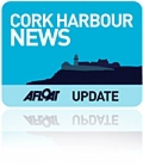
Camden Fort Meagher on Cork Harbour is set to reopen to the public in the coming weeks after extensive remediation works.

As RTÉ News reports, the fort is “one of the finest remaining examples of a classical coastal artillery fort” and played a crucial role in coastal defence for nearly 400 years after it was first established in the 16th century.

The fort was one of the Treaty Port installations handed over to the Irish Defence Forces in 1938, and has been in Cork County Council hands since 1989.

Volunteers led a campaign since 2010 to rescue the fort from potential dereliction but as volunteer Daniel Maverley says: “We could only take it so far. The Council came in…and they are taking it to the next stage.”

Some €480,000 in investment — including funding of €160,000 from the Department of Housing, Local Government and Heritage — included restoration on the casemate block which houses the fort’s primary exhibitions.

A full review of the potential of the fort was carried out late last year, the council says, with “future phases of development identified to preserve Camden Fort Meagher’s historical significance, as well as contributing significantly to the local community and economy”.

The council has also committed to recruiting 10 seasonal guides and will soon appoint a contractor to run the fort’s cafe, with a view to having the fort open up to five days a week — while €750,000 of accessibility measures are in the planning stages.

RTÉ News has more on the story HERE.

Published in Cork Harbour

A new exhibition on the role of the Royal National lifeboat Institution is coming to Cork Harbour's Camden Fort Meagher In Crosshaven and will be open to the public every weekend during this coming month of July.

The bravery of RNLI volunteers who risked their lives to save others during the First World War are the focus of an exhibition touring the UK and Ireland, Hope in the Great War.

The exhibition features six inspirational lifeboat rescue stories from around our coasts during the war. During the Great War, lifeboat crews launched 1,808 times, rescuing 5,332 people. And it was often down to the older generation to go to the aid of those in danger at sea, while many of the younger men were on active duty.

Among the stories featured in the exhibition are Cromer RNLI lifeboat's rescue of the Pyrin and Fernebo, which saw 33 people saved from the sea on 9 January 1917, and the 1914 Whitby RNLI lifeboat rescue of the wrecked hospital ship HMHS Rohilla which saw 144 people saved from the sea.

It is touring for four years – the length of the war – and opened on 4 February 2014 in the RNLI's Henry Blogg Museum in Cromer.

The exhibition was made possible by an Arts Council England grant of £78,200 awarded to the RNLI in order to share more widely the role of the charity's coastal community volunteers during WW1 to help mark the centenary. Community groups have come together to create interactive artworks to help tell the stories of the RNLI during the Great War.

Jacqui Palmer who is co-ordinating the exhibition, says: "As the world remembers the tragic events of the Great War, it's important that we also remember the courage and determination of those who risked their own lives to save others at a sea.

More than 15,000 people have visited the exhibition so far and community groups have been creating amazing artworks for the exhibition, so it's been a great way for everyone to come together and learn about the courageous work of our RNLI volunteers and coastal communities during the conflict."

Published in Cork Harbour
With less than a fortnight to go Corkonians and visitors alike can look forward to Cork Harbour Open Day, writes Jehan Ashmore
The Cork Harbour event is take place on Saturday 10 September, and on that morning the newest vessel of the Cunard Line fleet, the Queen Elizabeth is to make her maiden call to Cork following a visit to Dublin. At over 90,000 tonnes, the cruiseship which was named last year by Queen Elizabeth is to dock at Cobh. Visitors will be able to view the impressive vessel from the quayside. To read more facts and figures about the Cunard Line vessel click HERE.

This will be the third Cork Harbour Day which is to cover a wide range of events, such as concerts on Spike Island, a photographic exhibition in Camden Fort, guided tours of an Irish naval ship at Cork City Quays and an open day at the National Maritime College of Ireland (NMCI).

In addition Fastnet Line's ferry Julia will be open for the public to board. The 22,161 gross tonnes serves the Cork-Swansea route and for the Open Day she will be berthed at Ringaskiddy Deepwater Berth instead of the nearby ferry terminal. To read details of Open day programme visit www.corkharbour.ie and updates click HERE.

The concept for the Harbour Open Day emerged three years ago, which combined various stakeholders involved in the development and implementation of the Integrated Strategy for Cork Harbour. A group comprising of representatives from UCC, City and County Councils, the Naval Service and the Port of Cork set about working together to engage with users of the harbour and to organise the Open Day.

Cork Harbour is the second largest natural harbour in the world, next to Sydney Harbour, offering beautiful locations for enjoying the outdoors, dramatic coastlines, and excellent leisure facilities, and is home to some very talented artists, sportsmen and women, and people who are passionate about the history, heritage and cultural value of Cork Harbour.

Published in Cork Harbour

Marine Protected Areas (MPAs) - FAQS

Marine protected areas (MPAs) are geographically defined maritime areas where human activities are managed to protect important natural or cultural resources. In addition to conserving marine species and habitats, MPAs can support maritime economic activity and reduce the effects of climate change and ocean acidification.

MPAs can be found across a range of marine habitats, from the open ocean to coastal areas, intertidal zones, bays and estuaries. Marine protected areas are defined areas where human activities are managed to protect important natural or cultural resources.

The world's first MPA is said to have been the Fort Jefferson National Monument in Florida, North America, which covered 18,850 hectares of sea and 35 hectares of coastal land. This location was designated in 1935, but the main drive for MPAs came much later. The current global movement can be traced to the first World Congress on National Parks in 1962, and initiation in 1976 of a process to deliver exclusive rights to sovereign states over waters up to 200 nautical miles out then began to provide new focus

The Rio ‘Earth Summit’ on climate change in 1992 saw a global MPA area target of 10% by the 2010 deadline. When this was not met, an “Aichi target 11” was set requiring 10% coverage by 2020. There has been repeated efforts since then to tighten up MPA requirements.

Marae Moana is a multiple-use marine protected area created on July 13th 2017 by the government of the Cook islands in the south Pacific, north- east of New Zealand. The area extends across over 1.9 million square kilometres. However, In September 2019, Jacqueline Evans, a prominent marine biologist and Goldman environmental award winner who was openly critical of the government's plans for seabed mining, was replaced as director of the park by the Cook Islands prime minister’s office. The move attracted local media criticism, as Evans was responsible for developing the Marae Moana policy and the Marae Moana Act, She had worked on raising funding for the park, expanding policy and regulations and developing a plan that designates permitted areas for industrial activities.

Criteria for identifying and selecting MPAs depends on the overall objective or direction of the programme identified by the coastal state. For example, if the objective is to safeguard ecological habitats, the criteria will emphasise habitat diversity and the unique nature of the particular area.

Permanence of MPAs can vary internationally. Some are established under legislative action or under a different regulatory mechanism to exist permanently into the future. Others are intended to last only a few months or years.

Yes, Ireland has MPA cover in about 2.13 per cent of our waters. Although much of Ireland’s marine environment is regarded as in “generally good condition”, according to an expert group report for Government published in January 2021, it says that biodiversity loss and ecosystem degradation are of “wide concern due to increasing pressures such as overexploitation, habitat loss, pollution, and climate change”.

The Government has set a target of 30 per cent MPA coverage by 2030, and moves are already being made in that direction. However, environmentalists are dubious, pointing out that a previous target of ten per cent by 2020 was not met.

Conservation and sustainable management of the marine environment has been mandated by a number of international agreements and legal obligations, as an expert group report to government has pointed out. There are specific requirements for area-based protection in the EU Marine Strategy Framework Directive (MSFD), the OSPAR Convention, the UN Convention on Biological Diversity and the UN Sustainable Development Goals. 

Yes, the Marine Strategy Framework directive (2008/56/EC) required member states to put measures in place to achieve or maintain good environmental status in their waters by 2020. Under the directive a coherent and representative network of MPAs had to be created by 2016.

Ireland was about halfway up the EU table in designating protected areas under existing habitats and bird directives in a comparison published by the European Commission in 2009. However, the Fair Seas campaign, an environmental coalition formed in 2022, points out that Ireland is “lagging behind “ even our closest neighbours, such as Scotland which has 37 per cent. The Fair Seas campaign wants at least 10 per cent of Irish waters to be designated as “fully protected” by 2025, and “at least” 30 per cent by 2030.

Nearly a quarter of Britain’s territorial waters are covered by MPAs, set up to protect vital ecosystems and species. However, a conservation NGO, Oceana, said that analysis of fishing vessel tracking data published in The Guardian in October 2020 found that more than 97% of British MPAs created to safeguard ocean habitats, are being dredged and bottom trawled. 

There’s the rub. Currently, there is no definition of an MPA in Irish law, and environment protections under the Wildlife Acts only apply to the foreshore.

Current protection in marine areas beyond 12 nautical miles is limited to measures taken under the EU Birds and Habitats Directives or the OSPAR Convention. This means that habitats and species that are not listed in the EU Directives, but which may be locally, nationally or internationally important, cannot currently be afforded the necessary protection

Yes. In late March 2022, Minister for Housing Darragh O’Brien said that the Government had begun developing “stand-alone legislation” to enable identification, designation and management of MPAs to meet Ireland’s national and international commitments.

Yes. Environmental groups are not happy, as they have pointed out that legislation on marine planning took precedence over legislation on MPAs, due to the push to develop offshore renewable energy.

No, but some activities may be banned or restricted. Extraction is the main activity affected as in oil and gas activities; mining; dumping; and bottom trawling

The Government’s expert group report noted that MPA designations are likely to have the greatest influence on the “capture fisheries, marine tourism and aquaculture sectors”. It said research suggests that the net impacts on fisheries could ultimately be either positive or negative and will depend on the type of fishery involved and a wide array of other factors.

The same report noted that marine tourism and recreation sector can substantially benefit from MPA designation. However, it said that the “magnitude of the benefits” will depend to a large extent on the location of the MPA sites within the network and the management measures put in place.

© Afloat 2022