Displaying items by tag: Red Duchess
The Timber Traders and Days of Old Irish Sea Shipping Companies
#PORTS & SHIPPING- The general dry-cargo vessel, Red Duchess berthed at Ardrishaig on Scotland's west coast at Loch Fyne today, after completion of a voyage from Waterford, writes Jehan Ashmore.
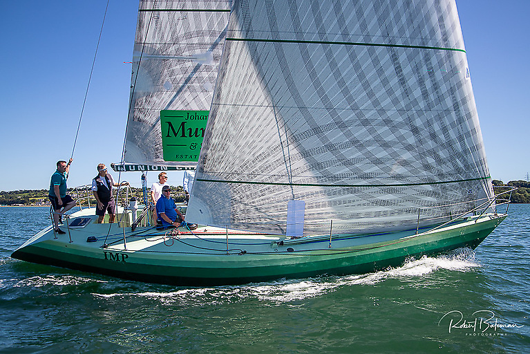
The 1969-built coaster rounded the Hook Head Lighthouse yesterday around noon, having departed Belview on Waterford Estuary. She is engaged on the Irish Sea timber trade, which have been the mainstay of the cruiser stern-vessel's career (see PHOTO).This feature maybe commonplace among yachting craft, yet it is an increasing rare feature, to be found on commercial ships these days.
Her builders were Bodewes Hoogezand Scheepswerf, Bergum of The Netherlands, though the veteran vessel received a modernisation programme in 1995. In addition to the 1,285grt Red Duchess, her fleetmate Red Baroness (1979/964grt) is also actively employed on the same trade.
Each vessel has a single 80m box-hold which can also handle coal, fertiliser, salt and stone. The UK flagged vessels are owned and managed by Coast Lines Shipping based in Midleton, Co. Cork which was established in 1981. For photos of the fleet and technical details, click HERE.
The name of the Irish shipping company revives the similarly named Coast Lines which was synonymous with the British & Irish Steam Packet Co. Ltd otherwise known as B+I Line. By 1917 the Coast Lines group operated seven Irish shipping companies and held all the shares in B+I Line.
The group also had a half interest in David MacBrayne, which was together acquired in the same year by Lord Kylsant's Royal Mail Steam Packet. It was during the Kylsant period that one of their vessels, the 696 ton Lochfyne served David MacBrayne. The Kylsant shipping empire collapsed and Coast Lines regained independence in 1935.
It is apt to have these historical associations as successors to David MacBrayne, now Caledonian MacBrayne (CalMac) are Scotland's largest island ferry network which includes the Loch Fyne ferry (PHOTO) route of Portavadie-Tarbert with the remote location of Ardrishaig further up the Loch.
By 1965 Coast Lines sold their British & Irish (including the associated City of Cork Co.) to the Irish Government and the remaining part of the company was purchased by P&O in 1971. This marked an end of era, with the names of several Irish Sea freight and ferry operators slipping away.
As for Coast Lines Shipping, which was established in 1981, both Red Duchess and Red Baroness are on a time charter arrangement with JST Services. The Ayr-based company provide an integrated shipping, handling and road haulage timber business in addition to the carriage of other cargoes.
Asides serving Ardrishaig, the red-hulled vessels call to their adopted homeport of Ayr, Campbeltown and Sandbank. In addition they call to Troon, where both coasters are registered (see PHOTO). From these ports they sail to Irish ports, in particular Derry, Youghal and Passage West, a privately-owned wharf in the centre of Cork Harbour.
Timber products can include logs, which are loaded by a grabber as depicted in this PHOTO taken at Passage West. The facility also deals in scrap-metal cargo, where a mounting pile is clearly evident on the quayside, awaiting to be disposed for export.
- Shipping
- Irish ports
- irish sea
- Red Duchess
- Coast Lines
- Hook Head Lighthouse
- Caledonian MacBrayne
- B&I Line
- Ports & Shipping news
- timber
- British & Irish Steam Packet Co
- Coast Lines Group
- Coast Lines Shipping Ltd
- JST Services
- Belview Waterford
- Red Baroness
- Irish Sea shortsea coasters
- Irish Sea fshipping companies
- CalMac
- Royal Mail Steam Packet
- Irish Sea coasters
- Irish Sea short sea shipping
- Loch Fyne Scotland
- David MacBrayne
- Passage West Cork Harbour
- Cork Harbour
- PortavadieTarbert
- MV Isle of Cumbrae
Drifting Irish-Cargo Vessel Rescued by ETV
The 1,285grt coaster owned by Coast Lines, was bound for Stornoway with a cargo of coal when the incident occurred. Onboard the vessel was 27 cubic metres of diesel oil and 400 litres of lube oil.
Despite the lack of engine-power, the vessel maintained electricity capacity but was unable to use anchor while drifting in 20m waters and over a rocky seabed. The vessel continued to drift in Force 7-8 conditions, close to the islands in Harris Bay. Fortunately the Mallaig lifeboat was able to get a line onboard the 1969 built Red Duchess to halt further drifting closer to the shore.
This brought some extra time for the stricken vessel until the UK Maritime & Coastguard Safety Agency (MCA) deployed their ETV (Emergency Towing Vessel) Anglian Prince (1980/1,641grt) to the scene.
In the interim period a coastguard rescue helicopter moved to Rhum to be on standby in the event of having to evacuate the crew. This was not required as the Anglian Prince managed to secure a line and safely tow the Red Duchess to Stornoway.
The Red Duchess is a veteren vessel in the coastal trade, regularly trading throughout Irish Sea ports and in particular for many years has been engaged in the carriage of timber logs between Scotland and Youghal, Co. Waterford.
As for the ETV Anglian Princess, she was involved only a fortnight ago in the high-profile rescue of the Royal Navy's HMS Astute, described as the newest, largest and stealthiest attack class submarine. The £1.2 billion submarine was believed to be undergoing sea trials when it went aground off the Isle of Skye. Anglian Princess successfully pulled free the submarine from a shingle bank.
Ironically hours before the the submarine's grounding, the Anglian Princess and three other ETV vessels were announced by the British Government to be withdrawn funding from the nation's (ETV) Emergency Towing Vessel service. The charter of the fleet of four ETV's from owners Klyne Tugs (Lowestoft) Ltd to the UK's Maritime & Coastguard Safety Agency (MCA) was expected to last with the current contract expiring in September 2011.
Since 2001, KTL's fleet of powerful tugs are on charter to the (MCA) for use in pollution control incidents and for towing vessels which are in difficulty in coastal waters.
The fleet are based in strategic locations around the UK, with two covering in Scottish waters, at Stornoway, the Western Isles and Lerwick in the Northern Isles (Shetland and Orkney). The other pair of ETV's cover the south of England at Falmouth in Cornwall and Dover in Kent. The Dover station is funded jointly with French maritime authorities.


