Displaying items by tag: Sally O'Keeffe
Shannon Estuary's Cutter Sally O'Keeffe Successfully Spans The Ages
The 25ft gaff cutter Sally O'Keeffe, built by a community group at Querrin on the Loop Head Peninsula under the guidance of master shipwright Steve Morris of Kilrush, to a design by Myles Stapleton of Malahide as a miniature synthesis of traditional Shannon Estuary Hookers, is ten years old this year.
Yet there ls something about the spirit of the way in which she was created, to be beneficially used by all ages, which gives her an eternal youthfulness with traditional appeal. If not unique, this impression is certainly especially strong with the Sally.
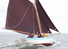
A good picture saves a thousand words, and this image - captured by Steve Morris in the current RWIYC October Series at Kilrush - says everything.
Shannon Estuary's Traditional Cutter Sally O'Keeffe Celebrates Ten Years Of Maritime Community Service
Sally O'Keeffe, the 25ft re-interpretation of the Shannon Estuary's traditional sail-driven cargo-carrying cutters which could usefully find their way into the smallest ports along both sides of the majestic waterway, is this year celebrating ten years of quietly useful service afloat.
It takes an effort to accept this time span, for her very complete and jaunty appearance still seems as fresh as a daisy. Yet it's a decade and more since naval architect Myles Stapleton of Malahide put his own characterful and stylish interpretation on the brief from the Querrin Community Group on the Loop Head Peninsula. They hoped to re-capture the spirit of a little ship which had been key to their area's well-being, and with Steve Morris of Kilrush to guide the building project in a farm
shed at Queerin, the result exceeded all expectations.
 A well-balanced hull shape. Regardless of the sail trim, Sally O'Keeffe remains light on the tiller. Photo: Con Egan
As a "Boat of the People", Sally O'Keeffe has become a familiar sight at many Shannonside ports large and small, and she has been much-admired when taking part in the Wooden Boat Festival at Baltimore, and the Cruinnui na mBad at Kinvara in Galway Bay. These photos taken by Con Egan while on mark-boat duty at the recent WIORA Championship at Kilrush tell us why people like sailing the Sally so much. There are some gaff cutters which hang heavy on their helm when there's a bite to the breeze. But in these images, you'll note that despite the varied conditions and the different rig set-ups, Sally's tiller is sweetly fore-and-aft as evidence of her well-balanced hull.
 Smokin' along....Sally cutting a dash with a bone in her teeth near a couple of contenders in the WIORA Championship at Kilrush. Photo: Con Egan
Shannon Estuary Cutter Sally O’Keeffe Brings Focus to Loop Head Peninsula
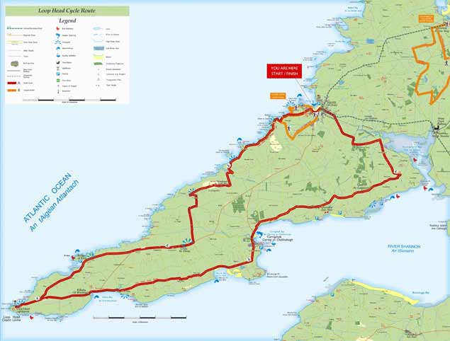
Though it may not look it on a map which emphasises the extensive low water limits, at high water the Loop Head Peninsula in southwest County Clare is almost an island writes W M Nixon.
Only a couple of small roads lead into it from the main road between Kilrush and Kilkee, and once you’re into the Loop, you’re in a different country, a distinctive place with its own strong sense of identity.
It was here in Querrin that a voluntary group got together some years ago to build a boat to commemorate the small Shannon sailing hookers which were once the Loop Head Peninsula’s most important transport link for goods coming down the long estuary from Limerick.
 Loop Head Peninsula – a world apart with Carrigaholt at its heart
This local community group only had some ancient photos and sketches - and some vague old memories - to go by. But, guided by shipwright Steve Morris of Kilrush, they had naval architect Myles Stapleton of Malahide to bring his considerable talents to the task, and he created a wonderfully characterful 25-footer which looks good from any angle, sails well too, and can carry significant numbers to avail of Seol Sionna’s enthusiasm for spreading seagoing awareness. They’ve fresh plans afoot for 2018, and have sent us this cheerful message:
“Sally O’Keeffe, the traditional wooden sail training vessel based on the Shannon Estuary, is currently gearing up for her seventh season on the ocean, and is putting a shout out to any and all who would wish to sail on her.
The 25-foot gaff rigged cutter was built by community group “Seol Sionna” under the guidance and tuition of local professional shipwright Steve Morris from plans drawn up by naval architect Myles Stapleton. Launched in Querrin in 2012 just 200 metres from where she was built, this craft has become one of the busiest and most capable sailing vessels on the Estuary.
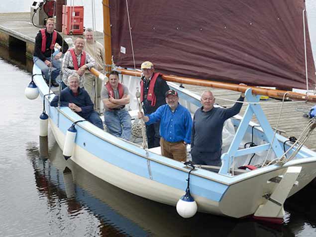 The design of Sally O’Keeffe was neatly judged to provide the maximum on-board space Photo: W M Nixon
Seol Sionna offer a “traditional seafaring skills” course on board Sally O’Keeffe each summer, taking participants through all stages of sailing to competent crew level. This is hands-on training - there are no winches or clutches, and the only buttons onboard are the chocolate ones that the skippers love! The atmosphere is fun and relaxed, but with a strong emphasis on safety.
On top of training, regular weekly sailing trips are made to various regions on the glorious estuary, picnics/walks/ birdwatching to Scattery Island, a jaunt to Carrigaholt for a pint and chowder, or out to Loop Head for a spot of fishing, for this is truly a versatile fun boat.
Over the past seven years, Sally (she’s named after the long-ago publican’s wife of Querrin) has shown her pedigree by sailing to and participating in traditional boat festivals in Baltimore and Glandore. There, she has taken first prize in her class on both occasions, confirming that she not only looks good, but sails well too.
This year’s plans are being finalised for taking Sally on a cruising trip up the west coast, taking in the Aran Islands and Inishbofin and calling in on Crinniú na Mbád in Kinvara on the way home.
Anyone interested in becoming a member can do so as a family, individual or concession for €60, €40, and €20 respectively. Training to competent crew level costs only €70, while daily membership is also available.
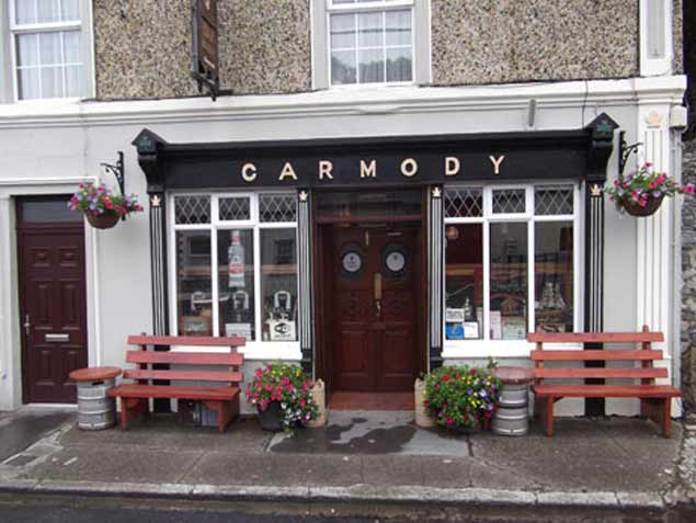 Carmody’s Bar, Carrigaholt – gather here on the night of Friday 23rd February to learn about Seol Sionna and Sally O’Keeffe
For more information, why not come along to Carmody's Bar at Carrigaholt on the 23rd February? There, a table quiz to raise funds for Seol Sionna will take place, and you may even win a free trip or two. Otherwise, check out Seol Sionna on Facebook or contact Fintan 087 2266501, Steve 087 7990091, or Richard 087 6744550.
And may you have fair winds and following seas.”
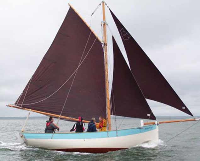 Community-built in Querrin on the Loop Head Peninsula, Sally O’Keeffe is a stylish design by Myles Stapleton.


