Menu

Ireland's sailing, boating & maritime magazine

Dublin Bay Boating News and Information

Campaigners Public Meeting To Discuss Proposed Development at Dalkey’s Bulloch Harbour

4th January 2017
Bulloch Harbour, Dalkey where there are plans to develop the former premises of Western Marine chandlery with a larger mixed development block (three-storeys) of luxury apartments and marine shop units. In addition to three houses (three-storeys) at the rear of site along the scenic coastal location in south Dublin. Bulloch Harbour, Dalkey where there are plans to develop the former premises of Western Marine chandlery with a larger mixed development block (three-storeys) of luxury apartments and marine shop units. In addition to three houses (three-storeys) at the rear of site along the scenic coastal location in south Dublin. Credit: Save Bulloch Harbour

#BullochHarbour - Concerned residents and marine users of Bulloch Harbour, Dalkey, Co. Dublin are to hold a public meeting tomorrow (Thurs. Jan.5th) over a proposed mixed development at a sensitive coastal site of the former premises of Western Marine, writes Jehan Ashmore.

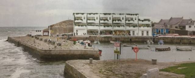
Afloat last reported just before Christmas of the proposed development by Bartra Property that acquired the site of the chandlery business that are to relocate locally. The site is fronting the quayside of the scenic Dublin Bay harbour. It is one of the last working harbours in the bay with fishing boats, is popular for marine leisure activities and as a tourist attraction in the salubrious southside suburb.

Last month the developer lodged a planning application to seek permission to demolish the single-storey warehouse (1,210 sq m) and replace with the construction of several structures totalling (2,324 sq m) and each of these buildings of three-storeys in height. Click for previous report / image here. According to Save Bulloch Harbour facebook page a public meeting is to be held tomorrow to discuss the development at the Fitzpatrick Hotel, Killiney, Thursday at 7.30pm.

The meeting organisers, Bulloch Harbour Preservation Association whose members include boat users, Dalkey Sea Scouts, Dalkey Community Council and Tidy Towns have raised strong concerns on the proposed redevelopment. The Association claims the proposed development given on grounds of scale, height and bulk will adversely impact and destroy the unique heritage character of the historic harbour that has its origins dating to the 12th century.

Part of the proposed development is a block comprising of two and three stories high containing seven commercial units for marine businesses at ground floor level along the quayside. One of the marine units would be set aside for a café. In addition to six residential apartment units (each of around 1,660 sq ft) at ground floor to the rear and first and second floor overhead. The design of the apartments would feature balconies and roof gardens overlooking the harbour.

In addition at the rear of the former marine chandlery boat storage yard are proposed three houses (each up to 4,800 sq ft). Likewsise of the mixed development block, these dwellings are three-storeys high along with roof terraces. These residential units would exceed the height of the mixed block fronting the harbour built of Dalkey granite. Such cargoes from local quarries were shipped across the bay to assist the Ballast Board in the construction of Dublin Port during the 19th century. 

In planning permission documents lodged by Bartra Property to the planning office of Dun Laoghaire-Rathdown County Council, the developers cite in their Planners Report that the brownfield site at Bulloch Harbour, is under the county development Plan 2016-2022. The lands at Bulluch Harbour are zoned with Objective W ‘to provide for waterfront development and harbour related uses’. The developer claims the café along the waterfront will enhance the amenity of the quayside.

Published in Dublin Bay
Jehan Ashmore

About The Author

Jehan Ashmore

Email The Author

Jehan Ashmore is a marine correspondent, researcher and photographer, specialising in Irish ports, shipping and the ferry sector serving the UK and directly to mainland Europe. Jehan also occasionally writes a column, 'Maritime' Dalkey for the (Dalkey Community Council Newsletter) in addition to contributing to UK marine periodicals. 

We've got a favour to ask

More people are reading Afloat.ie than ever thanks to the power of the internet but we're in stormy seas because advertising revenues across the media are falling fast. Unlike many news sites, we haven’t put up a paywall because we want to keep our marine journalism open.

Afloat.ie is Ireland's only full–time marine journalism team and it takes time, money and hard work to produce our content.

So you can see why we need to ask for your help.

If everyone chipped in, we can enhance our coverage and our future would be more secure. You can help us through a small donation. Thank you.

Direct Donation to Afloat button

Dublin Bay

Dublin Bay on the east coast of Ireland stretches over seven kilometres, from Howth Head on its northern tip to Dalkey Island in the south. It's a place most Dubliners simply take for granted, and one of the capital's least visited places. But there's more going on out there than you'd imagine.

The biggest boating centre is at Dun Laoghaire Harbour on the Bay's south shore that is home to over 1,500 pleasure craft, four waterfront yacht clubs and Ireland's largest marina.

The bay is rather shallow with many sandbanks and rocky outcrops, and was notorious in the past for shipwrecks, especially when the wind was from the east. Until modern times, many ships and their passengers were lost along the treacherous coastline from Howth to Dun Laoghaire, less than a kilometre from shore.

The Bay is a C-shaped inlet of the Irish Sea and is about 10 kilometres wide along its north-south base, and 7 km in length to its apex at the centre of the city of Dublin; stretching from Howth Head in the north to Dalkey Point in the south. North Bull Island is situated in the northwest part of the bay, where one of two major inshore sandbanks lie, and features a 5 km long sandy beach, Dollymount Strand, fronting an internationally recognised wildfowl reserve. Many of the rivers of Dublin reach the Irish Sea at Dublin Bay: the River Liffey, with the River Dodder flow received less than 1 km inland, River Tolka, and various smaller rivers and streams.

Dublin Bay FAQs

There are approximately ten beaches and bathing spots around Dublin Bay: Dollymount Strand; Forty Foot Bathing Place; Half Moon bathing spot; Merrion Strand; Bull Wall; Sandycove Beach; Sandymount Strand; Seapoint; Shelley Banks; Sutton, Burrow Beach

There are slipways on the north side of Dublin Bay at Clontarf, Sutton and on the southside at Dun Laoghaire Harbour, and in Dalkey at Coliemore and Bulloch Harbours.

Dublin Bay is administered by a number of Government Departments, three local authorities and several statutory agencies. Dublin Port Company is in charge of navigation on the Bay.

Dublin Bay is approximately 70 sq kilometres or 7,000 hectares. The Bay is about 10 kilometres wide along its north-south base, and seven km in length east-west to its peak at the centre of the city of Dublin; stretching from Howth Head in the north to Dalkey Point in the south.

Dun Laoghaire Harbour on the southside of the Bay has an East and West Pier, each one kilometre long; this is one of the largest human-made harbours in the world. There also piers or walls at the entrance to the River Liffey at Dublin city known as the Great North and South Walls. Other harbours on the Bay include Bulloch Harbour and Coliemore Harbours both at Dalkey.

There are two marinas on Dublin Bay. Ireland's largest marina with over 800 berths is on the southern shore at Dun Laoghaire Harbour. The other is at Poolbeg Yacht and Boat Club on the River Liffey close to Dublin City.

Car and passenger Ferries operate from Dublin Port to the UK, Isle of Man and France. A passenger ferry operates from Dun Laoghaire Harbour to Howth as well as providing tourist voyages around the bay.

Dublin Bay has two Islands. Bull Island at Clontarf and Dalkey Island on the southern shore of the Bay.

The River Liffey flows through Dublin city and into the Bay. Its tributaries include the River Dodder, the River Poddle and the River Camac.

Dollymount, Burrow and Seapoint beaches

Approximately 1,500 boats from small dinghies to motorboats to ocean-going yachts. The vast majority, over 1,000, are moored at Dun Laoghaire Harbour which is Ireland's boating capital.

In 1981, UNESCO recognised the importance of Dublin Bay by designating North Bull Island as a Biosphere because of its rare and internationally important habitats and species of wildlife. To support sustainable development, UNESCO’s concept of a Biosphere has evolved to include not just areas of ecological value but also the areas around them and the communities that live and work within these areas. There have since been additional international and national designations, covering much of Dublin Bay, to ensure the protection of its water quality and biodiversity. To fulfil these broader management aims for the ecosystem, the Biosphere was expanded in 2015. The Biosphere now covers Dublin Bay, reflecting its significant environmental, economic, cultural and tourism importance, and extends to over 300km² to include the bay, the shore and nearby residential areas.

On the Southside at Dun Laoghaire, there is the National Yacht Club, Royal St. George Yacht Club, Royal Irish Yacht Club and Dun Laoghaire Motor Yacht Club as well as Dublin Bay Sailing Club. In the city centre, there is Poolbeg Yacht and Boat Club. On the Northside of Dublin, there is Clontarf Yacht and Boat Club and Sutton Dinghy Club. While not on Dublin Bay, Howth Yacht Club is the major north Dublin Sailing centre.

© Afloat 2020