Menu

Ireland's sailing, boating & maritime magazine

Dublin Bay Boating News and Information

Displaying items by tag: Earlier start date

Hot on the heals of Stena Line's new Dublin-Cherbourg route announced today, Brittany Ferries has also acted quickly to support the freight sector and meet the needs of an industry battling Brexit by confirming a new weekly Rosslare-Cherbourg service.

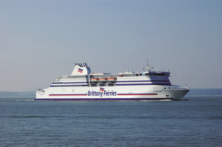
As Afloat reported back in July, this new Ireland-France service which was due to commence in March, will begin service on Monday, 18 January 2021. This new service will initially be served by the Cap Finistère.

Afloat adds Stena Line increased freight space with the brand new Stena Embla but on the Rosslare-Cherbourg route with the ferry completing a first round trip today. This follows Irish Ferries which only last week deployed W.B.Yeats onto the Dublin-Cherbourg route but much earlier so to alleviate pressing freight concerns over capacity.

As Brittany Ferries highlight, Irish and French hauliers have traditionally relied on the UK-land bridge when transporting goods to and from mainland Europe. However, since the beginning of the year, more companies have sought an alternative to the additional administration, new formalities, greater costs and potential delays that come from carrying goods though the UK.

Therefore, the French operator confirms today that Cap Finistère will cover the twice weekly sailing connecting Rosslare and Bilbao, taking over from Connemara until 10 February. As a consequence of this ship’s flexibility, Brittany Ferries will also add a weekly rotation connecting Rosslare with Cherbourg to the schedule, opening this Ireland-France route two months earlier than originally planned.

“Brittany Ferries prides itself on decisive action, based on the flexibility of its fleet and we can meet the needs of the marketplace quickly,” said Christophe Mathieu, Brittany Ferries CEO. “Cap Finistère is our fastest Ro-Ro vessel and she is therefore well suited to opening this new Brexit by-pass, making an additional sailing each week connecting France and Ireland.”

Glenn Carr, General Manager, Rosslare Europort said “all at Rosslare Europort welcome Brittany Ferries’ swift response to the needs of Irish industry in commencing this year’s Rosslare to Cherbourg services two months earlier than planned. We have worked closely with Brittany Ferries in ensuring that arrangements for the service were quickly put in place, further cementing Rosslare Europort’s position as Ireland’s Gateway to Europe.”

Published in Brittany Ferries

Dublin Bay

Dublin Bay on the east coast of Ireland stretches over seven kilometres, from Howth Head on its northern tip to Dalkey Island in the south. It's a place most Dubliners simply take for granted, and one of the capital's least visited places. But there's more going on out there than you'd imagine.

The biggest boating centre is at Dun Laoghaire Harbour on the Bay's south shore that is home to over 1,500 pleasure craft, four waterfront yacht clubs and Ireland's largest marina.

The bay is rather shallow with many sandbanks and rocky outcrops, and was notorious in the past for shipwrecks, especially when the wind was from the east. Until modern times, many ships and their passengers were lost along the treacherous coastline from Howth to Dun Laoghaire, less than a kilometre from shore.

The Bay is a C-shaped inlet of the Irish Sea and is about 10 kilometres wide along its north-south base, and 7 km in length to its apex at the centre of the city of Dublin; stretching from Howth Head in the north to Dalkey Point in the south. North Bull Island is situated in the northwest part of the bay, where one of two major inshore sandbanks lie, and features a 5 km long sandy beach, Dollymount Strand, fronting an internationally recognised wildfowl reserve. Many of the rivers of Dublin reach the Irish Sea at Dublin Bay: the River Liffey, with the River Dodder flow received less than 1 km inland, River Tolka, and various smaller rivers and streams.

Dublin Bay FAQs

There are approximately ten beaches and bathing spots around Dublin Bay: Dollymount Strand; Forty Foot Bathing Place; Half Moon bathing spot; Merrion Strand; Bull Wall; Sandycove Beach; Sandymount Strand; Seapoint; Shelley Banks; Sutton, Burrow Beach

There are slipways on the north side of Dublin Bay at Clontarf, Sutton and on the southside at Dun Laoghaire Harbour, and in Dalkey at Coliemore and Bulloch Harbours.

Dublin Bay is administered by a number of Government Departments, three local authorities and several statutory agencies. Dublin Port Company is in charge of navigation on the Bay.

Dublin Bay is approximately 70 sq kilometres or 7,000 hectares. The Bay is about 10 kilometres wide along its north-south base, and seven km in length east-west to its peak at the centre of the city of Dublin; stretching from Howth Head in the north to Dalkey Point in the south.

Dun Laoghaire Harbour on the southside of the Bay has an East and West Pier, each one kilometre long; this is one of the largest human-made harbours in the world. There also piers or walls at the entrance to the River Liffey at Dublin city known as the Great North and South Walls. Other harbours on the Bay include Bulloch Harbour and Coliemore Harbours both at Dalkey.

There are two marinas on Dublin Bay. Ireland's largest marina with over 800 berths is on the southern shore at Dun Laoghaire Harbour. The other is at Poolbeg Yacht and Boat Club on the River Liffey close to Dublin City.

Car and passenger Ferries operate from Dublin Port to the UK, Isle of Man and France. A passenger ferry operates from Dun Laoghaire Harbour to Howth as well as providing tourist voyages around the bay.

Dublin Bay has two Islands. Bull Island at Clontarf and Dalkey Island on the southern shore of the Bay.

The River Liffey flows through Dublin city and into the Bay. Its tributaries include the River Dodder, the River Poddle and the River Camac.

Dollymount, Burrow and Seapoint beaches

Approximately 1,500 boats from small dinghies to motorboats to ocean-going yachts. The vast majority, over 1,000, are moored at Dun Laoghaire Harbour which is Ireland's boating capital.

In 1981, UNESCO recognised the importance of Dublin Bay by designating North Bull Island as a Biosphere because of its rare and internationally important habitats and species of wildlife. To support sustainable development, UNESCO’s concept of a Biosphere has evolved to include not just areas of ecological value but also the areas around them and the communities that live and work within these areas. There have since been additional international and national designations, covering much of Dublin Bay, to ensure the protection of its water quality and biodiversity. To fulfil these broader management aims for the ecosystem, the Biosphere was expanded in 2015. The Biosphere now covers Dublin Bay, reflecting its significant environmental, economic, cultural and tourism importance, and extends to over 300km² to include the bay, the shore and nearby residential areas.

On the Southside at Dun Laoghaire, there is the National Yacht Club, Royal St. George Yacht Club, Royal Irish Yacht Club and Dun Laoghaire Motor Yacht Club as well as Dublin Bay Sailing Club. In the city centre, there is Poolbeg Yacht and Boat Club. On the Northside of Dublin, there is Clontarf Yacht and Boat Club and Sutton Dinghy Club. While not on Dublin Bay, Howth Yacht Club is the major north Dublin Sailing centre.

© Afloat 2020