Displaying items by tag: Little Skellig
Little Skellig– the inaccessible sister crag to Skellig Michael - was long thought to have been inhabited only by gannets, fulmars and other seabirds.
However, as The Sunday Times reports today, archaeologist Michael Gibbons and a group of climbers have located the remains of an early Christian oratory on a narrow precipitous terrace overlooking the Atlantic.
“The ultimate monastic site” is how Gibbons describes the remains of the oratory, which he examined on an expedition to the isolated crag some 13 km (eight miles) west of the Iveragh peninsula.
Little Skellig is a protected bird colony, managed by Birdwatch Ireland, and with one of the largest populations of gannets among its seabird population.
The Connemara archaeologist, who was accompanied by several experienced climbers including Con Moriarty and Sean O’Farrell, visited outside the nesting season.
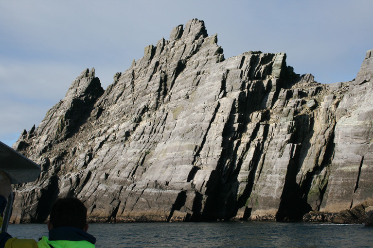
 Kerry climber Con Moriarty on the slight terrace where the remains of an early Christian oratory have been found for the first time on Little Skellig, the highly inaccessible sister crag to Skellig Michael Photo: Michael Gibbons
He noted that the gannets had completely colonised the remains of the structure, using it as store for discarded nets and other fishing equipment used to build nests.
He estimates that the oratory dates to about the late 7th or early 8th century, when a monastery with its beehive huts, including a hermitage some 700 ft above the sea, had already been built on Skellig Michael.
 Little Skellig the highly inaccessible sister crag to Skellig Michael
Read more in The Sunday Times here
Plastic Problem For Gannets On Little Skellig

#MarineWildlife - Concerns have been raised over the levels of plastic pollution at an important gannet colony on the smallest of the Skellig Islands.
As The Irish Times reports, discarded plastic waste – including parts of old fishing gear in the Atlantic for more than a decade – now comprises a large proportion of the material used by some 70,000 gannets to build their nests on Little Skellig.
And conservationists fear the problem is being ignored by authorities focused on marketing nearby Skellig Michael to tourists based on it appearance in recent Star Wars films.
“I film marine life underwater [and] it’s very difficult to get a frame without plastic in it, and that wasn’t an issue 15 years ago,” said local filmmaker Vincent Hyland, who added that plastic pollution levels had reached “frightening proportions” in the last year.
The Irish Times has more on the story HERE.


