Displaying items by tag: Peter Heffernan
Peter Heffernan Says Farewell to the Marine Institute
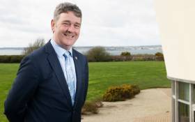
Dr Heffernan has served as the CEO of the Marine Institute since 1993 and has held a highly successful role in building and leading the organisation. The semi-state agency has grown from a staff of one to 230, which now incorporates the Institute’s headquarters in Co Galway, the Newport Research Facility in Co Mayo and the Irish Maritime Development Office (IMDO) in Dublin.
Chairman of the Marine Institute Dr John Killeen said, “As CEO, Dr Heffernan has overseen tremendous growth. He has played a fundamental role in developing Ireland’s ocean research capacity, increasing collaboration in marine research and innovation in Europe, as well as driving sustainable development across a range of maritime sectors. Dr Heffernan leaves a lasting-legacy and has set the Institute on course to become a global leader in ocean knowledge. On behalf of the Board and Marine Institute staff, I thank Dr Heffernan for his dedication, strategic direction and leadership as CEO and wish him all the best as he begins a new voyage.”
As CEO of the Institute, Dr Heffernan has overseen the arrival of Ireland’s two purpose-built marine research vessels, the RV Celtic Voyager in 1997 and the RV Celtic Explorer in 2003. The RV Celtic Voyager has provided a platform for scientists to undertake essential fisheries research, environmental monitoring, seabed mapping, oceanographic work, data buoy maintenance and student training. The RV Celtic Explorer has played a vital role in Ireland’s fisheries research, placing Ireland in a much stronger position to propose effective conservation measures for fish stocks and support the sustainability of the Irish fishing industry. A new state-of-the-art marine research vessel is also scheduled for completion in 2022, which will mark a major milestone in the Marine Institute’s effort to provide world-class marine scientific advice and services.
In 2009, Dr Peter Heffernan instigated the development of the Inter-Department Marine Coordination Group (MCG). Chaired by the Minister for Agriculture, Food and Marine, the group brought together representatives of departments with an involvement in marine and maritime issues to coordinate inter-departmental action. The MCG produced Ireland’s first integrated marine plan for Ireland Harnessing Our Ocean Wealth in 2012 which set out two targets - increase the value of Ireland’s ocean wealth to 2.4% of GDP by 2030 and double the turnover from our ocean economy (from €3.2 billion) to exceed €6.4 billion by 2020. In 2018, Ireland’s ocean economy is estimated to have a turnover of €6.2 billion and GVA estimated at €4.2 billion equivalent to 2% of GDP.
In 2013, Dr Heffernan acted as an inspiration and Irish EU Presidency ambassador for the creation of the Atlantic Ocean Research Alliance (AORA) with the signing of the Galway Statement on Atlantic Ocean Cooperation between Canada, the European Union and the United States of America. Six years on and AORA has been recognised as an outstanding success story in the Atlantic area and an exemplar of international science diplomacy. To date, AORA has achieved an investment from Horizon 2020 EU funding of more than €140 million to support research in the Atlantic Ocean.
Ireland is now considered a world leader in the field of seabed mapping through the expertise of the Geological Survey Ireland and the Marine Institute. The Irish National Seabed Survey (INSS), which began in 1999 remains one of the largest seabed mapping projects ever undertaken in the world. Now known as the INFOMAR programme and scheduled for completion in 2026, Ireland will become the first nation in the world to have comprehensively mapped its entire seabed territory.
Research and Innovation are central to the role and mission of the Marine Institute. A Marine Knowledge, Research and Innovation Strategy for Ireland, ‘Sea Change’ was prepared by the Marine Institute and launched in 2007. A new National Marine Research and Innovation Strategy 2021 was also prepared by the Marine Institute in 2017, to help ensure Ireland maintains its position at the forefront of marine research in Europe.
The Marine Institute has achieved an outstanding success rate of over 40% in funding bids to the European Union’s Horizon 2020 programme. The total funding approved to date under this programme has now surpassed the €8m target, 18 months ahead of schedule. The work of the Marine Institute has seen significant collaborations with industry and other research centres and universities in Ireland, Europe and international stakeholders, strengthening Ireland’s ability in providing a foundation for applied research and innovation.
Dr Heffernan was recently selected as a member of the European Commission’s Mission Board for Healthy Oceans, Seas, Coastal and Inland Waters, one of five major research missions of Horizon Europe, the EU Research and Innovation programme (2021 – 2027). Dr Heffernan will be one of 15 experts on the Mission Board which will identify the first possible specific missions on healthy oceans by the end of 2019.
U.S. Nobel Laureate Visits Marine Institute in Galway
The Marine Institute headquarters at Oranmore, Co. Galway was honoured last Saturday (6th November) by a visit from US Energy Secretary Prof. Steven Chu, himself a Nobel Prize-winning physicist and long-time advocate of alternative sources of sustainable energy.
This is the latest in a number of VIP visits to the Institute this year, which have included EU-Commissioner for Research, Innovation and Science Máire Geoghegan-Quinn and the Ambassadors to Ireland of both the USA and the United Kingdom, reflecting the growing international recognition of the Institute as a centre of excellence.
During his visit, Professor Chu was briefed by the Institute's CEO Dr Peter Heffernan and members of his senior management team on the Institute's work regarding ocean renewable energy, seabed observatories and the application of "Smart Technology" to ocean monitoring and climate change through such projects as SmartBay and SmartCoast.
He was also briefed on the results of the Irish National Seabed Survey which, at the time of its execution was the largest civilian mapping project in the world, and was given copies of "The Real Map of Ireland" showing the extent of Ireland's underwater territory.
Of particular interest to Prof. Chu, following the recent oil spill in the Gulf of Mexico, was a discussion on the use of new and developing technologies that might allow the deployment of sensor devices on the seabed to monitor offshore oil wells.


