Menu

Ireland's sailing, boating & maritime magazine

Dublin Bay Boating News and Information

Displaying items by tag: farmer

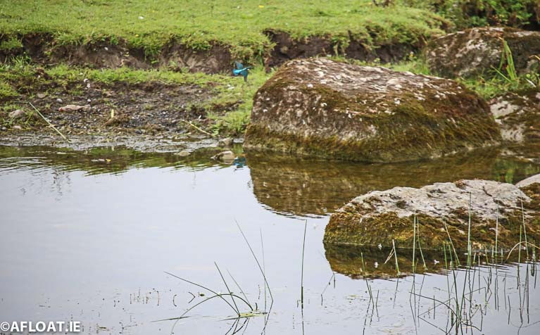
Inland Fisheries Ireland has issued an appeal to farmers to remain vigilant during the fertiliser spreading season to avoid water pollution and the loss of nutrients or other chemicals into rivers, lakes and other watercourses. 

The appeal comes on the back of Inland Fisheries Ireland’s preliminary collation of fish kill data for 2019 which indicate that 20 fish kills were recorded nationally (a welcome reduction when compared with 40 fish kills in 2018). Inland Fisheries Ireland is also emphasising the significance of the EPA’s recent report on water quality in Ireland (for the period 2013 to 2018) which found that there has been an overall decline in surface water quality, especially in our rivers, for the period. This report identified nutrient pollution (primarily nitrogen and phosphorus) as the main problem impacting on our waters. 

To prevent waters from being polluted by nitrogen and phosphorus when land-spreading, Inland Fisheries Ireland is advising farmers to refer to Good Agricultural Practice Regulations guidance (www.agriculture.gov.ie) which advises as follows:

  • Spread livestock manure and other organic fertilisers, effluents and soiled water as accurately and as evenly as possible.
  • Do not use an upward-facing splash plate or sludge irrigator on a tanker or umbilical system for spreading organic fertiliser or soiled water.
  • Do not spread organic fertilisers or soiled water from a road or passageway, even if the road or passageway is on your own holding.
  • Do not spread chemical fertilisers, livestock manure, soiled water or other organic fertilisers when:
  • The land is waterlogged;
  • The land is flooded, or it is likely to flood;
  • The land is frozen, or covered with snow;
  • Heavy rain is forecast within 48 hours (you must check the forecasts from Met Éireann).
  • Do not spread chemical fertilisers, livestock manure, soiled water or other organic fertilisers if the ground has a steep slope and if there is a significant risk of causing pollution.
  • When you are deciding whether there is a risk, you must take into account how close you are to waters, what condition the soil is in, the ground cover and how much rainfall there is or how much rainfall is expected.
  • Do not spread chemical fertiliser on land within 1.5 metres of a surface watercourse.

Farmers can get more information about these specifications or related buffer zones for spreading organic fertilisers from their adviser/consultant, the local Department office or on the Department of Agriculture Food and the Marine’s website http://www.agriculture.gov.ie.

Dr Greg Forde, Head of Operations at Inland Fisheries Ireland, said: “Livestock manure and other organic fertilisers, effluents and soiled water have the potential to cause devastating pollution in our streams and rivers. Such effluent is a significant polluting and potentially highly toxic substance, starving fish and other aquatic life of oxygen and resulting in potentially severe fish kills over long distances if it enters a watercourse. Impacts can be devastating at any time of year but are magnified in particular when river flows are reduced and dilution capacity is at a minimum. The effect of even a small leak under these conditions can cause huge damage. Inland Fisheries Ireland is grateful to the farming community for their continued consideration and vigilance. Good farmyard management and land-spreading practices (for example avoiding spreading during the season at times of low nutrient uptake because of slow growth) can help to prevent accidental discharges of polluting substances and protect the local environment. This will have a significant and lasting positive impact on valuable wild fish populations in an area.”

Inland Fisheries Ireland is the state agency responsible for the protection, management and conservation of Ireland's inland fisheries and sea angling resources. IFI focuses on a wide range of environmental pressures which can impact the fisheries resource, with over 25,000 environmental inspections carried out in 2019 across industrial, forestry, engineering / infrastructural and municipal sites. There were 1,623 inspections in agricultural settings to help identify environmental risks and prevent damage to the local aquatic environment and valuable fish populations.

Published in Inland Waterways

A four foot yacht containing goodwill messages from children in the US state of Maine has landed on the west coast of Ireland, more than a year after it was launched. The craft survived at least two hurricanes on its journey of more than 4,000 miles across the Atlantic Ocean. A farmer stumbled across the unique vessel after it was washed up on a Co Mayo beach. The Irish Independent has the full story HERE.

Published in Offshore

Dublin Bay

Dublin Bay on the east coast of Ireland stretches over seven kilometres, from Howth Head on its northern tip to Dalkey Island in the south. It's a place most Dubliners simply take for granted, and one of the capital's least visited places. But there's more going on out there than you'd imagine.

The biggest boating centre is at Dun Laoghaire Harbour on the Bay's south shore that is home to over 1,500 pleasure craft, four waterfront yacht clubs and Ireland's largest marina.

The bay is rather shallow with many sandbanks and rocky outcrops, and was notorious in the past for shipwrecks, especially when the wind was from the east. Until modern times, many ships and their passengers were lost along the treacherous coastline from Howth to Dun Laoghaire, less than a kilometre from shore.

The Bay is a C-shaped inlet of the Irish Sea and is about 10 kilometres wide along its north-south base, and 7 km in length to its apex at the centre of the city of Dublin; stretching from Howth Head in the north to Dalkey Point in the south. North Bull Island is situated in the northwest part of the bay, where one of two major inshore sandbanks lie, and features a 5 km long sandy beach, Dollymount Strand, fronting an internationally recognised wildfowl reserve. Many of the rivers of Dublin reach the Irish Sea at Dublin Bay: the River Liffey, with the River Dodder flow received less than 1 km inland, River Tolka, and various smaller rivers and streams.

Dublin Bay FAQs

There are approximately ten beaches and bathing spots around Dublin Bay: Dollymount Strand; Forty Foot Bathing Place; Half Moon bathing spot; Merrion Strand; Bull Wall; Sandycove Beach; Sandymount Strand; Seapoint; Shelley Banks; Sutton, Burrow Beach

There are slipways on the north side of Dublin Bay at Clontarf, Sutton and on the southside at Dun Laoghaire Harbour, and in Dalkey at Coliemore and Bulloch Harbours.

Dublin Bay is administered by a number of Government Departments, three local authorities and several statutory agencies. Dublin Port Company is in charge of navigation on the Bay.

Dublin Bay is approximately 70 sq kilometres or 7,000 hectares. The Bay is about 10 kilometres wide along its north-south base, and seven km in length east-west to its peak at the centre of the city of Dublin; stretching from Howth Head in the north to Dalkey Point in the south.

Dun Laoghaire Harbour on the southside of the Bay has an East and West Pier, each one kilometre long; this is one of the largest human-made harbours in the world. There also piers or walls at the entrance to the River Liffey at Dublin city known as the Great North and South Walls. Other harbours on the Bay include Bulloch Harbour and Coliemore Harbours both at Dalkey.

There are two marinas on Dublin Bay. Ireland's largest marina with over 800 berths is on the southern shore at Dun Laoghaire Harbour. The other is at Poolbeg Yacht and Boat Club on the River Liffey close to Dublin City.

Car and passenger Ferries operate from Dublin Port to the UK, Isle of Man and France. A passenger ferry operates from Dun Laoghaire Harbour to Howth as well as providing tourist voyages around the bay.

Dublin Bay has two Islands. Bull Island at Clontarf and Dalkey Island on the southern shore of the Bay.

The River Liffey flows through Dublin city and into the Bay. Its tributaries include the River Dodder, the River Poddle and the River Camac.

Dollymount, Burrow and Seapoint beaches

Approximately 1,500 boats from small dinghies to motorboats to ocean-going yachts. The vast majority, over 1,000, are moored at Dun Laoghaire Harbour which is Ireland's boating capital.

In 1981, UNESCO recognised the importance of Dublin Bay by designating North Bull Island as a Biosphere because of its rare and internationally important habitats and species of wildlife. To support sustainable development, UNESCO’s concept of a Biosphere has evolved to include not just areas of ecological value but also the areas around them and the communities that live and work within these areas. There have since been additional international and national designations, covering much of Dublin Bay, to ensure the protection of its water quality and biodiversity. To fulfil these broader management aims for the ecosystem, the Biosphere was expanded in 2015. The Biosphere now covers Dublin Bay, reflecting its significant environmental, economic, cultural and tourism importance, and extends to over 300km² to include the bay, the shore and nearby residential areas.

On the Southside at Dun Laoghaire, there is the National Yacht Club, Royal St. George Yacht Club, Royal Irish Yacht Club and Dun Laoghaire Motor Yacht Club as well as Dublin Bay Sailing Club. In the city centre, there is Poolbeg Yacht and Boat Club. On the Northside of Dublin, there is Clontarf Yacht and Boat Club and Sutton Dinghy Club. While not on Dublin Bay, Howth Yacht Club is the major north Dublin Sailing centre.

© Afloat 2020