Displaying items by tag: water safety
Marine Notice: Hi-Line Protocols For Helicopter SAR Assistance
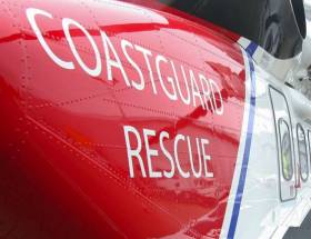
#MarineNotice - The latest Marine Notice from the Department of Transport, Tourism and Sport (DTTAS) details the proper hi-line protocols when receiving assistance from a search and rescue helicopter.
The notice follows the findings of last year’s MCIB report into the sinking of the fishing trawler Iúda Naofa off Scotland in January 2015.
As previously reported on Afloat.ie, it was determined that the crew of the trawler lacked knowhow regarding the use of hi-line, which meant they were unable to release an emergency pump dropped to the vessel on a standard clasp from a UK coastguard helicopter.
Full details are included of Marine Notice No 3 of 2017, a PDF of which is available to read or download HERE.
Talks Over Return Of Blackrock Tower Liferaft
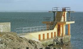
#Galway - Irish Water Safety in engaged in talks with Galway City Council over the possibility of reinstating the liferaft at BlackrockDiving Tower.
Councillors last year rejected proposals to replace the amenity after a poor health and safety assessment in 2015, as previously reported on Afloat.ie.
The raft was originally removed from the tower in Salthill in 2014 after it was associated with incidents of falls and near drownings.
But as Galway Bay FM reports, talks have begun in the wake of local public sentiment for the liferaft, with a view to including it in delayed upgrade works on the tower.
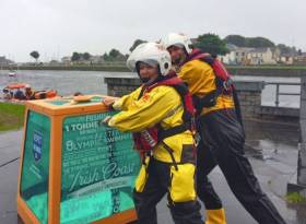
#RespectTheWater - The RNLI has placed a tonne of water in Galway and Dun Laoghaire respectively for the summer months in a bid to show visitors and locals alike the power of the water, river and sea.
The tonnes of water, which will be located at the Spanish Arch in Galway and Dun Laoghaire's East Pier until the end of August, forms part of the RNLI’s Respect The Water campaign.
Each tonne is printed with important advice about the power of water, such as how fast a rip current can flow. They will also demonstrate to people how heavy a relatively small volume of water is – one cubic metre of water weighs one tonne.
They were created to be a visual and engaging way of delivering this message that no matter how strong a swimmer you might be, you are no match for the power of the water.
Last month the RNLI launched its annual national drowning prevention campaign, Respect The Water, and this year the charity is warning the public to watch out for key dangers that can catch people out in or near water.
Galway Bay Swim In Call For Support Boats
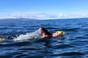
#GalwayBaySwim - Organisers of the Frances Thornton Memorial Galway Bay Swim are appealing for support boats to help out on the day.
As Galway Bay FM reports, this year's event in aid of Cancer Care West will take place on Saturday 23 July with 75 swimmers signed up to cross the bay from Auginish to Salthill.
And as ever, safety comes first, with race organisers seeking volunteers from the local maritime community who can spare their time and their boats – preferably 5m RIBs with a 50HP engine – for the duration of the 13km crossing.
Earlier this year a new documentary celebrating the first 10 years of the Galway Bay Swim was screened in the city, as previously reported on Afloat.ie.

#WaterSafety - This summer the RNLI is launching the second year of the popular Beach Builder Challenge using the interactive video game Minecraft, which allows children to create and build virtual worlds.
Available to play from Monday 1 August, the Beach Builder Challenge was created by the RNLI to teach children about beach and water safety.
The RNLI has this year expanded the virtual world to include a Beach Island Adventure, which means that as well as being able to create epic beaches, creative youngsters are also tasked with completing four levels based on the charity’s Stay SAFE acronym: Spot the dangers, Take Advice, Stay close to a Friend or family member, and learn what to do in an Emergency.
"This is a fun and interactive game for 7–14 year olds to play during the summer holidays," says Jenny Thompson, RNLI lifeguard supervisor on the Causeway Coast. "We really hope the challenges will help Minecraft users visiting the beach this summer put their newly acquired beach safety knowledge into reality, and have fun while staying safe."
Last year’s Beach Builder Challenge was a huge success with more than 8,000 children participating from all over the world, including Canada, Australia and the USA. It also proved successful in helping to reach a high number of children living in inland communities across Ireland and the UK.
Feedback from 2015 suggests the game is an excellent education platform particularly as results found that 97% of participants, after playing the game, knew to go to a lifeguarded beach; and there was a 20% increase in the number of children who knew to dial 999 and ask for the coastguard if they saw someone in trouble at the beach.
Bridiee Appleby-Gunnill, the RNLI’s Community Safety Product Manager, added: "We’ve created a fun, educational experience where a young person can engage and learn about water safety in a self-organised way and where academic ability does not limit learning.
"Research suggests that children learn and retain more when they can organise their own learning. Last year’s feedback has shown Minecraft to be a fantastic enabler in allowing this to happen.
"I’m really hopeful the results of this year’s challenge will be just as encouraging. We’ll be looking for participants to take part in research, to help us further develop ways to enable water safety learning in this age group."
This year, children using different platforms will be able to talk to one another while taking part in the challenge. To register your child’s involvement email [email protected].
Jellyfish Warning For Sandycove Beachgoers
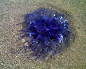
#Jellyfish - Dún Laoghaire-Rathdown County Council has raised the red warning flag in Sandycove and erected signs warning swimmers of the presence of stinging jellyfish in the water and washed up on the beach. Photographs have been taken and sent off for expert identification of the marine species.
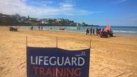
#Lifeguards - RNLI lifeguards will commence full-time summer patrol on 10 beaches in Northern Ireland from next Saturday 25 June.
Following a busy period of intensive training in preparation for the new season, the lifeguards will be keeping visitors safe on seven beaches along the Causeway Coast and three in Co Down.
The beaches include Benone, Downhill, Castlerock, Portstewart Strand, Portrush West, Portrush East, Whiterocks, Tyrella, Murlough and Cranfield.
From next weekend, the RNLI will take up full-time daily duty on all beaches continuing to Sunday 4 September, when weekend duty will then resume on selected beaches throughout September.
Lifeguards will be on the beach daily between 11am and 7pm on the Causeway Coast and between 10am and 6pm in Co Down.
Speaking ahead of the new season, RNLI lifeguard manager Mike Grocott is encouraging those planning a visit to the beach this summer to bear in mind some key water safety messages.
"The RNLI’s advice for anyone planning a trip to the beach is to check weather and tide times before you go and if planning to go into the water, swim at a lifeguarded beach, between the red and yellow flags," he says.
"Avoid using inflatables in strong winds or rough seas. If you get into trouble, stick your hand in the air and shout for help and if you see someone else in trouble, tell a lifeguard. If you can’t see a lifeguard, call 909 or 112 and ask for the coastguard."
The RNLI is running its annual national drowning prevention campaign Respect the Water throughout the summer months with the charity this year warning the public to watch out for key dangers that can catch people out in or near water.
Central to the campaign are the dangers that can lead to accidental drowning: cold water, unexpected entry into the water, and rip currents and waves.
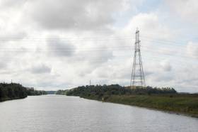
#InlandWaters - Waterways Ireland has warned masters and users of Ireland's inland navigations of the dangers associated with overhead power lines.
In particular, sailing vessels, sailing dinghys and workboats with cranes or large air draughts should take extra care around any overhead cables.
Vigilance is required especially in the vicinity of slipways and dinghy parks, while voyage planning is a necessity in order to identify the location of overhead lines crossing the navigations.
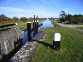
If the vessel or its equipment comes in contact with an overhead power line, do not attempt to move the equipment or a person if either is still in contact with or close to the cable, as the conductor may still be live or re-energise automatically.
Maintain a five-metre clearance if possible, and prevent third parties from approaching you or your vessel because of the risk of arcing.
Contact the emergency services for assistance: the ESB Networks emergency number is (+353) 1850 372 999 and Northern Ireland Electricity Networks is (+44) 0800 616 817.
Those engaged in angling are also reminded that a minimum ground distance of 30 metres should be maintained from overhead power lines when using rod and line.
Caution Against Swimming In Ireland's Inland Navigations
#WaterSafety - Waterways Ireland has echoed the recent advice over the dangers of the water during the current warm spell across Ireland.
The latest marine notice from the management body for Ireland's inland navigations warns the public on the dangers of swimming and diving in and around navigation infrastructure such as bridges, locks, weirs, pontoons and harbour jetties.
The possibility of a swimmer being struck by a vessel, its propeller or being run over is ever present while powered craft are manoeuvring. Swimming is therefore prohibited at these locations.
It follows similar warnings from the Irish Coast Guard, RNLI and Irish Water Safety urging caution to anyone engaged in activities on or near the water this summer.
The latest incident saw a 12-year-old boy airlifted to University Hospital Galway after wounding his leg on a jagged rock while cliff diving in the Gaeltacht, as Independent.ie reports.
Cork Trawler Owner & Skipper Fined Over Safety Breaches
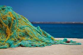
#Fishing - Out-of-date safety equipment has seen a Cork trawler skipper and owner landed with €4,000 in fines, as RTÉ News reports.
Pat O'Mahony of Kinsale and the Crosshaven-based Labardie Fisher Ltd pled guilty at district court in a case taken on behalf of the Minister for Transport, Tourism and Sport.
The former was convicted of having expired distress signals and hydrostatic life raft releases on his fishing trawler on 5 October last year.
Meanwhile, the trawler owner was fined on a charge of arriving in port with expired distress signals, and for failing to send the port superintendent a signed crew manifest as of 28 May last year.
The court heard that both skipper and owner, who lost 12 days of fishing during the investigation, co-operated fully during the process.
RTÉ News has more on the story HERE.


