Displaying items by tag: wave
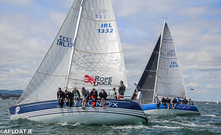
Following the cancellation of Cork Week 300, ICRA has decided to combine the National Championships with this year’s WAVE regatta which will take place at Howth Yacht Club from September 11-13th.
The decision was taken by unanimous vote by all the cruiser-racer representative Board Members at a strongly attended ICRA (remote) meeting this week, with the full support and backing of the RCYC Cork Week team.
The decision took into account a number of factors, including the desire to ensure that the event took place if at all possible and was not cancelled again, the costs and implications of running a standalone event at this stage and the understanding of ensuring boats and crews had some possible opportunity to get up to speed before the event.
The meeting chaired by Commodore Richard Colwell included Cxema Pico, RIYC; David Cullen, HYC; John Leech, LDYC; Ric Morris, RIYC; Johanna Murphy, GISC & SCORA; Peter Ryan, NYC; Denis Byrne, RCYC; Liam Lynch, TBSC. Brian Raftery of SBSC was absent.
The ICRA Committee also say they wish 'to thank generous offers from other clubs to host the regatta on alternate dates'.
 ICRA Commodore Richard Colwell
Commodore Richard Colwell commented “The ICRA Committee is saddened that the efforts of Cork Week cannot come to fruition so we have considered several alternative options for our annual ICRA National Championships. It was agreed that it would be prudent in the current environment, to delay the important National Championship regatta until as late as possible to try and ensure it goes ahead this year, so we have taken up the offer from Howth Yacht Club to combine the event with the WAVE regatta in September.”
"it would be prudent in the current environment, to delay the important National Championship regatta until as late as possible"
WAVE Chairman, Brian Turvey added “Our team in Howth is delighted to be able to lend support to ICRA for their 2020 Championships. Wave Regatta provides a relatively simple integration for the ICRA Nationals with much of the fleet already intending to compete and at a time of the year which suits many classes for their annual championships, not least that we are hopeful that the pandemic will have abated by then.”
Due to the uncertainty of which events will proceed, it has also been decided to cancel the original Boat of the Year schedule of races and keep under review.
Once we get clarity on what events will be proceeding, we will reissue a revised Notice of Race, ICRA spokesman Dave Cullen said.
‘World’s Biggest Wave’ Recorded Off Ireland
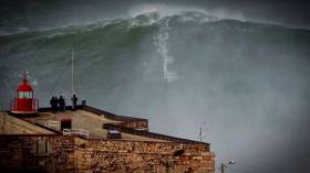
#RecordWave - Nineteen metres is the height of what’s being called the world’s largest wave, recorded recently off the North West Coast of Ireland.
Independent.ie reports on the record-breaking swell detected by a weather buoy in the North Atlantic between Ireland and Iceland, following what the World Meteorological Organization’s (WMO) Commission for Climatology described as a “very strong” cold front that passed through at more than 80km per hour.
WMO Assistant Secretary-General Wenjian Zhang said: ”This is the first time we have ever measured a wave of 19 metres. It is a remarkable record.”
The new measurement beats the previous record of 18.275 metres recorded in the North Atlantic nine years ago.
But while the news is causing gasps around the internet, for some it only confirms what’s long been known — that Ireland is on the doorstep of a big wave paradise.
Indeed, Ireland’s North West is no stranger to monster swells, with the giant surf offshore from Mullaghmore in Co Sligo a well-kept secret among the big wave surfing fraternity.
Couple Washed Away By Big Wave Shows Dangers of Winter Storms
The dangers of winter storms and the risk posed by freak waves are illustrated on the beach of Porsguen near to Portsall in Western France when a retired couple are swept away this month.
It is understood the couple survived the ordeal and rescued by coastal walkers.
The edge of the sea seems to be far enough away for the three people in this clip to be safe – but they are soon to learn that it isn’t.
A large wave crashed onto shore, knocking a pensioner to the floor. First his wife tries to save him before she too loses her footing and ends up being washed out.
The video was shot on the coast of France near Porsguen and uploaded onto YouTube by Olivier Lou who thanked locals Denise and Herve for giving them dry clothes.
Wave Measuring Device at Castletownbere Fishery Harbour Centre, Co. Cork
#castletownbere – The Department of Transport, Tourism and Sport has been advised that a wave measuring device has been installed on the seabed, adjacent to the Walter Scott Rock, at co-ordinates Latitude 51° 38' 33.6"N, Longitude 009° 54' 20.4"W. A yellow floating marker buoy with a special mark beacon has been installed to indicate the location of the device.
The wave study is being carried out by the Marine Engineering Division of the Department of Agriculture, Food & the Marine. The study is expected to be on-going until late March 2015, weather permitting.
For safety reasons, mariners are requested to keep a sharp lookout and to proceed slowly and with extreme caution in the vicinity of the Walter Scott Rock.
For safety reasons, fishermen are requested to avoid dredging at the co-ordinates mentioned above. Fisherman should take great care when dredging near this location and keep a wide berth from the device which is located on the seabed.
Donegal Coast Records Highest Ever Wave as Growlers Reach 80–Feet
#wave – A new maximum wave height measuring nearly 80–feet (23 metres) has been recorded in weekend storms off the coast of Ireland.
Monster waves the height of five double deck buses occurred during last weekend's ferocious storms off the coast of Donegal, the worst for 30 years, according to Donegal news sources.
The M4 weather buoy, located off the Northwest coast, recorded a new maximum individual wave height of 23.4 metres at 15.00 on Sunday 26th January 2014 during the weekend storm that prompted an orange alert by the Coast Guard.
The new wave measurement easily surpasses the previous record of 20.4 metres at the same location in December 2011, according to Met Eireann.
The M4 buoy is one of a new generation of weather buoys with the ability to measure maximum wave height as well as the more usual Significant Wave Height.
The Significant Wave Height is defined as the average height of the highest one-third of the waves and that is what our forecasts of wave height refer to.
In general, the highest wave of all will be about twice the Significant Wave Height.
There was also a record for maximum significant wave height for the M4 buoy of 15.3m at the same time, with the previous record being 14.7m. The all-time record for Significant Wave Height still rests with the M6 buoy of 17.2m.
more from Met Eireann on this story here
Cornish Surfer Rides Ireland's Record Biggest Wave
#SURFING - British surfer Jayce Robinson wasn't about to let the largest wave ever recorded off Ireland's shores go by without giving it a shot.
And as Sky News Online reports, he was captured doing exactly that on Tuesday afternoon.
The Cornish surfing pro told the website: "It was definitely the biggest barrell I've ever surfed.
"I was a little nervous but I didn't have time to think about it - it's almost like a car crash, you don't know what's happening."
Robinson rode the giant wave for 20 seconds before the lip crashed down and knocked him off his board.
His surfing partner Lyndon Wake, who towed him to the swell at Mullaghmore Head, said: "It's always a worst case scenario when your tow partner wipes out. Lucky he managed to come out the other side OK."
As previously reported on Afloat.ie, storm force winds off the coast of Donegal produced monster rollers of over 20 metres (over 60 feet) in height detected in Donegal Bay.
Mullaghmore Head will once again welcome the world's top big wave surfers for the second annual Tow-In Surf Session in the New Year.
Record Wave Detected By Offshore Weather Buoy
#WAVE – The biggest ever wave in Irish waters was recorded yesterday when storm force winds off the Coast of Donegal produced monster rollers of over 20 metres (over 60 feet) in height off the Northwest tip of Ireland. At least two giant waves put meterologists on alert yesterday prompting the Coastguard to issue a weather warning.
The 20.4 metre wave was detected in Donegal Bay by the M4 weather buoy, according to Met Eireann. The wave was recorded at 2pm yesterday. (Tuesday 13th December 2011),
Meteorologists said sea conditions, about 60 miles out to sea, were the most serious they had ever experienced. The Irish Coastguard said they had recorded winds of up to 140km per hour off the north-western coast yesterday and issued a warning.
The M4 weather buoy is located 75km north of Belmullet on the north west coast of Ireland. The M4 buoy forms part of the Irish Weather Buoy Network which began in 2000 and is funded by the Department of Transport, Tourism and Sport and run by the Marine Institute in collaboration with Met Eireann and the UKMO.
"This is the largest wave measured on the Weather buoy network to date. However, these recordings are a result of the next generation buoy which was deployed last year. Historically, only the significant wave height could be measured by the older buoys, where heights of between 10 and 13 meters were typically recorded around the coast during winter. The next generation buoys allow us to record and transmit both significant wave height and maximum wave heights as part of our hourly observations," explains Sheena Fennell, oceanographer with the Marine Institute.
Over the last number of years the network has been going through a transitional phase replacing the older models with next generation buoys supplied by Fugro Oceanor. The combination of high quality real time measurements coming from the offshore buoys and coastal systems, coupled with the mathematical forecasting models, is extending the well proven ability of scientists and engineers to accurately forecast the atmospheric conditions and sea state of the ocean.
"With the development in technology we are now able to record maximum wave heights which the older style buoys couldn't do. This parameter will form an important part of forecasting as we move forward." Sheena Fennell further said.
Met Eireann say the stormy conditions will gradually ease off tonight, but then frost and icy patches will develop. However it will remain very windy for a time early tonight, with severe southwest to west gales.
Ireland Battens Down the Hatches for Hurricane Katia
Ireland has battened down the hatches because of fears Hurricane Katia would wreak widespread havoc with storm-force winds and giant waves. The Coast Guard has issued a weather alert warning people to stay away from cliff edges. Boaters are also warned of the dangers of walking near exposed quays.
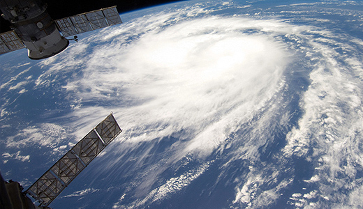
Hurricane Katia as seen from the space station
Dramatic Photos of Clifden Lifeboat Battling Surf
John organised the training in response to the increased popularity of the area with surfers. RNLI Divisional Assessor Trainer Helena Duggan travelled to the lifeboat station to put 18 volunteer lifeboat crew through their paces and train them in handling the lifeboat in surf and responding to potential callouts from leisure marine enthusiasts.
Training is a core part of volunteering with the RNLI and each crewmember in Clifden trains once a fortnight on the stations two inshore lifeboats.
Commenting on the exercise John said, "I took my camera down to photograph the exercise and was really pleased with the results. It is great to be able to show the public what our lifeboat volunteers go through to ensure they are fit and trained to go to sea. We had a fantastic turnout on the day and the lifeboat crew learned about boat handling in surf conditions. We are delighted so many people are visiting the area for leisure marine activities."
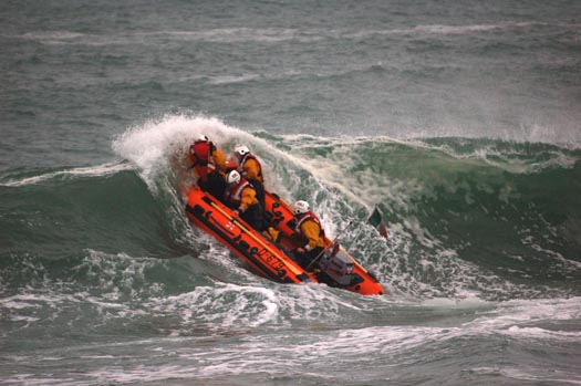
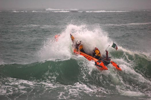
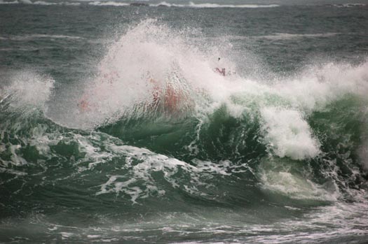
Photos by John Brittain/Clifden RNLI show Clifden volunteer lifeboat crew with RNLI Training assessor Helena Duggan during surf training on Dunloughan beach, Ballyconeely
Related Safety posts
RNLI Lifeboats in Ireland
Safety News
Rescue News from RNLI Lifeboats in Ireland
Coast Guard News from Ireland
Water Safety News from Ireland
Marine Casualty Investigation Board News
Marine Warnings
US Firm to Make Energy from Irish Waters
A US renewable energy company is proposing to meet the Government’s target of generating 500 megawatts of electricity from ocean energy systems by 2020, holding out the possibility of generating tens of thousands of jobs in Ireland. Frank McDonald's story in the Irish Times this morning is here.


