


Displaying items by tag: waves
Waves Setting Records Around Irish Coast

#WaveRecord - The waves just keep getting higher off Ireland's coast!
Following our report in January this year that the M3 weather buoy measured the second highest wave off the West Cork coast comes news of an even bigger swell just a few weeks later.
Met Éireann's Columba Creamer informs us of a maximum individual wave height of 21.91 metres recorded on the night of Monday 23 February.
That's more than two metres clear of the previous record set by the MM3 weather buoy in January 2013, and marks the fourth highest wave recorded across Ireland's buoy network.
But there's more, as Monday 26 January saw Ireland's biggest ever wave – a 23.44-metre whopper – recorded by the M4 buoy off Donegal.
Creamer – Met Éireann's port meteorological officer, who quality controls data streams from Ireland's buoy network – says the four Fugro buoys (labelled M2, M3, M4 and M5) measure significant wave height, individual wave height, swell height, wind wave height, period and direction for each wave type.
'World's Biggest Waves' Off Irish Coast?

#SURFING - One of Ireland's top surfers claims he has found the world's biggest waves off the coast of Ireland.
As Irish Central reports, Portrush waverider Al Mennie says that he and surfing partner Andrew Cotton have found two waves reaching as much as 120 feet in secret locations off the coasts of Antrim and Donegal.
The duo are currently waiting for the right conditions to surf the biggest swells.
"The good days are few and far between – 90 percent of the swells are unrideable and we'd reckon that only two days each year are rideable," Mennie told the Irish Independent.
Their location is being kept under wraps for now due to safety concerns, as the waves crash down in a hazardous rocky area - making them definitely not suitable for novices.
Irish Central has more on the story HERE.
New Radar System Could Improve Coastal Forecasts
A new radar system in Galway could help predict extreme weather events more accurately, The Irish Times reports.
Scientists at NUI Galway's Ryan Institute, in collaboration with the IBM Smarter Cities Technology Centre in Dublin, have installed the system on the shoreline in Galway Bay.
The system - the first of its kind in North Atlantic Europe - consists of two antennae, on Mutton Island and Spiddal, which scan the surface of the bay every half hour.
It then sends high-resolutions maps of surface currents and details of wave height and direction directly to the scientists' base at the NUIG campus.
The data is used, along with meteorological data, to develop models for forecasing marine conditions from tidal currents to storm surges - common on the challenging coastline around Galway Bay and the Aran Islands.
Moreover, the system is set to benefit the local community and beyond as the data, when completed, will be made freely available.
Silicon Republic says that the Galway Bay Coastal Observing System (GalCOS) could be used by sailors, fishermen and tourists to more accurately assess conditions in the area.
It could also be of use to local authorities in terms of providing details on the best time to release effluent while minimising environmental damage.
“This type of predictive modelling is critical to our Smarter Cities agenda," said IBM's Dr Lisa Amini, "and the findings can be widely applied to protect coastal cities and their environments."
Surfing Monsters at the Giant Causeway - The Finn McCool Story

Our week began with the forecast of a huge swell hitting the North Coast of Ireland. It is usual that we travel through the night to meet the swell somewhere on the West Coast with great anticipation writes Conn Osborne. This time there was none of that, this time the swell was coming to meet us in our own backyard.
There had always been rumours of a wave, rumours as mythical as the tales of the Giants themselves at the Causeway. (SCROLL DOWN FOR PHOTOS!)
Al Mennie has been surfing most of his life, and big wave surfing for alot of that. Years ago he began a survey of our coast searching for potential big wave spots, educating himself through much observation and study on what exact conditions were required for each indivdual location.
The exact conditions this time were culminating on one of Ireland's most famous landmarks and tourist attractions, we felt privileged and knew that performing our best was the only option.
Monday drew to a close with phone calls between us gradually slowing down and firm plans having been shaped and finalised by Al who stood alone on the Causeway in the dark watching...and waiting...
Tuesday finally arrived, we each set out alone before dawn, with an aim to meet at first light - plenty of time then to organise equipment and get the tide right.
We have done this so many times before and have seen so many big waves but it was certainly different and very inspiring to view our own waters through refreshed eyes.
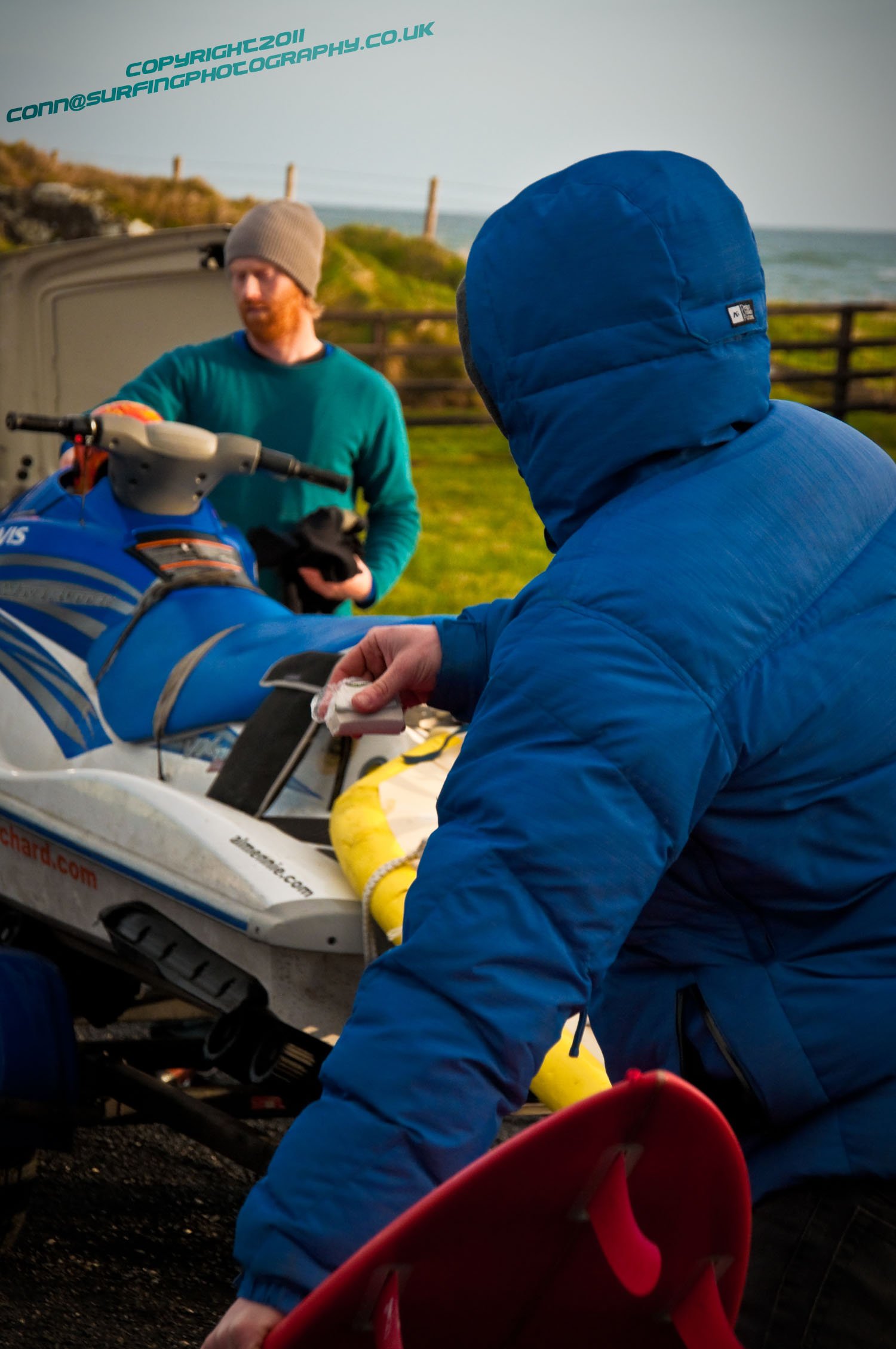
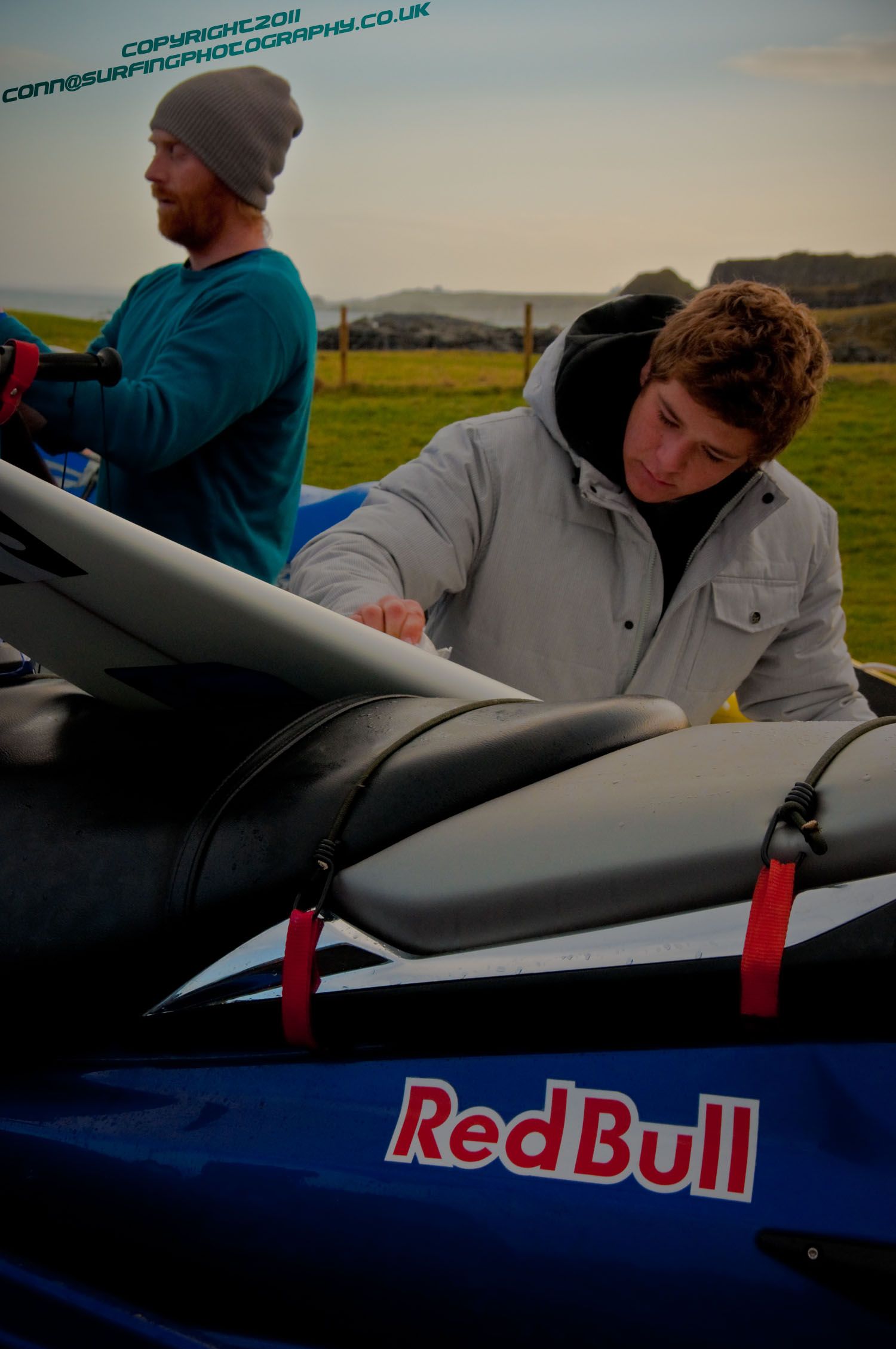
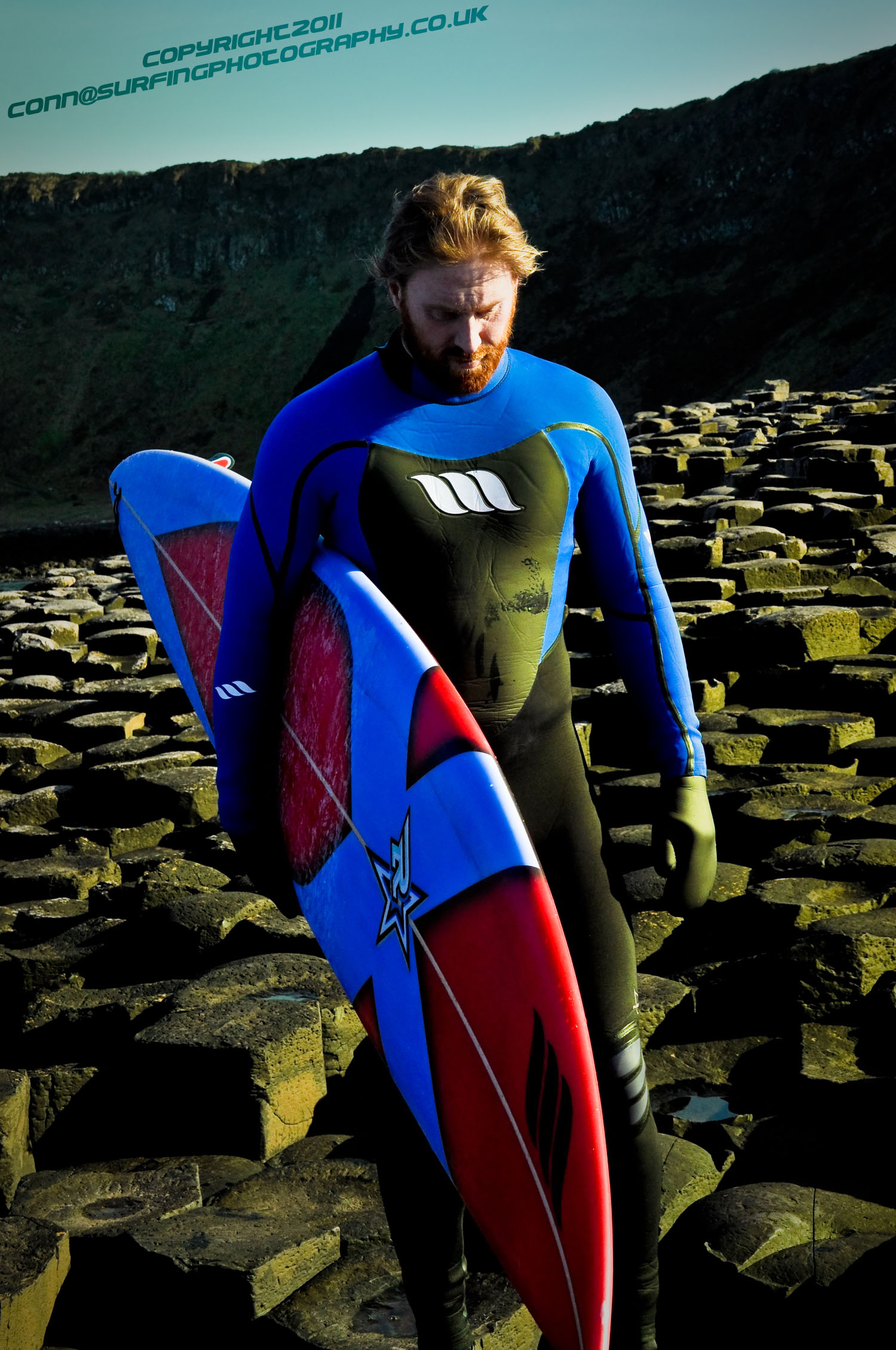
Equpiment was organised, set up and checked, the chosen boards were ritually waxed and choice of fins installed. The Riders, Al Mennie, Andrew Cotton, and Lyndon Wake protected from the bitterness by high tech wetsuits set down the slipway with their Jetski and "Sled" rigs into the icey waters of the Atlantic.
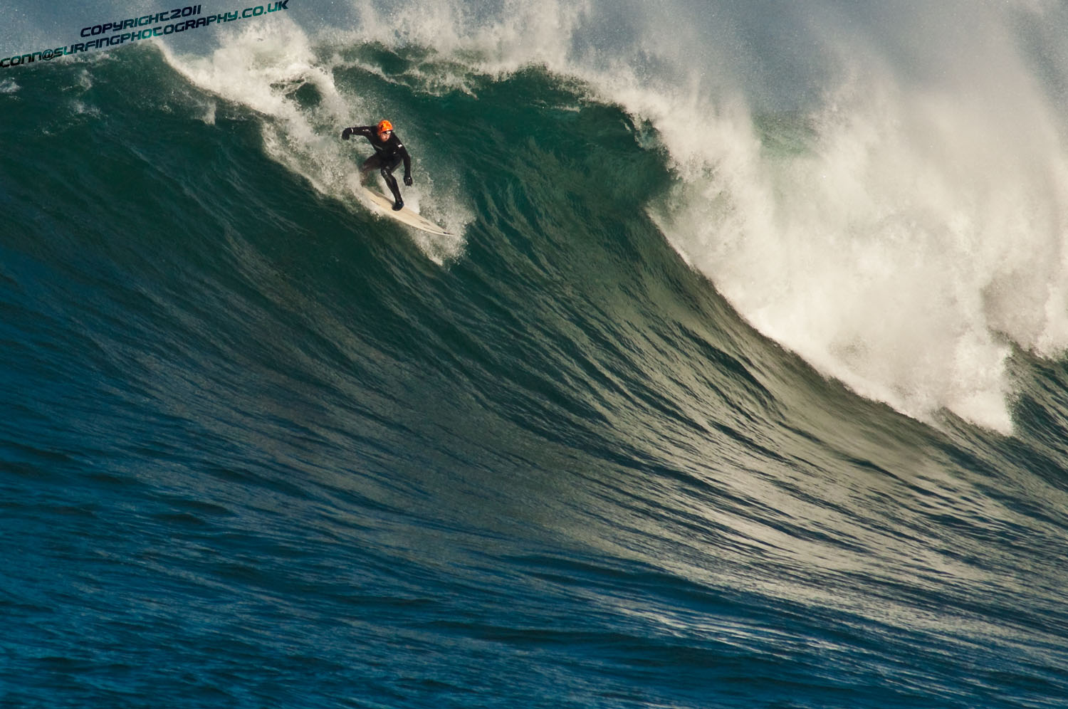
As we made our way over the the chop and over the swell we could see some white water entering the arena which is a bay that we knew would fill with white water and leave no safe exit from riding the large waves. (This was a spot that would prove to take all of our surfing knowledge and experience to surf.) We sat and prepaired with good grace 'n banter as we waited for those anticipated conditions to combine.
We could see spray fly off the back of swell as it rolled into the bay. The wind was picking up right.
Jetskis were powered up and we went in for a closer look to study how the wave was actually shaping up - the dynamics.
Swell increased in size and we could now really see the true challange of what we had set out to meet, for up until this moment, no one had witnessed swell of this size in position to surf.
Al Mennie Talks about his first experience..
"After watching the sets break and establishing some mark ups so we knew where we needed to sit in order to catch them, both Cotty and I jumped in and paddled to the peak. Every now and again the bay would close out with a set that would miss the main take off spot".
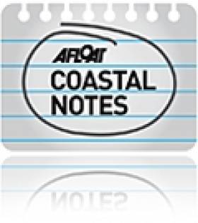
"Within 30 seconds, of paddling out, I got lucky and happened to be right under a big peak coming towards me. As I spun my 8'2" around to paddle into it I almost couldn't belive this was happening. Last week I was in La Vaca surfing in the contest and the week before I was surfing big La Santa point with Rob Small. Now, I'm paddling for a wave, just as big, two minutes from my house. I remember getting to my feet as it stood up and then going really fast down the face. As I kicked out I looked around me in disbelief. This big wave is breaking in one of the most beautiful natural arenas in the world and I've just ridden one. It was very satisfying. As I paddled back out for what became a four hour session Cotty went on his first elevator drop."
"The bay is very deep and holds a lot of water causing quite a lot of movement out there. There are rock boils everywhere and it would be very easy to fall and become a human pinball!"
Al Mennie's exploits, expeditions and endeavours can be read about in his book... Surfing Mennie Waves. Available online at www.almennie.com
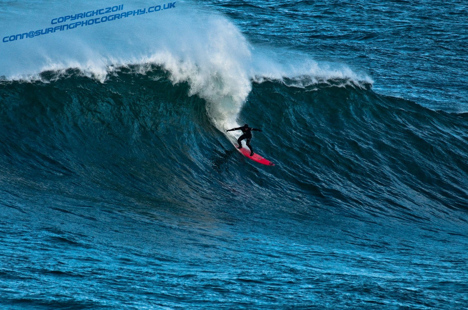
Irish Big Wave Rider Al Mennie going over the Edge @ Finn MacCools - Giants Causeway
The Team sit studying before commiting (Scale Setting)
Early in the day before the real conditions meet, this is the wind starting to Rise
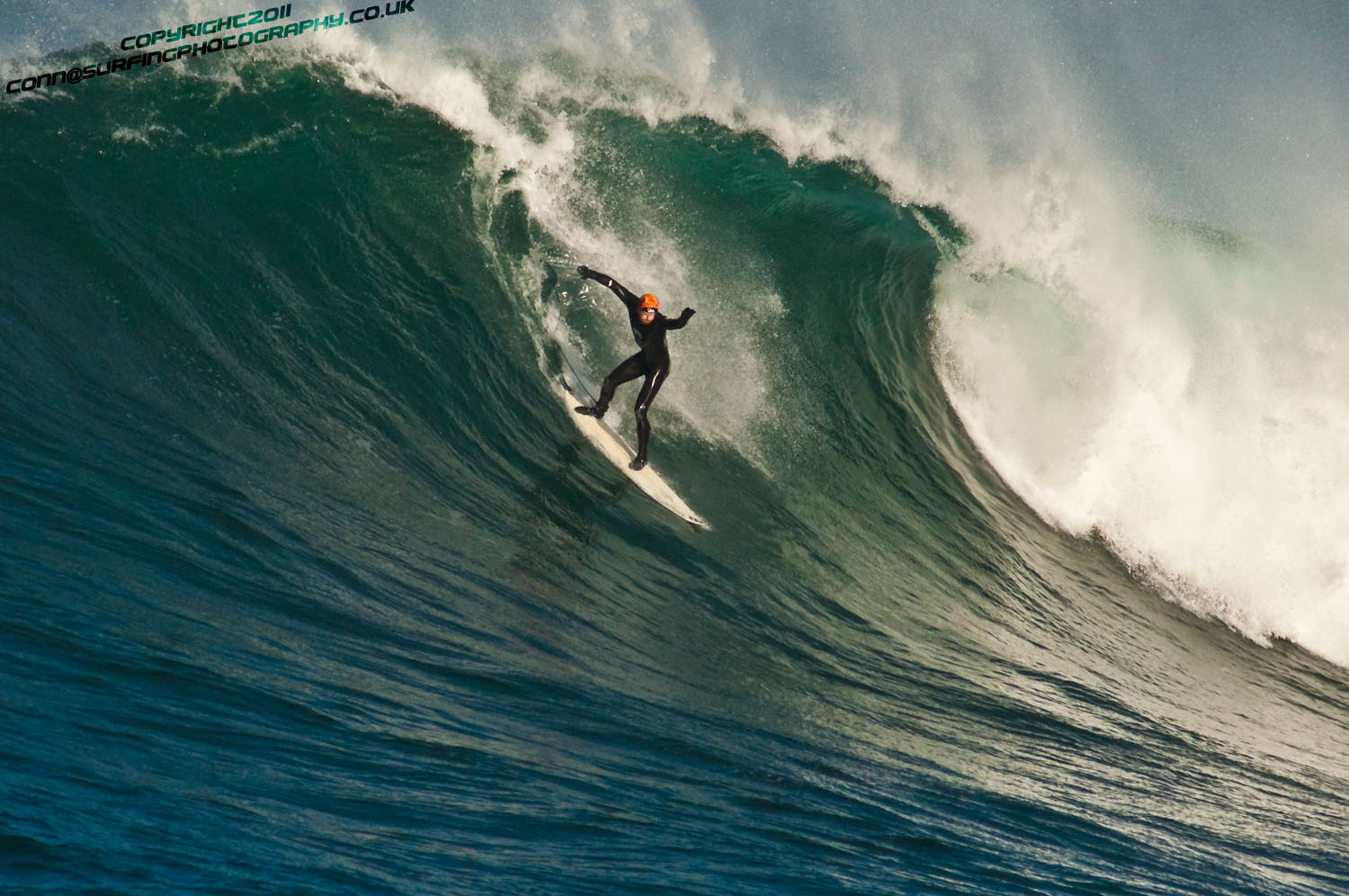
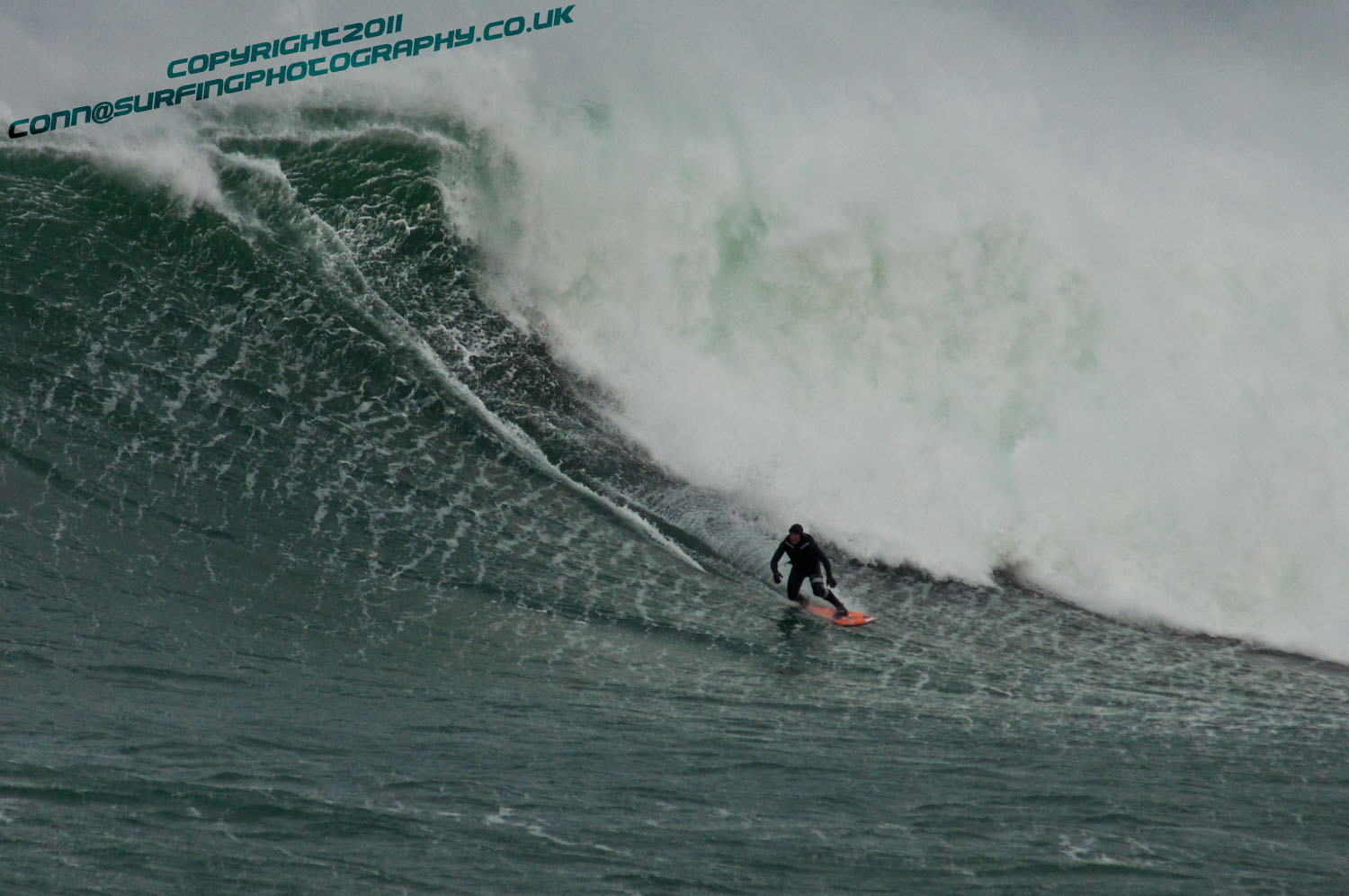
Al Mennie, Ireland's Big Wave Rider "Taking the Drop" and experiencing weightlessness
Al Mennie having a fun Tow In, the guys prefer to paddle into waves under their own steam, "Any wave worth surfing, is definitely worth earning"
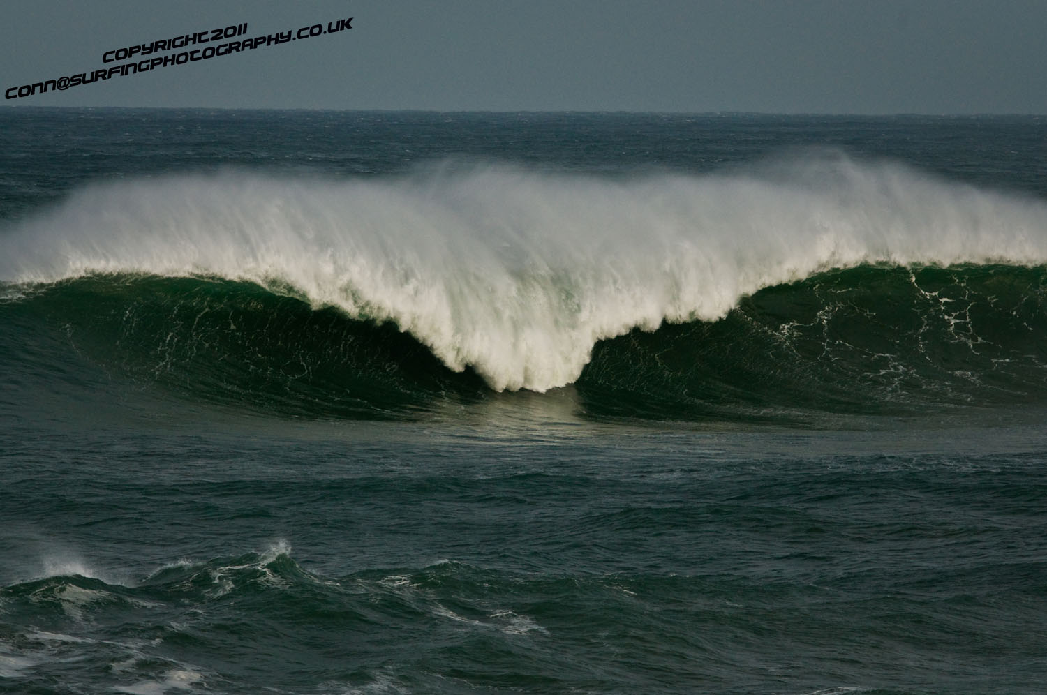
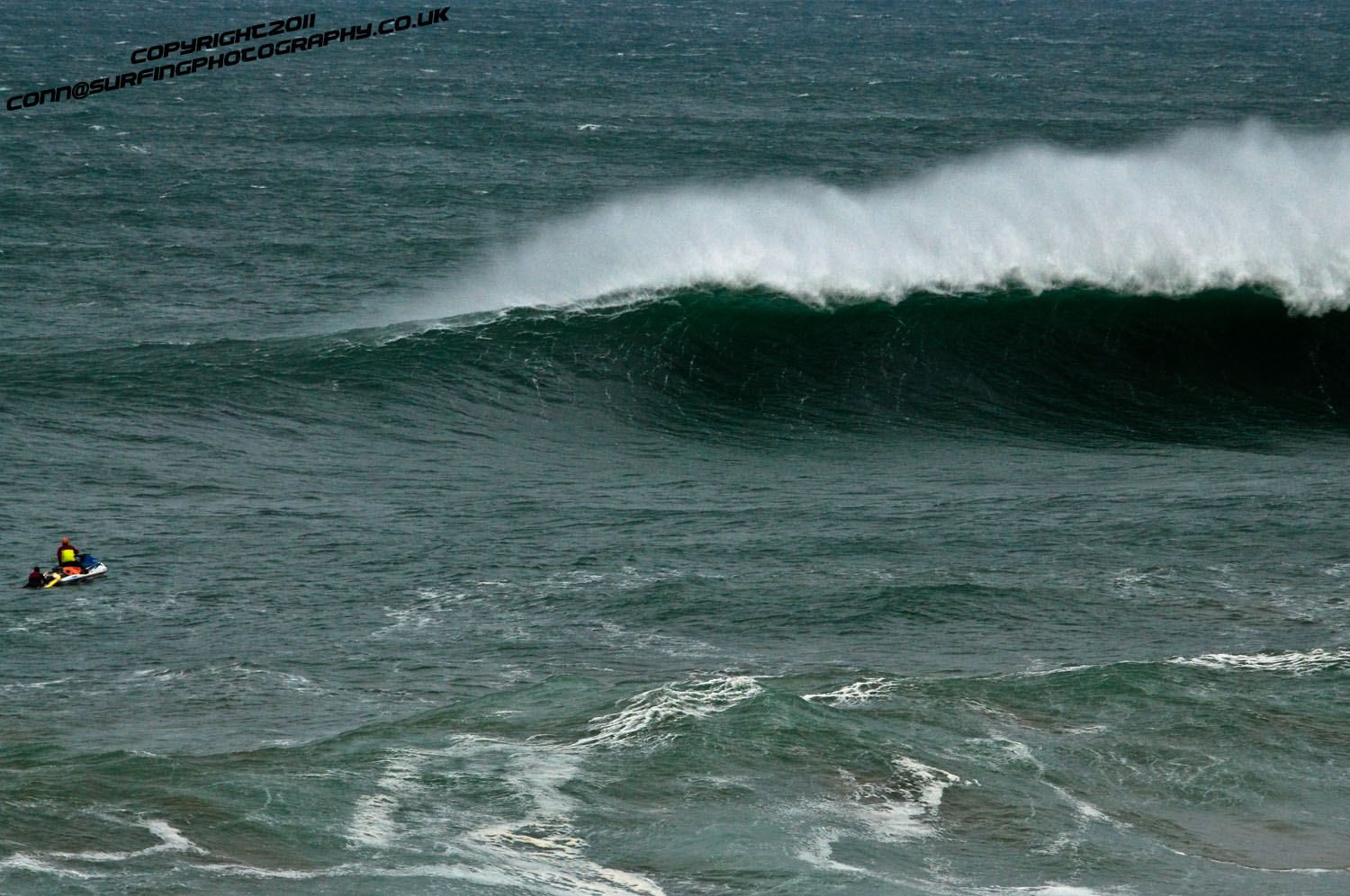
Favourable conditions.. This is what Finn MacCools looks like
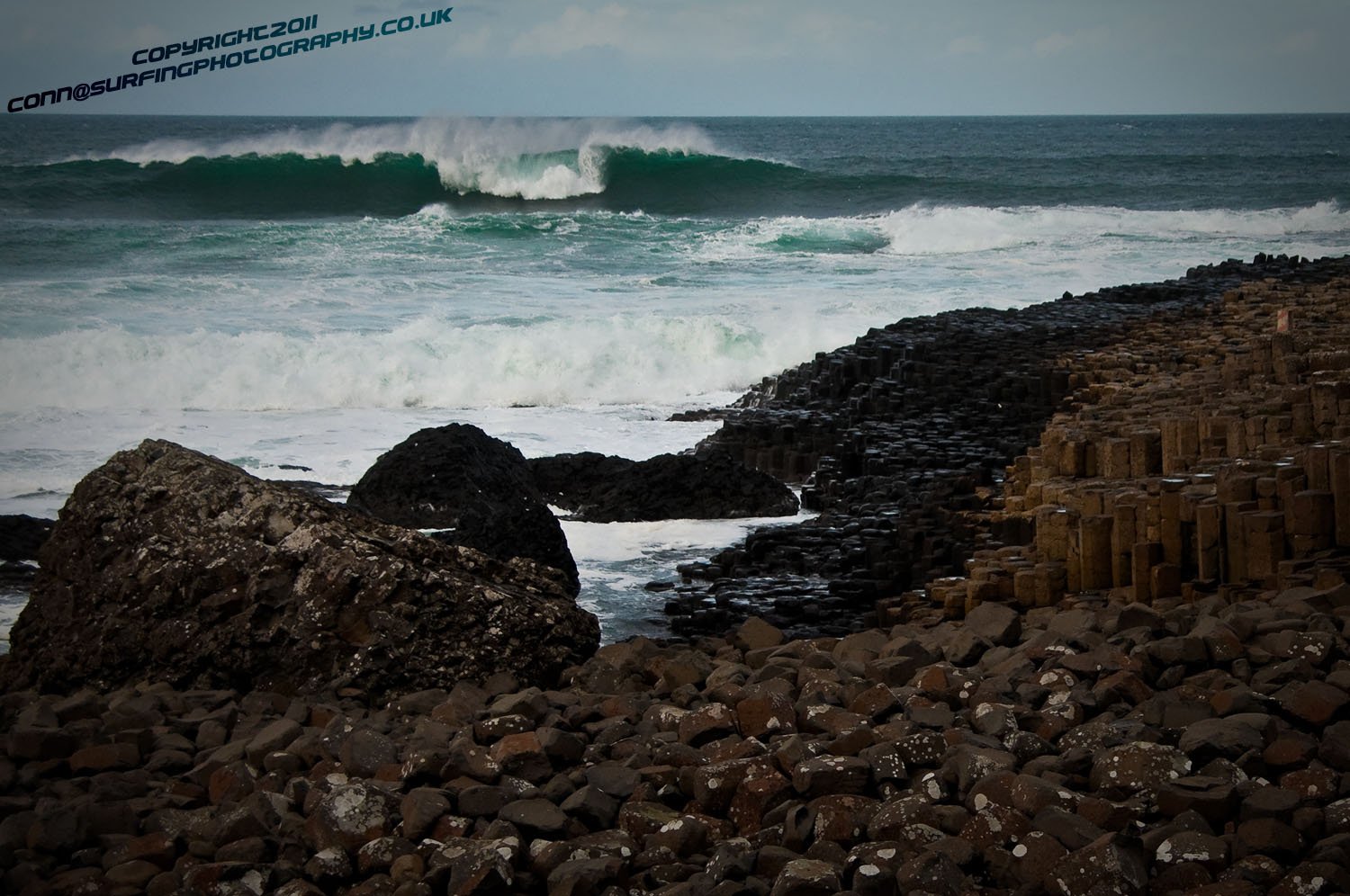
The Giant's Causeway before the real Big swell hits
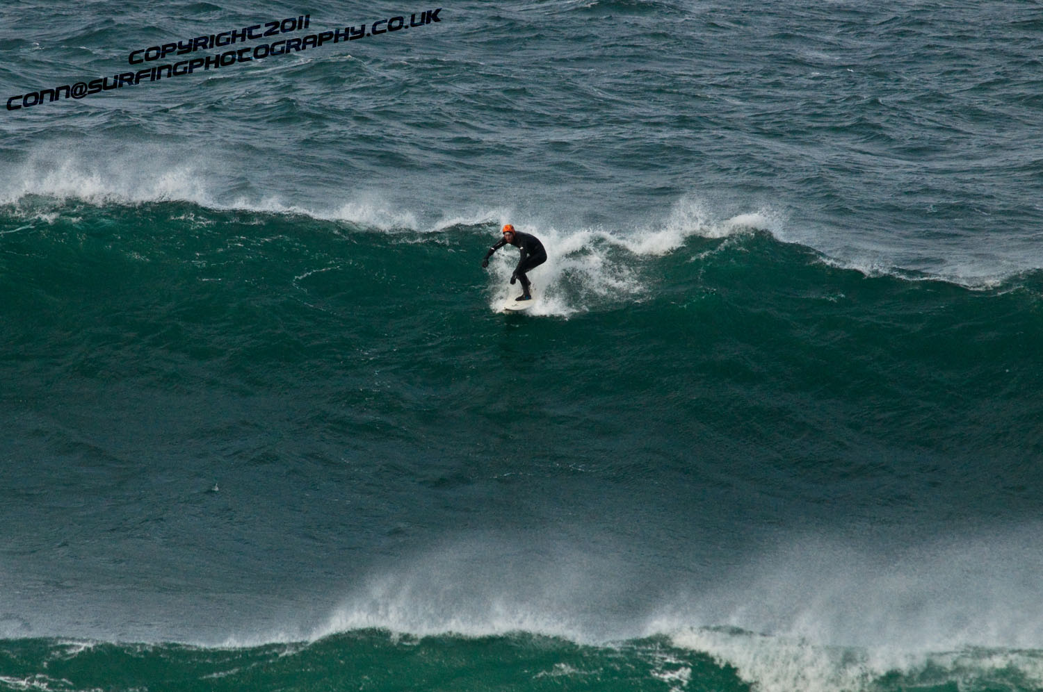
Al Mennie gets to his feet and anticipates the next 20 seconds
This is Al Mennie paddling to get up to speed so he can catch the Giant that is about to rare up to him
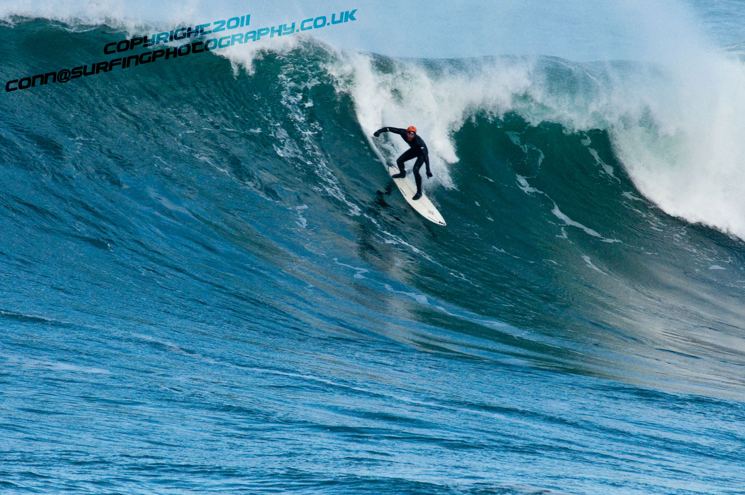
Al sets the Rail of the board as he makes the high speed descent down the face of this fast moving Giant
Irish Big Wave Rider, and Devonshire Big Wave Rider Andrew Cotton go over their equipment.. "to be able to actually put yourself in these potentialy dangerous situations and get out of them not only requires reliance on others, but also equipment"
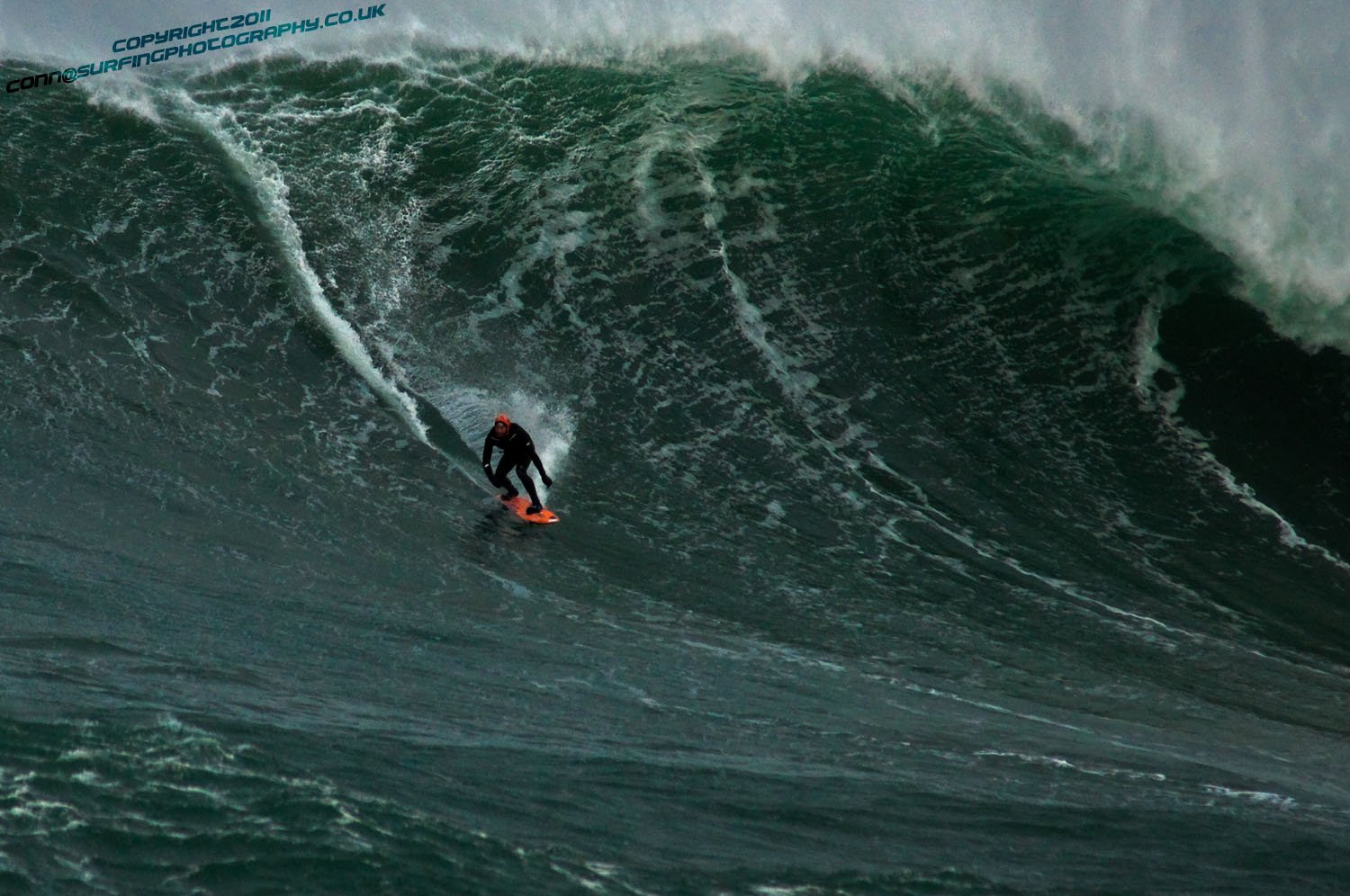
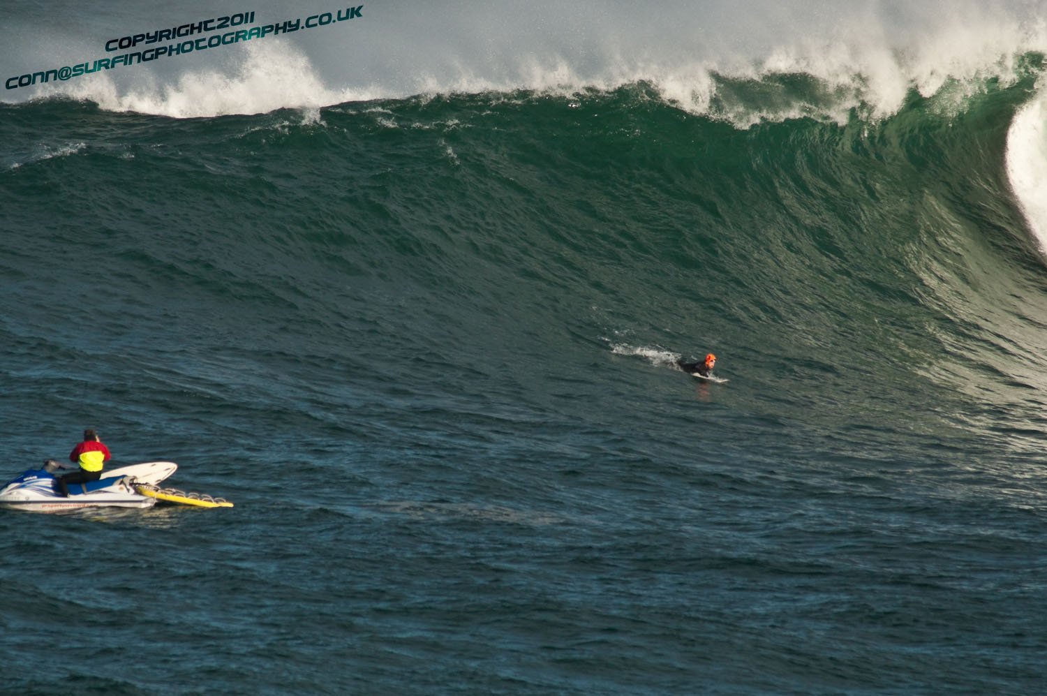
Andrew Cotton makes it to the bottom of a Finn MacCool wave ready to turn in towards it and climb
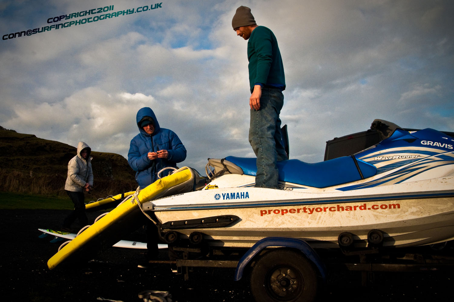
Young Devon Pro Surfer Lyndon Wake, Andrew Cotton, and Al Mennie attach their "Sleds" to their high powered jet skis, these enable a platform for a surfer in the water to swim, and hold onto so they can be evacuated from a hazardous situation in the least possible time
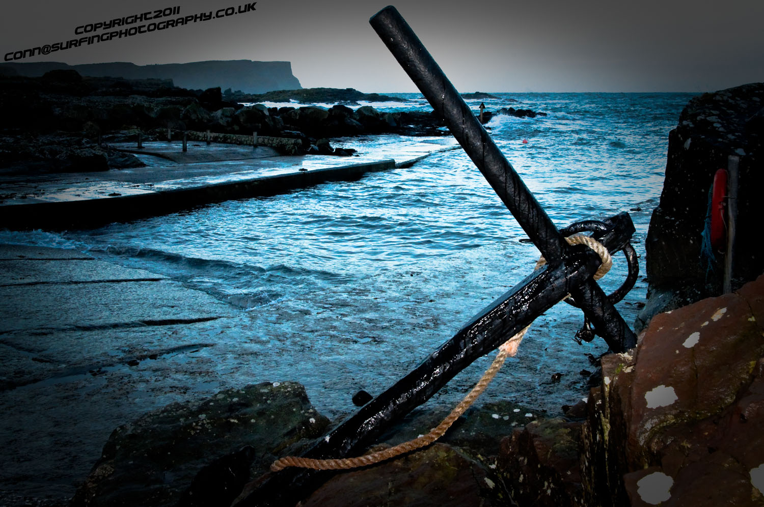
Early morning at the Harbour .. North Antrim.. Cold and deserted
Al Mennie and Lyndon Waxing their boards for traction
Andrew Cotton takes the drop at Finn MacCools and tries to force the nose of the board down against the wind that howls up the face of such sized waves
6ft 5' Al Mennie walks down the Causeway into the sea ready to paddle out and catch a giant
More from Conn Osborne on his website HERE
Giant Prowler Wave Location Remains Secret
According to a Press Association report one of the six-man team, Briton Andrew Cotton, first spotted it several years ago while on board an Irish Coast Guard helicopter after being rescued from a surf accident off Mullaghmore, Co Sligo.
Last night some west coast surfers told Afloat.ie the location is most likely off the Sligo coast, up to two kilometres offshore and close to an underwater reef.
The terrifying-looking wave, dubbed 'Prowlers', was reportedly up to 50ft high on Tuesday when the Irish, British, Australian and South African surfers ventured out. Photos of it appeared on the front page of the Irish Times yesterday.
The surf team included Bundoran's Richie Fitzgerald who says he had waited for five years for the type of conditions required to surf it and on Monday the waves were in the 40-50ft range. Conditions were perfect due to the massive swell generated by Hurricane Tomas.


, marking also a first presence in this market.")


 as lead helm, rounds the Fastnet Rock on the way to the overall win in 1987")


 Michael Murphy Schull Harbour Sailing Club (SHSC), Eric Coogan Heineken Ireland, Mark Murphy, Commodore SHSC, Jack Allen SHSC, Carmel O'Regan SHSC, Cornelious Ndlovu, Schull Harbour Hotel Operations Manager and Derval Murphy SHSC")
