#MarineNotice - RMS Submarine Ltd advises that they will be conducting nearshore survey operations associated with the proposed Celtic Interconnector on behalf of EirGrid, at three coastal locations in Co Cork — namely Ballinwilling Strand, Redbarn Beach and Claycastle Beach.
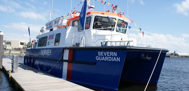
The survey vessel Severn Guardian (Callsign 2FGL5), an 18m catamaran coastal survey vessel, will operate on a 12-hour daily basis, in daylight hours only, commencing from today (Thursday 28 September) for the next two weeks, approximately. Common frequency VHF Channel 16 shall be used throughout the project.
This survey is to collect geophysical data utilising vessel mounted sensors and a towed sonar which will extend up to 100m from the vessel. The survey will be conducted under Foreshore Licence FS006722, as per the foreshore licence map included in Marine Notice No 41 of 2017.
The nearshore survey activities will extend no more than 5km from the shoreline, within a 1km area or corridor centred at each of the three coastal locations. The remaining offshore sections will be surveyed by a separate vessel in the coming months, for which a separate notice to mariners will be issued.
Full details of co-ordinates of the work areas and more are included in Marine Notice No 41 of 2017, a PDF of which is available to read or download HERE.