Displaying items by tag: disruption
Schoolchildren in their hundreds are facing disruption as the Strangford Lough ferry in Co. Down is to be affected over the next seven days due to strike action by ferry workers.
The passenger car-ferry service that links the villages of Strangford and Portaferry will not be operational for a week.
This means that commuters also will have to find an alternative method of transport as the service which has two car-ferries, Strangford II and Portaferry II (as above) are out of service.
According to BBC News a school principal said that four of his pupils will be left without any way of getting to school.
Members of the union, Unite, have voted to take strike-action after rejecting a pay offer of £552 extra per year for workers.
Commenting on the strike, Sharon Graham, Unite general secretary said the offer was a "slap in the face" for those responsible for the maintenance of vital public services and infrastructure.
It was on Thursday, at 00:01 (BST) that the strike had begun and is to continue into next week up until 23.59 on 26 April, Wednesday. For updated information visit the TravelWatchNI website here.
More here on the strike at the Strangford Lough Ferry Service which Afloat adds is operated by the Department for Infrastructure (DfI)'s Roads Division South, a Northern Ireland Government Department.
The road distance between Strangford and Portaferry is 46 miles and takes on average 30 minutes to drive. Whereas the ferry route of less than 1 nautical mile takes around 8 minutes to complete.
Sailing disruptions of the Isle of Man Steam Packet Company have been confirmed by the ferry operator with schedules over the next few days, as work is completed to resolve mechanical issues affecting one of the linkspans at Douglas Harbour.
Following an initial inspection by Department of Infrastructure and Steam Packet engineers, it is estimated rectification will take at least until the end of this week.
According to the Steam Packet, both Ben-my-Chree and Manannan will be utilising the King Edward VIII Pier (story) linkspan, initially with the 02:15 sailing from Heysham which will be rescheduled to 01:45. This will enable Ben-my-Chree to arrive on berth in Douglas at 05:45.
The early arrival of the Heysham-Douglas sailing will relieve some of the congestion in the harbour of Manx capital by allowing Ben-my-Chree to discharge before moving off berth to facilitate Manannan’s loading and departure. Ben-my-Chree will then return to the linkspan to load and depart on the scheduled 08:45 sailing.
The Isle of Man Steam Packet Company is working closely with colleagues at the Isle of Man Government’s Department of Infrastructure’s Harbours division to resolve the mechanical issues as quickly as possible
Until the situation is resolved all sailings will operate from the functional linkspan.
All passengers booked on any affected sailings will be informed.
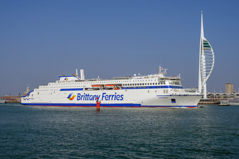
Disruption As Brittany Ferries New LNG-Powered Salamanca Breaks Down On UK-Spain Service
Asides delays to Stait of Dover ferry operators as Afloat reported, Brittany Ferries UK crossings to Spain and France are set to be disrupted after a new liquefied gas-powered (LNG) ship broke down days after its inaugural voyage.
Brittany Ferries said an engine fault delayed the departure from Bilbao of its Salamanca ferry by 26 hours.
The vessel powered by LNG, yesterday reported BBC News, was hailed as being cleaner and reducing emissions.
It is due to return to Portsmouth at 22:00 BST with knock-on delays expected for future sailings.
In a statement, the company said the fault was discovered during embarkation for Salamanca's 18:00 departure from Bilbao to Portsmouth.
For more on the first LNG ferry to operate out of the UK, click here.
Last month Afloat reported of Brittany Ferries seasonal Ireland-France route of Cork-Roscoff which resumed service almost a week ago by Armorique.
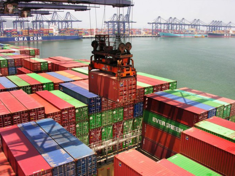
Disruption caused by the partial closure of the key south China Port of Yantian and its impact is set to exceed that of the Suez Canal blockage in late March and April, according to senior container shipping sources, with the ripple effects already being felt across supply chains.
According to LloydsLoadingList, container shipping industry commentator Lars Jensen, CEO of shipping consultancy Vespucci Maritime, observed that it “clearly currently appears that supply chain problems are worsening and not improving”. He highlighted that “the impact of the South China port issues continues to escalate”, and that the proportion of vessels affected “exceed the Suez incident”.
Taking a “quick look at four carriers, across each of the major alliances”, he yesterday highlighted that Maersk now advises that 64 of its vessels or its partner vessels in the 2M alliance have omitted Yantian and Shekou, with six switching to call in Nansha or Hong Kong, noting that “this is up from 40 vessels listed just two days ago”.
He notes that ONE now advises that 52 of THE Alliance’s vessels are being impacted, with 41 omissions and 11 changes typically from Yantian to Nansha – up from 27 vessels, of which 20 were omissions and seven were port changes, in their last advisory 5 days ago.
More here on this impact to global trade.
Customers in their thousands due to travel with Brittany Ferries are facing holiday disruption with the company's flagship Pont-Aven ferry now out of action until June 14.
The cruise-ferry, writes Independent.ie, which sails from Cork to Roscoff in France, has been out of service since May 17 to facilitate repairs to a fault.
"Despite these efforts it has now become apparent that this work will take longer than initially planned, whilst replacement parts are delivered and installed, and comprehensive checks are carried out," the company has announced.
The Pont Aven will not resume sailings until Friday, June 14.
For passengers, that means sailings on the Cork/Roscoff route have been cancelled for this weekend (May 31/June 1) and next (June7/8), along with a number of sailings on the company’s Plymouth/Santander and Plymouth/Roscoff routes.
Since May 17, a total of some 6,500 customers will be affected.
For more on the story click here including a Q&A link about what are my rights if my ferry is cancelled or delayed?
NI Recovers After Battering by Hurricane Katia
Northern Ireland is recovering after Hurricane Katia left power cuts and travel distruption in its wake.
As previously reported on Afloat.ie, the remains of Hurrican Katia had been expected to strike hardest in the northern half of Ireland.
The Belfast Telegraph reports that Derry, Antrim and Tyrone were worst hit by winds that reached speeds of up to 120kph on Monday.
There was widespread disruption to rail and ferry services, while drivers reported hazardous conditions. The Foyle Bridge was closed to all high-sided vehiches for a time.
Some 700 homes across Northern Ireland suffered a blackout when powerlines were cut and by falling trees and windborne debris, though power was mostly restored by Tuesday evening.
Though downgraded to tropical storm status after crossing the Atlantic, Katia's high winds wreaked similar havoc south of the border, with power cuts to over 13,000 homes in six different counties - half of them in Donegal alone.
Wind gusts of an incredible 137kmh were recorded on Arranmore Island.
The Belfast Telegraph has more on the story HERE.


