Displaying items by tag: UK landbridge
UK-Europe: Ferry Closure to Belgium Marks 'End of An Era'
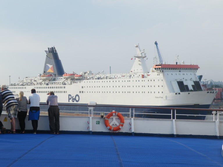
A UK-Belgium ferry route is to be cut between Hull and Belgium in a decision that has been described as the "end of an era" for the city.
Operator P&O Ferries said it was closing its service to Zeebrugge following a sharp drop in demand because of coronavirus.
Maritime historian Robb Robinson said Hull was losing another of its "connections with the Continent"
He described the decision as "damaging to the standing of the port".
Mr Robinson, who is a research fellow at the University of Hull, said: "It's very sad. "It's the end of an era.
"The purpose of the original settlement [Hull] was to trade with the Low Countries and literally the ferry is a modern example of the continuity of that trading and movement of peoples that's been going on for over 900 years or thereabouts."
"It really is psychologically, I think, quite serious damage in terms of that break."
For much more on the closure of the North Sea ferry BBC News reports here.
Afloat adds P&O Ferries also operate out of Hull on the route to Rotterdam, The Netherlands. In addition to operations on the Irish Sea, Dublin-Liverpool and on the North Channel the Larne-Cairnryan link.
New Ships for P&O Ferries Dover-Calais Route to Enter Service by 2023
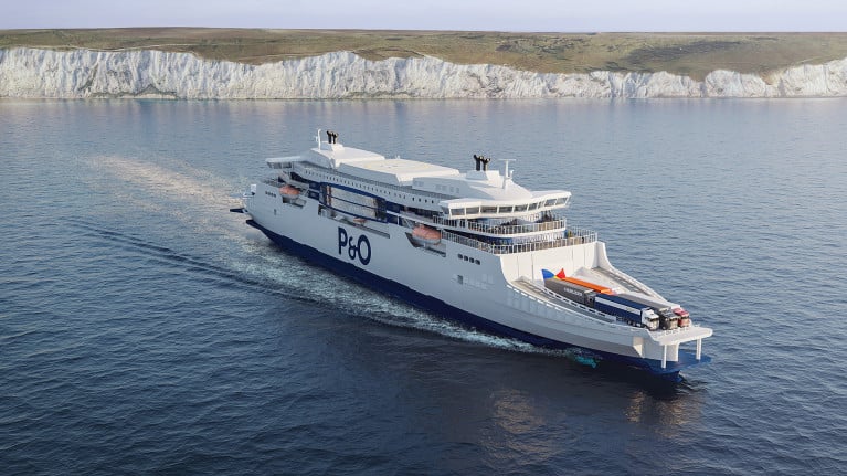
Official images have been released of P&O Ferries €260 million new generation of super-ferries which will see the new tonnage transform the experience of travelling between Britain and mainland Europe.
The newbuilds will be the largest ferries ever to sail between Dover and Calais at 230m long and according to Multimodal.org.uk the first is to enter service by 2023.
David Stretch, Managing Director - Short Routes at P&O Ferries, said: “These remarkable images provide a glimpse of the transformation which our customers will experience when they travel between Britain and Europe on the most sustainable, most reliable and most customer friendly ships ever to sail on the route.
“This major investment will be a vital part of Europe’s transport infrastructure into the 2040s and symbolises our commitment to making trade flow for our customers.”
Major innovations of the new super-ferries will include:
- Cutting fuel use by 40 per cent through a combination of fuel and battery propulsion
- The heat recovery system saves fuel which reduces the vessel’s carbon footprint
- Future proofing anticipates the ‘zero carbon emissions ship’
- A double-ended design and two bridges on the ship, meaning that there is no need for it to turn around
- Outside deck areas to provide viewing platforms of the White Cliffs of Dover
- Panoramic sea views for passengers
- A power management system to efficiently close down parts of the ship when not in use
- A revolutionary new shape of hull for the English Channel and azimuth thrusters which increase manoeuvrability of the ship
Exporters from Ireland 'to Keep UK Land-Bridge after Brexit'
#ExportersBrexit - Exporters from Ireland that go through Britain to get their produce to mainland Europe or further afield should still be able to do so after Brexit, the Revenue Commissioners expect, writes The Independent.ie
Michael Colgan, head of Revenue's Brexit Unit, said it is the body's "working assumption" that the UK land bridge for firms would still be available.
Two-thirds of exporters go through Britain, and expectations of continued use of the land bridge will come as a huge relief.
Currently, the common transit procedure of the EU is used for the movement of goods between the 28 EU member states, the EFTA countries, Turkey, the former Yugoslav Republic of Macedonia and Serbia.
The rules are effectively identical to those of the Union transit.
According to the European Commission, these are used for customs transit operations between member states and are applicable to the movement of non-Union goods for which customs duties and other charges at import are at stake, and of Union goods, which, between their point of departure and point of destination in the EU, have to pass through the territory of a third country.
To read more click the link here.
Freight Ferry Network on Stena North Sea UK-Rotterdam to Increase Capacity
#ferry- Stena Line which also operates a UK landbridge route network on the North Sea to mainland Europe, announced earlier this year an increase in its freight capacity on the Harwich-Rotterdam-Europoort route by replacing the current two RoRo vessels with two larger ships.
The ferry company has now confirmed plans to also increase capacity on the Killingholme-Rotterdam route in January 2018. Consequently this will increase its total capacity through Europoort by approximately 20%.
A decision has been taken to introduce a larger RoRo vessel on the North Sea to replace the current chartered ship, Caroline Russ, when its contract expires in January 2018.
Next year Stena Line will also reposition the RoRo ships between the Europoort routes to further optimise the available capacity. On the Killingholme-Rotterdam route, which was started with one vessel in 2014 and which has daily departures since 2016, MV Misida and MV Misana will operate. The new ship will be introduced on the Harwich-Rotterdam route in January 2018 and join former Irish Sea freightferry, Stena Scotia.
Annika Hult, Trade Director at Stena Line North Sea commented: “I am very pleased to announce that we will now take the next step in the strategic development of our Rotterdam (Europoort) Freight transport hub to the UK. We have seen a strong growth in the transport market to the UK over the past several years and we are currently trading at very high utilisation on both routes. We also see a good development in Freight volumes arriving to Europoort by train. We believe that the combination of rail and RoRo transportation will increase in the future and our vision is that Europoort will develop into a key rail freight connection point to and from the UK. These capacity increases clearly demonstrate our ambitions and we are confident our customers will react positively to our expansion plans.”


