Menu

Ireland's sailing, boating & maritime magazine

Dublin Bay Boating News and Information

Displaying items by tag: Xocean

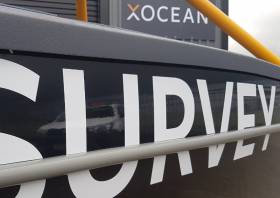
Many assorted vessels visit Bangor Marina, but the XOcean Uncrewed Surface Vessel (USV) may be the most unusual. Last week, Harbour Master Kevin Baird and his team, MCA staff and Belfast Coastguard welcomed the UK Maritime Minister Baroness Vere of Norbiton, Charlotte Vere, and the dynamic XOcean team.

The vessel Baroness Vere explored might seem unconventional, but it's revolutionising commercial boating.

It is a craft that can remain offshore for extended periods, harvesting large volumes of ocean data. Operators and data analysts remain safely located onshore, connected to the vessels over a satellite link.

As Afloat reported previously, trial operations of the USV took place in the Dundalk Bay area in mid November 2022.

Offering a carbon-neutral approach to mapping vast oceans, it can function untouched for 28 days with a 1,500 nautical mile range, all through satellite communications.

Harbour master Baird commented.” It’s hard to imagine a future where ships are operated from onshore stations, with crews only needed for specific harbour operations. That future is approaching fast, with companies like XOcean, based in Dublin, leading the charge. Thanks to everyone who made this visit memorable and enlightening”.

Published in Belfast Lough
Tagged under

Trial operations of remotely piloted uncrewed surface vessels (USVs) are planned to take place in the Dundalk Bay area from this week until mid November.

Subject to weather and operational constraints, the operations will run for a period of four weeks from Thursday 20 October.

The XO-450-type USVs from Greenore-based Xocean will be engaged in survey activities for the proposed Oriel Wind Farm in the Irish Sea some 22km off the coast of Dundalk in Co Louth.

This is a non-invasive survey, Xocean says, and no contact with the seabed or any other infrastructure is planned during survey operations.

The USVs will send real-time images and situational awareness data over satellite to a team of operators keeping watch and controlling the vessel remotely 24/7.

Although the vessels are uncrewed, they are constantly monitored and controlled, and piloted remotely using 360-degree cameras and other navigational aids.

Each USV is equipped with AIS, navigation lights and a sound signal, an active radar reflector and a yellow-painted superstructure to make it conspicuous to other marine traffic.

All other vessels operating within the affected area are requested to avoid contact with any USV and be aware of the operational area during this period. A Radio Navigation Warning will be in place during operations.

Contact details, relevant coordinates and a map of the survey area are included in Marine Notice No 71 of 2022, attached below.

Published in Power From the Sea

Survey operations conducted by an uncrewed surface vessel (USV) are taking place in Dundalk Bay this week.

The remotely piloted X-09 — from Greenore-based Xocean — was scheduled to launch from Clogherhead, Co Louth today, Tuesday 25 January, for the weeklong survey.

It will be engaged in survey activities supporting environmental research in the area. The survey will utilise multibeam echosounder to characterise the seabed across the site.

The USV sends real-time images and situational awareness data over satellite to a team of operators keeping watch and controlling the vessel remotely 24/7.

A Radio Navigation Warning will be in place during operations, and the USV has been made conspicuous to other marine traffic via its yellow superstructure, AIS, navigation lights and sound signal, and active radar reflector.

Coordinates and maps of the survey area are included in Marine Notice No 05 of 2022, attached below.

All other vessels operating within this area are requested to avoid contact with the USV and be aware of the operational area during this period.

Published in News Update

Louth-based marine technology firm Xocean is following its recent funding boost with plans to expand into North America and eventually Asia, according to business news site Fora.

The company specialises in innovative robotics, particularly unmanned vehicles, and IoT technology to monitor and collect data at sea.

Earlier this year it was awarded €199,739 in funding over two years via the Marine Institute to transform marine monitoring and data collection, as previously reported on Afloat.ie.

In addition the Greenore-based business raised half a million euro from Chris Huskilson, former CEO of Canadian energy company Emera and now chairman of Xocean.

While its focus until now has been on northern Europe, with clients including the UK’s Maritime and Coastguard Agency, Xocean confirms it is in discussions to deliver its first projects in the US and Canada within the next six months.

Fora has much more on the story HERE.

Published in Marine Science

Dublin Bay

Dublin Bay on the east coast of Ireland stretches over seven kilometres, from Howth Head on its northern tip to Dalkey Island in the south. It's a place most Dubliners simply take for granted, and one of the capital's least visited places. But there's more going on out there than you'd imagine.

The biggest boating centre is at Dun Laoghaire Harbour on the Bay's south shore that is home to over 1,500 pleasure craft, four waterfront yacht clubs and Ireland's largest marina.

The bay is rather shallow with many sandbanks and rocky outcrops, and was notorious in the past for shipwrecks, especially when the wind was from the east. Until modern times, many ships and their passengers were lost along the treacherous coastline from Howth to Dun Laoghaire, less than a kilometre from shore.

The Bay is a C-shaped inlet of the Irish Sea and is about 10 kilometres wide along its north-south base, and 7 km in length to its apex at the centre of the city of Dublin; stretching from Howth Head in the north to Dalkey Point in the south. North Bull Island is situated in the northwest part of the bay, where one of two major inshore sandbanks lie, and features a 5 km long sandy beach, Dollymount Strand, fronting an internationally recognised wildfowl reserve. Many of the rivers of Dublin reach the Irish Sea at Dublin Bay: the River Liffey, with the River Dodder flow received less than 1 km inland, River Tolka, and various smaller rivers and streams.

Dublin Bay FAQs

There are approximately ten beaches and bathing spots around Dublin Bay: Dollymount Strand; Forty Foot Bathing Place; Half Moon bathing spot; Merrion Strand; Bull Wall; Sandycove Beach; Sandymount Strand; Seapoint; Shelley Banks; Sutton, Burrow Beach

There are slipways on the north side of Dublin Bay at Clontarf, Sutton and on the southside at Dun Laoghaire Harbour, and in Dalkey at Coliemore and Bulloch Harbours.

Dublin Bay is administered by a number of Government Departments, three local authorities and several statutory agencies. Dublin Port Company is in charge of navigation on the Bay.

Dublin Bay is approximately 70 sq kilometres or 7,000 hectares. The Bay is about 10 kilometres wide along its north-south base, and seven km in length east-west to its peak at the centre of the city of Dublin; stretching from Howth Head in the north to Dalkey Point in the south.

Dun Laoghaire Harbour on the southside of the Bay has an East and West Pier, each one kilometre long; this is one of the largest human-made harbours in the world. There also piers or walls at the entrance to the River Liffey at Dublin city known as the Great North and South Walls. Other harbours on the Bay include Bulloch Harbour and Coliemore Harbours both at Dalkey.

There are two marinas on Dublin Bay. Ireland's largest marina with over 800 berths is on the southern shore at Dun Laoghaire Harbour. The other is at Poolbeg Yacht and Boat Club on the River Liffey close to Dublin City.

Car and passenger Ferries operate from Dublin Port to the UK, Isle of Man and France. A passenger ferry operates from Dun Laoghaire Harbour to Howth as well as providing tourist voyages around the bay.

Dublin Bay has two Islands. Bull Island at Clontarf and Dalkey Island on the southern shore of the Bay.

The River Liffey flows through Dublin city and into the Bay. Its tributaries include the River Dodder, the River Poddle and the River Camac.

Dollymount, Burrow and Seapoint beaches

Approximately 1,500 boats from small dinghies to motorboats to ocean-going yachts. The vast majority, over 1,000, are moored at Dun Laoghaire Harbour which is Ireland's boating capital.

In 1981, UNESCO recognised the importance of Dublin Bay by designating North Bull Island as a Biosphere because of its rare and internationally important habitats and species of wildlife. To support sustainable development, UNESCO’s concept of a Biosphere has evolved to include not just areas of ecological value but also the areas around them and the communities that live and work within these areas. There have since been additional international and national designations, covering much of Dublin Bay, to ensure the protection of its water quality and biodiversity. To fulfil these broader management aims for the ecosystem, the Biosphere was expanded in 2015. The Biosphere now covers Dublin Bay, reflecting its significant environmental, economic, cultural and tourism importance, and extends to over 300km² to include the bay, the shore and nearby residential areas.

On the Southside at Dun Laoghaire, there is the National Yacht Club, Royal St. George Yacht Club, Royal Irish Yacht Club and Dun Laoghaire Motor Yacht Club as well as Dublin Bay Sailing Club. In the city centre, there is Poolbeg Yacht and Boat Club. On the Northside of Dublin, there is Clontarf Yacht and Boat Club and Sutton Dinghy Club. While not on Dublin Bay, Howth Yacht Club is the major north Dublin Sailing centre.

© Afloat 2020