


Displaying items by tag: DTTAS
New Guidelines For Accessible Maritime Passenger Transport
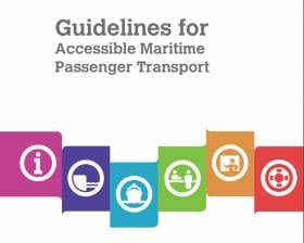
The Department of Transport, Tourism and Sport (DTTAS) recently published new accessibility guidelines designed as a support to all those involved in providing maritime passenger transport services.
This includes passenger vessel owners and operators, port operators and local authorities, as well as Government departments with a statutory remit in relation to maritime passenger transport services.
The advice given covers all aspects of a journey, including:
- Advice on providing accessible information for planning the journey
- Improving access on board vessels
- Making shore-side facilities accessible
- Disability awareness training for staff
- Improving communications with passengers
The full guidelines are available from the Government website as a PDF to read or download HERE.
Transport Launches New ‘Seafarers’ Website
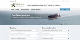
#Seafarers - The Department of Transport, Tourism and Sport (DTTAS) has launched its new Seafarers web resource for all seafarers, fishers, recreational craft users and others looking to obtain certification or qualification in the sector.
The new website is intended as a national and international resource for information relating to seafarers, which includes those involved in commercial shipping, the fishing industry and the recreational craft sector.
It provides full details of the career structures available and how to obtain the necessary qualifications for work in the industry, as well as for recreational craft users.
The site hosts all appropriate application forms and also provides for the verification of qualifications, listing details of approved training course providers in Ireland.
DTTAS says the Seafarers website forms part of a wider updating of seafarer education and training in Ireland, and is supported by a new Seafarers Information System, which provides for the registration of all seafarers and for life-long training and career development.
The department encourages seafarers who already hold Certificates of Competency or radio certificates issued in Ireland to register now on the new information system.
Marine Notice: 2D Seismic Survey On Continental Shelf

#MarineNotice - The latest Marine Notice from the Department of Transport, Tourism and Sport (DTTAS) advises that ENI Ireland BV, in conjunction with DCENR/PAD, is scheduled to conduct a 2D seismic survey in the Atlantic waters of the Irish Designated Continental Shelf (as defined under Part VI of UNCLOS).
The planned start of the survey is early June and, weather permitting, will continue until mid-October 2013. The seismic acquisition will be carried out by the seismic vessel M/V BGP Explorer (Call sign HP4919) and will be accompanied at all times by guard vessel M/V South (Call sign PJKE).
This proposed survey consists of 18,000km of a full fold 2D seismic survey in offshore waters beyond the 12-nautical-mile limit, and extends into international (high seas) waters.
The M/V BGP Explorer will travel at a speed of 4-5 knots, towing a single solid 10km streamer located approximately 10m below the surface. Both work vessels will be listening on VHF Channel 16 throughout the project.
All vessels, particularly those engaged in fishing, are requested to give the M/V BGP Explorer and the M/V South a wide berth and keep a sharp lookout in the relevant areas.
For co-ordinates of the seismic survey areas see Marine Notice No 25 of 2013, a PDF of which is available to read or download HERE.
Marine Notice: Corrib Field Seismic Survey Set to Recommence
#MarineNotice - The latest Marine Notice from the DTTAS concerns the scheduled recommencing of a 3D seismic survey over the Corrib Gas Field by Shell E&P Ireland Ltd.
Some 40% of the survey was completed in 2012, and the remaining 60% is now set to be conducted with a planned starting date of 20 February 2013. Weather permitting, the survey should be completed in June 2013.
The seismic acquisition will comprise a four-boat operation. The M/V Ocean Pearl (Call sign C6ZW4) will lay the ocean-bottom cables on the sea floor and will collect all data records, while the M/V Malene Ostervold (Call sign LCIU3) will serve as the source vessel. In addition to these vessels, a third vessel, the M/V Vikland (Call sign C6UL5) will assist the M/V Ocean Pearl with cable laying and also act as a utility vessel. A fourth vessel, the M/T Deilginis (Call sign EISL), will act as a guard wessel.
Seismic acquisition will occur over a set of four active 12km-long solid ocean-bottom cables laid 400m apart on the sea bed at a depth of 350m. At the end of each cable is a 1km lead-in section which is attached to a standalone buoy at surface. These buoys contain a power pack as well as a recording system. Each buoy contains a radio-link with the cable-laying vessel for remote control of the buoy and for data quality control. Each buoy has a GPS receiver, so its location is well known to both seismic vessels. One by one these cables are 'rolled along' (ie picked up from the northern edge of the active spread, and redeployed at the southern edge). The M/V Malene Ostervold will be towing two seismic sources, and operating around the set of four active 12km-long cables.
The overall survey area is divided into three work areas or Contact Zones (A, B and C). A Contact Zone is defined by a 10km radius circle. Radio Navigation Warnings will be given out daily by the Irish Coast Guard, giving the co-ordinates of the centre point of the Contact Zone for that day. All vessels will be listening on VHF Channel 16 throughout the project.
Full details - including co-ordinates and maps of the survey area - are contained in Marine Notice No 07 of 2013, a PDF of which is available to read or download HERE.
Marine Notices on Vessel Maintenance and Accessibility

#MarineNotice - A recent Marine Notice from the Department of Transport, Tourism and Sport (DTTAS) raises importance of maintenance as highlighted in the MCIB report into the scuttling of fishing vessel Jeanette Roberta in Glandore Harbour in late 2011.
As previously reported on Afloat.ie, the prawn boat was returning to port on 11 December 2011 when the skipper had difficulty switching the helm from auto-pilot to manual due to a known issue with "sticky solenoids". The boat subsequently veered off course without warning and was holed on rocks on Adam's Island.
The official report into the incident castigated the owner/skipper for continuing to sail the vessel with persistent navigation issues - and Marine Notice No 04 of 2013 reminds all fishing vessel operators to ensure that deficiencies with their vessels are rectified without delay.
It is the responsibility of the owner to ensure that a vessel is maintained and operated at all times in accordance with the requirements of the agreed Code of Practice. Owners of all vessels also have a legal obligation to operate their vessels in accordance with the law.
Meanwhile, the latest Marine Notice is directed at passenger vessel owners and operators - encouraging them to continue voluntary efforts to improve accessibility on their vessels.
A new questionnaire has been made available to inform the DTTAS about the extent of accessibility improvements introduced to maritime passenger transport services in the State.
Full details are included in Marine Notice No 05 of 2013, a PDF of which is available to read or download HERE.
Marine Notice: Casualty or Incident Reporting

#MarineNotice - The latest Marine Notice from the Department of Transport, Tourism and Sport (DTTAS) reminds all mariners of the obligation to report marine casualties to the appropriate authorities in the event of an incident.
The notice refers to the official report by the Marine Casualty Investigation Board (MCIB) into the grounding of the cargo ship Pantanal (more details) at Rossaveal on 31 March 2011, which can be read in full HERE.
The report recommends that mariners be reminded of the European Communities (Vessel Traffic Monitoring and Information System) Regulations 2010, as amended, which require the operator, agent or master of a ship in Irish waters to immediately report to the Irish Coast Guard any incident affecting the safety of the ship, or any incident liable to lead to pollution of the waters around Ireland or any other EU member state.
Full details are include within Marine Notice No 3 of 2013, a PDF of which is available to read or download HERE.
Marine Notice: Liability of Carriers of Passengers by Sea in the Event of Accidents
#MarineNotice - The latest Marine Notice from the Department of Transport, Tourism and Sport (DTTAS) draws attention to EU regulations pertaining to the liability of carriers of passengers by sea in the event of accidents.
The new EU Regulation 392/2009 came into force last week on 31 December 2012, incorporating provisions of the 2002 protocol to the Athens Convention relating to the carriage of passengers and their luggage by sea, which introduced compulsory insurance to cover passengers on ships such as passenger ferries, and covers the liability of the carrier in respect of passengers, their luggage and vehicles.
Full details of the new regulations are available in Marine Notice No 2 of 2013 via the department website HERE.
Marine Notice: Revised Medical and Energy Efficiency Certificates

#MarineNotice - The latest Marine Notices from the Department of Transport, Tourism and Sport (DTTAS) advise seafarers and vessel owners of revised medical and energy efficiency certificates that come into force this coming Tuesday 1 January 2013.
Marine Notice No 65 of 2012 contains details of the revised Seafarer Medical Certificate - Form 3 (ENG11) which is being introduced by the DTTAS to ensure continued improvements to seafarer safety.
The redesigned form incorporates additional information on a seafarer's medical fitness, and will be issued by approved doctors from 1 January onwards. All current certificates held by seafarers will remain valid till their expiry dates.
Meanwhile, Marine Notice No 66 of 2012 has full information on the new International Energy Efficiency Certificate which will be required for all ships of 400 GT and over.
The new certificate is based on amendments to MARPOL Annex VI relating to regulation on energy efficiency on board ships.
From 1 January all new build ships will be provided with an IEE Certificate subject to fulfilling relevant criteria. It will only be valid in combination with the Energy Efficience Design Index (EEDI) indicated on the cert, and the Ship Energy Efficiency Management Plan (SEEMP).
Existing ships will be provided with an IEE Certificate at the first intermediate or renewal survey of the International Air Pollution Prevention (IAPP) Certificate.
#MARINE NOTICE - The latest Marine Notice from the Department of Transport, Tourism and Sport (DTTAS) draws mariners' attention to the official report on the sinking of the fishing boat Ainmire and its recommendations for safety on board all fishing vessels.
As reported in September last year on Afloat.ie, the report by the Marine Casualty Investigation Board found that a breach in the engine compartment caused the Ainmire to take on water and sink off the coast of Scotland in April 2011.
The report concluded that the failure of a sea water cooling pipe in the engine room was the most likely cause of the flooding, and noted that the pipework had not been renewed during the life of the vessel.
Investigators also noted that the bilge pump was located under the floor plates in the engine room as was this inoperable when the water level rose in the compartment.
Marine Notice No 58 of 2012 - a PDF of which is available to read and download HERE - reminds fishing vessel operators that large sea-water inlets in engine rooms make their boats vulnerable to severe flooding if they fail.
It is recommended that these pipes should be checked for corrosion every year, especially around the welded joint at the hull. Ultrasonic thickness testing of the pipework should also be considered.
Moreover, such pipework can be eroded quickly by stray currents, so electrical equipment should be checked regularly, while the location of bilge pumps in the engine room should be carefully considered
ISA To Receive Sports Capital Programme Funding in 2012
#ISA FUNDING - The Irish Sailing Association will receive a special allocation of €70,000 through the Sports Capital Programme for 2012, it has been announced.
Deputy Michael Ring, Minister of State at the Departent of Transport, Tourism and Sport, made the declaration in response to a parliamentary question from Terrence Flanagan TD in reference to what grant aid will be awarded to Ireland's larger sporting bodies.
As expected, Gaelic games and soccer will receive the bulk of Government investment in 2012, adding up to a total of more than €5.5 million between them.
Meanwhile, both Badminton Ireland and the Irish Sailing Association (ISA) will receive special allocations of €40,000 and €70,000 respectively under the deparment's Sports Capital Programme (SCP).
This award is in addition to the funding received by the ISA via the Irish Sports Council, of which the core grant funding in 2012 totalled €447,313 - with additional grants of €600,000 in high performance funding; €220,000 in direct athlete investment funding; and €21,000 in 'women in sport' funding.
No other allocations under the SCP have been made to national governing bodies in 2012 thus far.


 as lead helm, rounds the Fastnet Rock on the way to the overall win in 1987")

