Displaying items by tag: Admiralty
Sonar Survey Reveals Torpedoed Guinness Ship
The detailed seabed images, which include deck features and complex sand wave structures, were recorded by towed sidescan sonar provided by the Moore Marine Group, and give a visual insight into the defensively armed ship that was sunk by a German torpedo in 1917, seven miles east of the Kish Bank off Dublin.
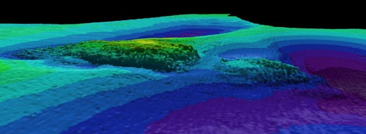
Photos above and below show topographic seafloor images in 3D, showing the partially buried wreck of the W M Barkley lying at a water depth of 56 metres; with deeper scouring around it down to 72 metres (darker colours indicate greater depths). The images were created from sonar data acquired onboard the Marine Institute's research vessel RV Celtic Voyager, during INFOMAR Programme mapping in 2010 and 2011 with data processed by INFOMAR's Fabio Sacchetti (University of Ulster) and Charise McKeon (Geological Survey of Ireland).
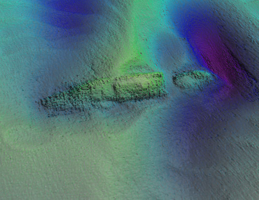
In May 2010, during a large scale mapping survey in the Irish Sea by INFOMAR, a national marine study run by the Marine Institute and the Geological Survey of Ireland, identified a seabed feature which, to the trained eye, was discernable as a potential shipwreck lying in the same position recorded on the Admiralty Chart, the EU wreck site and UK Hydrographic Office wreck site directories, as well as a survey conducted in the 1980s as the last known position of the W.M.Barkley.
Viewing the spectacular imagery of the shipwreck Minister for Communications, Energy & Natural Resources, Pat Rabbitte, said "I am delighted to note the continued excellence of the valuable work being carried out under the INFOMAR project. These images from the deep reveal a unique view of part of Ireland's marine heritage and I am delighted to announce details of INFOMAR''s annual seminar to be held in Galway on November 16 and 17th."
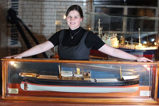
Eibhlin Roche - Guinness Archivist, Guinness Storehouse with the model of the W.M. Barkley. Photo: Jason Clarke Photography
Ninety four years ago on the dark night of October 12th 1917 the W.M.Barkley was torpedoed without warning by the German submarine UC-75. Within minutes the ship, which was owned and operated by the Guinness Company of Dublin, broke in two and sank, taking with her to the bottom four men including her Captain and leaving the rest of her crew to face the sea in an open lifeboat. Now, the darkness where the ship has lain in pieces has been disturbed, probed by fingers of sound that are mapping the seabed in incredible details and bringing to light the position of this famous Irish shipwreck.
"As the first Guinness owned ship, the W.M. Barkley played an important role in the story of the transportation of GUINNESS beer overseas," said Eibhlin Roche, Guinness Archivist. The events of the night of 12th October 1917 are very much part of the history of Guinness that is recorded in the Guinness Archive. It is exciting to finally know the exact resting place of the W.M. Barkley."
A scale model of the W.M. Barkley is on display in the Transport Gallery of Guinness Storehouse remembering the lives of the Guinness men who both perished and survived the events of 12th October 1917. These are stories of tragedy and bravery portraying Irish traditional values, and how they were brought to light with the application of cutting-edge technology.
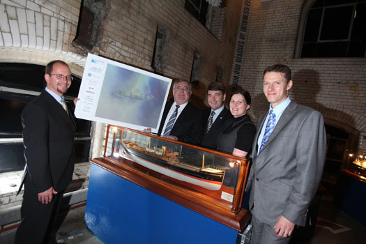
Koen Verbruggen (GSI), Minister Pat Rabbitte, Dr. Peter Heffernan (CEO, Marine Institute), Eibhlin Roche (Guinness Archivist, Guinness Storehouse) and David Smith (Country Director, Diageo Ireland) Photo: Jason Clarke Photography


