


Displaying items by tag: Marine Institute
The first week of the 2021 Oceans of Learning series focuses on how the ocean is key to our economy and essential to sustaining livelihoods and Ireland’s coastal communities.
In the second episode of the Oceans of Learning podcast out this week, host Finn van der Aar speaks with a range of guests about the influence the ocean has on their work and their lives.
The podcast hears from Tahlia Britton, the first woman to join the Irish Naval Service Diving Unit in 2020, and Patricia Comiskey of the SEAI about Ireland’s growing marine renewable energy sector, as well as Tracey Ryan, herbal alchemist and managing director for Codex Beauty Ireland, a plant-based biotechnology company.
Finn also speaks to Joe Silke, director of marine environment and food safety services at the Marine Institute, about supporting marine industries through licensing, monitoring programmes and marine spatial planning.
This week the Marine Institute has also partnered with Teagasc — the State agency providing research, advisory and education in agriculture, horticulture, food and rural development in Ireland — and Seavite, the Irish seaweed-based skincare range, to bring some interesting insights on seaweed in Ireland.
Seaweed harvesting is a traditional occupation in many coastal areas around Ireland, and seaweed has many valuable uses including its use in food products, pharmaceuticals and cosmetics.
To view the suite of resources available for Oceans of Learning this week, visit Our Ocean: Our Livelihoods at the Marine Institute website. The Oceans of Learning podcast is available from Apple Podcasts and Spotify.
For the latest on the Oceans of Learning series and more, follow the Marine Institute on Facebook, Twitter, Instagram and YouTube.
The Marine Institute’s joint acting chief executive Michael Gillooly recently spoke to Newsweek as part of its Country Report on Ireland alongside a number of this country’s political and business leaders.
Recognising Ireland’s robust economic performance in the five years preceding the COVID-19 pandemic, the Newsweek report on Ireland focuses on the country’s ambition and ability to navigate the economic challenges as a result of the pandemic in addition to the effects of Brexit.
Gillooly shares his thoughts on the Marine Institute’s efforts to promote research on Ireland’s rich maritime ecosystem and the reasons why our marine science research capabilities are significant on the international stage.
“We have an obvious geographical advantage in the marine sense. This allows us to use the country as a locus for Atlantic research, technology development and innovation,” he says.
“Ireland is described as an ideal place to innovate due to it being small enough to run tests, but large enough to demonstrate a significant impact.”
See Michael Gillooly’s full interview on the Country Reports website, and find the complete Ireland: New Dawn, New Opportunities report on Newsweek.com
From sailors, surfers, scientists and seafarers, to those who prefer to wade in the shallows or watch the wildlife, our sea means so many different things to different people.
As part of the Oceans of Learning programme that started on European Maritime Day yesterday, Thursday 20 May, the Marine Institute is celebrating our connection to the sea and its importance to our lives with its #SeaToMe social media competition, offering some great weekly prizes inspired by our seas.
“With 1.9 million people in Ireland living close to the coast, the sea has an impact on all of our lives every day. Many people also rely on the sea for their livelihood, from fishing, tourism and transport to our seafood industry,” said Patricia Orme, joint acting CEO of the Marine Institute.
“To celebrate our connection to the sea, we are asking you to share what the sea means to you. Together, we can celebrate our seas and oceans and Ireland’s valuable marine resource.”
To enter, simply share what the sea means to you on social media using the hashtag #SeaToMe. Draw a picture, take a photo, upload a video, make some music, share an image from a past holiday by the sea or favourite place along Ireland’s coast, or be inspired to write a poem or quote about what the sea means to you.
Follow #SeaToMe and #OceansOfLearning on the Marine Institute’s social media channels on Facebook, Twitter and Instagram.
And for inspiration, check out some of last year’s #SeatoMe competition entries:
Ireland’s Marine Sector Celebrates European Maritime Day Virtually with New ‘Oceans of Learning’ Series
In recognition of European Maritime Day — today, Thursday 20 May — and World Oceans Day on Tuesday 8 June, the Marine Institute has joined with a host of partners in Ireland’s marine sector to launch a new series of its Oceans of Learning education programme.
Over the next four weeks, Oceans of Learning will enable everyone to engage with our ocean from anywhere with a new podcast series, videos and short films, news and online resources all about our seas and Ireland’s marine resource — from our rich marine biodiversity to our changing ocean climate and our oceans‘ future.
Marine Minister Charlie McConalogue said: “As an island nation, Ireland has a special relationship with the seas and oceans and many of our coastal communities in particular also depend on them for their livelihoods.
“Collaboration and scientific research are now more important than ever as we continue to work together to understand and protect our valuable marine resource and ensure their future sustainability.”
 Marine scientist, speaker and author Finn van der Aar hosts the new Oceans of Learning podcast series
Mick Gillooly, joint acting CEO of the Marine Institute, added: “Ireland’s marine resource supports diverse ecosystems, is a source of food, influences our climate, weather and our wellbeing, and has an important role in Ireland’s economy, providing employment in fisheries, aquaculture, ports and shipping, technology, tourism and seafaring.
“Through Oceans of Learning, Ireland’s marine sector will come together to celebrate our seas by providing a host of engaging and entertaining resources on the enormous opportunities presented by our coast and ocean.”
The programme launched with a special live webinar earlier today hosted by Irish marine scientist and author Finn van der Aar, who also hosts a related podcast series that will share stories from the people and professionals who have a connection with the sea through science, careers, industry, art and more.
In its first episode, the podcast — available on Apple Podcasts and Spotify — focuses on the link between oceans and our health and wellbeing with scientist and big wave surfer, Dr Easkey Britton.
In addition, Green Rebel Marine lead scientist Dr Aaron Lim, Sibéal Regan of the Irish Whale and Dolphin Group and Debbi Pedreschi, post-doctoral researcher at the Marine Institute, discuss marine life on rocky seashores to the bed of the deep sea.
This week also sees the Marine Institute launch its Sea Science Series with Mark Langtry, ‘The Science Guy’. In this four-part series, Mark will bring the wonders of sea science to the screen with his entertaining, sometimes explosive, and totally educational shows.
A new short film collaboration between the Irish Chamber Orchestra, Kerry-based wildlife and underwater filmmaker Vincent Hyland and the Marine Institute also premieres this week.
Ireland’s Marine Life takes a dive beneath the waves of Ireland’s wild Atlantic waves to explore the variety of sea life found in Irish waters.
And the Explorers Education Programme has launched its Wild About Wildlife on the Seashore photo and art competition for children.
Between now and 21 June, primary school teachers, children and parents are encouraged to discover their seashore ’in my country' through photography and art.
More details on this year’s Oceans of Learning programme can be found on the Marine Institute website.
To celebrate European Maritime Day, the Marine Institute will broadcast a special live Oceans of Learning webinar at 4pm next Thursday 20 May.
Hosted by marine scientist, speaker and author Finn van der Aar, the one-hour Zoom webinar will explore our ocean, from supporting diverse marine wildlife and ecosystems to sustaining livelihoods and the impact of a changing ocean climate.
Filmmaker Ken O’Sullivan will share his experiences searching for blue whales, sharks and deep-water coral reefs in the North Atlantic for the documentary Ireland’s Deep Atlantic.
Finn will also speak to Roberta O’Brien, the first woman in the history of the Naval Service to achieve the rank of commander in 2020.
Commander O’Brien has held a wide variety of roles and appointments at sea and ashore, and was also the first female to captain an Irish warship when she assumed command of the LÉ Aisling in 2008.
In addition, the webinar will launch the latest Oceans of Learning series following the success of 2020’s programme.
Over four weeks, the Marine Institute will offer news, videos and resources which celebrate our seas and Ireland’s marine resource. The final week will celebrate World Oceans Day on Tuesday 8 June.
A weekly Oceans of Learning podcast, presented by Finn van der Aar, will share the stories from the people and professionals who have a connection with the sea — through science, careers, industry, art and more.
Register for the free webinar and tune in to hear more on how to subscribe and listen to the podcast — as well as join the conversation with scientists, seafarers and sea enthusiasts.
Can you tell the difference between a gastropod and a bivalve? Do you know how to identify a decapod, amphipod or an isopod? And can you tell what fish can walk across seaweed, are slippery as butter or can hide in the sand?
The Marine Institute’s Explorers Education Programme reveals all with the launch of its Wild about Wildlife on the Seashore teachers’ toolkit.
It’s packed with over 50 online educational resources including films, species information sheets and-cross curricular worksheets, that aim to help teachers and children get engaged with marine science and learn about our wildlife on the seashore.
Patricia Orme, joint acting chief executive of the Marine Institute, congratulated the Camden Education Trust and the Explorers team on the development and launch of the Explorers teaching resources.
“The Explorers Education Programme is leading the way in supporting teachers to teach children about the ocean in the classroom, and having fit-for-purpose materials that can support the curriculum is a great way to start their journey of learning about the ocean,” Orme said.
“These resources are an important addition to many of the great assets that the Explorers programme provides. Working with educators and outreach teams around the country helps us further encourage learning about our marine biodiversity, environmental care, as well as marine science and technology.
“Building these relationships with teachers and providing them with the resources they need, is key to ensuring Ireland is well equipped to have future generations of well informed and enthusiastic marine scientists; as well as a society that cares and values our marine environment.”
The new teaching materials include interactive films of seashore safaris covering shellfish, crustaceans and fish found on the rocky shore; species information sheets filled with photos of Irish seashore animals; as well as presentations, cross-curricular worksheets and visual art resources with plenty of illustrations of animals that can be used in class.
‘We are really excited about sharing these resources with teachers and children over the coming months’
“We are so excited to be launching these materials for teachers and children, where they can go to one website and find all that they need. The teaching resources have been created with the support from outreach educators and teachers and we are delighted to provide all of the content online, which is free to download at www.explorers.ie,” explained Cushla Dromgool-Regan, Explorers Education strategic manager with the Camden Education Trust.
Dromgool-Regan, who directed and produced the interactive films with Matt Kelly Productions, added: “The Explorers Wild about Wildlife films have been developed to bring the seashore into the classroom, and we have been very lucky to have some of the Explorers team from Galway Atlantaquaria take part in sharing their expertise about the animals on the shore in the films.”
Noirín Burke, Padraic Creedon and Anna Quinn show the animals that are likely to be found on the seashore, and explain the amazing facts about how the animals have adapted to deal with the extremes of the seashore. This includes animals of all shapes and sizes coping with crashing waves, changing tides, hot and cold weather; as well as a long list of predators that are on the shore.
“Creating these films was certainly a highlight for us and we are really excited about sharing these resources with teachers and children over the coming months,“ said Dr Noirin Burke, Explorers support services manager from Galway Atlantaquaria.
“We also get to tell stories about some of our favourite animals, from the barnacle that lives in one spot on its head and feeds with its ‘feet’ to the dogwhelk that can ‘drill holes’ into other shells to eat its prey — just like soup.
“We hope by bringing these stories about the seashore to the classroom, it helps children feel like they getting a seashore experience with us during the exploration.”
The Explorers team have developed over 30 species information sheets covering fish, crustaceans, shellfish, sponges and sea squirts to name a few, which are loaded with photos, and provide a wealth of scientific information that children can use to learn about living things and one of the harshest places for the animals to survive.
There are also creative art sheets and worksheets that can be used with the films in the classroom to help teachers and children with their scientific discovery and learn more about the animals found on the Irish seashore.
Health Check for the Atlantic on the Ocean Climate Survey
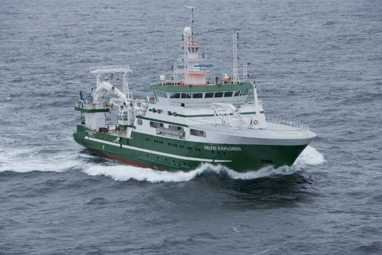
Scientists from the Marine Institute, Maynooth University and the National University of Ireland Galway were recently aboard the RV Celtic Explorer, for a 14-day scientific survey studying the shelf and deep water off the west coast of Ireland. This Marine Institute’s annual ocean climate survey has been running since 2006 and facilitates long-term physical and biogeochemical observations of the deepwater environment in the South Rockall Trough.
The Rockall Trough is an important region that provides a pathway for the transport of heat and salt from the North-East Atlantic to the Nordic Seas, where waters are subjected to phenomena such as deep convective mixing that creates cold dense water. Water exchange and interactions in the Rockall Trough play a fundamental part in the overall thermohaline circulation in the North-East Atlantic; as large volumes of warm water pass through the Rockall Channel, before flowing into the Nordic Seas with a return of cold dense bottom water outflow spilling into the region. Changes in the region’s water properties, such as temperature and salinity, vary on inter-annual and decadal time scales.
Chief Scientist on the research survey, Dr Caroline Cusack of the Marine Institute said, “Scientific data collected on this survey allows the assessment of interannual variability of physical and biogeochemical conditions that impact shelf and deep waters. This variability can have a range of impacts on ocean ecosystems, ocean circulation and weather patterns. The survey contributes to activities of the International Council for the Exploration of the Sea and provides support to the Convention for the protection of the marine environment of the North-East Atlantic (OSPAR Convention), the Marine Strategy Framework Directive focused on protecting ocean health, and climate change assessments.”
This year, Maynooth University scientists from the A4 project (Aigéin, Aeráid, agus athrú Atlantaigh = Oceans, Climate, and Atlantic Change) joined the survey to work with the Marine Institute oceanographic and climate services team. The A4 project, supported by Marine Institute funding, studies how changes in the Atlantic impact Ireland and northwestern Europe through changes in ocean circulation and sea level and is developing predictive capacity for these regions. Recent research by the A4 project found that the Gulf Stream System, also known as the Atlantic Meridional Overturning Circulation (AMOC), is at its weakest in over a millennium.
Scientists from the National University of Ireland, Galway were also on board the RV Celtic Explorer working with Marine Institute chemists to collect supporting chemistry information. The NUI Galway scientists are currently working on the Marine Institute funded VOCAB project (Ocean Acidification and Biogeochemistry: Variability and Vulnerability) to enhance knowledge on the vulnerability of selected marine ecosystems in Irish waters to ocean acidification. NUI Galway scientists also collected samples relevant to the JPI Climate and JPI Oceans CE2COAST project which aims to downscale global climate models to regional and local scales to provide information on the impacts of climate change tailored to local needs.
Mick Gillooly, Director of Ocean Climate and Information Services at the Marine Institute said, “Collaborative oceanographic research is very important to help inform Ireland’s response to climate change and underlines the importance of researching marine impacts of climate change, which could have a significant societal impact on Ireland. The Marine Institute’s annual climate survey, with scientific experts from collaborating research groups, enables us to generate a long-term time series of key oceanographic data to further increase our knowledge about our changing ocean climate.”
This year, 51 stations were occupied with 301 depths sampled. At each station, scientists profile the full water column and collect measurements of temperature, salinity and oxygen. Water samples are collected at targeted depths and analysed on board to determine the salinity, dissolved oxygen, inorganic nutrients and carbon content (DIC/TA). The RV Celtic Explorer’s advanced underway data acquisition system gathers information on temperature, salinity, fluorescence, and pCO2 in surface waters. This year, the Marine Institute also had a laboratory on board equipped with state-of-the-art analysers, enabling near real-time reporting of nutrients, oxygen and salinity.
The annual ocean climate survey supports a number of Marine Institute ocean observation programmes. The Irish Marine Data Buoy Observation Network, managed by the Marine Institute in collaboration with Met Éireann, is a network of five offshore weather observing marine buoys around Ireland. The M6 Data Buoy, located hundreds of kilometres to the west of Ireland in the South Rockall Trough, was a station sampled during this scientific survey.
A Marine Institute glider, an underwater autonomous vehicle, was also deployed near the M6 Data Buoy during this survey. The glider can reach depths of 1,000 metres and collects oceanographic data on conductivity, temperature, depth, fluorescence, turbidity and dissolved oxygen. Since its deployment, the glider has travelled more than 350 kilometres collecting additional oceanographic data for the scientists involved.
Scientists also deployed two Argo Floats, which measure temperature, salinity and depth with one Argo Float also taking measurements of the water oxygen content. Argo Floats are autonomous instruments that remain at sea for a period of three to five years which provide high-quality temperature and salinity depth profiles while ascending and descending to and from the surface from a depth of 2,000 metres, as it drifts through the ocean. There are currently about 4,000 Argo Floats in the world's oceans. As part of Ireland’s participation in the Euro-Argo ERIC Programme, the Marine Institute deploys three Argo Floats each year.
The track and data from current Irish Argo Floats can be viewed here
The annual ocean climate survey, the A4 project and VOCAB (Ocean Acidification and Biogeochemistry: variability, trends and vulnerability) are supported by the Marine Institute under the Marine Research Programme funded by the Irish Government.
Clew Bay and Achill, Co Mayo will be among the key study areas in SeaMonitor, a unique marine research project which is using innovative marine species tracking technology to better understand and protect vulnerable marine life in our oceans. The project is funded by EU INTERREG VA Programme and led by the Loughs Agency and supported by another eight leading marine research institutions, including the Marine Institute.
The innovative technology, called passive acoustic telemetry, relies on underwater tracking stations (acoustic receivers) to monitor the movements of marine animals tagged with acoustic transmitters. This technology will be used to better understand the movement and behaviour of species such as seals, basking shark, skate, cetaceans and salmon.
This new technology will be utilised in Clew Bay and Achill, to enable the Marine Institute to monitor juvenile salmon smolts as they make their first journey past Clare Island and on to the Atlantic Ocean. Acoustic receivers will be placed in strategic positions on what has been identified as the salmon “highway” through Clew Bay. This research will build on previous studies in the area, which indicate a high survival rate of salmon smolts through the Inner Bay and to Clare Island. Studies have also indicated that smolts following ocean currents seem to travel the northern route past Clare Island.
 Clare Island, Co Mayo Photo by Catherine Waters/Marine Institute
As part of the SeaMonitor project, the Marine Institute will be tagging smolts from the Burrishoole catchment over the next two years. Their journey will be monitored through Clew Bay and Achill, onward along the shelf edge, west of Scotland and to the Norwegian feeding grounds from May to June. The salmon smolts will be monitored by the Marine Institute using a Slocum glider, an autonomous remotely operated vehicle. The glider acts as a mobile listening device for the acoustic signals from tagged fish, and has the capability to monitor environmental conditions such as temperature, salinity and current profiles. The range of the remotely operated vehicle and its ability to remain at sea for months at a time, allows the tracking of salmon and other marine species further and for longer periods than ever before.
"The salmon smolts will be monitored by the Marine Institute using a Slocum glider, an autonomous remotely operated vehicle"
“Scientists still know very little about the detailed migration routes of Atlantic salmon, within the marine environment,” said Dr Ciaran Kelly, Director of Fisheries Ecosystems and Advisory Services at the Marine Institute. “Using new technology to track the migration pathways of Atlantic salmon smolts through Clew Bay, Achill and beyond, will greatly increase our understanding of migration and identify important marine habitats for Atlantic salmon.”
“The Marine Institute’s Newport Research Facility has a long and distinguished record of conducting scientific work on Atlantic salmon. The Marine Institute appreciates the support and assistance from local fishermen in Co Mayo for marine research projects such as SeaMonitor,” Dr Kelly added.
SeaMonitor project partner, Queen’s University Belfast, will also monitor skate and basking shark in Irish waters including Clew Bay and Achill. Using acoustic technology and satellite tagging technology, Queen’s University Belfast aims to gain a better understanding of the movement patterns and residency of these fish to develop management plans for these highly sensitive and vulnerable species.
The SeaMonitor project will also deliver Europe’s largest telemetric marine array, stretching over 60 kilometres and comprising of over one hundred acoustic listening stations. ‘Europe’s largest fish counter’ is being deployed off the north coast of Ireland and will bridge the gap between Malin and Islay forming an acoustic detection line between Ireland and western Scotland. This technology will allow scientists to monitor the movement of tagged marine animals resident in this area or passing through during annual oceanic migrations.
Funding for the SeaMonitor project has been provided by the EU’s INTERREG VA Programme (Environment theme), which is managed by the Special EU Programmes Body (SEUPB). Match-funding for this project has been provided by the Department for Agriculture, Environment and Rural Affairs in Northern Ireland and the Department of Housing, Planning and Local Government in Ireland.
Marine Institute Awards First Two Eoin Sweeney Scholarships
The Marine Institute has announced funding of €0.24 million for the first two Eoin Sweeney PhD Scholarships to run over the next four years.
This Scholarship Programme has been established by the Marine Institute and Plataforma Oceánica de Canarias (PLOCAN) in memory of Eoin Sweeney (1947-2017), who made a significant contribution to developing Irish marine industry, particularly the ocean energy sector, including the establishment of test-bed sites off the west coast of Ireland that provides sea-state testing opportunities for researchers and technology developers.
This Scholarship Programme provides a unique training opportunity for the students using the state-of-the-art scientific facilities at the Plataforma Oceánica de Canarias (PLOCAN) in Gran Canaria, Spain.
Dr José Joaquín Hernández-Brito, CEO said, “PLOCAN are delighted to collaborate with colleagues in Ireland on this Scholarship Programme. We are looking forward to hosting the students in due course, and wish to strengthen our existing research networks between Spain and Ireland together with exploring opportunities for future co-operation in ocean observation.”
The students will also benefit from access to the Marine Institute historical datasets, equipment and infrastructures including access to the national marine research vessels such as the new RV Tom Crean.
Congratulating the award recipients, Mick Gillooly, Director of Ocean Climate and Information Services in the Marine Institute said, “This is an exciting collaboration between the two Universities, PLOCAN and the Marine Institute that enables international collaboration and testing of novel technology, gliders and data buoys, to better understand our ocean ecosystems through long-term observations. Forecasting Ocean and Climate Change is a strategic focus area in the Marine Institute’s Strategic Plan and these scholarships will provide research data from a variety of locations and sea conditions, which will contribute to scientific advice to stakeholders backed up by high-quality peer-reviewed research.”
The awards funded are as follows:
|
PhD Project Title |
Lead Organisation |
Grant-Aid Funding Awarded (for 4 years) |
|
Application of AUVs to studies on Diel cycles of ocean plankton and biogeochemistry in the Northeast Atlantic |
NUI Galway |
€120,000 |
|
Wave-powered data buoy |
Maynooth University |
€120,000 |
The students are expected to have commenced by July 2021, with their first visit to PLOCAN expected to take place in 2022 (dependent on government restrictions).
Funding for the Eoin Sweeney Scholarship Programme is provided by the Marine Institute and the Irish Government, funded under the Marine Research Programme. PLOCAN will provide support and host the scholars for two to three months per annum.
Next Leg of Irish Anglerfish & Megrim Survey 2021 Set for April
The next leg of this year’s Irish Anglerfish and Megrim Survey (IAMS 2021) will be carried out from 10-21 April off the North and North West coasts.
The IAMS is carried out by the Marine Institute in fulfilment of Ireland’s obligations under the Common Fisheries Policy (CFP).
A demersal trawl survey, April’s leg will consist of some 50 otter trawls of 60 minutes’ duration in ICES area 6a.
Fishing will take place within a three-nautical-mile radius of the positions indicated in Appendix 1 and 2 of Marine Notice No 15 of 2021, a PDF of which can be downloaded below.
The survey will be conducted from the RV Celtic Explorer (callsign EIGB) which will be towing a Jackson demersal trawl and will display appropriate lights and signals.
All marine operators, especially those engaged in commercial fishing, are requested to keep a 3mn area around the indicated tow points clear of any gear or apparatus during the survey period.


 as lead helm, rounds the Fastnet Rock on the way to the overall win in 1987")


