


Displaying items by tag: Marine Institute
New Research Vessel for Marine Institute to be Named RV Tom Crean - Afloat Reveals
A Norwegian naval architect consultancy that has designed the Marine Institute's new research vessel, Afloat.ie reveals is to be named RV Tom Crean after the Irish seaman and polar explorer in Antarctica, writes Jehan Ashmore.
The name chosen for the 52.80m marine research vessel by the M.I. will honour and recognise the famous Co. Kerry born native from Annascaul who was a member of three major expeditions to Antarctica that took place more than century ago. To read more of these considerable achievements they can be read here.
Also the news of the vessel's name breaks away from the M.I's traditional naming nomenclature using the prefix 'Celtic' as used by a pair of existing research vessels.
As Afloat previously reported, €25m has been allocated in the 2021 budget to progress the construction of the vessel which will form a critical part of the Irish State’s maritime infrastructure, and the strategic importance positioned on the edge of the Atlantic Ocean.
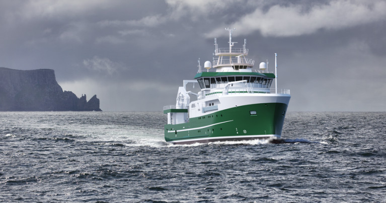
 RV Tom Crean: A screenshot from the website of the Norwegian naval architect consultancy, Skipsteknisk AS
RV Tom Crean is to replace the 23 year old RV Celtic Voyager with the newbuild scheduled to be completed in 2022 and be based in Galway Harbour where the port comprises a dock basin. Also in Co. Galway on the outskirts of the mid-west city, is where the Marine Institute has its headquarters based in Oranmore.
Minister for the Marine, Charlie McConalogue commented that the modern research vessel will enable Ireland to address considerable challenges faced by Brexit and the Common Fisheries Policy and climate-induced impacts on our oceans. The research ship will be able to operate in rougher seas and have the use of technology with 'green' credentials. Surveys will be up to 21 days duration and exploration depths down to 3,000m.
The newbuild designated as ST-366 by designers, Skipsteknisk AS based in Ålesund in western Norway, were awarded the work following a EU tender process. The above GCI image visual of the modern yet elegant appearance of RV Tom Crean arises from Afloat consulting the naval designer website, which displays other newbuild projects from the company founded in 1976. Norway, which is rich in fishing grounds has not surprisingly seen Skipsteknisk develop over the decades in designing ice-strengthened factory trawlers as a speciality.
As also to be seen in the image, the newbuild RV Tom Crean continues to retain the M.I. colours of a green hull and white superstructure of the current Galway based reseach vessel pair, Celtic Voyager and Celtic Explorer.
As for the accommodation of the RV Tom Crean this will provide for 12 crew and up to 14 scientists. In addition an on board hospital.
The classification of the newbuild as been appointed to Lloyds and below is a list of the main capabilies and duties to be tasked by RV Tom Crean:
⦁ Oceanographic surveys, incl. CTD water sampling
⦁ Fishery research operations
⦁ Acoustic research operations
⦁ Environmental research and sampling operation incl. coring
⦁ ROV and AUV/ASV Surveys
⦁ Buoy/Mooring operations
It is more than a year since the Marine Institute announced the ship's order in December 2019. The new research vessel which is to replace the older 31.40m RV Celtic Voyager (1997) while the larger 65.50m RV Celtic Explorer (2003) remains in service complete with the 'Holland I' deep-water ROV. It should be noted as part of this ship's equipment is a tender craft called Tom Crean.
Both of these M.I research vessels were custom built, with the Celtic Voyager from the Netherlands from where outfitting took place for the Celtic Explorer having been built in Romania.
This time the order for RV Tom Crean was contracted to the Spanish shipyard of Astilleros Armon Vigo S.A. The north-western Iberian yard is to build Ireland’s new state-of-the-art marine research vessel, which marks a significant milestone with the construction process expected to be completed next year.
In addition to RV Tom Crean's role mentioned above, the newbuild will also be supporting the Government’s national integrated marine plan, Harnessing Our Ocean Wealth, and the national Marine Research and Innovation Strategy.
Asides the Marine Institute headquarters, Galway is also home to P&O Maritime Services which over the years, provides the M.I. research vessels with crewing along with shore staff based in the coastal city.
Up to 20 Bursaries Offered in Marine Institute & SMART Research Vessel Call for 2021
The call is now open for Marine Institute SMART Research Vessel Bursaries 2021 — but applicants must act fast, as the closing date for the first survey is this coming Tuesday 2 February.
This year up to 20 bursaries are being offered on dedicated FEAS surveys, where successful applicants for the Student at Sea Bursary (fixed at €95 per survey night) will be mentored by experienced marine scientists and research leaders as they develop core offshore data collection skills.
As with last year’s bursaries call, applicants should be marine-oriented graduates, postgraduates, researchers or practitioners in marine-oriented enterprises.
Surveys with bursaries include the second and third legs of the Irish Anglerfish and Megrim Survey (20 February-4 March and 10-24 April respectively), Western Edge Small Pelagics Acoustic Survey (9 June-20 July), Celtic Sea Herring Acoustic Survey (8-28 October) and Irish Groundfish Survey (29 October-14 December).
To read more about these opportunities, including how to apply please, see the SMART website HERE.
Marine Institute’s 2020 Stock Book Assesses 74 Key Fish Stocks
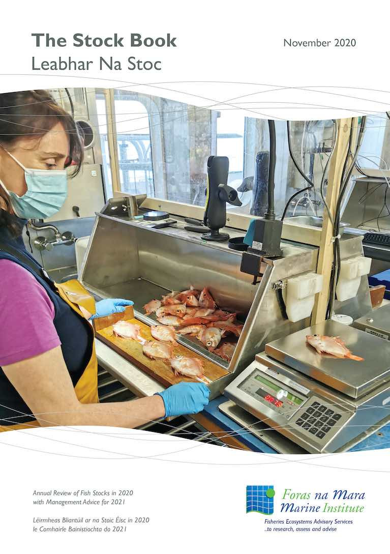
The Marine Institute’s 2020 Stock Book is now available online and via an interactive online application. Every year the Marine Institute produces an overview of scientific assessments and advice on 74 key fish stocks of interest to Ireland. The Stock Book is one of the principal annual publications of the Marine Institute, informing the Minister for Agriculture, Food and the Marine prior to the annual Fisheries Council negotiations. The Stock Book also serves as a valuable reference guide to a wide audience, including the fishing industry, managers, marine scientists, environmental NGOs, third level institutes and financial institutions.
The Stock Book, has been published by the Marine Institute since 1993 and in the last few years, the publication has also been accessible via an online application. The app allows users to quickly access the latest and historic scientific advice on most devices with a web browser. Interactive features such forecast graphs showing the consequences of following the scientific advice or choosing other scenarios in terms of catch for 2021 and future stock size in 2022.
The Stock Book integrates scientific advice from the International Council for the Exploration of the Seas (ICES) with relevant information on Irish fisheries. Marine Institute scientists participate in, and lead, many international working groups at ICES.
Dr Ciaran Kelly, Director of Fisheries Ecosystem Advisory Services at the Marine Institute said, “The interactive app developed by the Marine Institute is shaping thinking on how independent scientific advice can be delivered to fisheries managers and other stakeholders in the future. Ensuring that the best available scientific evidence for decision making is easy to access and transparent to all.”
The scientific advice and services provided by scientists to the Department of Agriculture, Food and the Marine, is a key focus of the Marine Institute’s Strategic Plan 2018-2022. “These scientific services are essential to supporting our sustainable ocean economy, protecting and managing our marine ecosystems and meeting EU obligations” said Dr Paul Connolly, CEO of the Marine Institute.
The Stock Book forms an important component of the sustainability impact assessment presented to the Oireachtas Joint Committee on Agriculture, Food and the Marine annually before the EU fisheries negotiations commence. There has been gradual increase in the number of stocks that are sustainably fished in line with Common Fisheries Policy objectives in the last decade. The two most valuable species for Irish fishermen, mackerel and many of the Nephrops (Dublin Bay Prawns) stocks, are sustainably fished. However, there are also a number of cod, herring and whiting stocks that continue to remain at low levels despite management measures aiming to rebuild them.
The 2020 Stock Book is available electronically on the Marine Institute’s website and as an interactive app. Most of the scientific work that delivers the Marine Institute’s Stock Book is funded under the European Maritime Fisheries Fund scheme.
Oceans of Online Learning Resources For Home-Schooling Families
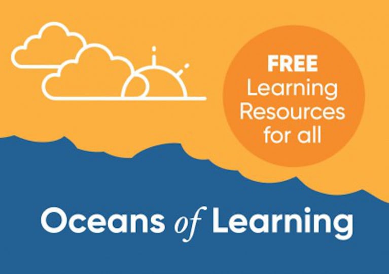
Families schooling their children at home during the January lockdown can find a wealth of free online activities and resources from the Marine Institute’s Oceans of Learning series.
According to Marine Institute chief executive Dr Paul Connolly, the series “highlights how the ocean has an impact on our lives every day — from providing food, transport and employment to the influence it has on our climate and weather, as well as our health and wellbeing”.
He adds: “In a challenging time, our online learning resources make it easier for those of all ages to learn about our ocean from home.”
The latest additions to the Oceans of Learning lineup comprise a deep dive on Ireland’s research vessels, including a virtual tour of the RV Celtic Explorer; exploring beneath the waves at the SmartBay Observatory; and learning how the Irish Marine Data Buoy Observation Network is crucial to our understanding of weather.
They add to a packed series of modules last summer, taking in everything from Ireland’s coastal communities to the shipping sector, the changing ocean climate, health and wellbeing, collaboration and sustainability.
A highlight was the exclusive Irish interview with Kathy Sullivan — the first person to ever experience travelling to both deep space and the oceans deep.
These are bolstered by additional resources on the RTÉ Learn website, including the documentary series Ireland’s Deep Atlantic which features on the Junior Cert curriculum.
The Marine Ireland Industry Network (MIIN) is expanding its social media presence as it prepares for the official launch of its brand-new website.
Established in 2016 with the aim of bringing together Ireland’s marine industry under the ‘Marine Ireland’ brand, the network comprises a diverse range of companies, State organisations, research groups and academia working in Ireland’s blue economy.
At the heart of the MIIN are the Marine Institute, Enterprise Ireland and BlueWise Marine — the former SmartBay Ireland based in Galway.
The network’s new website, which includes a member’s directory, is now live and among other things is intended to be a one-stop shop for international interests to better understand the capabilities of the marine industry here.
The MIIN says it is “focused on building collaboration and promotion opportunities for its members, both nationally and internationally”.
The new website is now live and will be officially launching soon. For updates on this launch event and more follow @MarineIrnNet on Twitter.
Minister Invites Applicants for Board of the Marine Institute
The Minister for Agriculture, Food and the Marine invites applications from suitably qualified candidates to fill four vacancies on the board of the Marine Institute.
Candidates must have demonstrable experience relevant to the work of the Institute in one or more of the following areas.
- Seafood/Sea Fisheries Sector
Given the strategic significance of the seafood sector, the complexity of the issues, opportunities it presents and the critical role of the MI in relation to this priority, at least one of the successful candidates should have demonstrable experience of having worked at an appropriately senior level in the seafood or wider food sectors and or the sea fisheries sector specifically. - Climate Impacts and Mitigation
The Marine Institute's Strategic Plan has a strong focus on Climate Change. One or more of the successful candidates should have demonstrable knowledge of Ocean Climate issues including mitigation/adaptation and research priorities in this area. - Ocean Energy and/or Marine Technology
The successful candidate(s) should demonstrate a strong demonstrable working knowledge at an appropriately senior level of policy and developments in the ocean energy and or marine technology sectors with particular emphasis on experience or knowledge of the sectors within an Irish context. - Marine Research and Development
The successful candidate(s) should have clearly demonstrated national & international research experience in the marine area. In addition, they should have experience in managing research programmes and a proven knowledge of research policy and the funding environment in the area of the marine science, both nationally and internationally. - Desirable:
• Previous Board Membership
• Corporate Governance & Compliance.
• Risk Management, Strategic Planning and Implementation
• Executive/Managerial/Professional Experience of relevance to the MI
• Strong marine sectoral knowledge
• Economic knowledge/expertise relevant to the Irish ocean economy
• Financial (Accountancy, Audit, Corporate Finance)
Closing Date: 15:00 on Friday 29th of January 2021
For more information see here
Waverider Buoy Research Project to Measure How Extreme Storms & Wave Heights will Impact the Coast
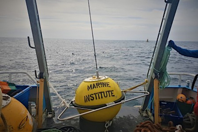
A research project led by coastal and ocean scientists in NUI Galway and the Marine Institute involves the deployment of a combination of smart buoys and time-lapse imaging to measure storm impacts and support the development of coastal flood and erosion defences.
The project, Brandon Bay on the Dingle Peninsula, Co Kerry, involves:
- A new waverider buoy provided by Sustainable Energy Authority of Ireland to measure wave height, wave direction, wave period, surface currents, and water temperature as well as storm impact
- Data being made available to view or download on the Marine Institute supported website Digital Ocean, a web portal to view data collected in and around Ireland's maritime zone.
- The installation of a shoreline monitoring system along Brandon Bay at three sites, which will capture images of the beach every 10 minutes during daylight hours over the next 12 months, to identify the time periods when wave run-up is high enough to reach the dune toe and potentially cause coastal erosion. This research is funded by Geological Survey Ireland.
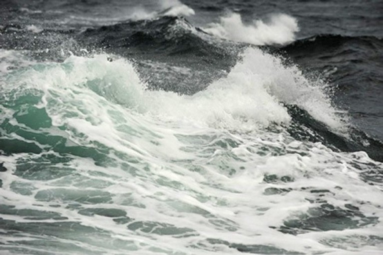
Dr Eugene Farrell, Discipline of Geography and Ryan Institute's Centre for Ocean Research and Exploration (COREx), NUI Galway, said: "We want to improve existing coastal change models by developing better insights into why does change occur and how much change will occur if we dial up climate projections for rising sea levels and storminess. To answer these questions we require process-response coastal models and these are only possible if nearshore observations from wave buoys such as the one in Brandon Bay are deployed over long time periods to capture all the seasons.
"We already know that changes along the coast from elevated storm surge and wave run-up result in changes in seabed and beach elevations. The data captured by the waverider will play an integral part in dismantling the important connections between different storm types such as size, direction, duration, clustering and coastal response that allows us to share real time ocean observations that can be used to address coastal erosion and coastal flood protection.
 The wave buoy pictured after deployment in Brandon Bay on the 1, December 2020. Photo: Eugene Farrell, NUI Galway
Alan Berry, Manager of Marine Research Infrastructures at the Marine Institute said, "The wave buoy at Brandon Bay will enable researchers to observe and understand how our ocean is changing and determine how to respond to current and future patterns of change. Open access to this data on Ireland's Digital Ocean website is valuable to climate researchers in Ireland and across Europe."
The Brandon Bay long-term waverider project is co-led by Dr Eugene Farrell, Discipline of Geography, Sheena Parsons, Earth and Ocean Sciences, and Dr Stephen Nash and Andi Egon, Civil Engineering in NUI Galway, and Alan Berry and Conall O'Malley from the Marine Institute with support from the Sustainable Energy Authority of Ireland.
In September 2020, a Coastal Change Technical Working Group was established within the Irish government and tasked with overseeing the development of a scoping report on a national coastal change management strategy. They have envisaged that the scoping report will address issues related to 'baseline and other data capture and research requirements to inform developing, implementing and monitoring a national coastal management strategy, to include potential damages assessment'.
Dr Eugene Farrell adds: "We feel it is our responsibility as coastal scientists to provide the requisite baseline information and recommendations to guide future research along the coast in order to fill knowledge gaps. This is an integral part of the Brandon Bay Waverider project and can be used as a demonstration project so that future investment in coastal infrastructure can be identified.
"Cumulatively, our approach requires a large team of experts to work together. The Maharees in Brandon Bay is already becoming a hub for coastal science thanks to the active community group in the area, the Maharees Conservation Association. There is an urgent need to increase our understanding of coastal change so that that we can better protect our coastal communities and design conservation plans for coastal ecosystems whose dynamic boundaries move in response to changing climate conditions."
The Brandon Bay Waverider project is supported by the Marine Institute, NUI Galway and MaREI, the SFI Research Centre for Energy, Climate and Marine research and the Sustainable Energy Authority of Ireland.
Wave data results from the Brandon Bay Waverider project can be viewed here
Photo: The wave buoy pictured after deployment in Brandon Bay on the 1, December 2020. Photo: Eugene Farrell, NUI Galway
About the Waverider Buoy
The data from the buoy is being used to validate a state-of-the-art high-resolution coastal erosion modelling system comprising of wave, tide and sediment transport models that is under co-development in Civil Engineering, Earth and Ocean Sciences and Geography disciplines at NUI Galway and the Marine Institute since early 2019. The key attraction of these specialised numerical ocean models is their predictive capability. The model predictions are first tested against real-time observations in the bay and then tested for different climate change scenarios such as rising water levels or increasing wave heights.
For example, once the model is validated using the wave buoy observations the project team can test outcomes using the OPW sea level rise scenarios: (1) conservative Mid-Range Future Scenario which uses a sea-level rise of 0.5m by the year 2100 and (2) a High-End Future Scenario, which uses the maximum projected sea-level rise of 1.05m for the year 2100.
Superimposed on these changing sea levels the group can investigate how extreme storms and wave heights will impact the coast and determine how these impacts will be manifested on the coast, such as rates of shoreline retreat or increasing vulnerability of coastal communities and infrastructure.
The yellow spherical wave rider is one metre in diameter, is equipped with an antenna and light and is anchored to the seabed by a mooring. The light will flash yellow for five seconds every 20 seconds in hours of darkness. An accelerometer mounted within the buoy registers the rate at which the buoy is rising or falling with the waves. This type of 'heave, pitch, and roll buoy' is the most commonly used buoy for measuring waves in deep water. It measures the surface height and slope in different orthogonal directions to yield the horizontal and vertical displacements of the buoy.
The Brandon Bay Waverider Acknowledgements
Marine Institute & Sustainable Energy Authority of Ireland
The Marine Institute, supported by the Sustainable Energy Authority of Ireland, have been instrumental in the execution of this project. They have been very generous with their time (research-in-kind) and sharing their expertise and equipment. We would especially like to acknowledge the leadership of Alan Berry, Section Manager, Marine Research Infrastructures and Conall O'Malley, both from the Marine Institute.
The Marine Institute is a State agency responsible for marine research, technology development and innovation in Ireland whose remit is: "to undertake, to coordinate, to promote and to assist in marine research and development and to provide such services related to research and development, that in the opinion of the Institute, will promote economic development and create employment and protect the marine environment." This project exemplifies how scientific progress can be made when academics link up with management agencies like the Marine Institute.
The Sustainable Energy Authority of Ireland is Ireland's national energy agency aiming to create a cleaner energy future by making Ireland's energy sustainable, secure, affordable and clean. SEAI supports the Irish offshore renewable energy sector by advising the government on policy, offering grant support schemes, developing test site infrastructure, and providing information through the Ocean Energy Ireland portal. The Brandon Bay wave rider provided by SEAI will be part of the wave monitoring network of coastal buoys operated on behalf of SEAI by the Marine Institute.
The Marine Institute work with P&O Maritime Logistics who co-led the technical parts of the deployment including the installation of the base station and also the actual deployment.
NUI Galway
The NUI Galway Research Office provided funding support. This office is part of the Office for the Vice President for Research and works closely with the Innovation Office, the Researcher Development Centre and other professional services supporting the NUI Galway research community. We would especially like to acknowledge the support of Aengus Parsons, Director of the Research Office and Professor Lokesh Joshi, Vice President for Research for their support.
MaREI
MaREI is the SFI Research Centre for Energy, Climate and Marine research and innovation co-ordinated by the Environmental Research Institute (ERI) at University College Cork and also based in NUI Galway. We would especially like to acknowledge the support of Dr Stephen Nash in Civil Engineering in NUI Galway. The data from the wave buoy are an integral part of an ongoing MaREI funded PhD programme in NUI Galway.
Maharees Conservation Association and partners
The ongoing coastal and ocean research is not possible without the support of the Maharees community. We are very excited to contribute to our scientific understanding of coastal and ocean dynamics in the bay area with the hope that the results will support ongoing efforts by the community to build their resilience to pressures from storms and people. We would especially like to acknowledge Mr Paddy Buckley and his family for allowing us to install the base station in their home in the Maharees. The NUI Galway team would also like to thank Kerry County Council, National Parks and Wildlife Service and OPW for supporting coastal research in the area.
Research Funders Review Ireland’s Progress in Marine Research & Innovation at Latest Forum Meeting
The recent sixth meeting of the National Marine Research Funders’ Forum on 26 November followed the launch this past summer of the new National Marine Research Database.
Developed in collaboration with national funders, the database displays more than 500 marine research projects that have received combined funding of over €230 million from national and international funding programmes.
The forum’s latest meeting provided an opportunity to share updates on organisation programmes, funding calls and developments of strategic importance.
This included an update on the EU Horizon Europe research and innovation (R&I) framework programme 2021-27 and the launch of a stakeholder consultation on a strategic R&I agenda on a ‘climate-neutral, sustainable and productive Blue Economy’ partnership.
A review of the National Marine Research and Innovation Strategy 2017–2021 commenced in June to assess progress in achieving the three goals of the strategy as it enters its final year. Initial findings of the review were presented and discussed at the meeting, with a final report due to be completed in early 2021.
Dr Niall McDonough, director of policy, innovation and research support services at the Marine Institute and chair of the Marine Research Funders’ Forum, said: “Coordinated and targeted investment in marine research and innovation in Ireland is essential to address key national and global challenges that we face as well as playing a significant role in Ireland’s economic recovery and growth.”
The Marine Research Funders’ Forum brings together State research funding organisations with the aim of enhancing coordination in marine-related research funding, while also addressing key implementing actions set out in the National Marine Research and Innovation Strategy.
Marine Institute Director Elected Chair of JPI Oceans Management Board
Dr Niall McDonough, Director of Policy Innovation and Research Support Services at the Marine Institute, was recently elected Chair of the JPI Oceans Management Board.
JPI Oceans is an intergovernmental platform that works to increase the alignment and impact of national investments in marine and maritime research and innovation in Europe. The platform provides its member countries with a shared voice, strategic agenda and action plan to address complex ocean-related societal challenges that cannot be solved at national level. JPI Oceans focuses on long-term collaboration between EU member states, associated countries and international partners.
Niall trained as a marine biologist with research interests in marine aquaculture and shellfish stock restoration. Following two years with the Environmental Change Institute at the National University of Ireland, Galway, he worked for five years as Head of the Centre for Marine Resources and Mariculture at Queen's University Belfast. From 2009 to 2017, he served as Executive Director of the European Marine Board based at the InnovOcean campus in Ostend, Belgium. In 2017, Niall commenced his current role with the Marine Institute where he oversees the management of the Institute's competitive marine research programme and coordinates the implementation of the National Marine Research and Innovation Strategy 2017-2021.
Dr Niall McDonough said, "JPI Oceans has become a key platform for cooperation in marine and maritime research in Europe. National ministries and funders value the efficient and agile mechanisms it provides to identify and implement the research needed to address shared challenges in the safe and sustainable use of ocean space and resources. I look forward to working with the Secretariat, vice-Chairs and Management Board to implement the new JPI Oceans Strategy Framework and to consolidate the role and impact of JPI Oceans at the core of European ocean research."
Prior to his appointment of Chair of the JPI Oceans Management Board and Internal Advisory Board, Niall was elected a member of the JPI Oceans Strategic Advisory Board. Alongside Dr Maurice Héral from the French National Research Agency, Niall also led recently the involvement of Member States and Associated Countries in the development of the European Partnership 'A climate neutral, sustainable and productive Blue Economy'.
Dr Niall McDonough will serve as Chair of the JPI Oceans Management Board for a three-year term.
Explorers Education Programme’s Workbook Causes a ‘CommOCEAN’ at International Conference
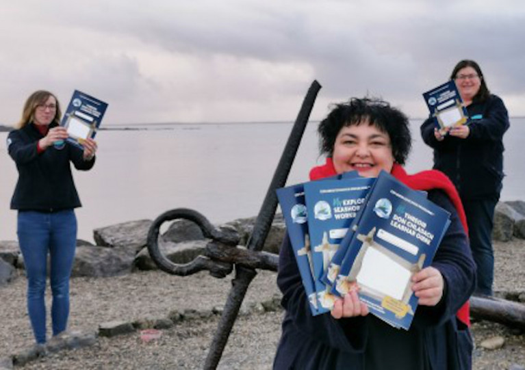
A publication by the Marine Institute’s Explorers Education Programme that connects children, parents, teachers and the media with the seashore in Ireland has been highlighted at a major international conference.
My Explorers Seashore Guide Workbook was recently presented at the 4th International Marine Science Communication Conference, CommOCEAN, which brings marine science experts and communication professionals together to learn more about advocating the spread and outreach and communication about the ocean.
Speaking at the conference, the book’s author Cushla Dromgool-Regan said: “To really engage and be passionate about caring for our marine environment, it is said that we need to be able to see it, hear it, feel it, smell it and taste it.
“Therefore, with over half of Ireland's population living 5km from the coast in Ireland, the seashore is the perfect playground to learn about our ocean.
“The Explorers workbook can be used to help inspire learning about the shore before, during and after heading to the beach. It can be used by children of all ages to learn about the amazing animals, seaweeds and habitats that can be found our doorstep.”
My Explorers Seashore Guide Workbook was launched earlier this year to mark International Biodiversity Day, as previously reported on Afloat.ie, and more than 800 copies of the book were downloaded within its first couple of months.
“I am delighted that the book sparked a keen interest with teachers and parents teaching at home this year, as well as the media’s interest in sharing our stories and passion for the sea,” added Dromgood-Regan, who is also Explorers strategic manager and communication lead from the Camden Education Trust.
“The importance of learning, communicating and engaging in decisions about our ocean, starts at home around our kitchen table.”
As announced at CommOCEAN, the My Explorers Seashore Guide Workbook is now published in English and Irish as a free download from the Marine Institute’s open access library.


 as lead helm, rounds the Fastnet Rock on the way to the overall win in 1987")


 Michael Murphy Schull Harbour Sailing Club (SHSC), Eric Coogan Heineken Ireland, Mark Murphy, Commodore SHSC, Jack Allen SHSC, Carmel O'Regan SHSC, Cornelious Ndlovu, Schull Harbour Hotel Operations Manager and Derval Murphy SHSC")
