


Displaying items by tag: Marine Institute
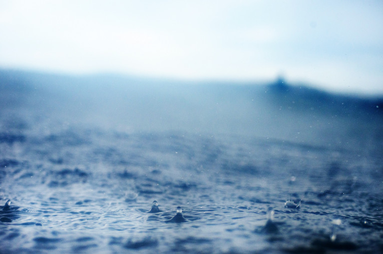
The Marine Institute (MI), Environmental Protection Agency (EPA) and Met Éireann (MÉ) have published a report on "The Status of Ireland's Climate".
This is the second comprehensive analysis of "essential" climate data collected in Ireland. It confirms and updates findings from the 2012 report and details how global changes are being reflected in our atmosphere, oceans and our landscape.
The report was prepared by MaREI, University College Cork and funded by The Environmental Protection Agency (EPA), Met Éireann (MÉ) and the Marine Institute (MI).
• Long term observations in Ireland provide important insights on the causes and consequences of Climate Change;
• Increases in atmospheric levels of carbon dioxide, methane and nitrous oxide have been observed in Ireland, and reflect the increasing global levels of these key drivers of global warming;
• Global warming has resulted in Ireland's climate becoming warmer and wetter;
• Sea level rise, increased ocean acidity, and higher ocean temperatures are also observed in our oceans and coastal areas;
• Ireland's ocean and terrestrial ecosystems are responding to these changes, resulting in changes in ocean species and a longer growing season on land.
Welcoming the publication of the report Laura Burke, EPA Director General, said: "Climate observations provide the basis for our understanding of the realities of climate change here in Ireland, in Europe, and globally. As a Party to the UN Framework Convention on Climate Change, and the Paris Agreement, Ireland has committed to carry out the range of climate observations outlined in this report. These data enable bodies such as the IPCC to carry out their analysis of global changes. Importantly, they are needed to inform effective responses to the changes that are happening here in Ireland.
Today's report brings together the evidence of the changes that have occurred across Ireland's environment, from both long term detailed measurements on our land and in our oceans and atmosphere and from linked data from satellite observations from programmes such as Copernicus."
The scientific data monitored and collated by GCOS Ireland represents Ireland's long- standing contribution to the international scientific effort of providing the fundamental data needed to monitor our changing climate. GCOS Ireland collects scientific data on more than 40 Essential Climate Variables, identified by the UNFCCC, across atmospheric, oceanic, and terrestrial domains.
Highlighting the importance of the Status of Ireland's Climate report Eoin Moran, Director, Met Éireann said: "As citizen's in Ireland and around the world are now seeing the impacts of Climate Change, through evermore extreme weather events, fires and flooding etc; high quality observations of the climate are crucial to help inform society's response to the Climate Emergency. Scientific long-term monitoring of the climate underpins climate research and the development of climate services which support policy making and decision making in the face of the urgency of the climate crisis.
The Status of Ireland's Climate report not only includes invaluable data provided to GCOS as Ireland's contribution to the global climate monitoring effort but also informs development and improvement of national climate monitoring infrastructure to provide ever better understanding of our climate system and to optimise national climate monitoring capacity. This long-term climate monitoring allows us to best compare changes occurring in Ireland's climate to those across Europe and the rest of the world and to tailor our national response into the future".
Commenting on the findings, Mick Gillooly, Interim CEO, Marine Institute, said: "Long term climate monitoring programmes are needed to provide the evidence required to support national climate policy and action. It is through sustainable long term monitoring networks that we can measure the current state of our climate, and how much it has changed by, which in turn gives us an indication of how much more it is likely to change by into the future."
Key findings from the report
Atmosphere
• The annual average surface air temperature in Ireland has increased by over 0.9oC over the last 120 years, with a rise in temperature being observed in all seasons.
• Annual precipitation was 6 per cent higher in the period 1989 to 2018, compared to the 30-year period 1961 to 1990.
• The concentration of the main Climate driver: greenhouse gases - carbon dioxide, methane and nitrous oxide - measured in Ireland, continued to increase since 2012 with long term implications for our climate.
Oceans
• Satellite observations indicate that the sea level around Ireland has risen by approximately 2-3mm per year since the early 1990s.
• Measurements in the surface water to the west of Ireland indicate an increase in ocean acidity which is comparable to the rate of change in oceans around the world.
• The average sea surface temperature measured at Malin Head has been 0.47ºC higher over the last ten years compared to the period 1981-2010.
Land
• There is an increase in river flows across most of Ireland since the early 70s. However, there is evidence in recent years of an increase in potential drought conditions especially in the east.
• Land cover observations since 1990 show increases in the areas covered by artificial surfaces and forest whilst there is a decrease in wetland areas.
The report also identified that progress has been made in several areas of Ireland's observation infrastructure, resourcing, analyses and co-ordination, since the 2012 Climate status report. Nonetheless, further action is needed to ensure the national climate observation system is fit for purpose for the coming decades. This includes continued maintenance of existing climate monitoring programmes and infrastructure, the transition of climate observations to long-term sustainable programmes, and investigate potential to monitor essential climate variables not currently observed in Ireland.
Links to relevant materials
The Status of Ireland's Climate, 2020
Climate Ireland, Ireland's Climate Status Tool, provides interactive access to the Climate Status Report Ireland (CSRI) 2020.
Contact Information
Environmental Protection Agency:
Emily Williamson/Aileen Moon, EPA Media Relations Office 053-9170770 (24 hours) or [email protected]
Met Éireann
Bonnie Diamond, Communications Meteorologist 01-8064255 or [email protected]
Marine Institute
Sheila Byrnes, Communications Manager, 087-8155271 or [email protected]
New Online Course in Integrated Multi-Trophic Aquaculture
A new, free online training course in integrated multi-trophic aquaculture has been developed as part of the IMPAQT research project.
Integrated multi-trophic aquaculture (IMTA) involves farming multiple, complementary species from different levels of the food chain together for their mutual benefit.
The new massive open online course (MOOC) available on the Open University’s OpenLearnCreate platform aims to facilitate the effective transfer of knowledge on IMTA, precision aquaculture and the results of the IMPAQT project to interested stakeholders, policy makers and the aquaculture industry.
The EU’s Horizon 2020 IMPAQT (Intelligent Management System for Integrated Multi-Trophic Aquaculture) project aims to promote aquaculture production based on the IMTA concept.
Coordinated by the Marine Institute, the IMPAQT research project has developed an AI management platform which analyses the environment, fish behaviour and data from satellites and images, as well as inputs from the farmer on site.
 Alaria esculenta being brought to the surface on a long line | Credit: IMPAQT
This platform provides information on fish welfare and water quality, as well as real-time operational feedback and advice to the farmer on the management of their site.
The IMPAQT system has been designed and tested at the Marine Institute’s research site in Lehanagh Pool in Co Galway, the Keywater Fisheries IMTA site in Co Sligo and four other aquaculture sites in Europe and China.
Frank Kane, Marine Institute and IMPAQT coordinator, said: “This new course presents the outputs and results from the IMPAQT project in an accessible, understandable and dynamic online format.
“The online training course will help to strengthen the research and innovative aquaculture landscape, by transferring the key aspects of IMTA to stakeholders, investors and enterprises interested in starting up or integrating an IMTA system.”
The new online course comprises four modules that can be completed in eight hours, and will be of interest to those working in the aquaculture sector (fish farmers, farm owners, regulators, policy makers) as well as those who support the sector (technology suppliers and developers, representative organisations, trainers and educators, regulators and policy makers) along with investors in the sector.
The ability to track free-swimming salmon juveniles has been extended hundreds of kilometres into the open ocean using advanced robotic technology.
As part of the EU INTERREG VA-funded SeaMonitor project, Dr Ross O'Neill of the Marine Institute and Kieran Adlum, P&O Maritime, tested a remotely operated ocean glider along the steeply sloping area of the shelf edge some 130km north-west of the Scottish Hebrides.
The torpedo-shaped device, equipped with an acoustic tag detector, was deployed from the RV Celtic Explorer on 16 April during the 2021 Irish Anglerfish and Megrim Survey.
This is the first time such active tracking technology has been applied to Atlantic salmon in Europe.
During its two-month mission, the glider successfully detected four individual juvenile salmon smolts measuring only 15-19cm, nearly 600km from their home rivers in Ireland, Northern Ireland and Scotland.
These fish had been tagged between four and six weeks previously with electronic acoustic transmitting tags along with hundreds of other juvenile salmon as part of the SeaMonitor project as well as the West Coast Tracking Project, a partnership between the Atlantic Salmon Trust, Fisheries Management Scotland and Marine Scotland, EU INTERREG VA-funded COMPASS project and Agri-Food Biosciences Institute (AFBI) research initiatives.
One of the main aims of these projects is to investigate the persistent low marine survival of Atlantic salmon in the early stages of their oceanic migration to feeding grounds in the North Atlantic.
The four fish originated from the River Burrishoole in Co Mayo, the River Bann in Northern Ireland and the rivers Clyde and Awe in Scotland.
Up to now, most tracking studies had been limited to estuarine or coastal areas due to technology limitations and the need for stationary receivers.

According to Dr Niall Ó Maoiléidigh of the Marine Institute and principal investigator for the SeaMonitor project: “The detection of these fish confirms the importance of the shelf edge in this amazing journey, as the faster currents associated with the steep slopes most likely act as an aquatic transport system facilitating the northward migration of these tiny fish through a very harsh environment.”
Prof Colin Adams of the University of Glasgow and principal investigator for the SeaMonitor Project added: “This study shows that tracking salmon over considerable distances at sea can be achieved which is crucial for research into highly migratory marine species especially where mortality may be occurring far from the shore.”
Dr Ciaran Kelly, director of fisheries ecosystems and advisory services at the Marine Institute, said: “The use of the glider to track the movements of even very small fish has been clearly demonstrated and this will encourage the use of autonomous underwater vehicles to improve information on many marine species of animals which may be endangered or threatened without interfering with their natural migrations.”
The SeaMonitor project is “breaking the boundaries of research into the marine migration journey of the iconic Atlantic salmon”, said Loughs Agency chief executive Sharon McMahon.
“This innovative research will help to identify migratory routes and factors influencing salmon survival at sea, providing data to inform future research and decision making.”
The glider is part of the SeaMonitor integrated cross-jurisdiction major network of acoustic receivers, robotic underwater vehicles, satellite tracking and passive acoustic receivers in European waters and its use will be extended to track cetaceans, basking shark and skates as well as to collect physical oceanographic data.
When combined, the data will enable a holistic view of the regions mobile marine species and will prove invaluable to the regions managers, as well as establishing an integrated network of marine receivers for future applications and extended monitoring.
Match-funding for the project has been provided by Northern Ireland’s Department of Agriculture, Environment & Rural Affairs (DAERA) and the Department of Housing, Local Government and Heritage in Ireland.
For more information about the project visit the Lough Agency’s SeaMonitor portal or follow the project on Twitter at @SeaMonitor1.
Anglers in Ireland are taking part in a unique ‘catch, tag and release’ programme to help Irish and international scientists learn more about the largest tuna in the world — the Atlantic bluefin tuna.
Under the Tuna CHART (CatcH And Release Tagging) programme, recreational anglers on board 22 authorised charter vessels the successfully applied to join the scheme this year will catch bluefin tuna and skippers will be tagging and releasing them back into the sea, alive, from this month to mid November.
The data collected on board authorised vessels will then be used for scientific assessment to improve knowledge of population structures, fish size and how bluefin tuna is distributed in Irish waters and throughout the North Atlantic.
Migrating through North Atlantic waters, bluefin tuna frequent Irish coastal waters to feed. Bluefin is an iconic sports-angling species and can grow up to 1,500lbs (around 680kg).
Under strictly controlled conditions, 685 bluefin tuna were caught, tagged, measured and released through the Tuna CHART programme in 2020. All bluefin tuna were caught by anglers in Irish coastal waters and then tagged by skippers. The fish is always kept in the water to ensure correct handling and tagging.
The largest tuna tagged in Ireland in 2020 was 2.75 metres long, estimated to weigh over 800 lbs (approximately 360 kgs).
Now in its third year, Tuna CHART is a collaborative scientific programme between Inland Fisheries Ireland and the Marine Institute in partnership with the Sea-Fisheries Protection Authority, the Department of Agriculture, Food and the Marine and the Department for Environment, Climate and Communications.
Environment Minister Eamon Ryan said: “The 22 angling vessels authorised by my department will contribute substantially to essential Bluefin tuna data collection as they migrate along the Irish coastline.
“The recreational fisheries sector is crucial in the delivery of this data collection programme and we look forward to continue working with all the State agencies involved.
“I want to acknowledge the key role of the authorised charter skippers and their crews who are bringing their unique expertise to bear on providing valuable data for scientific purposes, and the ‘citizen scientist’ anglers who will catch the fish. The fact that 685 fish were tagged last year with no mortalities recorded is a great achievement by the skippers.”
‘This programme also provides our coastal communities with access to a highly desired angling market that will bring a new demographic of tourists to our spectacular Wild Atlantic Way’
Marine Minister Charlie McConalogue welcomed the continuation of the programme for 2021.
“As a Donegal man, I have a keen interest in the bluefin tuna data collection programme,” he said. “I am delighted at the ongoing success of this programme as it allows our scientific partners in the Marine Institute and Inland Fisheries Ireland to collect valuable data and improve our understanding of the migratory patterns of bluefin tuna in Irish waters in a tightly controlled environment.
“This programme also provides our coastal communities with access to a highly desired angling market that will bring a new demographic of tourists to our spectacular Wild Atlantic Way.
“I am particularly pleased with the large increase in data collected in 2020, despite the restriction in place as a result of Covid and am anticipating an even more successful season this year thanks to our experienced skippers who have received authorisations for 2021.”
This year’s authorised vessels will operate out of ports in Donegal (Killybegs and Bundoran), Sligo (Rosses Point and Mullaghmore), Galway (Cleggan and Rossaveal), Clare (Carrigaholt and Kilrush), Cork (Courtmacsherry, Kinsale, Ballycotton, Union Hall, Great Island in Cobh, Baltimore and Youghal) and Waterford (Dungarvan).
All skippers have been fully trained while vessels have been fitted with a customised GPS device. Data is collected by skippers digitally by means of a specifically designed app.
Anglers looking to fish for bluefin tuna in Irish waters may only do so from an authorised charter vessel from now until 12 November 2021. The Sea Fisheries Protection Authority and Inland Fisheries Ireland are undertaking inspections and patrols around the coast to ensure that no unauthorised vessels are targeting or catching bluefin tuna.
Both organisations have also confirmed that any person engaging in fishing for bluefin tuna on a vessel which is not appropriately authorised, would be in breach of the Sea-Fisheries and Maritime Jurisdiction (Bluefin Tuna) Regulations 2019 (SI No 265 of 2019) and would face prosecution.
Like last season, skippers will have to adhere to any local or national COVID-19 public health guidelines that may be put in place. A full list of authorised skippers and vessels for the Tuna CHART programme in 2021 can be found at www.fisheriesireland.ie/bluefin.
The Marine Institute’s 2021 Summer Bursary Scholarship Programme is under way as a group of 10 undergraduate students have been welcomed by the State agency for marine research to expand their knowledge and understanding of marine science and related areas.
Running for over 30 years, as previously reported on Afloat.ie, the programme resumes this year in line with the Government’s public health guidelines. Through this programme students are brought together from a wide range of disciplines and educational institutes.
The bursary programme provides students with a unique opportunity to form connections with fellow students nationwide, experts in their fields and the wider marine sector.
“The work experience programme gives students the opportunity to further their knowledge and research in their particular area of interest and gain insight into careers in the marine sector,” said Ms Helen McCormick, senior laboratory analyst at the Marine Institute and co-ordinator of the bursary programme.
The programme helps to equip students with the skills to become ocean leaders and marine champions of the future, and is a key initiative of the Marine Institute's Strategic Plan 2018-2022: Building Ocean Knowledge, Delivering Ocean Services.
Welcoming this year’s students, Mick Gillooly, interim CEO at the Marine Institute, said: “The bursary programme is a long-established scholarship in the Marine Institute that continues to support and inspire the next generation of marine scientists and experts.
“Students are given a unique opportunity to learn from and form key connections with professionals across a range of areas in the marine sector.”
The Bursary Scholarship Programme is aimed at undergraduates of universities, institutes of technology and national institutes for higher education. To participate in the programme, undergraduate students must have completed two years of study in a relevant discipline by the beginning of June 2021.
Call for 2022 & 2023 Applications for Ship Time on Ireland’s Research Vessels Now Open
Applications are currently being accepted for ship time in on Ireland’s national marine science research vessels in 2022 and 2023.
In addition to the RV Celtic Explorer and RV Celtic Voyager, placements will also be available on the new RV Tom Crean which is expected to be operational in mid 2022 and will replace the RV Celtic Voyager.
The ROV Holland I as well as the Marine Institute’s Slocum Glider submersibles Laochra na Mara and Aisling na Mara are also offered.
Applications must be submitted using Research Vessel Operations’ online Survey Planning System by Thursday 16 September. Contact Research Vessel Operations at [email protected] to obtain a username and password.
Each application will be reviewed and the applicant will be informed as soon as possible whether the ship time they requested is available. If the requested timing is not available, alternative dates may be offered.
The Vessel Charter Guidelines should be read carefully before submitting the ship-time application form.
Further information, technical specification and contact details for the Slocum Gliders are available on the Glider webpage.
Applicants may seek grant-aid to cover all or part of the vessel charter costs for Research Surveys or Ship-Based Training Programmes in 2022. The closing date for receipt of grant-aid applications is 5pm on Thursday 16 September.
Applicants for ship-based training are advised to consult with the Strategic Marine Alliance for Research and Training (SMART) at [email protected]. SMART aims to standardise and optimise ship-based training for undergraduate and post-graduate students and develop nationally accredited ship-based training activities for national higher education.
Applicants are advised that survey schedules can change during the year; contact Research Vessel Operations at [email protected] to check whether any survey slots remain for 2021 and/or request to be notified if any dates become available.
Marine Institute To Launch Funding Call Aimed at Capturing Ireland’s ‘Blue Carbon’ Potential
This month the Marine Institute will launch a funding call for a major programme of marine science research in the area of ‘blue carbon’.
The absorption and storage of atmospheric carbon dioxide in the world’s oceans and coastal regions has been identified as one of the ways in which marine ecosystems can reduce the impacts of climate change.
Funding of up to €1.6m has been earmarked for the call to support a large-scale research project to run from 2021 to 2026.
Launched in June 2020, Ireland’s Programme for Government recognised the “the enormous blue carbon potential that the ocean has to offer in tackling climate change”.
Collaborative research initiative
The Government tasked the Marine Institute — the State agency responsible for marine research and innovation — with a collaborative research initiative, aimed at investigating the climate-change mitigation potential of blue carbon and working towards creating an inventory that will assist the EU in meeting Ireland’s climate-change objectives.
In order to prepare the ground for such a large-scale research programme, the Marine Institute commissioned a synthesis report to review existing knowledge on blue carbon habitats and their role as carbon sinks in Ireland. This report was published in May 2021.
“Blue carbon refers to carbon which is stored, or sequestered, in the ocean and in vegetated habitats around coastal regions,” explains the report’s lead author Dr Grace Cott, assistant professor at the UCD School of Biology and Environmental Science.
“In terms of blue carbon which we can actively manage, what we are really referring to is the vegetation in coastal regions, and that means three main habitats: firstly, mangrove forests — which we don’t have in Ireland and are mostly found in tropical regions — secondly, salt-marsh habitats and finally, seagrass meadows.”
From photosynthesis to sediment trapping
Carbon sequestration — the long-term capture and storage of carbon dioxide (CO2) from the atmosphere – can take place through a range of natural processes, from photosynthesis to sediment trapping, where carbon-based sediments from the tide are physically trapped by vegetation.
The Marine Institute report points out that Ireland’s tidally influenced coastal wetlands comprise approximately 160 square kilometres of salt-marsh and seagrass beds. Globally, although these habitats represent a much smaller area than terrestrial forests, their total contribution to long-term carbon storage is comparable to carbon sinks in tropical forests.
According to Dr Cott, salt marshes in Ireland are up to 10 times more efficient than agricultural grasslands at storing carbon on a per area basis. This is mainly due to the lack of microbial decomposition in these wet regions, which inland causes the release of carbon from the soil as carbon dioxide.
Supporting blue carbon into the future
The loss and destruction of vegetated coastal ecosystems threatens their ability to function as long-term carbon sinks, and mismanagement can lead to the release of stored carbon back into the atmosphere, says Dr Cott.
“But there is hope in the management of these resources,” she explains. “Even though researchers need to conduct further research into the matter, we are already becoming aware of certain strategies which can help preserve our blue carbon habitats around the Irish coast.”
These include allowing salt mash habitats to migrate inland, and improving water quality to optimise carbon capture in seagrass beds.
“Looking ahead, I believe that Ireland will need an appropriate management framework, led by Government, to enhance protection of these habitats in relation to carbon sequestration,” Dr Cott adds.
This week’s Oceans of Learning resources explore the inextricable link between our ocean and our climate.
Our ocean is the Earth’s natural climate moderator, influencing weather patterns around the globe by absorbing eat and excess carbon dioxide — and affecting every one of us no matter where we live.
Here in Ireland, our climate is regulated by the Gulf Stream which protects us from climatic extremes but leaves us exposed to climate change impacts such as sea level rise, ocean acidification, extreme weather events and climate-driven changes in our marine ecosystems.
The ocean’s potential as a climate solution is only now beginning and ocean research is vital to help us to mitigate, adapt and turn the tide on climate change.
“Climate change is one of the greatest challenges facing our world today,” said Patricia Orme, joint acting CEO of the Marine Institute. “There is significant demand for greatly enhanced knowledge and services that allow us to observe the changes to our ocean, project and model likely future scenarios and support adaptation planning.
“Forecasting ocean and climate change are important activities that support the scientific advice to many government policies and research initiatives.”
She added: “Ireland is uniquely positioned to be at the forefront of efforts to better understand global ocean challenges and provide essential national services in observing and projecting the regional and local impacts of climate change.”
In the third episode of the Oceans of Learning podcast, presenter Finn van der Aar is joined by Samantha Hallam, ocean and climate scientist at Maynooth University; Dr Ken Whelan, research director with the Atlantic Salmon Trust; and Dr Triona McGrath, research lead at An Fóram Uisce, The Water Forum, to shed some light on the past, present and future of climate change and the effects on our oceans.
Evelyn Cusack, head of forecasting at Met Éireann, will also share how our ocean influences our climate and weather in a video resource.
To view the suite of resources available for Oceans of Learning this week, visit Our Ocean: Our Climate at the Marine Institute website. The Oceans of Learning podcast is available to download from Apple Podcasts and Spotify.
For the latest on the Oceans of Learning series and more, follow the Marine Institute on Facebook, Twitter, Instagram and YouTube.
An Ocean of Stories - An Anthology of Children’s Ocean Stories Launched Ahead of World Oceans Day
The Marine Institute’s Explorers Education Programme has launched a new book, An Ocean of Stories - An Anthology of Children’s Ocean Stories, leading up to World Oceans Day this Tuesday 8 June.
The book, published by Explorers Education officer Carmel Madigan of the Loophead Summer Hedge School, includes over 50 stories, artworks and poems by children from counties Clare and Limerick who were inspired by ocean experiences — and highlights the major role the ocean has in our everyday lives.
Patricia Orme, joint acting CEO of the Marine Institute, congratulated Madigan and the Explorers team on the launch of the book.
“Carmel always puts the children first and this book has helped children find a positive place in a time that has been challenging for many in primary schools over the past year,” she said.
‘Each of the children's stories are engaging, capture the imagination and highlight the importance of our interconnection with the sea’
“While we celebrate World Oceans Day – The Ocean: Life and Livelihoods, this book reminds us of our childhood experiences and our love for and relationship with the sea.
“Reading the stories of children jumping off piers and their stories of the adventures of rock-pooling reminds us of how fortunate we are to live on an island surrounded by the ocean, where we can enjoy amazing beaches and coastline.
“Each of the children's stories are engaging, capture the imagination and highlight the importance of our interconnection with the sea. I am sure many will treasure this wonderful book in years to come.”
Madigan ran the Explorers project with 14 classes over the last school term, to engage teachers and children in the idea of documenting their experiences and memories of the seashore and the ocean.
‘The stories are the children’s own, their lived experiences intertwined with creative thinking’
With the production of an Explorers Personal Story Writing Guidebook and a series of short videos, as well as video chat sessions, the children were guided through the process of capturing their own stories about the ocean, through a series of creative writing exercises.
“I am delighted that I was able to bring something to the classroom that was fresh and new to the children with this project,” Madigan said. “Working with the teachers, and the Explorers team, we created a positive experience for the children promoting a sense of wellness and well-being.
“The stories are the children’s own, their lived experiences intertwined with creative thinking. Some are pure fact and some are pure fiction – all were a joy to read! The children should be very proud of their contributions. They are truly beautiful, engaging and thoughtful, making for wonderful insightful reading, whatever your age.”
Over 300 stories were produced by the children, highlighting the importance of including marine themes on the curriculum.
 Some of the children whose work is featured in An Ocean of Stories
“The stories and poems produced by the children conjure up many memories of sand in the sandwiches, being tumbled by waves, to having a big ice cream on the way home!” said Cushla Dromgool-Regan of the Camden Education Trust and Explorers strategic education manager.
“I am sure that for many who read this book, they will also turn the pages smiling with similar recollections of their own seashore and ocean experiences.
"Carmel has delivered a number of valuable projects with children over the years and her experience as an artist, author and ocean enthusiast is reflected in her work for the Explorers Education Programme. I sincerely hope that this book inspires those that read it.
“As one of the stories written about a sailor's adventure traveling across the seas says: the ocean may separate us physically around the world, but it provides us the opportunity to bring humanity together! Well done to all!”
Unmanned Irish Miniature Sailboat ‘Seoltóir Na Gaillimhe – the Galway Sailor’ to be Deployed from the RV Celtic Explorer
Yesterday, a group of students from 5th and 6th class from Kilglass National School in Co Galway delivered their 1.5 metre unmanned mini sailboat called ‘Seoltóir Na Gaillimhe – the Galway Sailor’ to the Marine Institute’s research vessel, RV Celtic Explorer, in Galway Harbour. Marine Institute scientists will deploy the mini-boat from the RV Celtic Explorer into the Atlantic Ocean, near the M6 Weather Buoy, during the AIMSIR (Atlantic In-situ Marine Scientific Infrastructure Replacement) survey.
The mini-boat is equipped with a sail and a satellite tracker, or transmitter, which allows the students to track it as it sails across the ocean and gain a better understanding of ocean currents. This initiative is part of the international Educational Passages programme which connects schools from across the globe through the mini-boat activity.
Congratulating the collaborative effort of the Explorers Education Programme team, Kilglass National school, the infrastructures team at the Marine Institute, as well as Educational Passages in the USA, Patricia Orme, Joint Acting CEO said, “The Explorers mini-boat project is a wonderful example of marine science literacy and citizen engagement with the oceans. It supports the Marine Institute’s Oceans of Learning campaign which highlights the value of partnerships essential for sharing marine science with the wider community. For children, this project provides an exciting way of seeing real life examples of how the ocean has an influence on all our lives, learning how the ocean influences our weather and climate, and the types of technology used.”
 ‘Seoltóir Na Gaillimhe – the Galway Sailor’ about to be Deployed from the RV Celtic Explorer
Peter Kane, teacher at Kilglass National School, Galway highlighted that working with the Explorers Education team and Educational Passages has helped to provide children with a better understanding of the ocean through real life hands-on activities. “The project involved more than 100 children in our school. Students have painted and decorated the boat, created artwork and good luck messages, and named the boat ‘Seoltóir Na Gaillimhe – the Galway Sailor’. Alisha McHugh from 4th class explained that the Irish term recognises the tradition of fishing in Galway and Ireland.”
Thanking the Marine Institute and the Explorers team for coordinating the delivery of the boat and teaching resources, Peter Kane said, “It has been a comprehensive STEM project and cross-curricular in nature. Using the boat as a focal point provides a great example of how teachers can integrate marine themes through a range of cross-curricular activities. This included learning how the boat was built, to covering a range of science and technology concepts using GPS and satellites.”
Padraic Creedon, Explorers Education Officer, Galway Atlantaquaria said, “It was great to see the children increasing their understanding of the ocean, completing science experiments and producing amazing class presentations about our ocean. The children also learned about marine biodiversity in the ocean from the smallest microscopic plankton to the largest animals in the world – the blue whales migrating across the Atlantic.”
The provision of the boat has been funded as part of the EU Interreg iFADO project, in which the Marine Institute are partners. Engaging in the mini-boat project, the iFADO consortium of researchers are launching five mini-boats this year around the Atlantic from Ireland, Portugal, Spain, France, and the UK.
“People all over the world can monitor and track the mini-boats in the ocean, including Seoltóir Na Gaillimhe – the Galway Sailor. The project webpage is available to children, teachers and their classes. This is a really fun way of connecting people, and predicting where the boat may land is part of that experience. At least 11 mini-boats have landed in Ireland since 2009, and some have been recovered, fixed, and relaunched. Currently, there are six actively reporting boats in the Atlantic, and some in the Pacific as well. Both the Explorers Education Programme and Educational Passages are absolutely delighted to see another boat leaving Galway, and look forward to seeing how it can connect more people around our world ocean,” said Cushla Dromgool-Regan, Explorers Strategic Education Manager, Camden Education Trust.
To follow the mini-boat Seoltóir Na Gaillimhe – the Galway Sailor, visit here
The Marine Institute and partners are celebrating our seas and Ireland’s marine resource through the Oceans of Learning series. Over four weeks, Oceans of Learning enables everyone to engage with our ocean through a podcast series, short films, news and online resources all about our ocean.
Teachers, children and parents can also follow the Explorers Education activities on Facebook: @ExplorersMarineEducation and Twitter @explorersedu for great ideas and fun facts about the ocean. The team in Galway will also be tracking the Seoltóir Na Gaillimhe – the Galway Sailor.
The Explorers Education Programme is funded by the Marine Institute, Ireland's state agency for marine research and development.


 as lead helm, rounds the Fastnet Rock on the way to the overall win in 1987")


 Michael Murphy Schull Harbour Sailing Club (SHSC), Eric Coogan Heineken Ireland, Mark Murphy, Commodore SHSC, Jack Allen SHSC, Carmel O'Regan SHSC, Cornelious Ndlovu, Schull Harbour Hotel Operations Manager and Derval Murphy SHSC")
