Displaying items by tag: Coastal Notes
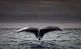
Stories from the Deep: Reflections on a Life Exploring Ireland’s North Atlantic Waters
Ken O’Sullivan spent the summers of his youth in what he describes as a ‘Huckleberry Finn-type existence’ on Fenit Island, Co Kerry, his father’s home place and that of his family since 1750. Getting the fishing bug at aged 10, his days were passed pulling nets out of freezing pre-dawn waters, and picking periwinkles and carrageen he’d sell in Tralee. Hard work, but it brought a great sense of purpose, of harvest and subsistence and self-dependence.
Little did he know, these were experiences and lessons that would stand to him when he chose a difficult but rewarding career route as a film-maker producing documentaries about the sea. This resulted in three ocean wildlife TV series including the critically acclaimed RTÉ TV series, ‘Ireland’s Deep Atlantic’, broadcast in 2018 and now a part to the Junior Cert curriculum.
Stories from the Deep is Ken’s lyrical potted memoir of a life-sustaining connection with the sea. Emigrating from recession Ireland to New York in the 1980s, O’Sullivan drove a truck, moved furniture and swept streets whilst trying to ‘make it’ in a rock band, before moving to London to work in computing on financial trading floors – but every sweltering summer Sunday was always spent craving for the sea at Lahinch, near his home place in Clare.
 Sea Fever - the new book by Ken O'Sullivan
Surrounded by pin-striped suits, money and egos, he felt suffocated, longing for the wide-open spaces of home, but he persevered, believing doing something you loved for a living wasn’t realistic. Until one-day his heart suddenly over-ruled his head. He just couldn’t work anymore and packed it in. So began his journey back home to Ireland and the sea.
Making peace with his home-place, he swam every day and explored the undersea world around Ireland, discovering breathtakingly beautiful habitats and creatures. Teaching himself underwater photography, Ken dedicated himself to making documentaries about the sea and ocean conservation, he was reminded of the summers of his youth spent fishing, and of his ancestors who made a living that way before him - for life as a film-maker was often one of subsistence and self-dependence, but it was also one of great meaning and adventure, all of which is documented in Ken’s new book, Stories from the Deep.
From childhood summers spent on Fenit Island, to the years in New York and London longing for the ocean, and stories of chasing giant whales, waves and running from storms off Ireland’s west coast and around the world, Stories from the Deep is a captivating memoir that eloquently encapsulates a magical connection with the sea.
The book is available directly from Afloat here at €16.99 plus P&P
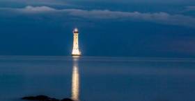
Haulbowline: Famous Lighthouse Illuminated in Memory of People Who Died in Carlingford Lough
Near the border of Northern Ireland and the Republic sits a famous lighthouse which has been illuminated in memory of people who have died in Carlingford Lough.
The Haulbowline Lighthouse, writes the Irish Examiner, is situated on the Lough, separating Co Louth and Co Down, and is thought to be the first and only lighthouse in Ireland and the UK to be externally illuminated.
The 34-metre tall lighthouse will remain lit up for the month of August to remember all those who have lost their lives there.
Carlingford Lough experienced its worst maritime disaster in 1916 when a coalship collided with a passenger ferry bound for Holyhead out of Greenore.
The disaster claimed the lives of 97 people, including passengers and crew. Only one person, a fireman on the collier, survived.
Click here for more on this story.
Clontarf Section Of Dublin Bay Cycleway To Open March
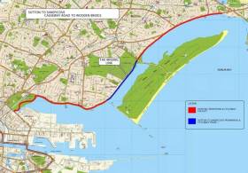
#S2S - The latest section of the Sutton to Sandycove (S2S) cycle route around Dublin Bay will not be opened till March due to delays on water main works, as Irish Cycle reports.
Once completed, the new cycle track — with mixed pedestrian and cyclist sections at junctions — will connect the pre-existing tracks between Sutton and the Bull Island causeway, and the route from Bull Bridge to East Wall Road.
As yet no section of the southside portion of the S2S has been completed, though a public consultation on the corridor from Sandymount/Merrion to Blackrock is currently open for public consultation till 31 January.
Irish Cycle has more on the story HERE.
Video Shows Child Swept Off Feet By Wave On Irish Coast
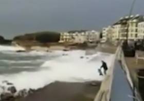
#WaterSafety - The Irish Coast Guard has once again warned the public to stay back and say safe in coastal areas during severe weather after video emerged of a young child swept off their feet by a surprise wave.
Independet.ie has video of the recent incident in Portstewart on the North Coast, where a man and the child are filmed walking along the promenade as large waves lap over the edge at high tide.
First Floating Hotel for Ireland Planned for Cork Quayside
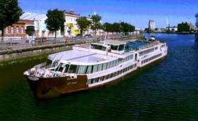
#CorkFloatel -The first floating hotel and restaurant in Ireland writes the Evening Echo is being planned for Cork's city centre quays.
The backers of the project have secured a 100-metre luxury cruise vessel that they plan to permanently moor at Penrose Quay near the Custom House and operate as a four-star hotel.
The €1.75m ship ‘My Story’ is 105 metres long and has 87 cabins, three decks, lounge areas, a large restaurant and sun deck. It previously operated on the River Rhine.
The floating vessel would be moored adjacent to Michael Collins Bridge, and modifications will also be made to the quay wall to provide gangway access.
The backers of the project Sick & Sore Limited said the vessel would enhance the leisure amenities of Cork. Based in Dublin, the company is headed by Sam Corbett, who has been involved in many maritime projects around Ireland.
He was a key part of the project to acquire the former Cork-based tender vessel the Cill Áirne, renovating and refitting it for use as a restaurant on Dublin’s North Wall Quay.
Mr Corbett told the Evening Echo the project has the backing of a major tourism and accommodation operator.
For more on this development, click here.
Climate Change Prompts New Coastal Erosion & Flooding Plan
#CoastalNotes - Coastal defences and protections against flooding are outlined in a new Department of Transport plan to prepare Ireland for future climate change, as The Irish Times reports.
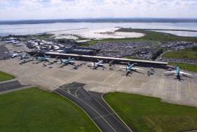
The draft consultation report, Developing Resilience to Climate Change in the Irish Transport Sector, details measures such as coastal flood defences at Shannon Airport and the railway line at Rosslare Harbour, the latter of which is inching ever closer to the cliff on the eroding shoreline.
As previously reported on Afloat.ie, the East Coast line suffered significant damage north of Wicklow town during last month’s Storm Angus.
Predicted rises in temperatures and sea level over the next century are expected to bring more of such storms, with heavier rainfalls and an increased risk of flooding and landslides in prone areas.
All of this has prompted the new plan to identify key remedial works for future-proofing the country’s transport infrastructure.
The Irish Times has more on the story HERE.
Campaign Raises Concerns Over Plans for Three-Storey Development at Dalkey's Bulloch Harbour
#BullochHarbour – Plans to redevelop the former Western Marine site at Bulloch Harbour, Dalkey in south Dublin, with a mixed development of houses, a café and shops are centre stage to a mounting campaign led by local opponents, writes Jehan Ashmore.
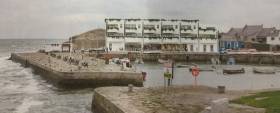
Developer Bartra Property Ltd lodged a planning permission with Dun Laoghaire-Rathdown County Council as Afloat reported early this month but further details can be revealed with the depicted image above of the proposed three-storey structure. If granted planning permission this would involve demolition of the existing single-storey warehouse previously used by Western Marine.
The marine business that was based in Dalkey for almost half a century are to relocate to new premises elsewhere but locally within the borough.
The proposed structure at Bulloch Harbour is a mixed use block of two and three stories high containing seven marine based units at ground floor level along the quayside. In addition to six residential units at ground floor to the rear and first and second floor overhead.
According to the Save Bulloch Harbour campaign they have raised concerns on the impact of such a development on the character of the scenic south Dublin Bay harbour. Overlooking the harbour is Bulloch Castle dating to the 12th century having been founded by the Cistercian Monks who held lucrative fishing rights.
A public meeting organised by Save Bulloch Harbour is to held on Thursday 5th January 2017.
The campaign is been led by the newly formed Bulloch Harbour Preservation Association, a group of boat owners, fishermen and harbour users. They claim that the harbour is one of the last small working harbours in county Dublin and the only place to keep or rent a small boat in the south of the county. The stone-cut harbour is notably popular in the summer with locals and tourists availing of marine leisure amenities.
The development in the planning application to DLRCC is described as a mixed-use marine commercial, leisure/community and residential based development, to consult click here.
According to Save Our Seafront (SOS) campaign of Dun Laoghaire Harbour, they claim the Bulloch Harbour development containing the three-storey houses are each about 5,000 square feet.
Yellow Warning For Small Craft As Storm Barbara Approaches
#Weather - Met Éireann has announced a Status Yellow small craft warning for strong gales in effect today (Wednesday 21 December) ahead of Storm Barbara’s expected arrival at the weekend.
Southwest winds will reach Force 8 at times this evening and tonight on coasts from Slyne Head to Rossan Point to Fair Head.
That’s before the deep Atlantic depression, the second winter storm of the current season, tracks eastwards well to the north of Scotland, bringing wet and windy weather across Ireland — and the risk of stormy conditions in the coastal counties of Connacht and Ulster.
Achill Island Coast Guard advises mariners and residents in these areas to expect at least an Status Orange weather warning this Friday, as the projected Force 10 winds are forecast to last up to 24 hours, according to the Connacht Telegraph.
‘World’s Biggest Wave’ Recorded Off Ireland
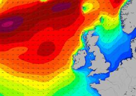
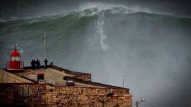
#RecordWave - Nineteen metres is the height of what’s being called the world’s largest wave, recorded recently off the North West Coast of Ireland.
Independent.ie reports on the record-breaking swell detected by a weather buoy in the North Atlantic between Ireland and Iceland, following what the World Meteorological Organization’s (WMO) Commission for Climatology described as a “very strong” cold front that passed through at more than 80km per hour.
WMO Assistant Secretary-General Wenjian Zhang said: ”This is the first time we have ever measured a wave of 19 metres. It is a remarkable record.”
The new measurement beats the previous record of 18.275 metres recorded in the North Atlantic nine years ago.
But while the news is causing gasps around the internet, for some it only confirms what’s long been known — that Ireland is on the doorstep of a big wave paradise.
Indeed, Ireland’s North West is no stranger to monster swells, with the giant surf offshore from Mullaghmore in Co Sligo a well-kept secret among the big wave surfing fraternity.
Further 'Marine' Developments at Dalkey’s Bulloch Harbour
#BullochHarbour – Afloat in October reported of a planning application for a mixed development scheme at the former premises of Western Marine at Dalkey’s Bulloch Harbour, whose waters are under pilotage district of Dublin Port Company, writes Jehan Ashmore.
The developer Bartra Property Ltd has sought planning permission for commercial and residential units located at the scenic south Dublin Bay harbour's waterfront site. It is because of this coastal site that has led to fears by locals and from a newly formed Bulloch Harbour Preservation Group. In addition Dalkey Community Council has since held meetings with the developers, citing concerns that the development will have a big impact on the harbour as a recreational and historical amenity for locals and tourists alike.
Western Marine which has yet to reveal its new home, having for almost half a century occupied the Bulloch Harbour site to where if granted permission the development would require demolition of the existing former chandlery warehouses. The development would involve the construction of six terraced homes over “marine-based activity units” and a quayside café.
It is along this stone-cut quayside hewn of Dalkey granite, is where recent developments to improve the harbour took place throughout the summer, notably the removal of a redundant five tonnes boat-hoist crane, property of Dublin Port Company. The harbour in past times used to have larger vessels trading that saw coal imported by steam-powered colliers.
The improvement works were carried out by the joint efforts of Dublin Port Company, Bulloch Harbour Group and Dalkey Tidy Towns to transform the harbour. Asides the aforementioned removal of the boat-crane coloured in distinctive pale blue, associated works involved upgrading of boat storage areas. Boat users also have new quay wall ladders and use of a refurbished slipway.
Bulloch Harbour is one of the last working harbours in Dublin Bay with its small inshore fishing boats, a large boat-hire fleet popular with anglers during the summer months along with marine leisure users mostly kayakers. The harbour is also home to the 3rd Port / 41st Dublin-Dalkey Sea Scouts which celebrates this year a 60th anniversary.
As to the origins of the quaint harbour where still stands Bulloch Castle built in the 12th century overlooking the present day harbour entrance. The castle towerhouse was established by the Cistercian monks along with lucrative fishing rights. The castle afforded protection for the Monks from that of the marauding Wicklow tribes.
Also as part of the improvement works saw the removal of the rotting boat flower bed and its restoration was completed next to the RNLI flag staff. There is no RNLI station located here but the local lifeboat RNLB Anna Livia from Dun Laoghaire Harbour does make visits to Bulloch for the annual 'Blessing of the Boats" ceremony.
The blessing service sees the 'Trent' class lifeboat berth alongside the harbour’s broad pier where coal was discharged. For a photo and more about ‘Maritime Dalkey’ (a five year long series) published in the September 2013 issue, click the Dalkey Community Council (newsletters) website.
According to the current newsletter, Dalkey Tidy Towns say that the harbour's improvement is a work in progress with more planned in 2017.


