


Displaying items by tag: Royal Canal
Royal Canal: No Passage Through Lock 13 for Deep Gate Replacement Works
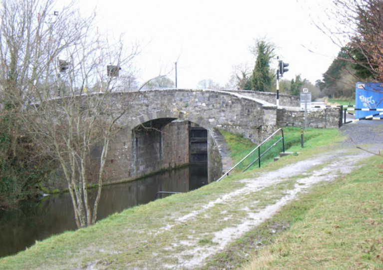
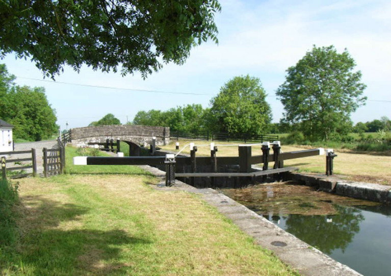
Waterways Ireland advises users of the Royal Canal between Leixlip and Maynooth in Co Kildare that there will be no boat passages permitted from next Monday 23 November until the end of January 2021 due to deep gate replacement and associated works on Lock 13 at Deey Bridge.
New Infrastructure for Waterways in €63M Greenways Funding Allocation
Refurbishment of the Longford Canal and the extension of the Grand Canal Greenway from Daingean to Edenderry are two of the projects that will be funded from a €63.5m allocation for greenways in 2021.
Transport Minister Eamon Ryan and Minister of State Hildegarde Naughton today (Monday 9 November) confirmed the funding for a range of greenways across the country.
Minister Ryan said the funding “is the highest single year amount ever allocated to greenways”.
“Indeed, it nearly equals the total amount originally allocated for the four years 2018-2021 (€53m) and shows the commitment of this Government to providing a step-change in the way in which we fund walking and cycling,” he said.
Among the inland waterways projects in the list is the €172,000 refurbishment of the Longford Canal spur of the Royal Canal, with improved infrastructure being provided along its cycleway.
In Co Offaly, €3.1 million has been allocated to fund the extension of the Grand Canal Greenway from Daingean to Edenderry, with another €1.66 million for the stretch between Daingean and Lough Boora, west of Tullamore.
“By the end of next year it will be possible to cycle the greenway the whole way from Edenderry to Lough Boora, over 50km worth of cycleway,” Minister Ryan said.
Minister Naughton added that a new greenway bridge across the River Shannon in Athlone would be funded from a €8.1 million allocation to the Galway-to-Dublin Greenway.
Planned Removal Of Vessels From Barrow & Royal Canal Later This Month
Owners of boats without permits on the Barrow Line of the Grand Canal and the Barrow Navigation face the removal of their vessels by Waterways Ireland later this month.
They are among the boats in contravention of bye-laws that will be taken from these inland waterways from Monday 26 October.
Others include vessels that appear abandoned, are double moored and/or causing obstruction (sunk) or are deemed to be or likely to cause a hazard to navigation, as per the Canal Act 1986 (Bye-Laws) 1988.
Owners of boats on the Royal Canal have been similarly advised of plans to remove non-permitted, abandoned or obstructing vessels from Monday 9 November.
Similar to last month’s planned boat removal on the Grand Canal, affected vessels have been stickered with warning notices, given suitable access, and owners — where known — have been contacted, Waterways Ireland says.
This story was updated on Wednesday 14 November with additional details about Royal Canal boat removals.
Royal Canal Closed In City For Lock Gate Repairs
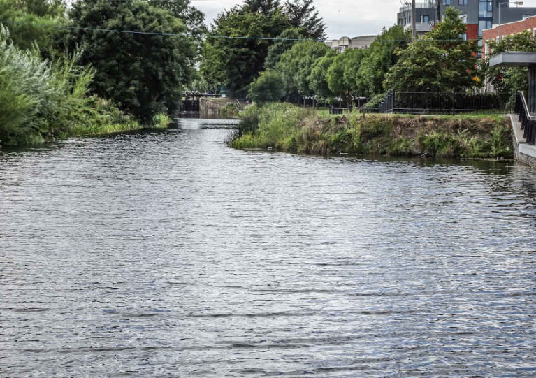
Navigation in or out of the Dublin on the Royal Canal is currently suspended until the completion of works on three separate lock gates.
Waterways Ireland says repair and upgrading works are required at Lock 12 in Castleknock, Lock 10 in Ashtown and the Spencer Dock Sea Lock.
Passage through the city on the Northside inland waterway will remain closed until such time as these works are completed and the locks are again operational.
Boat Restrictions For Canoe Polo Events On Royal Canal In Mullingar
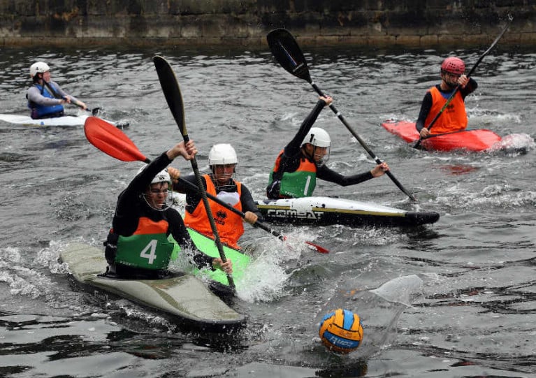
Waterways Ireland advises all masters and users of the Royal Canal that canoe polo events will take place in the vicinity of the harbour in Mullingar this weekend, 27-28 September and the following Sunday, 4 October.
Boat movements in the area will be restricted on the inland waterway for the duration of the events. Masters of vessels should navigate the area with caution and comply with guidance from marshals.
Further information may be obtained from Mullingar Harbour Canoe Polo at 086 244 62 20.
Emergency Repairs To Royal Canal Embankment In Westmeath Until End of Month
Waterways Ireland advises that emergency works on the Royal Canal embankment in Westmeath will continue until the end of this month.
As previously reported on Afloat.ie, the inland waterway between the 34th and 35th locks, at Balroe and Ballynacarrigy respectively, was closed for emergency repairs following poor weather at the end of August.
These repair works will now continue until Monday 28 September and navigation in this section will not resume before that date.
National Famine Way Evokes Story Of Forced Migration In Black ’47
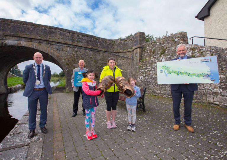
A new interactive outdoor experience along the Royal Canal hopes to bring to life the experience of famine emigrants who walked from Strokestown to Dublin at the height of An Gorta Mór.
The National Famine Way was launched last Thursday 10 September by the National Famine Museum at Strokestown Park with a special National Famine Way Passport/Guide and OSI trail map.
The 14-page guidebook highlights local historical landmarks and allows walkers and cyclists to record their progress with 27 stage stamps along the specially developed 165km heritage route.
The trail details the ill-fated journey of 1,490 famine emigrants who walked from Strokestown Park in Co Roscommon to ships in the capital in 1847, a year which became infamous as ‘Black ’47’.
And the new Passport/Guide is centred around the walk of one of the original famine emigrants from Strokestown Park: 12-year-old Daniel Tighe, who remarkably survived the horrific journey to Quebec, Canada on one of the worst famine ships.
Award-winning author Marita Conlon-McKenna wrote short pieces that reimagine Daniel’s journey in 1847 and are connected to over 30 pairs of bronze children’s shoes dotted along the route. They are also available as audio recordings to listen to at www.nationalfamineway.ie
The National Famine Way crosses six counties — Roscommon, Longford, Westmeath, Meath, Kildare and Fingal — on the way to Dublin, mostly along the Royal Canal, and a completion certificate is awarded at the end of the trail at EPIC: The Irish Emigration Museum at George’s Dock.
The National Famine Museum collaborated on the project with Waterways Ireland and county councils along the route, which is designed to be accessible for families, schools, casual walkers and cyclists — as well as those who want to learn more about the famine and Ireland’s history.
Anne O’Donoghue, chief executive of the Irish Heritage Trust, which cares for Strokestown Park and the National Famine Museum, said: “This heritage trail not only links two significant Irish museums but also makes the connection between Ireland’s Hidden Heartlands and Ireland’s Ancient East.
“In addition to the health, historical, cultural and arts impact, the trail also has the potential to open up rural Ireland and offer an economic boost to local communities with cycling hire, cafés, bars, shops and accommodation all benefiting with an expected economic impact of over €2 million spent along the route.”
Emergency Embankment Repairs On Royal Canal In Westmeath

Waterways Ireland advises masters and users of vessels on the Royal Canal that the inland waterway is closed between Balroe and Ballynacarrigy in Co Westmeath.
Navigation will be prohibited between the 34th and 35th locks for the next two weeks to facilitate emergency repairs to the embankment following this past week’s poor weather.

Waterways Ireland advises boaters on the Royal Canal that there will be restrictions to navigation in the Castleknock area west of Lock 12 from next Monday 18 May until Friday 29 May.
This is for previously notified site investigation works on the waterway that were delayed due to Covid-19 restrictions.
A pontoon is being used as part of works west of Lock 12 towards Coolmine, and while it is in place other craft will be unable to pass.
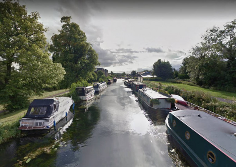
For those of you missing Ireland’s inland waterways, you can now view the stunning Royal Canal, Grand Canal Barrow Line and Barrow Navigation along with the Shannon through Google Maps and Google Earth.
Waterways Ireland, in partnership with the Google Trekker Loan Programme, has continued to capture Ireland’s inland waterways and make them accessible online.
Last year, street view imagery was captured along the Royal Canal, Grand Canal Barrow Line and Barrow Navigation to compliment the stunning Shannon imagery captured in 2018.
So now you can follow some of Ireland’s most beautiful and popular waterways destinations from the comfort of your own home — and hopefully plan a visit when conditions allow.
As previously reported on Afloat.ie, winter mooring has been extended until Sunday 31 May to ease the pressure on the inland boating community amid the current coronavirus restrictions.
And while the outdoor exercise distance has been extended to 5k from home, the advice for those using canal towpaths to maintain social distancing remains in place.


, marking also a first presence in this market.")


 as lead helm, rounds the Fastnet Rock on the way to the overall win in 1987")


 Michael Murphy Schull Harbour Sailing Club (SHSC), Eric Coogan Heineken Ireland, Mark Murphy, Commodore SHSC, Jack Allen SHSC, Carmel O'Regan SHSC, Cornelious Ndlovu, Schull Harbour Hotel Operations Manager and Derval Murphy SHSC")
