


Displaying items by tag: pier
Aran Island businessman Tarlach de Blacam has called on Minister for Rural and Community Development Heather Humphreys to withdraw a tender for a new cargo vessel service to Inis Meáin due to the “highly dangerous” nature of the main pier.
As The Sunday Independent reports, de Blacam of Cniotáil Inis Meáin (Inis Meáin Knitting Company) has warned that lives are at risk if the pier at An Córa continues to be used.
Two people died, and there have been several ferry accidents at the pier at An Córa on Inis Meáin since its construction.
 Tarlach de Blacam of Inis Meain Photo: Joe O'Shaughnessy
Former Gaeltacht and Islands minister Eamon Ó Cuív (FF) says he supports de Blacam’s call and says an alternative and safer pier, An Caladh Mór, should be completed and used by State-funded ferry services.
Ó Cuiv says Ms Humphreys, who has just published a new ten-year island policy this week, must respond positively to the demand on safety grounds.
A study by consultants Kirk McClure Morton in 2004 commissioned by Galway County Council and funded by the Department of the Gaeltacht stated that the pier at An Córa on Inis Meáin could only provide safe berthage for 70 per cent of the time “in a typical year”.
The 2004 report identified the alternative, An Caladh Mór, as “most suitable for providing safe and reliable access to Inis Meáin by sea”.
Read The Sunday Independent here
Consultants Appointed To Design Doolin Pier Facilities
Clare County Council has today (Tuesday, 12 April 2016) announced the appointment of consultants for the design of proposed shoreline facilities at Doolin Pier, including a new visitor facility.
A new €6m pier was officially opened in June 2015 in the North Clare coastal village where currently an estimated 70,000 to 90,000 passengers are carried to and from the Aran Islands by Doolin-based ferry operators and this is expanding annually with the introduction of the Wild Atlantic Way through this part of County Clare.
The Council says the proposed visitor facility will replace existing temporary structures and will be part of a masterplan proposal relating to the development of the Doolin Pier area including the pier area in general, vehicle routes to and from Doolin village, and parking and traffic management.
Among the functions and operations being considered within the overall plan is the sale of tickets by a number of Ferry Operators, the serving of food, and the provision of toilet facilities for patrons and staff, public waiting/viewing area, luggage holding area, tourism information, car/bike parking, waste management, harbour master office, and health and safety requirements.
The architect-led design team comprises Bucholz McEvoy Architects (Architects), Punch Consulting Engineers (Civil Structural Engineers), IN2 Engineering (M&E Engineers), Aecom (Quantity Surveyor), Aegis Safety Ltd (PSDP safety) and HRA Planning (Planning).
“The key to the success of this project is the design of a sustainable product that is delivered in an environmentally, socially and economically balanced way to ensure longevity and success of the pier and maximise the potential of the new pier infrastructure already invested,” said Tom Coughlan, Chief Executive.
The consultation process, expected to commence during the summer months, will be taken into consideration during the design development to assist in maximising the potential of the site and also to facilitate an opportunity to obtain valuable local knowledge and insight from the primary users.
"The commencement of the design stage of this project is very welcome and it begins the process of delivering a visitor facility at Doolin which has been long sought after by pier users," said Cllr. James Breen, Cathaoirleach of Clare County Council.
"Doolin Pier is one of the most important pieces of infrastructure in North Clare and the primary tourism nautical link with the islands from County Clare. It is important therefore, that it is complemented with the delivery of important ancillary services and facilities as those proposed," said Cllr. Breen.
The appointment of an architect-led design team to develop a full design brief and the Council's decision to hold a public consultation process also has been welcomed by Cllr. Christy Curtin, Chair of the West Clare Municipal District.
"The proposed facilities will greatly improve the visitor experience in Doolin and they will help to further drive ferry activity between North Clare and the Aran Islands and the Cliffs of Moher during the tourist season, as well as accommodate other activities – both leisure-based and otherwise," said Cllr. Curtin.
More on visiting Doolin can be found here
Funding Allocated for Works at Kilkee Pier & Slipway
Clare County Council today confirmed the Department of Agriculture, Food & the Marine has approved its application for funding for coastal infrastructure work improvements at Kilkee, Co Clare.
The Local Authority says the funding will go towards providing a new entrance to the slipway and pier area in Kilkee.
Cyril Feeney, Area Engineer, West Clare Municipal District, commented: "This proposed new entrance will address a long standing issue of access to the pier and slipway area through the existing overhead barriers at the East End car park, whilst also separating the marine and leisure boating activity from the general car parking area."
"These proposed works, which have been discussed with Elected Members, Kilkee Development Association and users of the pier, will allow for controlled access to the pier and slipway and also provide additional security to the area with the installation of CCTV and lighting," he added.
Weather permitting, Clare County Council anticipates that the proposed works will commence in the next fortnight.
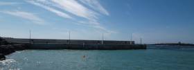
Marine Notice: Kinsale Pier Extension
#MarineNotice - Cork County Council is due to commence a 15-metre extension of the Town Pier in Kinsale in Co Cork.
The works are due to take place from this week till early December 2013, and will comprise the excavation of the sea bed from a pontoon barge (barge to be confirmed) for the installation of a mass concrete base and pier walls (15m x 30m).
Divers will be deployed throughout the underwater works. Hydrographic surveying will be carried out at intermittent stages throughout the works. Buoys will be deployed to mark the works area around the pier.
The commercial berth and north berth of the pier will remain operational throughout the works.
For further details of the works area see Marine Notice No 21 of 2013, a PDF of which is available to read or download HERE.
Duncannon Pier Pontoon. Berths for Boats in County Wexford
Duncannon Pier Pontoon is at Waterford Harbour’s eastern shore, six miles north of Hook Head lighthouse. It is a small fishing port where you may come alongside the commercial wall. In 2010, following the provision of €56,250 to improve boat access on piers along the Hook Peninsula such as Ballyhack, Slade and Arthurstown Wexford County Council installed a small pontoon facility to encourage leisure boating in the area. As well as local boaters the faciility is also proving popular with local fishermen.
€39.5m Pier Development Opens in Castletownbere

#CASTLETOWNBERE –The Minister for Agriculture, Food and the Marine, Simon Coveney TD officially opened the major new €39.5 million Dinish Wharf Development on Dinish Island at Castletownbere Fishery Harbour Centre and also launched the community led development strategy - 'Castletownbere - An Economic Survey to Determine the Level of Seafood Activity and Establish its Economic Importance for the Region' in Castletownbere today, the 30th April.
Castletownbere Fishery Harbour Centre is one of Ireland's major fishing ports and is Ireland's largest whitefish port. Proximity to rich fishing grounds makes Castletownbere an attractive fish landing location for Irish and foreign vessels. The major pier development on Dinish Island which commenced in 2005 as part of a multi stage project now provides world class infrastructure to grow the marine industries in Castletownbere to new levels. The project is a major infrastructural development that included the dredging of the approach channel, inner harbour and berthing quay at Dinish Island, the construction of a 215m quay and associated infrastructure. The harbour can now accommodate more modern and larger vessels in our fleet and visiting fleets. The development will address congestion in the harbour and presents possibilities for other large fishing vessels to berth at Dinish Island increasing the supply of fish for processing or export and generating greater economic activity. In addition, cruise vessels, large commercial or exploration vessels will also now be able to land into and operate out of Castletownbere.
The report - 'Castletownbere - An Economic Survey to Determine the Level of Seafood Activity and Establish its Economic Importance for the Region' which was facilitated by BIM is the result of a collaborative action by local stakeholders.
The report details qualitative and quantative information on the value that fishing contributes to the town directly and indirectly through ancillary services. Fishing has helped to sustain and develop the local economy. The report identifies new opportunities for the area.
Minister Coveney said; "The new Dinish Wharf Development at Castletownbere Fishery Harbour Centre is an impressive piece of infrastructure. It provides a springboard to grow the fishing, aquaculture and associated industries to new heights and opens the door to the opportunities identified in the report being launched today. I would like to acknowledge the contribution of everyone associated with the construction of this facility, which was lead by my Department. I would also like to congratulate and recognise the hard work that has gone into the compilation of this very detailed report on Castletownbere. As Ireland's largest whitefish port, we are all aware of the integral part the town plays in our fishing industry but it is inspiring to see that local community representatives are now looking to further develop ways to grow the fishing and aquaculture output in the area with a view to generating increased revenue and employment".
Minister Coveney continued "I am very impressed by the initiative and hard work of the local community and stakeholders who have prepared a clear and forward thinking report on the future opportunities to grow employment and economic activity in Castletownbere. I would like to, in particular, thank Eibhlin O'Sullivan (Irish South and West Fishermen's Producer Organisation (IS&WFPO) and Frank Fleming (key actor in the local seafood sector) for their work in bringing together this important work. I would also like to thank Michael Keatinge of BIM for his contribution to the report. This report can now be used as a strategy to drive the seafood sector in Castletownbere forward and deliver much needed job creation and economic activity in the south west based not just on seafood but also on the other economic activities which have been identified in the report as offering potential. The major investment in the harbour can now be the launch pad for delivering on the potential identified in the Report."
Finally Minister Coveney said "Adding value to fish landed in Castletownbere is key to the economic future of the area. For every €1 million of fish landed, a further €2.12m is created by the processing and ancillary sectors. If we can process more Irish and foreign landings, the area will benefit substantially and we are currently working through BIM and the industry to achieve this."
A number of key actions are outlined in the report including:
Improved co-operation in the catching sector
New gear adaptations and techniques
Tuna processing
Surimi processing of boarfish as well as other human consumption options
Frozen prawns at sea brand
Greater differentiation of product in the market place
Explore the potential for adding value from foreign landings
Increase aquaculture development and support including processing.
The report proposes that a local stakeholder group is tasked to implement the actions set out in the report.
Castletownbere is one of six Fishery Harbour Centres that is owned, managed and Developed by the Department of Agriculture, Food and the Marine (others are located at Dunmore East, Howth, Killybegs, Ros an Mhíl and Dingle). The Castletownbere Fishery Harbour Centre Development was initiated following the introduction of more modern and lager fishing vessels carrying greater draft (up to 6 metres) and to ease congestion within the harbour. The development consists of the construction of a new 215 metre quay, a dredged berthing basin and a dredged approach channel.
- Dredging
Due to the historic use of antifouling paints on boats significant concentrations of contaminated sediments were found within the harbour. Specialist dredging techniques, including seabed profiling and use of an eco-dredging bucket were used to bring dredge material ashore. The silt was then stabilised using cement bentonite prior to shipping to a licensed disposal site in Germany.
The remaining uncontaminated dredging material was, where suitable, used to reclaim a substantial area of foreshore. A quantity of material (silt) was disposed at sea.
The deepened and widened approach and manoeuvring channels will allow greater access for deep sea and inshore fishing vessels. Two new navigation piles were constructed marking the approach channel further improving navigational safety within the harbour.
- New Dinish Wharf
The construction of the new Dinish Wharf comprised of two separate elements. The first was a new mass concrete wall supporting a reinforced concrete deck. The completion of this new quay allowed the fishing fleet to move from the existing old Dinish Wharf, thereby keeping the harbour fully operational during construction.
The second stage was replacement of the old Dinish Wharf Pier, an open timber fender construction, which was structurally inadequate. The replacement structure is a suspended reinforced concrete slab supported on steel cased reinforce concrete piles, with a concrete face.
The completed Dinish Wharf development provides a total berthing length of 266 metres (including end return walls); and a 0.7 hectare deck surface working area. The total cost of developing the new quay, dredging berthing basin and dredging approach channel amounted to €39.5 million
Bord Iascaigh Mhara (BIM), the Irish Sea Fisheries Board is the Irish State agency with responsibility for developing the Irish Sea Fishing and Aquaculture industries. BIM provides commercially relevant and innovative services to the Irish seafood industry that drive growth opportunities, add value, enhance competitiveness and create jobs in a sustainable, natural resource based industry for the benefit of coastal communities. www.bim.ie
- Castletownbere is the primary urban economic and social centre on the Beara Peninsula in South West Ireland. The harbour is one of the largest natural harbours in the world and is formed by Dinish Island to the south (hosting most of the fisheries infrastructure and processing activity) and the town of Castletownbere to the north.
- The town is set in a dramatic and largely unspoilt landscape that is an important asset in the development of secondary, tourist-based, economic activity.
- Castletownbere remains the largest whitefish port in Ireland, with vessels from Spain, Scotland and France making significant landings of whitefish to the port alongside the local fleet.
- The total landed value of fish was €50.4 million in 2010, with around 11,000 tonnes with a value of €23 million landed by Irish vessels targeting pelagic species, monkfish, other whitefish and tuna and 7,500 tonnes with a value of €27 million from foreign vessels targeting monkfish, hake and megrim. There are also significant landings of shellfish (Nephrops, crab and lobster) by the Irish inshore fleet.
The group that produced the report 'Castletownbere - An Economic Survey to Determine the Level of Seafood Activity and Establish its Economic Importance for the Region' was chaired by Eibhlin O'Sullivan (Irish South and West Fishermen's Producer Organisation (IS&WFPO) with the assistance of Frank Fleming (consultant to the IS&WFPO), and co-ordinated by Rod Cappell (Poseidon Aquatic Resource Management Ltd).
The report details how the fish catching and processing sectors in Castletownbere account for over half (54%) of the town's economic activity (the total economic activity for the town is an estimated €146 million). With the inclusion of aquaculture and ancillary sectors, this rises to 86% fisheries-related turnover with the induced spend by employees of these sectors making a substantial contribution to the service and retail sector of the town. Local companies supply oil to the local fleet, foreign fleet and also to vessels based outside of Castletownbere. The total value of the ancillary sector, based on local fleet sales, is estimated to be €19 million (17% of total turnover).
The population of Castletownbere is estimated to be between 900 and 1,000. In terms of employment, 660 jobs representing 81% of the employment in Castletownbere, are related to fishing. This remarkably high level of dependency has been sustained in the area throughout the year as fish is landed from a wide range of fisheries.
Europe's Largest Organic Fish Farm Proposed for Aran Islands
#FISHING - Bord Iascaigh Mhara (BIM) has begun the consultation process for a proposed new deep-sea fish farm in the Aran Islands, The Irish Times reports.
The 15,000-tonne organic salmon farm would be located off Inis Oírr on a 500-hectare site in Galway Bay, and would be one of the largest of its kind in Europe.
Approval of the project could see the creation of 350 direct and 150 indirect jobs, says BIM. It will be owned by the body on behalf of the State but leased to operators on a franchise basis.
The scheme has been welcomed by Comhar Caomhán Inis Oírr, but the island co-op said it was important that a promised €8-million pier for the island is constructed first to provide the necessary infrastructure.
The Irish Times has more on the story HERE.
Clare County Council Approves Doolin Development

The controversial €6 million deveopment of Doolin Point has been backed unanimously by Clare councillors.
Clare county manager Tom Coughlan had recommended giving approval for the revised plan, which was submitted after surfers expressed concerns over the impact of the original scheme on waves in the area.
The scheme has already received support from the Doolin Coast Guard Unit and local tourism and business groups.
But according to The Irish Times, the Irish Surfing Association (ISA) maintains that even the amended plans – which move the new pier 25m further away from the surf – would destroy the "world renowned" Crab Island and Doolin Point waves.
The ISA and West Coast Surf Club have warned the council that loss of the waves could cost up to €33 million per year in revenue generated by surf tourism in the area - a concern backed by Fáilte Ireland.
The Doolin Point pier project must be completed by the end of this year in order for the council to draw the €6 million in Government funding required.
Coastguard Calls for Doolin Pier Go-Ahead
The Doolin Coast Guard Unit has urged Clare County Council to continue its €6 million development plan for Doolin Point.
The pier plan has faced opposition from surfers who argue that the development will ruin the popular waves in the area.
The Irish Examiner reports that in the latest submission to the council, the Doolin Coast Guard Unit supports the development, claiming the current pier is "regularly over-congested" in peak tourist periods.
"This, in turn, can make it very difficult for our members to launch our boats in an efficient manner where time is of the essence," states the unit's officer in charge Mattie Shannon.
A separate submission by Doolin Tourism and Doolin Community Harbour Co-op, backed by 150 signatures from locals, called on Clare County Council to go ahead with the plan.
They dismissed surfers' concerns, stating that "the proposed pier and breakwater will not create a back wash effect" on the surfing waves at Crab Island and other areas.
The Irish Examiner has more on the story HERE.
Dun Laoghaire Lifeboat Saves Woman after Fall from Pier
Dun Laoghaire RNLI inshore Lifeboat Realt na Mara launched this evening at 5.02pm to rescue a woman who had fallen into the harbour close by the East Pier lighthouse.
It is believed the woman stumbled while walking along the popular pier and fell into the harbour. Her cries for help were heard by people walking on the pier, who in turn contacted the Coast guard and threw a lifebuoy into the water to keep her afloat until help arrived.
The RNLI inshore lifeboat was quickly launched and on scene in minutes. It was dark with an easterly wind blowing in the harbour. The lifeboat volunteers recovered the freezing woman from the water and brought her alongside the pier. She was then winched onboard the Coast Guard Helicopter and transferred to hospital for medical treatment.
Stephen Wynne, Dun Laoghaire RNLI Lifeboat Operations Manager said, "This is a very lucky woman. Without the quick action of the members of the public who raised the alarm and gave assistance along with the rapid response of the Dun Laoghaire RNLI volunteer lifeboat crew, we would be dealing with a tragedy today."
Related Safety posts
RNLI Lifeboats in Ireland
Safety News
Rescue News from RNLI Lifeboats in Ireland
Coast Guard News from Ireland
Water Safety News from Ireland
Marine Casualty Investigation Board News
Marine Warnings


, marking also a first presence in this market.")


 Michael Murphy Schull Harbour Sailing Club (SHSC), Eric Coogan Heineken Ireland, Mark Murphy, Commodore SHSC, Jack Allen SHSC, Carmel O'Regan SHSC, Cornelious Ndlovu, Schull Harbour Hotel Operations Manager and Derval Murphy SHSC")


