


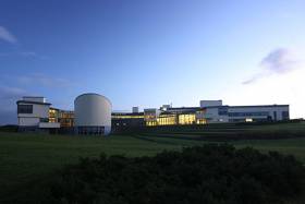
Displaying items by tag: research
€108,000 Awarded To Early-Stage Marine Researchers
#MarineScience - The Marine Institute awarded €108,000 in grant-aid funding to 94 recipients in 2017 under its Networking & Travel Awards.
This scheme, funded under the Marine Research Programme with the support of the Government, makes awards to provide assistance for networking activities that support the goals of the Harnessing Our Ocean Wealth Strategy.
They also constitute an important part of the implementation of the National Marine Research and Innovation Strategy 2017-2021, which was launched in June this year.
The main focus of the Networking & Travel Awards is to give early-stage researchers, post-graduate students, research assistants and intern staff an opportunity to present their marine research to an international audience, network with international marine experts, and promote research carried out in Ireland on the global stage.
Seventy-seven applicants received travel awards for this purpose. A further nine awards were made in support of hosting marine conferences or workshops in Ireland and for the establishment of international networks for leveraging marine funding.
A final eight awards were for the mobility of research expertise by SMEs for the transfer of knowledge in science and technology towards the development of the marine sector.
Since 2014, 41 participating Irish marine organisations have successfully partnered in 77 marine-related EU projects, bringing a minimum of €29.7 million in EU grant-aid to Ireland.
This represents 7% of the total available drawdown for Ireland for a range of research, development and innovation projects.
Next year’s call for the Marine Institute Networking & Travel Awards will open a month from now in mid-January.
Connemara ‘Marine Innovation Park’ Preps New Planning Application
#MarineScience - A new planning application is set to be submitted for the proposed ‘marine innovation park’ in Connemara, as Galway Bay FM reports.
Páirc na Mara is envisaged as a low-carbon marine industry hub over nine hectares, with a focus on aquaculture research.
As previously reported on Afloat.ie, the new research cluster would form part of a network including the existing Marine Institute facilities at Newport in Co Mayo.
The deadline for expressions of interest in the revised project is tomorrow, Friday 1 December.
Galway Bay FM has more on the story HERE.
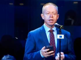
Minister Announces Funding For Marine Research Projects
#MarineScience - Marine Minister Michael Creed has announced the awarding of €3.3 million grant funding through the Marine Institute to research projects in specialist marine equipment and ocean law.
Some 19 funding grants in total have been made in the area of specialist marine equipment and small infrastructure, totalling more than €2.5 million.
The Higher Education Institutes (HEI) sector will receive 14 of these grants with five being granted to industry-led proposals (SMEs). The funding grants range from €20,000 to €200,000, with industry being funded at 75 per cent — meaning that these will also leverage private investment in specialist marine equipment for research and innovation development.
The ocean law and marine governance grant is being made to a partnership project between the MaREI Centre and University College of Cork School of Law. The funding amounts to €800,000 and will run over four years, employing three researchers with contributions from 12 MaREI and five UCC School of Law staff.
More than 20 researchers attended the announcement of the grants yesterday (Wednesday 22 November) in Dublin city centre.
“I’m delighted to announce these funding grants which herald the next step forward for many new projects in our marine sector,” said Minister Creed. “The funding for marine research equipment helps to target a gap in funding that exists between supports available to Higher Education Institutes via HEA and support from Ireland’s development agencies such as SFI and Enterprise Ireland.
“These grants will allow the marine research and innovation community to purchase specialist equipment needed to support their current and future research activities.”
Peter Heffernan, CEO of the Marine Institute, said the funding grants would enable pioneering marine research projects to develop in decades to come.
“The ocean law and marine governance grant marks a very important step in investing further in the area of marine law and governance,” he said.
“During the development of the National Marine Research and Innovation Strategy, it was indicated that this important research area should be supported and the Marine Institute, Department of Agriculture, Food and the Marine and the Department of Foreign Affairs were consulted and a call was launched for a project-based funding grant.
“We are delighted that the MaREI Centre and UCC School of Law will be collaborating on this project which is called Navigate and will be led and co-ordinated by Dr Anne Marie O’Hagan, a senior post-doctoral research fellow in the Marine and Coastal Governance Group in the MaREI Centre.”
Biologist Presents Novel Approach To Boosting Wild Atlantic Salmon Numbers In Irish Rivers
#Angling - An international fisheries biologist has suggested a novel approach to boosting numbers of wild Atlantic salmon in Irish rivers — by moving wild fry from more abundant areas to weaker spots within a catchment.
Dr Kyle Young, a research associate from the University of Zurich, was recently invited to give a presentation as part of the Inland Fisheries Ireland (IFI) Research Seminar Series, at which he outlined his proposal for translocation of salmon fry.
Natural survival bottlenecks are experienced by Atlantic salmon through each stage of its lifecycle, from egg to fry, fry to parr, parr to smolt and so on, he outlined. Under natural conditions, the vast majority of wild salmon fry do not survive to become parr.
These so called “doomed majorities” can be present in sections of rivers with an initial abundance of emergent salmon fry, whose subsequent population size is constrained by density-dependent mortality and by the carrying capacity of the habitat.
Dr Young proposes that such fry could be translocated from these areas to low or non-productive sections of the same river where suitable habitat is present, in an effort to potentially boost the overall production of native wild salmon populations.
This approach may minimise the unintended negative consequences of more conventional salmon stocking programmes where wild salmon broodstock are taken from spawning areas and eggs fertilised in the hatchery.
Hatchery-origin fish are also typically less well-adapted to thrive than their wild compatriots and the overall fitness of the wild component of a population may be compromised through lower overall survival, interbreeding and competition for resources with stocked fish.
IFI’s head of R&D Dr Cathal Gallagher said: “We were delighted to welcome Dr Young to our headquarters in Citywest to further explore the potential of this novel proposal to boost wild Atlantic salmon populations.
“This iconic species is of both major conservation and socio-economic importance to Ireland. Although wild salmon are widely distributed in Irish freshwaters, their long-term sustainability remains under continued threat from a variety of factors. These include habitat degradation, issues related to aquaculture, oceanic and climatic change, pollution, illegal fishing and over-fishing.”
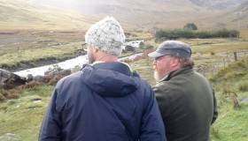
Following the seminar, Dr Young visited the National Salmonid Index Catchment (NSIC) at the River Erriff, the Galway Salmon Fishery and the Cong hatchery facility to further discuss his theorised approach to salmon stocking with IFI management, field staff and researchers.
IFI are discussing the possibility of undertaking experimental trials with this novel approach to boost juvenile salmon production upstream of their trapping facilities in the Erriff catchment.
High Genetic Diversity In Irish Brown Trout Stocks, Conference Hears
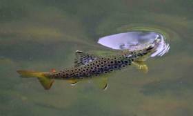
#BrownTrout - There is a high level of genetic diversity in brown trout populations evident from all catchments studied.
That’s according to the findings of a groundbreaking ‘citizen science’ research into the genetic makeup of Ireland’s brown trout and sea trout stocks, presented at a conference in Athlone yesterday (Tuesday 17 October).
Inland Fisheries Ireland (IFI), in collaboration with Queen’s University Belfast (QUB), presented the findings of a three-year research study entitled ‘Understanding Brown Trout - Genes, Ecology and Citizen Science’ at a one-day conference at the Hodson Bay Hotel.
IFI says the findings of the study will provide valuable information on how genetic diversity is distributed among trout populations within certain catchments.
A succession of expert speakers presented the findings, which encompassed ‘citizen science’ — research conducted in whole or in part by amateur or non-professional anglers and participants — as well as detailed genetic research.
The main areas in the study included selected Dublin rivers, the Moy catchment area in Co Mayo, and the Shannon system (Lough Derg, Lough Ree and Lough Sheelin), in addition to Lough Corrib and Lough Ramor.
Among the key findings presented today were:
- There is a high level of genetic diversity in brown trout populations evident from all catchments studied. For example, there are 27 genetic groupings of brown trout populations in the Moy catchment, 17 in the Liffey, and 34 in the Lough Ree catchment, while there are 40 in the Lough Derg catchment.
- Western tributaries keep Lough Conn well stocked with brown trout, in particular the River Addergoole complex and River Deel system (together they contribute 77% to adult stocks of the lake).
- Key contributors of brown trout to Lough Ree are the River Inny and the Camlin River (over 80%).
- Barriers and poor water quality were found to be significant factors in unravelling genetic diversity patterns.
The project also highlighted how successful ‘citizen science’ can be with IFI, QUB and angling clubs working well together. Indeed, ‘citizen science’ working with angling communities from across all three main project areas was critical to the success of the project.
Speaking after the conference, Dr Cathal Gallagher, IFI director of research and development, said it was “a huge success and the findings of the three-year study will be of interest to anglers, conservationists, fishery managers and the wider public.
“More crucially, it has been an exciting and exhaustive project that will have real practical applications and will assist Inland Fisheries Ireland in making the correct and most cost effective fisheries management and conservation decisions.”
Commitments To €6M Funding For Seabed Mapping & Marine Research Welcomed
#MarineScience - The Marine Institute has welcomed commitments of €6 million in funding for seabed mapping and marine research announced at the fourth Our Ocean Conference in Malta last week.
Ciaran Cannon, Minister of State for International Development, addressed representatives from more than 200 countries at the EU conference, stressing the importance of promoting and protecting the world's marine resources for present and future generations.
Aside from the new funding for mapping and research, Minister Cannon also announced the roll-out of a 'groundbreaking' Global Citizenship marine environment education module for school children from September 2017 onwards.
“This programme will increase ocean literacy by fostering understanding of the important role our oceans play in our lives, how individual actions can affect them and how we can act together to protect them,” he said.
Marine Institute chief executive Dr Peter Heffernan explained that the new module supports the aims of the institute’s own Explorers Education Programme “to build on Ireland's marine and maritime heritage by increasing awareness of the value, opportunities and social benefits of our ocean wealth and identity.”
Meanwhile, Minister Cannon committed to €320,000 in funding to the 2017 Clean Coasts programme and its more than 550 volunteer groups established in Ireland to date.
Also noted was an expansion of the 2015 Fishing for Litter programme, and continued contributions to support developing countries engagement at the UN on issues relating to marine governance.
In addition, Minister Cannon reaffirmed Ireland's commitment to prohibit the sale or manufacture of certain products containing microbeads, announced at the UN in June of this year.
Offshore Earthquakes & Deep Sea Corals Among 26 Projects Awarded €45m By SFI
#MarineScience - Offshore earthquakes and cold water coral in subsea canyons in Irish waters are among 26 projects awarded €45 million in research investment through the Science Foundation Ireland's Investigators Programme, announced last week by Minister of State for Training and Skills, John Halligan.
“This funding recognises some of Ireland’s top researchers and enables them to advance vital research areas in Ireland,” said the minister. “I am confident that the teams being supported will generate important new scientific breakthroughs.”
The 26 research projects will support 94 research positions over the next five years.
“In addition, today’s investment provides 20 companies with access to invaluable expertise and infrastructure across the country,” said Minister Halligan. “These collaborations between industry and academia are integral to further enhancing Ireland’s reputation for research excellence.”
To strengthen and accelerate research in key strategic areas of national interest, Science Foundation Ireland (SFI) collaborates with several funding agencies and public bodies through the SFI Investigators Programme.
Six of the research projects received co-funding worth a total of €3 million from Teagasc, the Geological Survey of Ireland, the Marine Institute, and the Environmental Protection Agency. The Marine Institute and the Geological Survey of Ireland are co-funding two marine science awards with SFI to the value of €2.65 million.
Professor Sergei Lebedev of the Dublin Institute of Advanced Studies (DIAS) has been awarded €1,248,989 to investigate the structure, evolution and seismic hazard of Ireland’s offshore territory.
With 90% of Ireland’s territory offshore, it represents vast resources but also hazards, with offshore earthquakes posing the biggest risk with the potential to trigger undersea landslides and tsunamis.
Prof Lebedev’s team will for the first time deploy an array of ocean-bottom, broadband seismometers offshore which, together with existing arrays onshore, will cover the entire Irish territory.
Professor Andy Wheeler of University College Cork has been awarded €874,329 to explore and monitor cold water corals in submarine canyons in the deep ocean and determine their sensitivity to climate change and fisheries and oil industry impacts.
Prof Wheeler’s team will used advanced robotic technology and novel 3D visualisation and will make recommendations for sustainable responsible fisheries and hydrocarbon activity and for effective management during climate change.
Dr Ciaran Kelly, R&D manager at the Marine Institute, said, “The Marine Institute is delighted to partner with SFI again in co-funding these important projects through the investigators programme, together with our INFOMAR programme partners, Geological Survey of Ireland.
“This collaboration will accelerate our knowledge of key processes of the deep ocean bringing longstanding benefits to society.”
For more information on the 26 projects funded through the SFI Investigators Programme see www.sfi.ie.
Call For Marine Researchers To Apply For Fulbright Irish Awards

#MarineScience - The Marine Institute and the Fulbright Commission are once again offering a unique opportunity for an Irish PhD candidate or scholar to travel to the USA to research in the fields of marine science or a marine-related business sector.
The Fulbright Commission is seeking applicants with academic and personal excellence, strong leadership potential and a commitment to being a Fulbrighter. The commission is particularly interested in receiving applications for this award from candidates who are exploring:
- Marine Sensor Technologies and Observation Systems
- Maritime Economics
- Marine Spatial Planning
- Maritime Law and Security
- Renewable Ocean Energy
- Marine Biotechnology (including Functional Foods)
- Marine Environment
- Oceanographic Modelling
- Shipping
- Seafood Safety
- Ecosystems-based Fisheries Management
- Big Data, and Sustainable Development
The 2018-2019 Fulbright Irish Awards supporting Irish and EU citizens to study, research or teach in the USA are now open for application. All applications are due by 4pm on Tuesday 31 October.
These globally-recognised and prestigious awards, operating between the United States and 155 countries, were founded by Senator J William Fulbright in 1946 “to expand the boundaries of human wisdom, empathy and perception” through educational and cultural exchange.
As a Fulbright Scholar, Dr Triona McGrath — a post-doctoral researcher at NUI Galway — visited Scripps Institution of Oceanography in San Diego in 2013 on a trip funded by the Marine Institute to develop her analytical skills in ocean carbon chemistry.
Dr McGrath has been researching ocean climate change since 2008 and highlights the value of her experience in the USA, saying: “The opportunity provided me with a wealth of information of how others work and increasing my knowledge at an international level.”
Dr McGrath’s team continues to monitor levels of carbon dioxide in Irish marine waters to determine the level of carbon in the ocean and subsequent increase in ocean acidity.
Along with her colleagues, Dr McGrath published the first rates of ocean acidification for Irish offshore waters and the first baseline dataset of carbon parameters in Irish coastal waters.
This data is crucial for our understanding of the future health of our oceans, and can provide information to determine the impacts of ocean acidification on marine ecosystems.
The Fulbright Commission in Ireland recently launched its new website and a promotional video called ‘Across the Water’ created by IADT student Gary Boyd, which also features Dr McGrath.
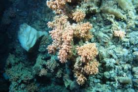
New Expedition Finds Deepest Ever Irish Corals

#MarineScience - A team of scientists have discovered the deepest known occurrence of a cold water coral reef known as Solenosmilia variabilis in Irish waters.
The marine scientists, led by the Marine Institute with the National Parks and Wildlife Service (NPWS), travelled over 1,000 nautical miles over three weeks along Ireland's Porcupine Bank and continental slope collecting HD video, sample cores and biological specimens from marine wildlife along the shelf edge from 50 locations.
They also explored the Atlantic Ocean to depths of more than 1,600 metres as part of a multi-agency and university collaboration using video mapping with the Marine Institute’s mini-submarine ROV Holland I.
The SeaRover survey was carried out on the Commissioner of Irish Lights vessel ILV Granuaile, gathering data for marine planning, habitat protection and measuring the effects of climate change.
“Some of the reef ecosystems and habitats we discovered have never been seen before, and discovering S. variabilis at depths greater than 1,600m helps us establish a better understanding of the environmental conditions necessary for this species to thrive,” said INFOMAR chief scientist David O’Sullivan.
"The deep-sea coral S. variabilis is widespread, normally seen at depths between 1,000 to 1,300m on seamounts or rocky areas deep under the sea but only occasionally forms reefs.
“Its growth rate is very slow approximately one millimetre per year, so finding the reef structure, which is part of a fragile ecosystem thousands of years old, in deeper parts of the ocean is an important find for marine science.”
Also found in this extreme deep sea environment were sea pens, which visually look like a cross between a feather, a starfish and a fern, but are are actually a form of soft coral.
“With over 300 species currently known around the world, they come in a variety of shapes, sizes and colours — we have seen a wide variety of forms on this survey, and can only give species names to very few as many are likely to be new to science and have yet to be described,” said Dr Yvonne Leahy of the NPWS.
“There are undoubtedly many more unidentified species out there and we ourselves have observed some specimens that require closer examination to properly identify.”
The team used the ROV Holland 1 to map the distribution and extent of deep water reefs and associated habitats, as well as using high-resolution bathymetric maps produced under the national seabed mapping programme INFOMAR, a joint initiative of the Marine Institute and the Geological Survey of Ireland.
The bathymetric data, which shows the depths of the ocean, has been key in identifying specific seabed features such as submarine canyons, escarpments and mounds where reef habitats are likely to occur.
The SeaRover (Sensitive Ecosystem Assessment and ROV Exploration of Reef Habitat) survey is jointly funded by the Government and the EU through the European Maritime Fisheries Fund and NPWS to undertake further mapping surveys of offshore reefs, with the aim of evaluating status and review requirements for conservation and management measures consistent with the Habitats Directive.
The project is co-managed by the INFOMAR programme and Fisheries Science and Ecosystem Services at the Marine Institute and NPWS. While the project objectives are primarily policy driven, the collection of data and scientific benefit will also be of immense benefit to the national and international research community.
The ROV robotic arms were also used to collect biological specimens for NUI Galway's SFI funded project ‘Exploiting and Conserving Deep Sea Genetic Resources’, and will also give new information on where sensitive species are found to help research at University of Plymouth’s Deep Sea Conservation Unit to predict where high value ecological areas might be identified offshore of Ireland and the wider North East Atlantic.
“The biological samples will help us understand the connectivity of different cold-water coral reef habitats, which will ultimately help with their future management,” said on-board senior scientist Dr Kerry Howell from Plymouth University.
This latest research mission comes less than two months after a team of university researchers and students on the RV Celtic Explorer explored cold water corals and sponges in the Whittard Canyon on the south-western edge of the continental shelf.
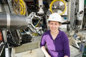
#MarineScience - Marine scientist and researcher Dr Louise Allcock from NUI Galway is leading a team of 10 university researchers and students on a two-week deep-sea expedition researching cold water corals and sponges.
The team — who can be followed on the Scientists@Sea blog – are currently exploring the Whittard Canyon, located 200 nautical miles south-west of Ireland at the edge of the continental shelf in the Atlantic Ocean aboard the Marine Institute’s RV Celtic Explorer, which recently returned from a climate change ‘health check’ of the Atlantic.
And the researchers are making extensive use of the Marine Institute’s ROV Holland I, deployed into areas where the sea floor rapidly drops from around 300m down to 3,000m.
“The researchers and students are seeing for the first time corals and sponges covering an area around the Whittard Canyon, Porcupine Seabight, Gollum Channel and the Belgica Mounds in Irish waters,” said Dr Olivier Thomas, a professor of marine biodiscovery at NUI Galway and co-ordinator of the National Marine Biodiscovery Laboratory located at the Marine Institute.
Dr Allcock added: “Using the ROV’s robotic and lighting capabilities, we are able to manoeuvre the Holland I, which is comparable to the size of a mini-van, through the water, and use its arms and clasps, which are like hands, to take small samples of corals, sponges and other specimens from extremely hostile parts of the ocean floor where there is no natural light and tremendous ocean pressure.”
By analysing past research relating to sponges and corals, Dr Allcock explained that her team “are able to see that some species are better target groups than others in having antimicrobial or anti-cancer properties.
“Based on this information we are building mathematical models to predict the likelihood of any given species yielding a novel natural product, along with developing species distribution maps of corals and sponges on the deep-sea floor, so that we know the best places to go searching.”
When the research team returns from sea, they work with the national marine biodiscovery lab at the Marine Institute. The chemists at NUI Galway extract the chemical compounds from all of the samples of sponges and corals to see if they have drug-like characteristics such as anti-cancer or antimicrobial properties that can be used for novel drugs to combat human illnesses.
“Chemists involved in biodiscovery research only need small quantities of any organism to develop a new drug, because once a suitable compound is identified, it can be synthesised in the lab, which can then be used in drugs to combat human diseases,” said Dr Thomas.
The ROV Holland I provides high definition continuous video footage of the deep seafloor as it is being used to collect samples.
“Going back through footage after the expedition enables us to further analyse the location recording of all the corals and sponges,” said Dr Allcock. “This improves future predictions of where else we might find similar specimens and also allows us to provide data to inform conservation policy so that we make sure that important ‘hotspots’ rich in corals and sponges are preserved.”
Marine Institute chief executive Dr Peter Heffernan was enthusiastic about the mission’s prospects.
“These are exciting times to be a marine researcher as marine scientists around the world have discovered more species in the ocean in the last ten years than ever before, with an average of 2,000 new discoveries each year,” he said.
“In Ireland we are contributing to building on this wealth of valuable information and sharing the best available science and knowledge to inform decisions affecting the Atlantic Ocean.”
This survey is being undertaken as part of a five-year project on ‘Exploiting and conserving deep-sea genetic resources’ at NUI Galway, co-funded by the Science Foundation Ireland and Marine Institute.
The National Marine Biodiscovery Laboratory project brings together six of the country’s leading marine researchers across a range of disciplines from NUI Galway, University of Limerick and University College Cork to study how marine substances might in future be used to make ingredients for cosmetics, pharmaceuticals and functional foods.


 Michael Murphy Schull Harbour Sailing Club (SHSC), Eric Coogan Heineken Ireland, Mark Murphy, Commodore SHSC, Jack Allen SHSC, Carmel O'Regan SHSC, Cornelious Ndlovu, Schull Harbour Hotel Operations Manager and Derval Murphy SHSC")

