


In recent months the concept of a fixed link between Ireland and Britain has been rapidly developing as various politicians have proposed bridges between Northern Ireland and Scotland across the narrow, storm-tossed and tide-riven waters of the North Channel.
But while the distance between Fair Head on the northeast corner of Antrim and the Mull of Kintyre in West Scotland is barely 13 miles, as one critic has pointed out, this would be a link “from the back of beyond to the middle of nowhere”. For even when Scotland has been reached at Kintyre, any traffic would have hundreds of miles of driving before getting anywhere near the main road system, let alone the primary motorway routes.
As for a connection across the established ferry route between Larne in Northern Ireland and Stranraer in southwest Scotland, that would also bring traffic from Ireland into a relatively remote part of Scotland, with a long slow drive to the nearest part of the motorway system towards Carlisle in northwest England. That in turn then involves a long haul through the notoriously congested M6 in order to connect with other main routes into the prosperous southeast of England and on into mainland Europe.
 The challenges of providing a fixed link between Ireland and Britain are abundantly clear in this image, with the 160 metres depth of the explosives-filled Beaufort Dyke in the southern North Channel clearly in evidence. In terms of providing a relatively level seabed for the proposed Brunel Link from the greater Dublin area to North Wales, it looks as though a straight line between Skerries and Holyhead would offer the best option
But in any case, it has been pointed out that a Larne-Stranraer link would be considerably longer than the shorter County Antrim link between Black Head in Northern Ireland and Corsewall Point in Scotland. Yet both of these would involve difficult shoreside access, whereas a link slightly further south from Donaghadee in County Down through the nearby Copeland Island and across to Portpatrick in Scotland is only about 20 miles, although putting a motorway through the choice residential districts of North Down and across Copeland Island might meet with some local resistance.
In any case, in this area, the North Channel includes the 160 metres deep fissure which is the Beaufort Dyke, a hidden depth which has the added hazard of use as a dumping group for explosives – millions of them – after World War II ended in 1945. Even after 75 years, there is no reason to assume that they still are anything other than extremely dangerous.
Yet in theory, a viable bridge could be built at this point, for civil engineers reckon anything is possible if they’re only given enough resources to do it. Nevertheless, even though it might be less expensive than a tunnel, it boggles the mind to think of the expenditure which would be required to create a bridge structure which could withstand the really extreme conditions of the North Channel, and thus another idea which has been around for some time has been put forward as a possible solution.
 The basic structure of the Brunel Link is very simple. In the completed full-size project, a motorway standard dual carriageway with three lanes either side will be in place across the middle, while a two-line railway will run along the floor.
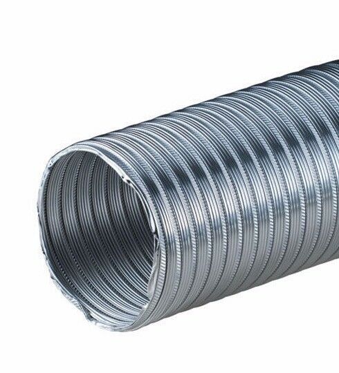
This is the Bridge/Tunnel, the “Brunnel”, which is somewhere between a bridge and a tunnel. It is in effect a giant tube which is laid along the sea-bed in such a way that it flexibly follows the contours when they are reasonably even, but by its nature, the structure can be reinforced to become a rigid tube-bridge when it is necessary to cross an undersea valley.
As the portmanteau name of Brunnel is so near to the surname of Brunel to remind us of the great Victorian engineer-builder Isambard Kingdom Brunel (who would be just the man for a massive and visionary project of this nature), the concept is becoming known as the Brunel Link. And its potential for being extruded in virtually infinite lengths by a giant (and we really mean giant) tube-making machine from a reinforced mixture of concrete and advance epoxies has been taken into consideration by a mysterious Dublin-based organisation known as the Committee for the Re-Alignment of Ports.
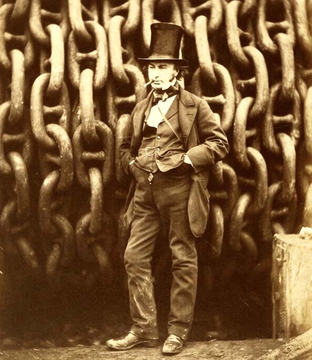 The greatest engineer? Isambard Kingdom Brunel (1806-1859) has been deservedly honoured in the name of the Brunel Link.
Basically, this Committee is primarily concerned with connecting Ireland as directly as possible with the most prosperous and industrious part of middle and southeast England, which in turn gives connections into the commercial, financial and industrial heartlands of Europe. In order to achieve this, they have concluded that the key arterial route to be followed would be based around the Dublin to Holyhead route.
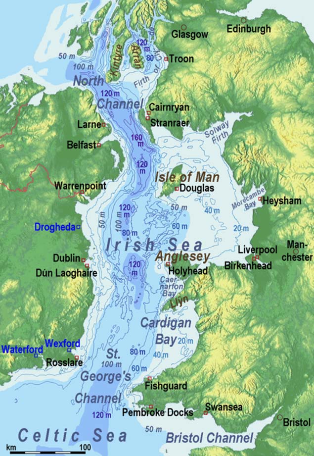
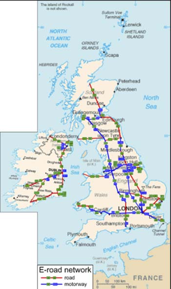 The logic of the Dublin-Holyhead link as the most efficient inter-connector from the island of Ireland to Britain’s industrial and commercial heartlands and on into mainland Europe is evident from this map of the main routes
Thus the Committee’s plan is for a Brunel cross-channel tube connection from somewhere on the coast of the Greater Dublin region to Holyhead, the structure to be of sufficient diameter to accommodate a dual carriageway motorway with three lanes either side, plus vitally important hard shoulders, at its widest horizontal diameter, and below this would be a twin-track railway system running along the Brunel Link floor which will somehow accommodate the differing railway gauges to be found on either side of the Irish Sea.
As the impetus for this huge project is essentially coming from the Irish side, the group behind it plan to invest heavily in Holyhead harbourside property. In fact, one development of this idea is that Ireland should buy Holy Island, the offlyer beside Anglesey on which Holyhead is located, and make it in effect an extension of the Irish Republic. Ideally, in fact, the promoters would like to take over the entire island of Anglesey to provide Dublin with the potential for an easterly extension and its useful hinterland.
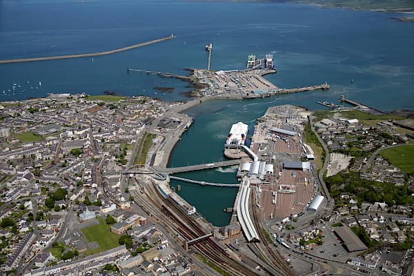 With the Brunel Link in place, the port of Holyhead could have a brighter future as an extension of Dublin Port.
 The promoters of the Brunel Link are thinking in terms of initially taking over Holy Island on which Holyhead is located, and ideally, they hope to buy all of Anglesey in due course to provide Dublin with a viable eastern hinterland.
At the moment that is only the stuff of dreams, but with the Brunel cross-channel connection, the entire geography of the northern area of St George’s Channel would be changed. With Anglesey less than an hour’s drive away from Dublin regardless of the weather, Holyhead could be transformed from an economic blackspot into becoming part of one of Europe’s most successful technical and financial hubs.
This ready access to Holyhead would, in turn, add another option to the regularly-issued demand by high-flown economic commentators and urban planners that Dublin Port be moved entirely out of the city in order to facilitate the “proper 21st Century potential” of the Capital. Those of us who think that the regular and much-observed ship movements in and out of the Port and Dublin Bay are integral to the character of the city may disagree with this, but nevertheless it’s interesting to see how the Holyhead option may affect the overall thinking.
For the “Move the Port out of the City” movement assumes that somewhere else can be conveniently found to place the large and complex infrastructure of Dublin port. Yet no remotely comparable natural harbour exists any nearer than Carlingford Lough to the north, and Wexford Harbour to the south, while the proposals for a new port at Bremor close north of Balbriggan seem to take no account of the need there would be for the construction of massive new breakwaters to create an artificial harbour which would have to be many times the size of Dun Laoghaire.
Yet with Holyhead brought into the equation through the Brunel Link, valuable land on the East Coast of Ireland could be retained for residential and recreational use, while an under-utilised industrial area and harbour on the Welsh coast could be brought to life as an extension of Dublin port.
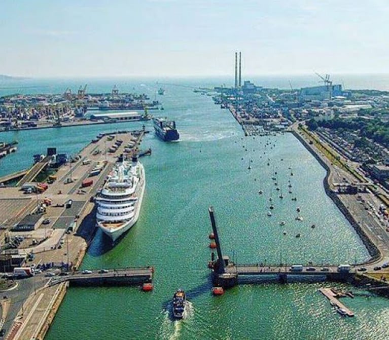
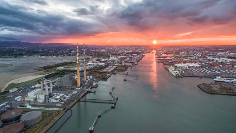 Sunset for Dublin Port? With ferry operations removed by the opening of the Brunel Link to Holyhead, and with Holyhead thereby enabled to take over the freight services of Dublin, the way would be clear for the Dublin port area to be re-developed for residential, office and recreational use.
Behind all this re-alignment of ports, the new arterial connection from the heart of Ireland through Britain to the heart of Europe would be made even more viable in several obvious ways. With the rapidly increased use of electrically-powered vehicles in the near future, the convenience and environmental compatibility of the Brunel Link, and the inescapable logic of its location, arguably make the visionary proposals from the Committee for the Re-Alignment of Ports a real no-brainer.


 was the Cruisers IRC Zero winner in Thursday's DBSC race")
