Displaying items by tag: MSO
Appointment of Recognised Security Organisations (Ports)
The Marine Survey Office (MSO) of the Department of Transport has appointed four companies to the panel as Recognised Security Organisations (Ports) for the period covering 1 January 2024 to 31 December 2028.
These companies appointed as RSOs for the creation of port security assessments, port facility security assessments, port security plans and port facility security plans are as follows:
CMG (Crime Management Group),
Regus House,
Harcourt Road,
Dublin,
D02 HW77
Tel: +353 1 417 4242
Email: [email protected]
Crime Management Services,
Block B, The Crescent Building,
Northwood, Santry,
Dublin D09 C6X8
Tel: +353 1 893 4906
Email: [email protected]
Bureau Veritas Marine and Offshore UK and Ireland
1 & 2, Keel House,
South Shields
NE34 9PY, United Kingdom
Tel: +44 (0) 191 427 8170
Email: [email protected]
Seaport Services Crann Centre,
Classis, Ovens,
Co Cork P31 TX39
Tel. +353 86 190 1913/+353 87 237 8103
Email: [email protected]
The appointment will cover work as an RSO in relation to both Regulation (EC) No 725/2004 and Directive 2005/65/EC on Port Security.
MSO Seeks Applications for Authorisation to Act as Recognised Security Organisations (Ports)
The Marine Survey Office (MSO) of the Department of Transport is seeking applications from interested parties who wish to act as Recognised Security Organisations - RSO (Ports) for the period from January 2024 to 31 December 2028.
The authorisation will cover work as an RSO in relation to both Regulation EC 725/2004 on enhancing ship and port facility security and Directive 2005/65/EC on enhancing port security.
The closing date for receipt of completed applications is 3pm on Tuesday 16 January 2024.
Requirements and conditions for application are set out in the annex of Marine Notice No 82 of 2023, attached below.
Completed applications should be returned to the Marine Survey Office by post, or by email to [email protected].
New Maritime Security Measures for Domestic Shipping Services in Ireland Commence 1 March
The Marine Survey Office (MSO) of the Irish Maritime Administration has completed a review of security risk assessments for vessels and ports engaged in domestic shipping operation on the Irish coast.
This review was conducted as part of the obligations under EU Regulation (EC) No 725/2004 – Enhancing Ship and Port Facility Security, which entered into force on 31 March 2004.
The objective of this Regulation is to introduce and implement measures aimed at enhancing the security of ships used in international and domestic trade, and associated port facilities within EU member states, in the face of threats of intentional unlawful acts.
Article 3.3 of the Regulation requires that member states shall, after a mandatory security risk assessment, decide the extent to which they will apply the provisions of this Regulation to different categories of ships operating on national domestic services, their companies and the port facilities serving them, and this is subject to periodic review.
Details of the maritime security measures to be applied as a result of this review are outlined in Marine Notice No 9 of 2023, which is available to read or download below. This notice supersedes Marine Notice No 61 of 2013 which is hereby revoked.
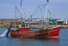
Crew Leaves Roach-Ridden Trawler Detained In West Cork
#Fishing - A UK-registered fishing boat detained in West Cork last week had to be fumigated twice to remove an infestation of cockroaches.
And according to the Irish Examiner, the Indonesian crew of the trawler Christian M have now walked off the vessel as arrangements are made for their voluntary return.
The Christian M was towed into Castletownbere on Wednesday 8 November after breaking down off the West Cork coast.
A subsequent inspection by the Marine Survey Office (MSO) led to its detention over a number of issues, including the cockroach infestation.
Ken Fleming, a co-ordinator with the International Transport Workers Federation (ITF), visited the boat yesterday (Friday 17 November) along with gardaí and an Indonesian embassy official.
“When I went onboard the vessel, I witnessed cockroaches still on surfaces,” said Fleming. “The accommodation is unfit for purpose.”
The Irish Examiner has much more on the story HERE.
MSO Seeks To Appoint Panel For Surveying Small Fishing Vessels
#Fishing - The Marine Survey Office (MSO) of the Department of Transport, Tourism and Sport (DTTAS) wishes to appoint a panel of surveyors to conduct surveys of fishing vessels of less than 15m length overall, in accordance with the Code of Practice for such vessels.
For more information or to register your interest for this panel, see the published tender on the eTenders Public Procurement website.
The MSO will accept electronic responses to this notice via a 'Tender Submission Postbox' facility. Further details of this facility are available at the tender notice page on the eTenders website, under the Postbox tab.
The closing date for completed applications is Friday 10 November.
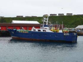
MCIB Report on Sinking of Fishing Vessel 'Ainmire'
A breach in the engine compartment caused the fishing vessel Ainmire to take on water and sink off the coast of Scotland in April last year, according to the official report into the incident.
All crew on board the vessel were transferred safetly to another fishing boat that responded to its distress call, some 30 miles northwest of the Butt of Lewis on the morning of 29 April 2010.
The Marine Casualty Investigation Board (MCIB) report concluded that the failure of a sea water cooling pipe in the engine room was the most likely cause of the flooding, and pointed to the fact that the pipework had not been renewed during the life of the vessel.
It was also noted that the bilge pump and its motors were located under the floor plates in the engine room, and thus were inoperable when the water level had risen in the compartment.
In addition, the MCIB report found that the Ainmire has been operating without a Fishing Vessel Safety Certificate for more than six months at the time of the incident.
Though the owner had submitted a survey application and paid the required fee to the Marine Survey Office (MSO) the previous summer, a communication breakdown resulted in the required survey not being carried out before the expiration of the vessel's previous certification.
The MCIB advised boat owners and operators to be extra vigilant regarding the location of bilge pumps in their vessels.
It also warned that survey applications for certification "may not accommodate all situations", and that the issuing of a recepit is not a guarantee that an application is being dealt with.
The full report is available to download as a PDF from the MCIB website HERE.


