


Displaying items by tag: Dredging
Dublin Port Dredging Plans For Cruise Terminal Project Get Go-Ahead

#DublinPort - Planning permission has been granted for a major dredging scheme at Dublin Port, clearing the final hurdle before works on the proposed new cruise liner terminal for the city.
The application, given the go-ahead by the Environmental Protection Agency (EPA) on Tuesday 13 September, provides for dredging from the North Wall Quay Extension to the -10m Chart Datum contour in Dublin Bay.
It also permits the disposal of dredged material at the existing licensed site west of the Burford Bank – a matter of much controversy this summer due to its location within the special are of conservation from Rockabill to Dalkey Island.
The subsequent Alexandra Basin Redevelopment Project comprises the infilling of the basin at current berths 52 and 53, a deepening of the fairway and a marina protection structure, intended to future-proof the port to accommodate the next generation of cruise liners of more than 300m in length.
Dublin Port's plans advance as Dun Laoghaire awaits the next step in its own harbour masterplan proposals for a modern cruise terminal.
Marine Notice: Dregding Works At Rossaveal Fishery Harbour Centre
#MarineNotice - The latest Marine Notice from the Department of Transport, Tourism and Sport (DTTAS) advises of the of the dredging of soft material and disposal at sea, drilling and blasting and removal of bedrock, construction of breakwater and revetment and other associated works at Rossaveal Fishery Harbour Centre.
The works by Cronin Millar Consulting Engineers at the Galway Bay fishing harbour will commence on tomorrow Monday 22 August and continue till January 2017.
The first phase of the works, commencing tomorrow, will comprise the construction of a temporary causeway on the foreshore within the dredge site to facilitate excavation of seabed and disposal at a licensed on-shore site.
The second phase of the works, will commence in the coming weeks and will involve a jack-up barge, floating barge, safety boat, personnel boat, split barge and work boats. This will be advised under a second marine notice.
Maps and co-ordinates of the work areas are detailed in Marine Notice No 34 of 2016, a PDF of which is available to read or download HERE.
Other recent Marine Notices cover outfall pipeline remedial works ongoing at the Corrib gas field, and information on the carriage of inflatable life rafts on small fishing vessels under 15m.
Lough Neagh Dredging Brings NI 'Into Ridicule'
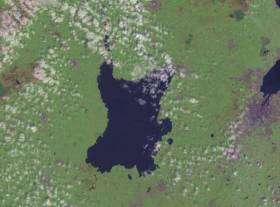
#LoughNeagh - Environmentalists have branded Northern Ireland a laughing stock for its failure to stop sand dredging in Lough Neagh, as the News Letter reports.
The issue is currently before the High Court after dredging firms appealed NI Environment Minister Mark Durkan's 2015 enforcement notice against the removal of as much as 1.8 million tonnes of sand from Ireland's largest lake.
And the practice has continued unabated, despite planning permission never being granted for sand dredging on the lough, a protected area for wildlife, said Gregory Jones QC on opening the application for judicial review by Friends of the Earth.
“This issue is bringing the planning system in Northern Ireland into ridicule," the charity's counsel told the court. “This is something one would not expect of the most primitive dictatorship.”
The News Letter has more on the story HERE.
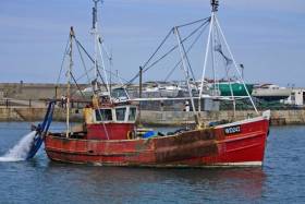
Howth Yacht Club Calls On Members To Push TDs On Harbour Dredging
#HYC - Howth Yacht Club has posted a draft letter for all club members and harbour users to send to their public representatives highlighting the urgent need to dredge Howth Harbour.
As previously reported on Afloat.ie, levels of silt build-up in the North Co Dublin harbour have accumulated to around 1.5 metres, rendering low-water spring-tide launches impossible.
The Harbour Users Action Group claims that various Governments since the 1980s have passed the buck for responsibility.
As such, the issue should be a priority among Howth voters heading into the General Election later this month.
In other HYC news, the club will host the ISA Cruising Conference on 20 February (more details HERE) a week before the club's race management team attends the ISA Race Officials Conference the at the Green Isle Hotel on 28 February.
The club is also hosting a prizegiving dinner for all Class 3 racing teams tomorrow evening Friday 12 February (contact the office for reservations) and another dinner next month in honour of the club's first commodore WH Boyd on Saturday 12 March, with a talk by Brian Turvey and Afloat.ie's own WM Nixon.
Silt Renders Low-Water Launches 'Impossible' At Howth Harbour
#IrishHarbours - Concerns over rising silt levels in Howth Harbour have made the pages of the Swords Gazette, which quotes the Harbour Users Action Group as saying launches at low water on a spring tide are now impossible.
Not only is the harbour's busy fishing industry under threat, but coastguard and lifeboat rescues – the harbour is home to Howth RNLI – could also be affected.
"The potential for that is very serious," said the group's Brian Turvey, who claims that various Governments have passed the buck for responsibility since the harbour was last dredged in the early 1980s.
"We've got to the stage now where we have about a metre and a half of silt accumulated," he added, noting the problems that poses for boats with deeper keels.
His comments echo a recent statement by local TD Tommy Broughan, who said it is "critical that the harbour does not become unworkable as a result of the build-up of silt".
Trawling For Sprat In Dun Laoghaire's Inner Harbour Surprises Locals
#IrishHarbours - Concerns expressed by a number of readers to Afloat.ie over fishing activity in Dun Laoghaire's inner harbour have been assuaged by the Dun Laoghaire Harbour Company.
Two trawlers were spotted around noon last Friday (4 December) dragging a full-sized fishing net between them around the inner harbour.
But Dun Laoghaire's acting harbour master Simon Coate has since confirmed to Afloat.ie that the boats in question were fishing with permission for sprat.
Coate added that the forage fish species comes into the harbour in large numbers on a regular basis at this time of year.
Harbour concerns of a different kind have been heard in Howth, with local TD Tommy Broughan taking the Department of the Marine to task over the lack of any timetable or specific funding for dredging the harbour area - where local yacht club users have found conditions getting worse.
In a post on his website, Deputy Broughan said he was "contacted by members of the Howth Harbour Users Action Group who are very concerned about the build-up of silt in the harbour and the damaging effect this is having on all aspects of this important harbour.
"Howth Harbour has not been dredged for decades. I understand it was last dredged in 1981 or 1982 and I do not recall a dredging programme in the harbour in many years representing the area.
"The action group reports that this neglect has led to almost 6ft of silt building up in the harbour and an operational crisis for all the fishing and leisure craft which use it."
While welcoming investment in infrastructural works at the fishery harbour centre, Deputy Broughan underlines that it is "critical that the harbour does not become unworkable as a result of the build-up of silt".
Read more on this story HERE.
Sligo Harbour Faces Dredging Costs of €5m

#sligoharbour – Utilising Sligo Harbour to the best affect is the vexed question confronting Sligo County Council who face dredging costs 'in the region of €5m'. The problem is that if the council invested that figure, there is doubt if they could recover that from the Harbour, according to a report of a Council meeting carried by the Sligo Champion.
Councillors were told that the money required for the next stage of Sligo Harbour acquiring its Dumping at Sea Licence was not available. Earlier this year, the Department of the Environment granted a licence under the Foreshore Act to allow the council to undertake dredging works at Sligo Harbour.
The following phase requires the harbour getting a Dumping at Sea Licence from the Environmental Protection Agency.
However, at last week's budget meeting, it became clear that the €12,000 for this phase was not available.
Sligo Champion has much more on the story here
Dredger Starts Work to Remove 100,000m3 of Sand in Rosslare Europort

#RosslareDredging - Sospan Dau a Dutch dredger has recently started work in Rosslare Europort where as previously reported, sand of around 100,000m3 is to be removed from the breakwater, writes Jehan Ashmore.
The harbour's port authority in Rosslare Europort, Iarnród Éireann was allocated funding of €1.4m to contract out the works and is to take some three weeks to complete. Previous sand accumulation at the breakwater has normally been just 11,000m3.
The 1978 built Sospan Dau is transferring the dredged sand to an area just outside the low-water off Rosslare Strand. The sand is understood to be expected to be naturally carried ashore and replenish the beach.
The accumulated sand built up at the Wexford port arose due to severe storms within a fortnight during January and February. A buoy was positioned to mark off this restricted area, for photo click here.
Accompanying the 1,546 tonnes trailing suction hopper dredger is the Irish flagged workboat tug Trojan which has carried out many projects among them the construction of the new Kilronan Harbour on Inishmore, Aran Islands.
‘Rotten Eggs’ Smell in Cork City Blamed on Dredging Works
#CitySmell - Strong smells affecting Cork city for the past four days are being blamed due to dredging works near the city quays.
The Environmental Protection Agency (EPA), which monitors air quality in the city, said the disturbance of marine sediments could give rise to a release of hydrogen sulphide, which would explain the sulphur or rotten eggs odour.
Shoppers, business owners and visitors to Cork have all reported a foul smell at various locations since Saturday. For more on this the Evening Echo has a report.
Contract Signed For Dredging Of Arklow Port

#ArklowHarbour - Arklow Harbour is set to be dredged for the first time in 15 years this June after a €2.2 million contract for the job with Clare-based L&M Keating Ltd was officially signed earlier this month.
Wicklow News reports that the works were finally approved after a permit from the Environmental Protection Agency (EPA) for dumping an expected 60,000 tonnes of dredged soil from the harbour out at sea.
Arklow mayor Tommy Annesley said the dredging plans, which follow similar works in Wicklow Harbour, showed a “great commitment to the future of Arklow Port”.
Wicklow News has more on the story HERE.


 as lead helm, rounds the Fastnet Rock on the way to the overall win in 1987")


