Menu

Ireland's sailing, boating & maritime magazine

Inland afloat headers


Displaying items by tag: Climate Change

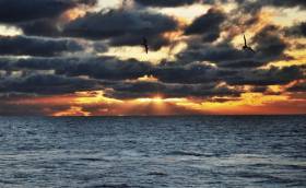
The Irish state is particularly aware of the threat climate change poses through sea level rises, given its island status, Tánaiste Simon Coveney has said.

As The Irish Times reports, Mr Coveney and Minister for the Marine Michael Creed are leading the Government’s participation in the 2019 SeaFest and Our Ocean Wealth Summit in Cork this week.

Ahead of the conference, Mr Coveney welcomed the leaders and ambassadors from more than 30 island states such as the Seychelles, Mauritius, Antigua, Haiti, Barbados, Fiji and Papua New Guinea.

“As a small island, Ireland understands the threats climate change poses to our friends in the Pacific, Caribbean, Atlantic and Indian oceans. It threatens their very existence,” Mr Coveney said.

“Ireland strongly believes that we can only address this challenge of a generation if we take strong climate justice approach. Emphasising the needs and realities of those who have the most to lose, yet have done least to contribute to the problem, will always be a centerpiece of our approach.”

Mr Coveney said Ireland wants to give leadership on the important issues of protecting the seas and maritime environment and countering climate change.

For more on the conference at the Ocean Summit, click here.

Published in Island News

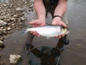
#MarineWildlife - A new project which aims to promote international action and co-operation to conserve vulnerable migratory fish species launched yesterday, Thursday 28 March.

The DiadES initiative will see 30 partners from different countries participate in this European project, with Inland Fisheries Ireland (IFI) leading out on the project in Ireland.

The project launches as migratory fish and their habitats continue to come under pressure as a result of human activity and climate change.

It will focus on fish such as shads, lampreys, salmon, trout and mullet which are known as ‘diadromous’ fish as they migrate between fresh and salt waters to reproduce or feed.

The DiadES initiative intends to improve knowledge of the ecological, economic and cultural benefits offered by these migratory species while assessing the possibility of these species changing their locations due to climate change.

It will also examine the emergence of new interactions between fish territories as a result of these relocations.

In addition to collaboration across research and knowledge sharing between countries, the project will take a global multidisciplinary approach.

It will focus on several species across different geographical areas and involve researchers in the field of natural sciences and environmental economists as well as an experienced network of fish managers.

As part of the research, a transnational interactive atlas will be produced which will outline the current distribution of diadromous fish and how they help the ecosystem. This will forecast trends in the geographical distribution of various species and look at possible redistribution of some species as a result of climate change.

The programme will also design a platform for stakeholders to explore different management strategies.

Dr Cathal Gallagher, head of research and development at IFI, said: “Throughout their life cycle, diadromous fish provide ‘ecosystem services’. This means they provide food, regulate and support the ecosystem through the nutrient cycle and offer a recreational pursuit to local communities. All of these fish generate significant ecological, economic and cultural benefits for local communities across Europe.

“We are keen to play our role in assessing and enhancing the role these fish play while also assisting them as they navigate the effects of climate change which has resulted in a reduction in their distribution.”

The DiadES project is led by the French research institute Irstea and is financed by the Interreg Atlantic Area Programme of the European Regional Development Fund (ERDF) to the value of €2.2 million.

Published in Marine Science

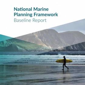
A policy-based plan that puts climate change front and centre and steers away from privatising coastal resources is what the country wants from the State’s National Marine Planning Framework, as The Irish Times reports.

Details have been released from the recently concluded consultation on the framework’s baseline report, released in September and branded as “a key part of the process of developing Ireland’s first marine spatial plan”.

The majority of responses (53%) were related to the marine environment, with 42% of submissions raising the prospect of the plan including measures to deal with climate change.

That news is timely with fears that coastal erosion poses a threat to hundreds of communities around Ireland.

Respondents also expressed preference for a policy-driven approach over specific zoning or a hybrid of the two, and many were adamant that the plan must retain Ireland’s marine resources in public hands.

The Irish Times has much more on the story HERE.

Published in News Update

#MarineScience - Marine Minister Minister Creed has welcomed the announcement of €2 million from the Marine Institute and the European Regional Development Fund for a major project on Atlantic climate change.

Led by Dr Gerard McCarthy of the ICARUS Climate Research Centre and Department of Geography at Maynooth University and guided by the goals of the Government’s national marine strategies, the international A4 Project marks a substantial investment in physical oceanography and climate change research in Ireland, and aims to improve understanding of the links between trends in Atlantic temperatures and climate change.

The project name A4 stands for aigéin (oceans), aeráid (climate) agus athrú Atlantaigh (Atlantic change).

“This funding being provided will enable Maynooth University to increase the research capacity to broaden Ireland's knowledge at a societal level, to better understand the ocean and climate change,” Minister Creed said.

“The research will contribute to national climate adaptation as well as international climate policy, supporting enhanced forecasting capabilities and contributing to adaptation and mitigation strategies and actions.

“The project is an important element underpinning implementation of the Marine Institute’s Strategic Plan 2018-2022 ‘Building Ocean Knowledge, Delivering Ocean Services’. The strategy aims to provide world-leading regional and localised forecasting outputs and services that support Ireland’s challenge in responding to changes in our ocean and climate.”

Dr McCarthy added: “Over the next five years, this project will target three areas in which substantial progress can be made including ongoing Atlantic change, sea level rise, and decadal climate prediction.

“As a small island on the edge of a large ocean, Atlantic changes impact Ireland more than any other country. When record global surface temperatures were reached in 2015, Ireland had below average temperatures due to a cool Atlantic. The reasons why Irish temperatures bucked the trend in 2015 requires a better understanding of Ireland's place in a changing climate, and for this, we need to understand the changing Atlantic.

“This important project, which I am delighted to be leading, will greatly assist in our overall understanding of this complex and fascinating area. The Atlantic’s future will differ from the rest of the world in response to a changing climate. This is primarily because the Gulf Stream system of currents, which gives Ireland its mild climate, is predicted to weaken.

“The time is ripe to build upon the observations of Ireland’s ocean made by the Marine Institute over the past decades to understand Ireland’s place on the edge of the changing Atlantic.”

The project will be supported by Prof Peter Thorne, director of the ICARUS Climate Research Centre at Maynooth University with Prof Andrew Parnell, Dr Niamh Cahill, Dr Conor Murphy, and Dr Rowan Fealy at Maynooth University. Maynooth’s lead team will utilise approximately two-thirds of a total €2 million funding with the balance utilised by co-investigators in Trinity College Dublin led by Dr Robin Edwards.

The A4 Project’s international partners are the National Oceanography Centre, UK; Scottish Association for Marine Science, UK; University of Bremen, Germany; BSH, Germany; University of Hamburg, Germany; National Center for Atmospheric Research, USA; Met Office, UK; and Tufts University, USA.

Professor Ray O’Neill, vice president for innovation at Maynooth University, said: “This major funding award reflects the global significance of the climate science research being undertaken at the ICARUS Climate Research Centre at Maynooth University.

“Enabled by this funding, Gerard McCarthy’s expertise, and that of his national and international partners, will significantly advance understanding of how Ireland and the Atlantic region more broadly will be affected by climate change in the years ahead.”

The project team will use advanced geological techniques to reconstruct Ireland’s sea level, and combine these estimates with the modern National Tide Gauge Network managed by the Marine Institute, to better understand how sea levels have been changing around Ireland and the edges of the Atlantic.

The A4 Project will also bring to Ireland the emerging field of decadal climate prediction, which will lead to improved estimates of the future climate over the period of a decade by using the predictability of the ocean.

A recent report by the Intergovernmental Panel for Climate Change on the dangers of 1.5C warming highlighted many risks including that of sea level rise. “Every nation needs to understand its own vulnerabilities to sea level rise as the effects are not the same everywhere,” Dr McCarthy said.

This project is funded by the Marine Institute under the Marine Research Programme 2014-2020, co-funded by the European Regional Development Fund.

Published in Marine Science

The Marine Institute has welcomed Irish commitments announced at the recent Our Ocean Conference in Bali which include the provision of €25 million for a 50-metre modern research vessel to replace the RV Celtic Voyager.

“The vessel will provide critical national infrastructure to enable Ireland to address the considerable challenges of Brexit and the Common Fisheries Policy as well as climate-induced impacts on our oceans,” Marine Institute chief executive Dr Peter Heffernan said.

In addition, the Marine Institute says it has committed €2 million towards a new five-year programme of ocean and climate research.

With 50% funding from the EU ERDF scheme, the Marine Institute is running a competitive funding call to support the establishment of a principal investigator-led research team in an Irish higher education iSnstitution.

“This is a key investment to build capacity in an area of research prioritised under the National Marine Research and Innovation Strategy (2017-2021),” Dr Heffernan said.

“The research funded under this programme will deliver societally relevant knowledge aimed at better understanding the complex interactions between the ocean and climate change.”

Minister Creed also announced the continued commitment to the Environmental Educational module of Ireland’s Green Schools programme, and the continued support of the Clean Coasts programme.

“These programmes aim to build on Ireland’s marine and maritime heritage by increasing awareness of the value, opportunities and social benefits of our ocean wealth and identity, further supporting the Marine Institute’s Explorers Education Programme,” Dr Heffernan said.

Other announcements by Ireland include the provision of €10m to the local authority sector in Ireland to aid in the establishment of four Climate Action Regional Offices (CAROs) and €1m over a five-year period (2019-2024) towards a new programme of ocean and climate research.

The Marine Institute also welcomes commitments announced by the European Commission which include €300 million for EU-funded initiatives for projects to tackle plastic pollution, make the ‘blue economy’ more sustainable and improve research and marine surveillance.

Published in Marine Science

#Jobs - This Thursday 16 November is the closing date for two post-doctoral research roles with the Marine Institute.

Based at the Marine Institute’s facility in Newport, Co Mayo, the WATexR (Climate JPI) Project requires a post-doc for a period of up to 34 months, who will have a central role in implementing the research project along with the project team.

Meanwhile, at the institute’s headquarters in Oranmore, Co Galway, a data analyst is sought to work on the Co-development of Climate Services for Adaptation to Changing Marine Ecosystems (CoCliME) project.

Applications for both positions close at noon on Thursday 16 November.

Published in Jobs

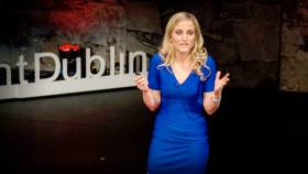
#MarineScience - A talk on how pollution is changing the chemistry of the seas around Ireland has been selected as a featured video by TED.com.

The talk by Irish marine scientist and Fulbright Scholar Dr Triona McGrath discusses the process of ocean acidification, caused by the absorption of carbon dioxide in the atmosphere into the world’s oceans.

A post-doctorate researcher at NUI Galway, Dr McGrath presented her talk on 6 February last year to a local audience at TEDxFulbrightDublin, organised by the Fulbright Commission in Ireland and Fulbright alumnus Dr Lorcan Walsh.

Dr McGrath’s team monitors levels of carbon dioxide in Irish marine waters to determine the level of carbon in the ocean and subsequent increase in ocean acidity.

Along with her colleagues, she published the first rates of ocean acidification for Irish offshore waters and the first baseline dataset of carbon parameters in Irish coastal waters.

This data is crucial for our understanding of the future health of our oceans, and can provide information to determine the impacts of ocean acidification on marine ecosystems.

In her talk, Dr McGrath states: “Ocean acidification is a global threat ... The rate of acidification is ten times faster than any acidification in our oceans for over 55 million years, our marine life has never experienced such a fast rate of change before ... There was a natural acidification event millions of years ago, it was much slower than what we're seeing today, this coincided with the mass extinction of many marine species.”

She also warns: “We will see acidification, we have already put too much carbon dioxide into the atmosphere ... but we can slow this down, we can prevent the worst case scenario. The only way of doing that is by reducing our carbon dioxide emissions.”

As a Fulbright Scholar, Dr McGrath visited the Scripps Institution of Oceanography in San Diego in 2013 to develop her analytical skills in ocean carbon chemistry.

A researcher in ocean climate change since 2008, her latest research project started in February 2017 and for the next four years she will work with colleagues to further develop ocean acidification research through the continuation of an ongoing time series in the Rockall Trough and the determination of seasonal and inter-annual variability of the carbon system in coastal waters.

Dr McGrath has a PhD in Chemical Oceanography and a BSc in Marine Science from NUI Galway.

Published in Marine Science

#ClimateChange - Preliminary results from the recent ‘health check’ of the Atlantic Ocean suggest a greater penetration of manmade chlorofluorocarbons (CFCs) further into the deeper ocean since 20 years ago.

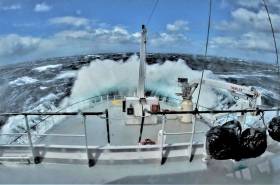
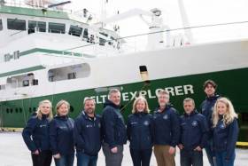
As previously reported on Afloat.ie, an Irish-led international team of marine scientists from six countries set out from Newfoundland on 27 April on board the RV Celtic Explorer, to survey a transect of the Atlantic last measured two decades ago and investigate the impact of climate change on the deep ocean.

Explaining the team’s findings, Dr Evin McGovern of the Marine Institute and principal investigator on the GO-SHIP A02 survey said: “Although these chemicals have been phased out, they remain in the atmosphere and enter the ocean, where over time, they travel to the deep ocean.

“We measure the CFCs to tell the age of the water masses in the deep ocean and this helps us assess the uptake of fossil fuel carbon from the atmosphere and penetration into the deep ocean.”

The survey formed part of the Global Oceans Ship-Based Hydrographic Investigations Programme (GO-SHIP), which carries out systematic and global surveys of select hydrographic sections, through an international consortium of 16 countries and laboratories.

This was the first GO-SHIP survey to involve such a level of collaboration, with scientists from 10 leading universities and research institutes representing six countries.

Canadian Ambassador to Ireland Kevin Vickers visited the RV Celtic Explorer to meet the team in Galway following their arrival on Monday 22 May.

“This survey is a wonderful example of the Galway Statement in action as well as the longstanding collaboration on marine research between Ireland and Canada,” he said.

Marine Institute chief executive Dr Peter Heffernan added that the expedition’s scientists “are contributing to addressing some of the biggest questions for society and our interaction with our planet.”

Find out more about the survey on the Scientists@Sea blog, where the GO-SHIP team aboard the RV Celtic Explorer recorded their work and experiences.

Published in Marine Science

#MarineScience - An international team of marine scientists from six countries are currently sailing on Ireland’s national research vessel RV Celtic Explorer on a transatlantic voyage to study the impact of climate change on the ocean.

Departing from St John’s in Newfoundland on Thursday 27 April — after launching the miniature yacht Lancer a few days previously — and due to arrive in Galway on 23 May, the Marine Institute-led team of experts are surveying a transect of the Atlantic Ocean last surveyed 20 years ago to investigate carbon dioxide levels in the ocean.

The survey is essential to understand and project how carbon dioxide emissions are accumulated in the oceans and the atmosphere, as well as its effects on the acidification of the ocean.

The survey is part of the Global Oceans Ship-Based Hydrographic Investigations Program (GO-SHIP), which carries out systematic and global surveys of select hydrographic sections, through an international consortium of 16 countries and laboratories.

This is the first GO-SHIP survey to involve this level of collaboration with scientists from ten leading universities and research institutes representing six countries joining the survey.

Marine Institute chief executive Dr Peter Heffernan said: “The Marine Institute is proud to lead this truly international collaboration. This GO-SHIP A02 survey is a very real example of the Galway Statement in action: working together to better understand and increase our knowledge of the Atlantic Ocean and its dynamic systems, and promoting the sustainable management of its resources.”

The Galway Statement, signed at the Marine Institute 24 May 2013, launched the Atlantic Ocean Research Alliance between the EU, Canada and the USA.

The survey is co-ordinated by the Marine Institute and NUI Galway with research partners in Dalhousie University and Fisheries and Oceans, Canada; University of Exeter, United Kingdom; GEOMAR, Germany; Woods Hole Oceanographic Institution and Columbia University, USA; and Aarhus University, Denmark.

“Ship-based surveys are still the only way to collect the best quality measurements of fundamental physical, chemical and biological properties known as Essential Ocean Variables,” said Dr Evin McGovern of the Marine Institute and principal investigator on the GO-SHIP A02 survey.

“Although technology has provided many new methods to collect ocean measurements, there’s really no substitute for going out on the ocean on a research vessel.

“We can use satellite technology to look at certain properties the ocean surface and can deploy autonomous argo floats to take some measurements to depths of 2000, but we need to carry out ocean surveys that can measure to get a complete picture of the chemistry of the ocean at different depths up to 5,000m.

“The transect we are surveying is a really dynamic area of the Atlantic for heat transport and carbon uptake and is hugely important to informing our understanding of our global climate and how the ocean regulates our climate,” added Dr McGovern.

“The Northwest Atlantic is one of the world’s largest sinks of carbon dioxide and despite progress in our understanding there’s still a huge lack of data as it relates to climate change’s impact on the ocean and what that means for the economy and society,” said Brad de Young, a professor of physics and physical oceanography at Memorial University, Newfoundland and an Ocean Frontier Institute researcher.

“Improving our scientific understanding and developing strategic and effective solutions for safe and sustainable ocean development requires sharing of expertise, international co-operation and exchange of data and best practices. And that’s what this voyage is all about,” adds Doug Wallace, Canada Excellence research chair at Dalhousie University.

Published in Marine Science

#CoastalNotes - Coastal defences and protections against flooding are outlined in a new Department of Transport plan to prepare Ireland for future climate change, as The Irish Times reports.

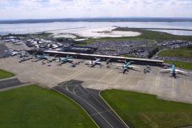
The draft consultation report, Developing Resilience to Climate Change in the Irish Transport Sector, details measures such as coastal flood defences at Shannon Airport and the railway line at Rosslare Harbour, the latter of which is inching ever closer to the cliff on the eroding shoreline.

As previously reported on Afloat.ie, the East Coast line suffered significant damage north of Wicklow town during last month’s Storm Angus.

Predicted rises in temperatures and sea level over the next century are expected to bring more of such storms, with heavier rainfalls and an increased risk of flooding and landslides in prone areas.

All of this has prompted the new plan to identify key remedial works for future-proofing the country’s transport infrastructure.

The Irish Times has more on the story HERE.

Published in Coastal Notes
Page 6 of 8

General Information on using Waterways Ireland inland navigations

Safety on the Water

All users of the navigations are strongly recommended to make themselves aware of safety on the water for whatever activity they are involved in and to read the advice offered by the various governing bodies and by:

The Dept. of Transport, Ireland: www.gov.ie/transport and The Maritime and Coastguard Agency, UK, The RNLI – Water Safety Ireland for information in terms of drowning prevention and water safety.

Registration of Vessels

All vessels using the Shannon Navigation, which includes the Shannon-Erne Waterways and the Erne System must be registered with Waterways Ireland. Only open undecked boats with an engine of 15 horsepower or less on the Shannon Navigation, and vessels of 10 horsepower or less on the Erne System, are exempt. Registration is free of charge.

Craft registration should be completed online at: https://www.waterwaysireland.org/online-services/craft-registration

Permits for use of the Grand and Royal Canals and the Barrow Navigation

All vessels using the Grand and Royal Canals and the Barrow Navigation must display appropriate valid Permit(s) i.e A Combined Mooring and Passage Permit (€126) and if not intending to move every five days, an Extended Mooring Permit (€152).

Permit applications should be completed online at: https://www.waterwaysireland.org/online-services/canal-permits

Passage on the Royal and Grand Canals – Dublin Area

For boat passage through the locks east of Lock 12 into / out of Dublin on either the Royal or Grand Canals, Masters are requested to contact the Waterways Ireland Eastern Regional Office (M-F 9.30am-4.30pm) on tel: +353(0)1 868 0148 or email [email protected] prior to making passage in order to plan the necessary lock-keeping assistance arrangements.

On the Grand Canal a minimum of two days notice prior to the planned passage should be given, masters should note that with the exception of pre-arranged events, a maximum of 2 boats per day will be taken through the locks, travelling either east or west.

Movements in or out of the city will be organised by prior arrangement to take place as a single movement in one day. Boaters will be facilitated to travel the system if their passage is considered to be safe by Waterways Ireland and they have the valid permit(s) for mooring and passage.

Newcomen Lifting Bridge

On the Royal Canal two weeks’ notice of bridge passage (Newcomen Lifting Bridge) is required for the pre-set lift date, and lock assistance will then also be arranged. A minimum of 2 boats is required for a bridge lift to go ahead.

Waterways Ireland Eastern Regional Office (Tel: +353(0)1 868 0148 or [email protected] ) is the point of contact for the bridge lift.

A maximum number of boats passing will be implemented to keep to the times given above for the planned lifts (16 for the Sat / Sun lifts & 8 for the weekday lifts). Priority will be given on a first come first served basis.

On day of lift, boaters and passengers must follow guidance from Waterways Ireland staff about sequence of passage under bridge & through Lock 1, and must remain within signed and designated areas.

Events Held on the Waterways

All organised events taking place on the waterways must have the prior approval of Waterways Ireland. This is a twelve week process and application forms must be accompanied with the appropriate insurance, signed indemnity and risk assessment. The application should be completed on the Waterways Ireland events page at :

https://www.waterwaysireland.org/online-services/event-approval

Time Limits on Mooring in Public Harbours

On the Shannon Navigation and the Shannon-Erne Waterway craft may berth in public harbours for five consecutive days or a total of seven days in any one month.

On the Erne System, revised Bye Laws state that: No master or owner shall permit a vessel, boat or any floating or sunken object to remain moored at or in the vicinity of any public mooring, including mooring at any other public mooring within 3 kilometres of that location, for more than 3 consecutive days and shall not moor at that same mooring or any other public mooring within 3 kilometres of that location within the following 3 consecutive days without prior permission by an authorised official.

Winter Mooring on the Shannon Navigation and Shannon Erne Waterway

Winter mooring may be availed of by owners during the period 1 Nov to 31 Mar by prior arrangement and payment of a charge of €63.50 per craft. Craft not availing of Winter Mooring must continue to comply with the “5 Day Rule”. Winter Mooring applications should be completed online at : https://www.waterwaysireland.org/online-services/winter-moorings-booking

Owners should be aware that electricity supply and water supply to public moorings is disconnected for the winter months. This is to protect against frost damage, to reduce running costs and to minimise maintenance requirements during the winter months.

Vessel owners are advised that advance purchasing of electricity on the power bollards leading up to the disconnection date should be minimal. Electricity credit existing on the bollards will not be recoverable after the winter decommissioning date. Both services will be reinstated prior to the commencement of the next boating season.

Smart Cards

Waterways Ireland smart cards are used to operate locks on the Shannon Erne Waterway, to access the service blocks, to use the pump-outs along the navigations, to avail of electrical power at Waterways Ireland jetties.

Berthing in Public Harbours

Masters are reminded of the following:

  • Equip their vessel with mooring lines of appropriate length and strength and only secure their craft to mooring bollards and cleats provided for this purpose.
  • Ensure the available berth is suitable to the length of your vessel, do not overhang the mooring especially on finger moorings on floating pontoon moorings.
  • Ensure mooring lines, electric cables and fresh water hoses do not create a trip hazard on public jetties for others users.
  • Carry sufficient fenders to prevent damage to your own vessel, other vessels and WI property.
  • Allow sufficient space between your vessel and the vessel ahead /astern (c.1m) for fire safety purposes and /or to recover somebody from the water.
  • Do not berth more than two vessels side by side and ensure there is safe access/egress at all times between vessels and onto the harbour itself.
  • Do not berth in such a way to prevent use of harbour safety ladders, slipways or pump-outs.
  • Do not allow the bow of your vessel to overhang the walkway of a floating mooring thus creating a hazard for others with an overhanging anchor or bow fendering.
  • Animals are not allowed to be loose or stray at any time.
  • Harbour and jetty infrastructure such as railings, power pedestals, fresh water taps, electric light poles, safety bollards, ladders etc are not designed for the purpose of mooring craft , they will not bear the strain of a vessel and will be damaged.
  • At Carrybridge on the Erne System, Masters of vessels are not permitted to use stern on mooring. Masters of vessels must use the mooring fingers for mooring of vessels and for embarkation / disembarkation from vessels.

Passenger Vessel Berths

Masters of vessels should not berth on passenger vessel berths where it is indicated that an arrival is imminent. Passenger vessels plying the navigations generally only occupy the berths to embark and disembark passengers and rarely remain on the berths for extended periods or overnight.

Lock Lead-in Jetties

Lead-in jetties adjacent to the upstream and downstream gates at lock chambers are solely for the purpose of craft waiting to use the lock and should not be used for long term berthing.

Vessel Wake

Vessel wake, that is, the wave generated by the passage of the boat through the water, can sometimes be large, powerful and destructive depending on the hull shape and engine power of the vessel. This wake can be detrimental to other users of the navigation when it strikes their craft or inundates the shoreline or riverbank. Masters are requested to frequently look behind and check the effect of their wake / wash particularly when passing moored vessels, on entering harbours and approaching jetties and to be aware of people pursuing other activities such as fishing on the riverbank.

Speed Restriction

A vessel or boat shall not be navigated on the Shannon Navigation at a speed in excess of 5 kph when within 200 metres of a bridge, quay, jetty or wharf, when in a harbour or canal or when passing within 100 metres of a moored vessel or boat.

Vessels navigating the Shannon-Erne Waterway should observe the general 5 kph speed limit which applies along the waterway. This is necessary in order to prevent damage to the banks caused by excessive wash from vessels.

Vessels navigating the Erne System should observe the statutory 5kt / 6mph / 10kph speed limit areas.

A craft on the Royal and Grand canals shall not be navigated at a speed in excess of 6km per hour.

A craft on the Barrow Navigation shall not be navigated at a speed in excess of 11km per hour except as necessary for safe navigation in conditions of fast flow.

Bank Erosion

Narrow sections of all the navigations are particularly prone to bank erosion due to the large wash generated by some craft. Masters are requested to be vigilant and to slow down to a speed sufficient to maintain steerage when they observe the wash of their craft inundating the river banks.

Unusual Waterborne Activity

Unusual waterborne vessels may be encountered from time to time, such as, hovercraft or amphibious aircraft / seaplanes. Masters of such craft are reminded to apply the normal “Rule of the Road” when they meet conventional craft on the water and to allow extra room to manoeuvre in the interest of safety.

Sailing Activity

Mariners will encounter large numbers of sailing dinghies from late June to August in the vicinity of Lough Derg, Lough Ree and Lower Lough Erne. Sailing courses are marked by yellow buoys to suit weather conditions on the day. Vessels should proceed at slow speed and with due caution and observe the rules of navigation when passing these fleets, as many of the participants are junior sailors under training.

Rowing

Mariners should expect to meet canoes and vessels under oars on any part of the navigations, but more so in the vicinity of Athlone, Carrick-on-Shannon, Coleraine, Enniskillen and Limerick. Masters are reminded to proceed at slow speed and especially to reduce their wash to a minimum when passing these craft as they can be easily upset and swamped due to their very low freeboard and always be prepared to give way in any given traffic situation.

Canoeing

Canoeing is an adventure sport and participants are strongly recommended to seek the advice of the sport’s governing bodies i.e Canoeing Ireland and the Canoe Association of Northern Ireland, before venturing onto the navigations.

Persons in charge of canoes are reminded of the inherent danger to these craft associated with operating close to weirs, sluice gates, locks and other infrastructure particularly when rivers are in flood and large volumes of water are moving through the navigations due to general flood conditions or very heavy localised precipitation e.g. turbulent and broken water, stopper waves. Shooting weirs is prohibited without prior permission of Waterways Ireland.

Canoeists should check with lockkeepers prior entering a lock to ensure passage is done in a safe manner. Portage is required at all unmanned locks.

Canoe Trail Network – "Blueways"

Masters of powered craft are reminded that a canoe trail network is being developed across all navigations and to expect more organised canoeing along these trails necessitating slow speed and minimum wash when encountering canoeists, rowing boats etc

Rockingham and Drummans Island Canals – Lough Key

It is expected that work on Rockingham and Drummans Island Canals on Lough Key will be completed in 2021. Access to these canals will be for non-powered craft only, eg canoes, kayaks, rowing boats.

Fast Powerboats and Personal Watercraft (Jet Skis)

Masters of Fast Powerboats (speed greater than 17kts) and Personal Watercraft (i.e.Jet Skis) are reminded of the inherent dangers associated with high speed on the water and especially in the confines of small bays and narrow sections of the navigations. Keeping a proper look-out, making early alterations to course and /or reducing speed will avoid conflict with slower vessels using the navigation. Personal Watercraft are not permitted to be used on the canals.

Towing Waterskiers, Wakeboarders, Doughnuts etc

Masters of vessels engaged in any of these activities are reminded of the manoeuvring constraints imposed upon their vessel by the tow and of the added responsibilities that they have to the person(s) being towed. These activities should be conducted in areas which are clear of conflicting traffic. It is highly recommended that a person additional to the master be carried to act as a “look-out” to keep the tow under observation at all times.

Prohibition on Swimming

Swimming in the navigable channel, particularly at bridges, is dangerous and is prohibited due to the risk of being run over by a vessel underway in the navigation.

Age Restrictions on operating of powered craft

In the Republic of Ireland, Statutory Instrument 921 of 2005 provides the legal requirements regarding the minimum age for operating of powered craft. The Statutory Instrument contains the following requirements:

- The master or owner of a personal watercraft or a fast power craft shall take all reasonable steps to ensure that a person who has not attained the age of 16 years does not operate or control the craft

- The master or owner of a pleasure craft powered by an engine with a rating of more than 5 horse power or 3.7 kilowatts shall take all reasonable steps to ensure that a person who has not attained the age of 12 years does not operate or control the craft.

Lifejackets and Personal Flotation Devices (PFDs)

Lifejackets and PFD’s are the single most important items of personal protective equipment to be used on a vessel and should be worn especially when the vessel is being manoeuvred such as entering / departing a lock, anchoring, coming alongside or departing a jetty or quayside.

In the Republic of Ireland, Statutory Instrument 921 of 2005 provides the legal requirements regarding the wearing of Personal Flotation Devices. The Statutory Instrument contains the following requirements:

- The master or owner of a pleasure craft (other than a personal watercraft) shall ensure, that there are, at all times on board the craft, sufficient suitable personal flotation devices for each person on board.

- A person on a pleasure craft (other than a personal watercraft) of less than 7 metres length overall shall wear a suitable personal flotation device while on board an open craft or while on the deck of decked craft, other than when the craft is made fast to the shore or at anchor.

- The master or owner of a pleasure craft (other than a personal watercraft) shall take all reasonable steps to ensure that a person who has not attained the age of 16 years complies with paragraph above.

- The master or owner of a pleasure craft (other than a personal watercraft), shall take all reasonable steps to ensure that a person who has not attained the age of 16 years wears a suitable personal flotation device while on board an open craft or while on the deck of a decked craft other than when it is made fast to the shore or at anchor.

- The master or owner of a pleasure craft (other than a personal watercraft) shall take all reasonable steps to ensure that a person wears a suitable personal flotation device, at all times while – (a) being towed by the craft, (b) on board a vessel or object of any kind which is being towed by the craft.

Further information is available at: http://www.irishstatutebook.ie/eli/2005/si/921/made/en/print

Firing Range Danger Area – Lough Ree

The attention of mariners is drawn to the Irish Defence Forces Firing Range situated in the vicinity of buoys No’s 2 and 3, on Lough Ree on the Shannon Navigation. This range is used regularly for live firing exercises, throughout the year, all boats and vessels should stay clear of the area marked with yellow buoys showing a yellow "X" topmark and displaying the word "Danger".

Shannon Navigation, Portumna Swing Bridge Tolls

No attempt should be made by Masters’ of vessels to pay the bridge toll while making way through the bridge opening. Payment will only be taken by the Collector from Masters when they are secured alongside the jetties north and south of the bridge.

Navigating from Killaloe to Limerick on the Shannon Navigation

The navigation from Killaloe to Limerick involves passage through Ardnacrusha locks, the associated headrace and tailrace and the Abbey River into Limerick City. Careful passage planning is required to undertake this voyage. Considerations include: lock passage at Ardnacrusha, water flow in the navigation, airdraft under bridges on Abbey River in Limerick, state of tide in Limerick

Users are advised to contact the ESB Ardnacrusha hydroelectric power station (00353 (0)87 9970131) 48 hours in advance of commencing their journey to book passage through the locks at Ardnacrusha. It is NOT advised to undertake a voyage if more than one turbine is operating (20MW), due to the increased velocity of flow in the navigation channel, which can be dangerous. To ascertain automatically in real time how many turbines are running, users can phone +353 (0)87 6477229.

For safety reasons the ESB has advised that only powered craft with a capacity in excess of 5 knots are allowed to enter Ardnacrusha Headrace and Tailrace Canals.

Passage through Sarsfield Lock should be booked on +353-87-7972998, on the day prior to travel and it should be noted also that transit is not possible two hours either side of low water.

A Hydrographic survey in 2020 of the navigation channel revealed that the approach from Shannon Bridge to Sarsfield Lock and the Dock area has silted up. Masters of vessels and water users are advised to navigate to the Lock from Shannon bridge on a rising tide one or two hours before High Tide.

Lower Bann Navigation

The attention of all users is drawn to the “Users Code for the Lower Bann”, in particular to that section covering “Flow in the River” outlining the dangers for users both on the banks and in the navigation, associated with high flow rates when the river is in spate. Canoeists should consult and carry a copy of the “Lower Bann Canoe Trail” guide issued by the Canoe Association of Northern Ireland. Users should also contact the DfI Rivers Coleraine, who is responsible for regulating the flow rates on the river, for advisory information on the flow rates to be expected on any given day.

DfI Rivers Coleraine. Tel: 0044 28 7034 2357 Email: [email protected]

Lower Bann Navigation – Newferry – No wake zone

A No Wake Zone exists on the Lower Bann Navigation at Newferry. Masters of vessels are requested to proceed at a slow speed and create no wake while passing the jetties and slipways at Newferry.

Overhead Power Lines (OHPL) and Air draft

All Masters must be aware of the dangers associated with overhead power lines, in particular sailing vessels and workboats with cranes or large air drafts. Voyage planning is a necessity in order to identify the location of overhead lines crossing the navigation.

Overhead power line heights on the River Shannon are maintained at 12.6metres (40 feet) from Normal Summer level for that section of navigation, masters of vessels with a large air draft should proceed with caution and make additional allowances when water levels are high.

If a vessel or its equipment comes into contact with an OHPL the operator should NOT attempt to move the vessel or equipment. The conductor may still be alive or re-energise automatically. Maintain a safe distance and prevent third parties from approaching due to risk of arcing. Contact the emergency services for assistance.

Anglers are also reminded that a minimum ground distance of 30 metres should be maintained from overhead power lines when using a rod and line.

Submarine Cables and Pipes

Masters of vessels are reminded not to anchor their vessels in the vicinity of submarine cables or pipes in case they foul their anchor or damage the cables or pipes. Look to the river banks for signage indicating their presence.

Water Levels - Precautions

Low Water Levels:

When water levels fall below normal summer levels masters should be aware of:

Navigation

To reduce the risk of grounding masters should navigate on or near the centreline of the channel, avoid short cutting in dog-legged channels and navigating too close to navigation markers.

Proceeding at a slow speed will also reduce “squat” effect i.e. where the vessel tends to sit lower in the water as a consequence of higher speed.

Slipways

Reduced slipway length available under the water surface and the possibility of launching trailers dropping off the end of the concrete apron.

More slipway surface susceptible to weed growth requiring care while engaged in launching boats, from slipping and sliding on the slope. Note also that launching vehicles may not be able to get sufficient traction on the slipway once the craft is launched to get up the incline.

Bank Erosion

Very dry riverbanks are more susceptible to erosion from vessel wash.

Lock Share

Maximising on the number of vessels in a lock will ensure that the total volume of water moving downstream is decreased. Lock cycles should be used for vessels travelling each way.

High Water Levels:

When water levels rise above normal summer level masters should be aware of:

Navigation

Navigation marks will have reduced height above the water level or may disappear underwater altogether making the navigable channel difficult to discern.

In narrow sections of the navigations water levels will tend to rise more quickly than in main streams and air draft at bridges will likewise be reduced.

There will also be increased flow rates particularly in the vicinity of navigation infrastructure such as bridges, weirs, locks etc where extra care in manoeuvring vessels will be required.

Harbours and Jetties

Due care is required in harbours and at slipways when levels are at or near the same level as the harbour walkways' as the edge will be difficult to discern especially in reduced light conditions. It is advised that Personal Flotation Devices be worn if tending to craft in a harbour in these conditions.

Slipways

Slipways should only be used for the purpose of launching and recovering of water craft or other objects from the water. Before using a slipway it should be examined to ensure that the surface has sufficient traction/grip for the intended purpose such as launching a craft from a trailer using a vehicle, that there is sufficient depth of water on the slipway to float the craft off the trailer before the concrete apron ends and that the wheels of the trailer do not drop off the edge of the slipway. That life-saving appliances are available in the vicinity, that the vehicle is roadworthy and capable of coping with the weight of the trailer and boat on the incline. It is recommended that slipway operations are conducted by two persons.

Caution to be Used in Reliance upon Aids to Navigation

The aids to navigation depicted on the navigation guides comprise a system of fixed and floating aids to navigation. Prudent mariners will not rely solely on any single aid to navigation, particularly a floating aid to navigation. With respect to buoys, the buoy symbol is used to indicate the approximate position of the buoy body and the ground tackle which secures it to the lake or river bed. The approximate position is used because of the practical limitations in positioning and maintaining buoys in precise geographical locations. These limitations include, but are not limited to, prevailing atmospheric and lake/river conditions, the slope of and the material making up the lake/river bed, the fact that the buoys are moored to varying lengths of chain, and the fact that the buoy body and/or ground tackle positions are not under continuous surveillance. Due to the forces of nature, the position of the buoy body can be expected to shift inside and outside the charted symbol.

Buoys and perches are also moved out of position or pulled over by those mariners who use them to moor up to instead of anchoring. To this end, mariners should always monitor their passage by relating buoy/perch positions with the published navigation guide. Furthermore, a vessel attempting to pass close by always risks collision with a yawing buoy or with the obstruction that the buoy or beacon/perch marks.

Masters of Vessels are requested to use the most up to date Navigation guides when navigating on the Inland Waterways.

Information taken from Special Marine Notice No 1 of 2023