


Displaying items by tag: Clare County Council
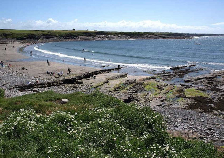
Clare County Council has confirmed that boats can be launched from the slipway at White Strand in Miltown Malbay following confusion over alleged changes to area bye-laws.
Local boaters had contacted Afloat.ie to express concern over claims that the slipway the community have used for generations was suddenly closed to power craft without consultation.
“There’s uproar in the local community to say the least,” said one local. “It’s been a public right of access for boats for generations and the only one the village has.”
Beach bye-laws available from the Clare County Council website make no reference to any recent change prohibiting launches of power craft from White Strand.
When contacted for a response, Clare County Council made clear that the local community has no current cause for concern and may launch and retrieve from the slipway as usual.
“Clare County Council is currently reviewing the process of the new bye law amendments,” it said. “While this administrative/legal review takes place, the 2016 beach bye laws will be reverted to, allowing the launch of boats at the slipway at White Strand.”
325-Million-Year-Old Amphibian Bones Discovered in County Clare

The fossilized bones of a tiny amphibian-like creature that scurried around the shores of County Clare 325 million years ago have been discovered by Dr Eamon Doyle, a geologist for the Burren and Cliffs of Moher UNESCO Global Geopark and Clare County Council. The two small bones have been described by Dr Doyle and fossil vertebrate researcher Aodhán Ó Gogáin of Trinity College Dublin in the latest edition of the Irish Journal of Earth Sciences, published by the Royal Irish Academy.
The 10mm-long bones come from a leg and possibly a hip bone from a small amphibian that would have been an ancestor to the first lizards which ultimately evolved into the dinosaurs 100 million years later.
The amphibian lived during a geological time called the Carboniferous Period which lasted from 360 to 299 million years ago. This is an important period in the evolution of life as it is during this time that amphibians evolved from fish and first began to colonise the land. The fact that amphibian bones are rare finds in rocks of this age highlights the importance of Dr Doyle’s discovery.
The amphibian from Clare which would fit in the palm of your hand, probably lived along a swampy coastline, either in an estuary or along rivers further inland and may have been washed out to sea during a storm or flood, the bones eventually settling onto the muddy seafloor where they were buried and turned to fossils.

#holyisland – Clare County Council has confirmed it is seeking tenders from professional experts to produce an implementation strategy for visitor management and sustainable tourism development on Holy Island.
Earlier this month, the Local Authority acquired 41 acres on the island which, together with the 2 acres already in the ownership of the Office of Public Works (OPW), has resulted in the entire island being brought into public ownership for the first time.
The successful tenderer will be required to prepare proposals in relation to improving access to Holy Island and the provision of tourism facilities on or near the Island, as well as proposals on the marketing and promoting of the Island as a visitor destination.
The preparation of the Visitor Management and Sustainable Tourism Development Plan will also incorporate a public consultation process and consultation with key stakeholders, including the Council, OPW, Department of Arts, Heritage & the Gaeltacht, Waterways Ireland, Fáilte Ireland, Inland Waterways, adjoining Local Authorities, relevant statutory bodies, and local tourism, community and angling organisations.
Dating back to the 7th century, Holy Island is one of the most important historical and ecclesiastical sites in Ireland, and it has important links to Brian Ború. Buildings on the island include a 24-metre high Round Tower, an Oratory, and a number of churches. Holy Island is on the UNESCO world heritage site tentative list for Ireland as an early medieval monastic site along with Clonmacnoise, Durrow, Glendalough, Kells and Monasterboice.
Gerard Dollard, Director of Services, Clare County Council, said: "The Visitor Management and Sustainable Tourism Development Plan will provide a framework, in consultation with key stakeholders, for tourism development and visitor management of the Island, whilst also ensuring the cultural heritage and natural assets that contribute to the Island's uniqueness are maintained and protected."
"Holy Island is very much part of the fabric of the local community and continues to be used as a burial ground. Therefore, it is essential that the overall plan provides for the future management and development of this important site but takes full cognisance of the rich archaeology, landscape, wildlife and cultural heritage of the area. The successful tenderer will be required to consider all of these aspects in recommending a framework for the future management and development of the island," added Mr. Dollard.
#shannonestuary – Clare County Council says the zoning of more than 345 hectares of land along the Shannon Estuary will give 'greater investor confidence' for anyone considering large-scale marine related development proposals.
The Council's 28 Elected Members last evening (Monday) unanimously backed the move to incorporate the zoned lands into the Clare County Development Plan 2011-17 along with the Strategic Integrated Framework Plan (SIFP) for the Shannon Estuary, a major strategic plan for the future development and management of marine-related industry and tourism along Ireland's largest estuary.
The newly zoned lands relate to Strategic Development Locations (SDL) at Cahercon and Moneypoint where existing pier facilities and deep estuarial water provide potential for maritime industry investment.
Clare County Council says it would welcome any opportunity to discuss suitable development proposals for the locations.
A new working group has also been established to promote and market the sites and wider Estuary as a key investment location. Led by Clare County Council, the group also comprises the IDA, Shannon Group plc, Shannon Foynes Port Company, Kerry County Council, and Limerick City and County Council.
"The zoning of lands at Cahercon and Moneypoint complements the vision of both the SIFP and the Clare County Development Plan, and will deliver greater investor confidence," stated Tom Coughlan, Chief Executive of Clare County Council and Chairman of the SIFP Steering Group.
He explained: "While the SIFP attributes a very strong weight to the growth of shipping and safeguarding the commercial shipping lanes of the Shannon Estuary, it also contains objectives for marine tourism, leisure and recreation, commercial fishing and aquaculture, aviation, and energy and renewable energy. The Council's decision to zone 345 hectares of land is significant in the context of being able to widely promote these new development opportunities. The IDA's marketing of the estuary's development potential alongside other key development agencies in Clare, Kerry and Limerick is very much welcomed."
"The Council would welcome any opportunity to meet potential investors to discuss suitable development proposals, particularly in relation to marine industry, for the sites in question," added Mr. Coughlan.
Commenting on the background to the zoning of lands along the Shannon Estuary, Clare County Council's Senior Planner Gordon Daly said: "Clare County Council, through the zoning of these lands and the County Development Plan, is seeking to build on the strategic location and natural resources of the Estuary by facilitating and maximising its potential for marine-related industry development while at the same time managing and protecting its environment in conformance with the requirements of the Habitats & Birds Directives."
Moneypoint SDL comprises approximately 280 hectares is located on the Shannon Estuary 5km east of Kilrush. The landbank also includes one of Ireland's largest electricity generation stations.
Mr. Daly commented: "The marine related industry zoning recognises the importance of the existing Moneypoint Power Plant Facility and facilitates its expansion and/or redevelopment. It also includes over 50 hectares of lands to the east of the Power Plant not in the ownership of the ESB that could further harness the deepwater potential in this area which has excellent road access and is close to the town of Kilrush and the Killimer-Tarbert Ferry."
The Innismurry / Cahercon SDL meanwhile, comprises approximately 66 hectares of land
"This area has potential for development of marine related industry due to a well-sheltered location with an existing pier offering direct access to a large pocket of well sheltered deep water and the main navigation channel. It also has a considerable area of hinterland available and is in close proximity to the R473," explained Mr. Daly.
Mr Daly also confirmed that the zoning for Marine Related Industry only allows for the use of land for industry that, by its nature, requires a location adjacent to estuarine/deep water including a dependency on marine transport, transhipment, bulk cargo or where the industrial processes benefit from a location adjacent to the marine area.
The Shannon Estuary features 500km2 of navigable water running from Loop Head and Kerry Head as far as Limerick City, a distance of 100km. The Estuary is Ireland's premier deepwater port, routinely catering for ships up to 200,000 deadweight tonnage, with key ports at Limerick and Foynes. It is home to a number of large industries and employers, including ESB Moneypoint, Aughinish Alumina, Tarbert Power Station, Shannon Airport and NORA Fuel Reserve. Meanwhile, the Estuary supports a variety of economic uses but is also rich in natural resources, wildlife and ecosystems.
Clare County Council Undertake Emergency Flood Defence Works

Clare County Council is to commence emergency flood defence works along the County Clare coastline near Quilty over fears that up to 15 homes could experience flooding.
Recent storms caused significant coastal erosion at Cloughaninchy leaving private residential properties exposed to flooding by sea water.
The local authority is investing 50,000 euro, which it says it will seek to recoup from any future funding allocation from Government, to install approximately one thousand 1-tonne bags of rock and sand as an interim flood defence barrier.
Cloughaninchy is already the subject of a funding application submitted to Government by Clare County Council. The local authority is seeking €2,581,250 to undertake permanent coastal protection works over a 800 metre stretch of coastline as well as repairs to a road, sewage pumping station and bridge, all damaged by recent flooding.
Mayor of Clare Cllr. Joe Arkins commented: "In recent days Clare County Council has met with residents at Cloughaninchy to discuss ways of addressing the very real threat of flooding posed to a number of residential properties. I want to praise the Chairman of the residents group, Michael Neenan for his pragmatic approach and to acknowledge the support of my fellow elected members in ensuring these works will now proceed."
Clare County Manager, Tom Coughlan says he has informed the Department of the Environment of the local authority's plans to proceed with emergency flood defence works.
In a letter to Sean Hogan, who is National Director for Fire and Emergency Management at the Department of the Environment, Mr. Coughlan stated: "The Council has undertaken a survey of the levels of coastline and it appears that the level of the high tides which are due in early February may exceed the height of the shoreline which has been reduced as a consequence of the storms. Such an occurrence, without the benefit of interim defence works, would probably result in flooding of private residential properties which have already suffered flooding earlier this month."
He continued: "The only apparent possible defence to this undesirable flooding event is the construction of coastal protection over a length of approximately 800 metres. It is not possible, for a number of reasons, to construct a permanent protection of rock armour at this time. However, in order to attempt to provide an interim defence, Clare County Council is proceeding with the construction of a temporary barrier of bags of material and other works along the shoreline. This temporary barrier will be constructed on the private properties along the shore and an agreement has been entered into between the landowners and the Council to facilitate the necessary works."
"Clare County Council has not made financial provision for this emergency work which may cost in excess of €50,000 – however, we have no option but to make every effort to safeguard the properties at Cloughaninchy," concluded Mr. Coughlan
Surfers To Clash With Council Over Doolin Development

#DOOLIN PIER - The Irish Times reports that surfers will be at loggerheads with Clare County Council this week over controversial plans to redevelop Doolin Pier.
The €8 million plans for the Clare coastal village have been delayed for some time, and have already cost the council more than €250,000.
As previously reported on Afloat.ie, the development was backed unanimously by Clare councillors in March 2011 after revisions made following concerns from local surfers about its impact on popular waves in the area.
However, the Irish Surfing Association (ISA) maintained that even that revised plan would result in the elimination of the waves at Doolin Point and Crab Island - the latter described as Ireland's answer to the Pipeline in Hawaii.
The proposed new pier would serve the 70,000 passengers that use the ferry service between Doolin and the Aran Islands. The development is also supported by the Doolin unit of the Irish Coast Guard, which hopes to get a new coastguard station as part of development plans for the area.
Mystery of Missing 'Narwhal' in Clare is Solved
#MARINE WILDLIFE - The mystery disappearance of an allegedly rare whale carcass from a Co Clare beach last week has been solved.
As The Irish Times reports, Clare County Council admitted yesterday that the "badly decomposed whale" was removed from Liscannor beach "due to public health concerns".
The vanishing of the creature had been a source of puzzlement to the Irish Whale and Dolphin Group (IWDG), after scientists dispatched to examine the carcass found no trace on arrival.
Experts had been hoping to verify whether the carcass was indeed that of a narwhal, an Arctic cetacean renowned for its unicorn-like tusk.It would have been the first recorded sighting of a narwhal in Irish waters.
Max Halliday from Shannon, who reported the find to the IWDG, said he was "convinced that what I saw is a narwhal. It had the long tusk protruding from its head, but its head was badly damaged. I am absolutely mad that I didn't take a photo."
According to the Irish Independent, the IWDG had appealed to those responsible for removing the whale to get in touch so the remains could be transferred to the Natural History Museum.
But it has since emerged that the creature was taken to a rendering plant in Derry by a team contracted by the council.
A spokesperson for Clare County Council said no remains of a tusk were found in the removal operation.
Loop Head Lighthouse Will Open To Public in 2012
#LIGHTHOUSES - Loop Head Lighthouse in Co Clare, is set to re-open to the public later this year following a successful trial scheme last summer.
As The Irish Times reports, Clare County Council opened the lighthouse for an 11-week trial period last July with the support of the Commissioners of Irish Lights, Shannon Development and Loop Head Tourism.
Some 17,000 people took up the invitation to visit the 23-metre beacon, which is still in use as a navigational aid, as previously reported on Afloat.ie.
The consortium is now looking for consultants to help expand tourism the facility with an exhibition and interpretation plan.
Surfers Welcome New Ruling on Doolin Pier Development

Surfers have hailed the recent ruling by An Bord Pleanála that Clare County Council must reapply for planning permission for its proposed €6 million redevelopment of Doolin Pier.
As previously reported on Afloat.ie, local surfers and the Irish Surfing Association (ISA) had expressed dismay over the current development plans – approved by the council earlier this year – which they maintain would result in the destruction of the "world renowned" waves at Doolin Point and Crab Island.
The Irish Times reports that the council must now resubmit its planning application and prepare and environmental impact statement (EIS) due to the potential impact on tidal and wave patterns in the area, setting back plans for at least a year.
The proposed scheme already has support from the local business community and the Doolin Coast Guard unit, which argues that congestion on the pier in peak tourist periods may interfere with rescue efforts.
A spokesperson for the West Coast Surf Club said that both it and the ISA were available "to meet with the council to progress a mutually agreeable design for the pier".
The Irish Times has more on the story HERE.
Doolin May Soon Get New Coastguard Station

The Irish Examiner reports that the Doolin coastguard unit is finally set to get a new coastguard station.
One of the busiest search and rescue units in the State, the Doolin unit of the Irish Coast Guard currently has to drag its boat some 2km by tractor to Doolin pier.
Much to the delight of local campaigners, the Office of Public Works is now inviting tenders for a €1.9 million dedicated coastguard facility at the pier, following the granting of planning permission by Clare County Council as part of a development plan for the area.
However, the unit's officer in charge Mattie Shannon is cautious about a start date for construction, as the Department of Transport will not be able to provide funding for the project until next year at the earliest.
Fianna Fáil TD for Clare Timmy Dooley told the Examiner: "The least the current Government can do is honour the commitment of the previous government and ensure that the appropriate finances are in place for next year."
The Irish Examiner has more on the story HERE.


 at Dublin when bound for Holyhead; such high-speed craft 'seasonal’ services resume next month")
 Michael Murphy Schull Harbour Sailing Club (SHSC), Eric Coogan Heineken Ireland, Mark Murphy, Commodore SHSC, Jack Allen SHSC, Carmel O'Regan SHSC, Cornelious Ndlovu, Schull Harbour Hotel Operations Manager and Derval Murphy SHSC")

, marking also a first presence in this market.")


